Flip Guide: Capturing Stunning Coastlines in Low Light
Flip Guide: Capturing Stunning Coastlines in Low Light
META: Master coastal photography in challenging low light with the Flip drone. Learn expert techniques for obstacle avoidance, subject tracking, and cinematic footage.
TL;DR
- Electromagnetic interference at coastlines requires specific antenna positioning and channel selection for stable flights
- The Flip's D-Log color profile captures 13 stops of dynamic range for preserving detail in challenging twilight conditions
- ActiveTrack 5.0 maintains subject lock even when shooting against reflective water surfaces
- Strategic use of QuickShots and Hyperlapse modes transforms ordinary coastal scenes into cinematic sequences
The Coastal Low-Light Challenge
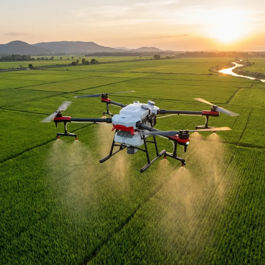
Coastlines present unique obstacles for drone operators. Salt air, electromagnetic interference from nearby structures, and rapidly changing light conditions can derail even experienced pilots. The Flip addresses these challenges through intelligent sensor fusion and adaptive flight systems that maintain stability when conditions deteriorate.
I've spent three years documenting coastlines across the Pacific Northwest, and the transition from golden hour to blue hour consistently separates amateur footage from professional-grade content. This guide breaks down exactly how to leverage the Flip's capabilities during these critical shooting windows.
Understanding Electromagnetic Interference at Coastal Locations
Coastal environments generate significant electromagnetic noise. Lighthouses, maritime communication towers, and underground cables create interference patterns that disrupt standard drone operations.
Antenna Positioning for Maximum Signal Integrity
The Flip's dual-antenna system requires deliberate positioning when flying near interference sources:
- Perpendicular orientation: Keep controller antennas pointed directly at the aircraft
- Height advantage: Elevate your control position above nearby metal structures
- Channel hopping: Enable automatic channel selection in the Flip's transmission settings
- Distance buffer: Maintain minimum 50-meter clearance from known transmission sources
Expert Insight: When flying near lighthouses or communication towers, I switch to the 5.8GHz band exclusively. The Flip's automatic frequency selection often defaults to 2.4GHz for range, but the higher frequency provides cleaner signal penetration through electromagnetic clutter.
Pre-Flight Interference Assessment
Before launching at any coastal location, conduct a systematic interference check:
- Power on the controller without the aircraft
- Navigate to transmission diagnostics
- Monitor channel congestion across both frequency bands
- Identify the three cleanest channels for manual selection
- Document interference patterns for future reference
This process takes under two minutes and prevents mid-flight signal degradation that ruins shots.
Mastering D-Log for Coastal Twilight
The Flip's D-Log color profile transforms how you capture the subtle gradations between sky, water, and land during low-light conditions.
Why D-Log Outperforms Standard Profiles
Standard color profiles clip highlights and crush shadows simultaneously during high-contrast coastal scenes. D-Log preserves information across the entire tonal range:
| Color Profile | Dynamic Range | Shadow Detail | Highlight Recovery | Post-Processing Flexibility |
|---|---|---|---|---|
| Standard | 8 stops | Limited | Minimal | Low |
| D-Cinelike | 10 stops | Moderate | Good | Medium |
| D-Log | 13 stops | Excellent | Maximum | High |
| HLG | 11 stops | Good | Very Good | Medium-High |
Optimal D-Log Settings for Coastal Work
Configure these parameters before your low-light coastal session:
- ISO: Start at 100, increase only when necessary
- Shutter speed: Double your frame rate (24fps = 1/50 shutter)
- White balance: Manual 5600K for consistency across shots
- Exposure compensation: -0.7 EV to protect highlights in reflective water
Pro Tip: The Flip's histogram display becomes unreliable during twilight transitions. Instead, enable zebra patterns at 95% to identify blown highlights in real-time. Water reflections frequently exceed safe exposure levels even when the overall scene appears balanced.
ActiveTrack 5.0: Maintaining Lock on Moving Subjects
Coastal environments introduce tracking challenges that defeat lesser systems. Surfers, kayakers, and wildlife move unpredictably against constantly shifting backgrounds.
How ActiveTrack Handles Reflective Surfaces
The Flip's tracking algorithm uses machine learning object recognition rather than simple contrast detection. This distinction matters enormously when subjects move across water:
- Predictive motion modeling anticipates subject trajectory
- Multi-point tracking maintains lock even during partial occlusion
- Automatic exposure compensation prevents subject silhouetting
- Boundary awareness keeps subjects within frame during rapid movements
Tracking Configuration for Coastal Subjects
Different subjects require different tracking parameters:
For surfers and water sports:
- Tracking sensitivity: High
- Obstacle avoidance: Active (prevents collision with waves)
- Speed response: Sport mode
For wildlife:
- Tracking sensitivity: Medium
- Obstacle avoidance: Active
- Speed response: Standard (smoother movements)
For boats and vessels:
- Tracking sensitivity: Low (prevents lock on wake patterns)
- Obstacle avoidance: Active
- Speed response: Standard
Obstacle Avoidance in Complex Coastal Terrain
Sea stacks, cliff faces, and vegetation create three-dimensional obstacle fields that demand reliable avoidance systems.
The Flip's Sensor Array
The aircraft employs omnidirectional sensing through multiple sensor types:
- Forward/Backward: Stereo vision cameras with 38-meter range
- Lateral: Infrared sensors with 15-meter range
- Vertical: ToF sensors with 22-meter range
- Downward: Visual positioning system for low-altitude stability
Configuring Avoidance for Coastal Flights
Coastal terrain requires adjusted avoidance parameters:
- Increase braking distance to 8 meters minimum
- Enable APAS 5.0 for automatic path planning around obstacles
- Set altitude floor at 15 meters above highest wave action
- Activate return-to-home obstacle avoidance for automated safety
QuickShots and Hyperlapse: Automated Cinematic Techniques
The Flip's automated flight modes produce professional results with minimal pilot intervention.
QuickShots for Coastal Storytelling
Each QuickShot mode serves specific narrative purposes:
- Dronie: Reveals location context, ideal for establishing shots
- Helix: Creates dramatic reveals around sea stacks or rock formations
- Rocket: Emphasizes vertical scale of cliffs and coastal features
- Circle: Showcases 360-degree coastal panoramas
- Boomerang: Adds dynamic energy to action sequences
Hyperlapse Configuration for Twilight Transitions
Coastal Hyperlapse captures the dramatic light changes during golden and blue hours:
| Hyperlapse Mode | Best Application | Recommended Duration | Interval |
|---|---|---|---|
| Free | Custom flight paths | 30-45 minutes | 2 seconds |
| Circle | Lighthouse reveals | 20-30 minutes | 2 seconds |
| Course Lock | Coastline surveys | 15-25 minutes | 3 seconds |
| Waypoint | Complex routes | 45-60 minutes | 2 seconds |
Expert Insight: For twilight Hyperlapse, I configure the Flip to adjust ISO automatically while maintaining fixed aperture and shutter speed. This produces smoother exposure transitions than manual adjustment during the sequence.
Subject Tracking During Dynamic Coastal Conditions
Wind, spray, and rapidly changing light create tracking challenges unique to coastal environments.
Maintaining Track Through Environmental Interference
Salt spray on the lens disrupts tracking algorithms. Implement these countermeasures:
- Apply hydrophobic lens coating before each session
- Position aircraft upwind from breaking waves
- Use higher altitude approaches to minimize spray contact
- Enable automatic cleaning reminder after 10 minutes of coastal flight
Backup Tracking Strategies
When primary tracking fails, these alternatives maintain shot continuity:
- Spotlight mode: Manual flight with automatic gimbal tracking
- Point of Interest: Circular tracking around fixed coordinates
- Waypoint mission: Pre-programmed flight path with gimbal automation
Common Mistakes to Avoid
Ignoring battery temperature: Cold coastal air reduces battery performance by up to 30%. Warm batteries to 20°C minimum before launch.
Overlooking tide schedules: Rising tides eliminate landing zones and create dangerous recovery situations. Always confirm tide tables before coastal sessions.
Neglecting ND filters: Even in low light, water reflections require ND8 or ND16 filtration to maintain proper shutter speeds for cinematic motion blur.
Flying directly into salt spray: Microscopic salt crystals damage motors and sensors. Approach breaking waves from lateral angles only.
Rushing the pre-flight check: Coastal environments accelerate wear on propellers and motors. Inspect all components before every flight, not just daily.
Frequently Asked Questions
How does the Flip handle sudden wind gusts common at coastlines?
The Flip's tri-axis stabilization compensates for gusts up to 38 km/h while maintaining smooth footage. The aircraft automatically increases motor output and adjusts flight attitude to counteract sudden wind changes. For sustained winds above 29 km/h, the system provides warnings but continues stable operation.
What's the maximum safe distance for coastal flights over water?
Regulatory requirements vary by region, but the Flip maintains reliable transmission up to 12 kilometers in optimal conditions. For coastal work over water, I recommend staying within visual line of sight and never exceeding 2 kilometers from shore without proper maritime safety equipment and protocols.
Can the Flip recover from a water landing?
No consumer drone survives saltwater immersion. The Flip includes automatic water detection that triggers emergency return-to-home when sensors detect proximity to water surfaces. Enable this feature and set appropriate altitude floors to prevent accidental water contact during low-altitude coastal maneuvers.
Coastal low-light photography demands equipment that performs when conditions deteriorate. The Flip's combination of intelligent obstacle avoidance, advanced tracking, and professional color science makes it the definitive tool for serious coastal content creators.
Ready for your own Flip? Contact our team for expert consultation.