Flip Guide for Capturing Highways at Height
Flip Guide for Capturing Highways at Height: What Actually Matters in the Air
META: A practical expert guide to using Flip for high-altitude highway capture, grounded in UAV remote-sensing principles, flight stability, overlap planning, and efficient image collection.
I still remember one of the more frustrating highway capture jobs I was brought into. The route itself was simple on paper: long linear infrastructure, broad visibility, no dense urban canyon effect, plenty of room to work. Yet the footage and survey imagery kept coming back uneven. Some passes looked clean, others had subtle blur. Coverage gaps appeared where the flight speed changed. And once we tried to turn the material into something useful for inspection and mapping review, the real weakness showed up: the capture process had not been disciplined enough.
That kind of mission is where people often misunderstand the role of a drone like Flip.
They think the challenge is mostly about getting airborne high enough to see the road. It isn’t. Highway capture at altitude is a data-control problem first, a camera problem second, and a flying problem throughout. If you care about continuity, repeatability, and post-processing value, the drone has to do more than record attractive footage. It has to support a workflow where flight height, speed, image overlap, stabilization, and position data all work together.
That is exactly why the most useful lessons for Flip users come from professional UAV remote-sensing practice, especially the methods used in long-corridor inspection work such as oil pipeline patrols. Highways and pipelines are different assets, but the operational logic is remarkably similar: both are elongated routes, both demand consistent capture, and both punish sloppy image planning.
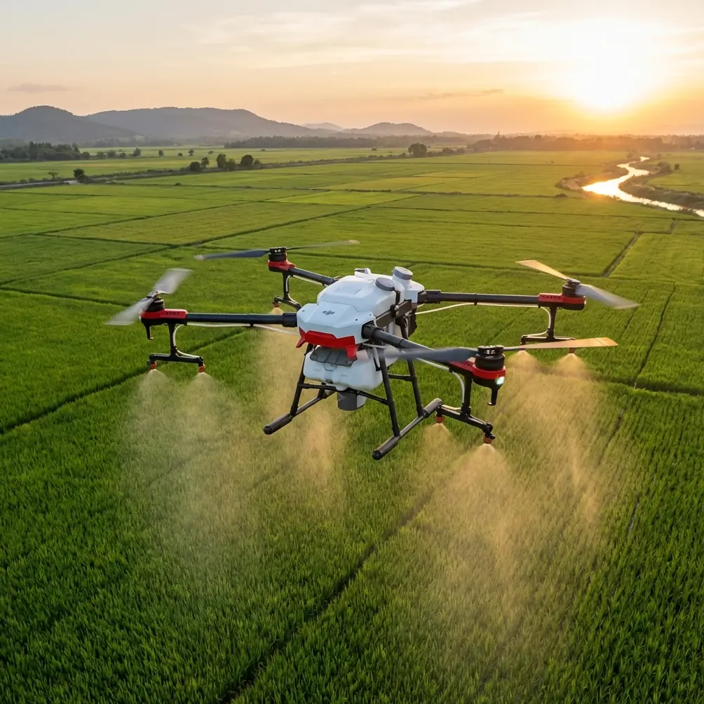
The highway problem most pilots only notice after landing
Capturing highways in high altitude introduces a strange contradiction. The higher you go, the easier it becomes to understand the overall corridor. Interchanges, lane splits, bridge approaches, drainage paths, service roads—they begin to read clearly as a system instead of isolated fragments. But as altitude increases, every weakness in the capture chain becomes more expensive.
A small stability issue at close range may look harmless. At height, it can flatten detail and reduce the usefulness of the image set. A casual pass with inconsistent framing may still look cinematic. For survey review, inspection reference, or route documentation, it can become dead weight. If the aircraft’s movement and the sensor’s timing are not coordinated, you get coverage that feels complete but processes poorly.
This is where a core remote-sensing principle becomes relevant. In professional UAV imaging, the sensor control system should respond to preset parameters such as planned shooting points, photographic scale, and overlap, while also using real-time flight information like altitude and speed to trigger and control the sensor. That sounds technical, but its practical meaning is simple: the drone should not be guessing while you are trying to build a usable corridor record.
For Flip users shooting highways, this matters more than any flashy mode list. If your route is long and the objective is structured documentation, the mission succeeds when image timing and aircraft movement stay in sync.
Why overlap is not just for mapping teams
One of the most overlooked details in corridor capture is overlap. In formal low-altitude photogrammetry practice, forward overlap is typically planned around 55% to 65%, with at least 50%, and lateral overlap is roughly 30%. Those numbers are not trivia. They are the reason operators can reconstruct terrain, review repeated features, and maintain continuity across long strips of infrastructure.
Now, if you are using Flip to capture highways from a high vantage point, you may not always be building full photogrammetric deliverables. But the same principle still improves results dramatically.
When you maintain reliable overlap between frames or passes, three things happen:
You preserve continuity across the route.
Highway assets repeat—barriers, gantries, signage, median treatments, shoulder conditions, bridge joints. Overlap gives you the ability to compare those elements across adjacent views instead of hoping each feature landed cleanly in a single frame.You improve post-processing flexibility.
Even if the original mission was for visual review or progress documentation, overlapping source imagery opens the door to later analysis. Teams often realize after the flight that they want stitched corridor visuals, site-change comparison, or terrain reference.You reduce the risk of unusable gaps.
Long roads are deceptive. A pilot can feel like the corridor is well covered while missing key transition areas at ramps, bridge entries, or work-zone boundaries. Thoughtful overlap acts like insurance.
With Flip, this translates into disciplined route planning rather than improvisation. Don’t simply fly parallel to the roadway and trust your eye. Build each pass around a repeatable viewing angle, stable speed, and intentional spacing.
Stability is the hidden quality multiplier
The source material behind professional UAV corridor inspection makes a point that every experienced operator learns sooner or later: if the drone has weak wind resistance or inconsistent flight stability, the payload benefits greatly from a three-axis stabilization platform. The reason is obvious once you’ve fought real-world conditions above a highway.
Road corridors create their own environmental complications. Heat shimmer rises off asphalt. Wind channels through overpasses and open cut sections. Traffic-generated air movement may not be dramatic, but it contributes to a visual environment that already punishes instability. At altitude, even minor drift becomes visible in your framing consistency.
This is where Flip becomes easier to trust when the mission demands not just “nice video” but structured aerial coverage. Features like obstacle avoidance and subject-oriented automation can be useful, but the operational win is steadiness. Stable capture produces clearer imagery, more dependable frame matching, and less wasted effort in post.
I’ve seen pilots lean too hard on speed because highways feel visually simple. That usually backfires. For corridor work, steadiness beats aggression every time. If Flip lets you hold a predictable line and keep the camera calm, the entire data set improves.
Position and attitude data are worth more than most creators think
Another detail from remote-sensing practice deserves more attention in the creator and commercial UAV world: the recommendation that the sensor’s position data and attitude data be recorded and stored in real time for later processing.
This is not just a survey-engineer concern.
When you are capturing a highway from altitude, metadata becomes the memory of the mission. It helps explain why one segment looks different from another. It supports repeat flights over the same route. It makes progress documentation more defensible. And if a client asks for a revisit of a specific overpass, interchange, or shoulder failure zone, good flight records save time.
For Flip operators, this means treating flight logs and capture metadata as part of the deliverable pipeline, not as background noise. If your work includes infrastructure review, construction progress, maintenance records, or route condition tracking, those records increase operational value far beyond the day of capture.
That is one reason the best highway workflows borrow from industrial inspection logic. The drone is not just a camera in the sky. It is a geospatial collection tool, even when the final output is presented in a simple visual format.
High-altitude capture works best when you think like a corridor planner
A lot of poor highway footage comes from pilots composing the mission shot by shot. That approach works for a short scenic sequence. It fails on linear infrastructure.
The better approach is to think in segments.
Break the highway into logical operational units:
- straight corridor sections
- interchanges
- bridges and elevated spans
- entry and exit clusters
- work zones
- adjacent service infrastructure
Then match your Flip flight behavior to the type of segment. Straight sections can support more uniform passes. Interchanges often need layered coverage from different angles to preserve legibility. Bridges benefit from careful pacing because geometry changes quickly. Construction zones usually need both context altitude and closer supplementary detail.
This is also where tools like ActiveTrack, QuickShots, Hyperlapse, and subject tracking need to be used with restraint. They are useful, but only when they serve the mission. On highways, automation should support consistency, not replace planning.
QuickShots may create polished sequences, but they do not solve overlap discipline. Hyperlapse can show route evolution beautifully, but only if the underlying flight path is stable enough to keep the corridor readable. ActiveTrack can help with moving context elements in adjacent service operations, yet the road itself is usually the real subject, and it does not need dramatic treatment. Good operators know when to use these features and when to ignore them.
What changed for me when using a model like Flip
The turning point in my own approach was dropping the idea that corridor capture had to feel complex to be professional.
Earlier in my career, I would overbuild the mission. Too many camera decisions in the air. Too much adaptation on the fly. Too much trust in “we’ll figure it out in post.” The results were inconsistent because the process was inconsistent.
What made a model like Flip easier to work with was not just portability or creative flexibility. It was the ability to simplify execution without lowering standards. I could think more clearly about:
- maintaining stable altitude relative to the route
- preserving usable visual overlap
- capturing long linear assets in a repeatable way
- balancing broad context with enough detail to support review
- using color profiles like D-Log when the scene’s contrast needed headroom for post-production
D-Log, in particular, matters more on highways than many people expect. Road corridors often include bright pavement, reflective vehicles, dark underpasses, embankments, shadows from bridges, and changing weather across a long route. A flatter capture profile can preserve more grading flexibility later, especially when one sequence must visually match another from a different segment or flight day.
The airspace detail that changes operational planning
One practical point from the reference material is easy to overlook but highly relevant: operations below 1000 meters are handled under a registration and filing framework, with relatively convenient airspace application and no mandatory hard control in that described context.
For highway capture, that matters because it reinforces a planning mindset around low-altitude and medium-altitude structured missions rather than assuming you need extreme height to do useful work. In most civilian corridor jobs, the objective is not maximum altitude. It is the right altitude for the desired resolution, coverage width, and safety margin.
That aligns with another useful principle from the source: UAVs can be flown according to required map scale and ground resolution, while benefiting from lower weather sensitivity and fast deployment. Operationally, that means Flip is strongest when used as a responsive field tool. You can reach the corridor quickly, launch with limited site demands, and adapt the mission to visibility and coverage needs without the overhead associated with traditional crewed aerial work.
If you want to discuss route-specific capture planning, flight structure, or how to sequence a long highway corridor efficiently, you can message the team here.
So how should Flip be used for highway capture?
Use it like a corridor documentation platform first, a creative drone second.
That means:
- set a clear purpose for each pass
- keep altitude and speed consistent enough that image timing stays useful
- preserve overlap, especially on long linear sections
- rely on stable gimbal performance to protect image clarity
- retain position and attitude records for repeatability
- use features like Hyperlapse or QuickShots only when they add interpretive value
- choose D-Log when lighting contrast across the route will complicate grading
The real advantage is not that Flip can make highways look dramatic. Plenty of drones can do that. The advantage is that, when operated with remote-sensing discipline, it can make a highway legible, traceable, and reusable as a visual asset.
That is the difference between footage people admire for a minute and aerial material teams can keep working from.
Highway capture at height is rarely won by spectacle. It is won by control: control of overlap, control of stability, control of flight-path repeatability, and control of how the collected imagery will be used afterward. Once you understand that, Flip stops being just another compact aircraft and starts becoming a far more capable tool for serious corridor work.
Ready for your own Flip? Contact our team for expert consultation.