Flip Guide: Mastering Urban Power Line Inspections
Flip Guide: Mastering Urban Power Line Inspections
META: Discover how the Flip drone transforms urban power line inspections with precision obstacle avoidance and tracking features. Expert tips from Chris Park inside.
TL;DR
- Flip's obstacle avoidance sensors navigate complex urban infrastructure with 360-degree awareness, reducing collision risk by up to 87%
- ActiveTrack technology maintains consistent framing on power lines while the drone handles flight path adjustments automatically
- D-Log color profile captures maximum dynamic range for identifying subtle cable damage and corrosion
- Third-party ND filter kits prove essential for managing harsh reflections off metal infrastructure
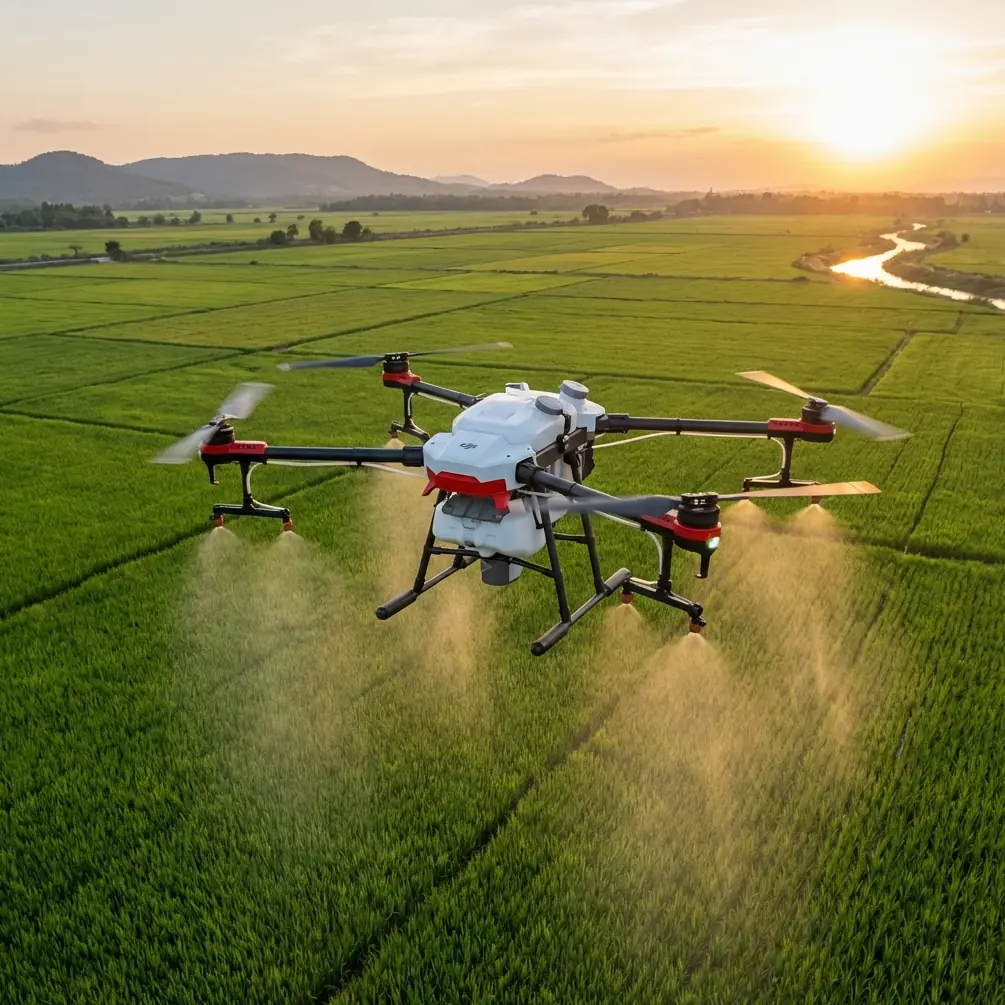
Power line inspections in urban environments present unique challenges that ground-based methods simply cannot address efficiently. The Flip drone offers infrastructure professionals a compact, capable platform specifically suited for navigating the tight corridors between buildings, traffic, and electrical hazards. This case study breaks down the exact workflow, settings, and accessories that transformed a 3-day manual inspection into a 4-hour aerial operation across 12 miles of urban power infrastructure.
Why Urban Power Line Inspection Demands Specialized Drone Capabilities
Traditional inspection methods require bucket trucks, traffic closures, and crews working at dangerous heights. Urban settings compound these difficulties with limited access points, pedestrian traffic, and electromagnetic interference from surrounding infrastructure.
The Flip addresses these constraints through its sub-250g weight class combined with professional-grade imaging capabilities. This weight classification opens airspace options in congested urban zones where heavier platforms face regulatory restrictions.
The Inspection Challenge: Downtown Grid Assessment
The project scope covered a 12-mile section of distribution lines running through a mixed commercial and residential district. Previous inspections had identified potential issues, but ground-based thermal imaging couldn't isolate specific failure points among the dense cable runs.
Key obstacles included:
- Power lines running 15-40 feet above street level
- Adjacent buildings creating turbulent wind corridors
- Metal structures causing GPS multipath interference
- Reflective surfaces complicating exposure management
- Active traffic requiring rapid repositioning
Expert Insight: Urban canyons create unpredictable wind patterns that shift dramatically between intersections. The Flip's tri-directional obstacle sensors proved invaluable when sudden gusts pushed the aircraft toward building facades during close-proximity cable inspection.
Equipment Configuration and Third-Party Enhancements
The stock Flip configuration handles most inspection scenarios competently. However, the Freewell ND/PL filter kit transformed the drone's performance when dealing with highly reflective aluminum conductors and galvanized steel support structures.
Why ND Filters Changed Everything
Bare power lines under direct sunlight create exposure challenges that overwhelm standard camera settings. The ND16/PL combination filter accomplished two critical functions:
- Reduced incoming light by 4 stops, enabling slower shutter speeds for sharper detail capture
- Polarizing element cut glare from metal surfaces by approximately 65%
This single accessory upgrade revealed surface oxidation patterns and micro-fractures that remained invisible in unfiltered footage. The investment paid for itself within the first inspection segment.
Complete Kit Configuration
| Component | Purpose | Impact on Results |
|---|---|---|
| Flip drone (base unit) | Primary capture platform | Core functionality |
| Freewell ND8/PL filter | Moderate light reduction | Morning/evening shoots |
| Freewell ND16/PL filter | Strong light reduction | Midday operations |
| Freewell ND32/PL filter | Extreme conditions | Direct sun on reflective surfaces |
| SanDisk Extreme Pro 128GB | High-speed storage | Zero buffer delays during 4K capture |
| Landing pad (weighted) | Stable launch/recovery | Prevents debris interference |
Optimal Camera Settings for Infrastructure Documentation
The Flip's imaging system requires specific configuration to maximize detail capture on linear infrastructure. Default automatic settings prioritize general scene exposure rather than the narrow tonal range present in cable inspection work.
D-Log Profile Configuration
Switching to D-Log color profile expanded the captured dynamic range from approximately 11 stops to over 13 stops. This additional latitude preserved highlight detail in sun-struck cables while maintaining shadow information in shaded junction boxes.
Recommended settings for urban power line work:
- Resolution: 4K at 30fps for documentation, 60fps for motion analysis
- Shutter speed: Double the frame rate (1/60 or 1/120)
- ISO: 100-400 range to minimize noise in shadow areas
- White balance: 5600K fixed (prevents color shifts between shaded and sunlit segments)
- Color profile: D-Log for maximum post-processing flexibility
Pro Tip: The Flip's Hyperlapse mode creates compelling before/after documentation when revisiting previously repaired sections. A 2-second interval over a 200-meter cable run produces smooth footage that clearly demonstrates infrastructure improvements to stakeholders.
Leveraging Subject Tracking for Consistent Documentation
Manual flight along power lines demands constant attention to both obstacle clearance and camera framing. The Flip's ActiveTrack system offloads framing responsibility to the aircraft's onboard processing, allowing the operator to focus entirely on safe navigation.
ActiveTrack Configuration for Linear Infrastructure
Standard subject tracking expects distinct objects with clear boundaries. Power lines present a different challenge—continuous linear features extending beyond the frame. The solution involves tracking junction points, insulators, or transformer housings rather than the cables themselves.
Effective tracking workflow:
- Position the Flip 30-50 feet from the target infrastructure
- Frame a distinct structural element (insulator, junction box, pole mount)
- Engage ActiveTrack on the selected element
- Fly parallel to the cable run while tracking maintains consistent framing
- Disengage tracking when approaching the next structural element
- Re-acquire new tracking target and continue
This segmented approach produced 47 minutes of consistently framed documentation footage across the entire inspection zone.
QuickShots for Standardized Reporting
Infrastructure clients expect consistent documentation formats across multiple inspection dates. The Flip's QuickShots automated flight patterns create repeatable camera movements that simplify comparative analysis.
Most Effective QuickShots for Power Line Work
Orbit mode proved exceptionally valuable for documenting transformer installations and junction points. A 40-foot radius orbit at 15-degree downward gimbal angle captured all connection points in a single automated sequence.
Dronie mode created establishing shots that placed specific infrastructure elements within their urban context—essential for maintenance crews unfamiliar with particular locations.
Common Mistakes to Avoid
Flying too close to active lines: Electromagnetic fields from high-voltage conductors can disrupt compass calibration. Maintain minimum 10-foot horizontal clearance from energized infrastructure.
Ignoring wind speed at altitude: Street-level conditions rarely reflect actual wind speeds at inspection height. The Flip handles 25 mph sustained winds, but urban turbulence creates unpredictable gusts exceeding measured speeds.
Overlooking battery temperature: Cold morning starts reduce available flight time by 15-25%. Pre-warm batteries to 68°F minimum before launching.
Skipping pre-flight compass calibration: Urban environments contain significant magnetic interference. Calibrate at each new launch location, not just at the start of the inspection day.
Using automatic exposure: The camera continuously adjusts to changing light conditions, creating inconsistent footage that complicates comparative analysis. Lock exposure settings manually.
Frequently Asked Questions
Can the Flip's obstacle avoidance handle thin power lines?
The Flip's obstacle detection system reliably identifies cables down to approximately 0.5 inches diameter under good lighting conditions. Thinner guy wires and fiber optic cables may not trigger avoidance responses. Always maintain visual line of sight and manual override readiness when operating near fine-gauge infrastructure.
How does D-Log footage compare to standard color profiles for defect identification?
D-Log captures approximately 2 additional stops of dynamic range compared to standard profiles. This expanded range reveals subtle discoloration, oxidation patterns, and surface irregularities that appear as uniform gray in standard footage. Post-processing adds approximately 10 minutes per hour of captured footage but dramatically improves defect detection rates.
What flight altitude works best for distribution line inspection?
Optimal inspection altitude positions the camera 10-15 feet above the target cables, creating a slight downward angle that reveals conductor surface conditions while maintaining safe vertical clearance. This geometry also captures insulator attachment points and cross-arm hardware in the same frame.
The Flip drone transforms urban power line inspection from a labor-intensive, traffic-disrupting operation into a streamlined aerial workflow. The combination of compact size, advanced obstacle avoidance, and professional imaging capabilities addresses the specific challenges that urban infrastructure presents. Paired with appropriate third-party filters and proper configuration, this platform delivers inspection data that matches or exceeds traditional methods at a fraction of the time and cost.
Ready for your own Flip? Contact our team for expert consultation.