Flip for Power-Line Fire Patrol: What These China Drone
Flip for Power-Line Fire Patrol: What These China Drone Inspections Reveal About Real Remote-Capture Work
META: A field-driven technical review of how Flip fits remote power-line and forest inspection scenarios, using recent drone fire-prevention patrols in Liangshan and Licheng to explain thermal workflows, obstacle risks, flight planning, and battery discipline.
By Jessica Brown
Spring fire season exposes the difference between a drone that is merely easy to fly and one that can deliver usable footage and actionable visibility under pressure. Two recent patrol reports from China make that distinction clear.
On March 22, utility staff in Meiyu Town, Yanyuan County, Liangshan Prefecture carried out a mountain-fire special inspection at Tower 72 on the 35 kV Yantang line. The assignment was not cinematic. It was operational: watch the distance between nearby vegetation and the line corridor, record infrared temperature data, and check line hardware in dry, windy conditions with elevated forest fire risk. Two days later, on March 24, forest protection personnel in Licheng County used drones to inspect woodland as part of what officials described as a dual-track model combining technology with foot patrols, organized into an “air + ground + backend” protection system.
Those details matter because they describe the exact kind of remote-capture environment where Flip either proves its value or shows its limits. If your interest is capturing power lines in remote terrain, not just flying for fun, these stories offer a practical lens for evaluating how Flip should be used.
Why this news matters for Flip users
The Liangshan patrol is especially instructive because it was not a single flyover. It was part of a systematic screening routine during a period of persistent dryness and frequent wind. That means the drone was operating inside a wider inspection method, not replacing it. The team used a combined workflow: refined drone flight, infrared temperature checking, and on-foot special patrols. In plain terms, the aircraft handled reach and perspective; thermal readings added risk detection; human inspectors closed the loop.
That is the right mental model for Flip in utility-adjacent work.
A lot of drone buyers fixate on headline features like QuickShots or Hyperlapse because they are visible and easy to understand. In corridor inspection, the useful questions are different. Can the drone maintain a safe, stable line near towers without drifting into wires during gusts? Can the operator gather repeatable visuals that help compare vegetation clearance from one sortie to the next? Can battery use stay predictable enough to avoid pushing a return leg over broken terrain? Those questions decide whether footage becomes evidence or just content.
The Licheng forest patrol adds another operational lesson. The county’s emergency management approach explicitly combined walking patrols with aerial inspection and backend support. That layered structure is more realistic than the fantasy that a single drone solves the whole problem. For a Flip operator, that means planning flights as part of a chain: capture, review, relay, revisit. Even a compact aircraft becomes more valuable when every sortie is designed to support teams on the ground.
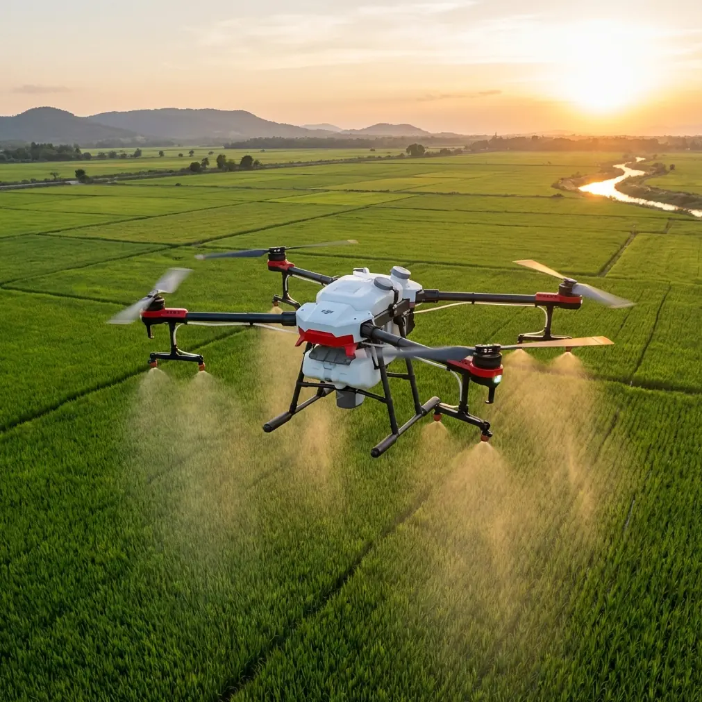
Flip in a power-line environment: where it helps most
For remote power-line capture, Flip’s appeal starts with mobility. When access roads are poor and tower locations force you to hike, compactness becomes more than convenience. It affects whether the drone is with you at the right moment, fully charged, with enough reserve to conduct one more pass after the light shifts or the wind eases.
But the Liangshan example also highlights what remote line work demands from a flight platform.
The crew there paid attention to vegetation near the poles and line span, while also recording infrared temperature data. Even if your own Flip setup is aimed at visual documentation rather than thermal sensing, this workflow tells you what to prioritize in your captures:
- vegetation encroachment around tower bases and line corridors
- insulator and hardware visibility from consistent angles
- repeatable framing for comparison over time
- enough resolution and tonal range to inspect shadows, glare, and backlit metal surfaces
This is where features like D-Log become more relevant than many users expect. Bright sky, reflective hardware, dark tree cover, and uneven mountain light often produce ugly contrast. If you are documenting a tower line against a washed-out sky, a flatter capture profile gives you more room to recover highlights and separate metal, cable, and vegetation in post. That may sound like a photographer’s concern, but it is also an inspection concern. If detail disappears in clipped highlights, the flight was less useful than it looked on the controller screen.
Obstacle avoidance is another practical issue. Utility corridors are deceptive. Towers are obvious; the real hazard is often the wire geometry, side vegetation, and shifting gusts in saddles or ridgelines. Any avoidance system should be treated as a backup, not a permission slip. In line work, I would rather see a conservative flight path and a slightly less dramatic angle than rely on automation close to conductors.
ActiveTrack and subject tracking, while helpful in many shooting scenarios, are not the star of this specific job. A tower does not move, and a line corridor does not need cinematic following. Still, tracking can help when documenting vehicle movement, maintenance teams approaching a site, or repeat passes along a service path. It is a support feature, not the core reason to choose Flip for this mission.
The thermal lesson hidden in the Liangshan report
The most important technical detail in the Liangshan report is not simply that a drone was used. It is that infrared temperature data was recorded alongside the aerial patrol.
That pairing is operationally smart.
Visual imagery tells you about clearance, structural condition, smoke traces, access constraints, and surrounding fuel load. Thermal data helps surface abnormal heat signatures that a standard camera will miss. In a dry, windy month, where fire danger remains high, that difference is significant. A line component running hot or a localized abnormal temperature near equipment can change inspection priority very quickly.
For Flip users, the lesson is not to pretend a standard compact drone replaces a thermal platform. The lesson is to shoot in a way that complements thermal workflows. If your team also has access to infrared inspection tools, your Flip footage should establish context: exact tower orientation, surrounding vegetation density, approach hazards, and the best route for a follow-up team. The drone is strongest when it gives thermal findings a visual map.
That also changes how you frame your shots. Don’t just orbit because it looks good. Fly for reference. Lock in a front oblique, a side angle along the corridor, and a wider establishing pass that shows tree distance to the conductors. Those are the views that make temperature anomalies easier to interpret later.
Battery management in the field: the tip that actually saves flights
Remote power-line capture punishes lazy battery habits. This is where field discipline matters more than spec-sheet confidence.
My rule in mountain corridor work is simple: divide the battery mentally into thirds. One third for outbound work, one third for the planned capture sequence, one third reserved for wind changes, climb-outs, and a less-than-ideal return route. I started doing this after one too many flights where the aircraft looked fine on paper but the headwind over a ridge turned the return into a negotiation.
That matters even more in the kind of environment described in Liangshan, where dry conditions and frequent wind were already affecting risk management. A battery percentage is not a guarantee. It is just a number until terrain, altitude changes, and gusts start taxing the aircraft.
A few habits help:
- launch only after deciding your primary capture angles
- avoid hovering while “thinking” near towers
- shoot your must-have pass first, not last
- keep batteries warm before launch in cold morning conditions
- swap earlier than you think is necessary if the return route climbs
If you are documenting a remote line section and need one more orbit at low battery, you probably do not need the orbit. What you need is a safe landing with the footage already secured.
How Flip fits the “air + ground + backend” model
The Licheng report uses a phrase that deserves attention: “air + ground + backend.” It sounds administrative, but it points to a mature use case for compact drones like Flip.
Air handles speed and perspective. Ground teams verify. Backend review organizes, compares, and dispatches.
That means the drone pilot’s job is not finished when the aircraft lands. File discipline matters. If you are shooting multiple towers or forest edges in one sortie, label footage immediately by location, tower number, or route segment. The Liangshan patrol cited Tower 72 on a specific 35 kV line. That level of specificity is what makes aerial material useful. Without it, even sharp footage becomes difficult to act on.
For solo operators or small teams, a lightweight workflow goes a long way:
- brief the route before takeoff
- capture in a repeatable sequence
- note wind direction and visibility changes
- flag any unusual heat shimmer, smoke, or vegetation proximity
- sync clips to field notes before moving on
If you are building a remote inspection routine around Flip and want to compare setups or discuss corridor shooting practices, you can message me here as part of that planning process.
Camera settings that make remote infrastructure footage more usable
A lot of power-line footage fails not because the drone was inadequate, but because the settings were chosen for social video rather than technical clarity.
For this kind of work, I favor stability over flair. QuickShots are fine for overview context, especially when you want one clean establishing move around a tower site or ridgeline. Hyperlapse can help illustrate changing weather patterns or smoke movement over time, but it is secondary. The core capture should be slower, deliberate, and repeatable.
My baseline approach for a Flip-style inspection shoot looks like this:
- prioritize manual exposure consistency
- use D-Log when contrast is extreme and post-processing is planned
- keep shutter behavior controlled to preserve detail in wires and hardware
- avoid overusing digital sharpening, which can make line detail look brittle
- repeat identical passes at matching altitude when monitoring changes
Subject tracking and ActiveTrack are useful only when the subject truly benefits from motion following. In line inspection, static reference framing usually wins. The better you can match one pass to the next, the easier it is to notice vegetation growth, changed clearances, or structural anomalies.
The bigger takeaway from these patrols
Both March reports point in the same direction. Drones are now embedded in frontline fire prevention and corridor monitoring, but their role is disciplined rather than theatrical. In Liangshan, the mission combined UAV flyovers with infrared temperature recording and on-foot inspection around a specific transmission tower. In Licheng, officials built a layered forest patrol model that joined UAVs, human teams, and backend coordination.
For Flip users, the takeaway is sharp: compact drones are most valuable when treated as precision field tools. Not because they can do everything, but because they can do the right subset of tasks quickly, repeatedly, and with less logistical drag.
If your reader scenario is capturing power lines in remote areas, these news items offer a grounded benchmark. Dry weather, wind, vegetation risk, and hard-to-reach infrastructure all place pressure on aircraft handling, shot discipline, and battery judgment. A good result depends less on flashy flight modes than on the operator’s ability to integrate obstacle awareness, structured capture, and conservative energy management into one repeatable workflow.
That is the real standard. Not whether Flip can get airborne fast, but whether it can come back with footage that a field team can actually use.
Ready for your own Flip? Contact our team for expert consultation.