Expert Capturing With Flip: A Technical Review for Mountain
Expert Capturing With Flip: A Technical Review for Mountain Power Line Work
META: A field-focused technical review of using DJI Flip for mountain power line capture, with practical insight on interference, tracking, obstacle awareness, and multi-angle aerial data collection.
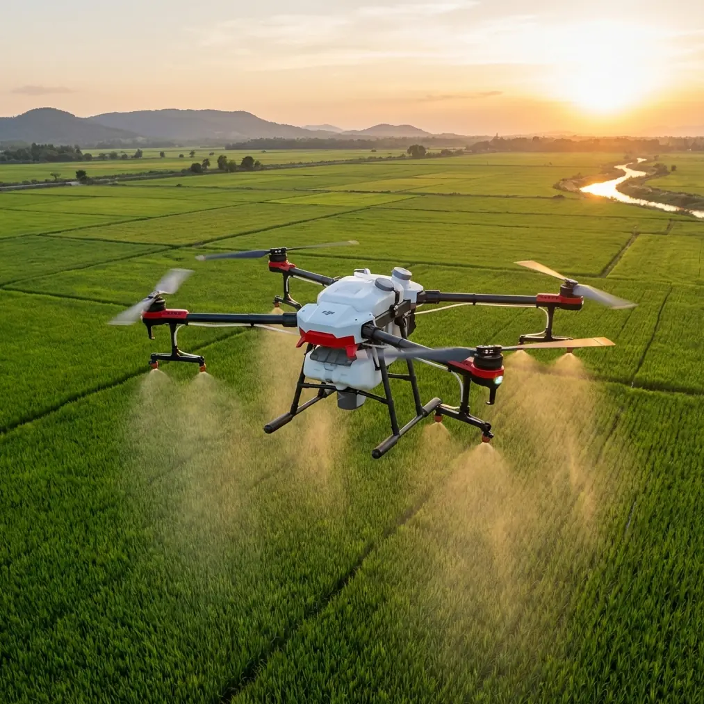
Mountain power line imaging sounds simple until the terrain starts dictating every decision.
Ridges compress your GPS perspective. Valleys distort wind behavior. Conductors, towers, and hardware create a visually cluttered scene that can confuse tracking and force constant reframing. Add electromagnetic interference near transmission infrastructure and suddenly even a short flight requires discipline. That is where a compact aircraft like the Flip becomes interesting—not because it replaces a larger enterprise platform, but because it can handle short-notice visual capture in places where access is awkward and setup time matters.
The latest conversation in enterprise aviation has shifted toward smarter aerial operations. DJI’s Matrice 4 Series was introduced with a clear message: support daily aerial tasks and gather data from multiple angles. That framing matters even when discussing a lighter platform like Flip. Mountain power line documentation is rarely about one heroic image. It is about repeatable, useful visual coverage from several perspectives, collected efficiently enough to fit real field schedules. The big takeaway from the Matrice 4 positioning is not airframe class. It is workflow philosophy. Daily operations need aircraft that think in terms of practical capture, not just flight.
That is the lens I used when evaluating Flip for this scenario.
Why Flip makes sense for mountain utility visuals
A mountain power line job usually begins with constraints, not creative freedom. The launch area may be narrow. You may need to hike in. Wind can shift when it clears a ridge face. If the task is visual inspection support, route familiarization, vegetation awareness, or progress documentation around line infrastructure, the first advantage of Flip is logistical: you can get airborne fast without hauling a heavy kit.
Compact drones tend to be underestimated in utility environments because people assume only larger platforms belong near critical infrastructure. For detailed thermal or sensor-heavy missions, that assumption often holds. But for daylight visual capture, training flights, route overviews, and supplemental documentation, a smaller aircraft can be the better tool precisely because it reduces operational drag. Less setup means more attention available for terrain, signal behavior, and line-of-sight management.
That matters in mountains. Every minute saved on unpacking or repositioning is a minute you can spend studying slope exposure, escape paths, and the spacing between towers.
The real challenge: electromagnetic interference near power lines
Anyone who has flown around transmission structures knows the issue is not dramatic cinematic danger. It is subtle degradation.
You may notice heading instability. Yaw can feel less precise. Video transmission confidence may fluctuate. Compass behavior can become less predictable depending on your standoff distance and relative position to energized lines or metallic tower members. In mountain environments, those effects can be compounded by terrain shielding and the need to stand in less-than-ideal controller positions.
This is where antenna adjustment becomes more than a beginner tip.
When capturing power lines in a mountain corridor, I do not treat the controller antennas as something set once at takeoff. I actively reassess orientation each time I move laterally along the slope or shift elevation relative to the aircraft. If the drone transitions from a broadside line to a descending angle beyond a spur, the best signal posture can change quickly. Small antenna corrections often produce cleaner control confidence than pilots expect.
Operationally, the goal is simple: keep the strongest possible link while minimizing unnecessary proximity to interference sources. That means avoiding flights that place the aircraft directly in line with both conductors and obstructing terrain from your control position. If I can sidestep a few meters to open a cleaner geometric relationship between controller and aircraft, I will. In a mountain setting, that tiny relocation can matter more than any menu setting.
Flip benefits here because its quick deployment lets you adapt without friction. Land, reposition, relaunch. That is often smarter than forcing one compromised flight path.
Multi-angle capture is not a luxury here
One of the most useful details in the enterprise reference is the emphasis on gathering data from multiple angles. For mountain power line work, that is operationally significant.
A single angle can hide conductor sag against dark forest, flatten insulator strings against the tower body, or erase terrain clearance cues. Multiple angles reveal context. A shallow uphill perspective shows line path over the ridge. A side-on pass exposes hardware spacing and relative vegetation proximity. A slightly elevated oblique gives planners a better read on access routes and slope conditions below the span.
Flip’s value increases when you stop thinking of it as a camera for isolated shots and start treating it as a fast visual acquisition tool. In one short session, you can collect:
- corridor establishing footage,
- tower approach visuals,
- side-angle conductor framing,
- terrain context around poles or pylons,
- and close environmental detail for route planning or crew briefings.
That is exactly the type of “daily aerial task” logic highlighted by DJI’s Matrice 4 Series announcement. Different aircraft category, same operational truth: useful aerial work is built on repeatable perspective management.
Obstacle avoidance in ridge and line environments
Obstacle avoidance is often discussed too casually. In mountain utility work, it is not a guarantee; it is one layer in a larger risk picture.
Power lines are thin, background contrast changes constantly, and steep terrain can create difficult visual scenes for any sensing system. Trees on a slope are another complication because canopy edges can look deceptively clean from the pilot’s viewpoint while hiding protruding branches.
With Flip, obstacle awareness is most valuable when it supports conservative route design, not when it encourages aggressive proximity. I plan capture lanes that preserve margin from conductors, tower steel, and terrain walls. If I need a more dramatic composition, I earn it through angle selection, not through squeezing the aircraft into a narrow safety envelope.
That approach becomes especially important when wind rolls over ridges. A drone may hold steadily in open air, then experience an abrupt lateral push near a saddle or cut. Obstacle sensing can help, but it should never be the reason a pilot chooses a tight corridor near energized infrastructure.
In practical terms, the best use of obstacle avoidance on a mountain line job is as backup protection during repositioning and environmental framing—not as a substitute for disciplined stand-off distance.
ActiveTrack and subject tracking: useful, but only in the right moments
The context hints at Subject tracking and ActiveTrack, and both can be useful around linear infrastructure if used selectively.
Tracking is not something I rely on for the conductors themselves. Wires and hardware are visually complex and can blend into terrain, sky, or forest depending on light. Where tracking becomes valuable is with support activity around the site: a vehicle moving along an access road, a walking surveyor on a ridgeline, or a maintenance route sequence where the human movement provides scale and spatial context.
That gives stakeholders something static images often miss: how difficult the terrain really is, how crews approach a structure, and how the corridor sits inside the landscape.
The key is restraint. In a mountain power line environment, manual oversight remains king. I treat ActiveTrack as a tool for selected storytelling segments or route documentation, not the backbone of the mission.
QuickShots and Hyperlapse for utility storytelling
These modes are usually filed under “content creation,” but that undersells them.
QuickShots can create consistent reveal moves that are useful for stakeholder presentations, vegetation management briefings, or training materials. A controlled pullback from a tower location, for example, can show line direction, terrain complexity, and access conditions in a way a static frame cannot. Hyperlapse can compress changing mountain weather, crew movement, or light progression over a corridor into a readable sequence for planning reviews.
The trick is to keep these features serving documentation, not aesthetics for their own sake.
If a utility contractor is explaining why a line section is difficult to access, a properly framed Hyperlapse or automated reveal can do real explanatory work. It turns terrain into evidence. That is a stronger use case than simply making the footage look polished.
D-Log and image discipline in high-contrast mountains
Mountain power line scenes are a grading challenge. You can have reflective hardware, dark conifer backgrounds, bright cloud edges, and shadowed valley floors in the same frame. That is where D-Log becomes useful.
When you need to preserve highlight detail on metallic components while keeping some recoverable information in the surrounding terrain, a flatter profile offers more room in post. For technical users, that flexibility matters less for “cinematic look” and more for legibility. You want the structure, the line path, and the environmental context to remain readable when conditions are harsh.
I would still caution against overcomplicating the capture workflow on fast-moving field jobs. If the footage is going straight into same-day reporting, a simpler profile may be more efficient. But when the mission includes archive value, presentation use, or comparative reviews over time, D-Log gives Flip more headroom than many casual users take advantage of.
Handling the flight on location
Here is the sequence I tend to follow in a mountain power line scenario.
First, I assess the controller position before the aircraft ever leaves the ground. I want a spot with the cleanest possible view of the planned airspace, even if that means walking a little farther from the most obvious launch point. Second, I define the first two or three capture angles ahead of time. Improvised wandering wastes battery and increases exposure to interference variables. Third, I monitor signal quality with the same seriousness as battery state. If I see instability developing, I look at geometry before blaming the aircraft.
That is usually when antenna adjustment earns its place. Rotate your body. Change your stance relative to the slope. Re-aim the controller antennas for the aircraft’s actual position, not where it was thirty seconds ago. If needed, descend, widen the stand-off distance, and rebuild the shot from a cleaner line. In power line work, patience is a technical skill.
If you need a second opinion on flight setup for this kind of terrain, I’d suggest reaching out through this direct field coordination channel: https://wa.me/85255379740
Where Flip fits beside enterprise systems
It would be a mistake to pretend Flip is the answer to every utility aviation task. It is not built to replace a dedicated enterprise platform when the mission requires heavy sensors, complex data products, or broader integration with inspection programs.
But that is not the standard it should be judged against.
The more relevant question is whether it can help crews and content teams capture useful, repeatable, multi-angle visual information in difficult terrain with less friction. On that measure, it has a strong case. The DJI enterprise messaging around the Matrice 4 Series is revealing here. The emphasis was not on abstract innovation. It was on intelligence applied to daily aerial work. That is exactly the frame in which Flip becomes valuable: not as a spectacle machine, but as a practical aerial camera for everyday field reality.
For mountain power lines, that means route familiarization before larger operations, visual records after weather events, contractor progress updates, training content for new field teams, and environmental context capture that can be collected quickly and safely.
Final assessment
Flip is at its best in mountain power line work when the pilot respects the environment and uses the aircraft for what it does well: fast deployment, efficient multi-angle coverage, and controlled visual documentation.
Two details from the reference material stand out. First, DJI’s focus on supporting daily aerial tasks aligns perfectly with how these missions actually happen—often on tight timelines, with limited access, and a need for dependable visual output rather than elaborate setup. Second, the emphasis on gathering data from multiple angles is not marketing decoration in this context. It directly improves how well teams can interpret line condition, terrain relationship, and access complexity in mountainous corridors.
Add disciplined antenna adjustment in the presence of electromagnetic interference, conservative use of obstacle avoidance, selective application of ActiveTrack, and thoughtful use of D-Log, and Flip becomes more than a compact drone. It becomes a highly workable field tool for real-world utility capture.
Ready for your own Flip? Contact our team for expert consultation.