Flip at Height: A Venue Capture Case Study Built on Real
Flip at Height: A Venue Capture Case Study Built on Real Photogrammetry Discipline
META: A field-tested case study on using Flip for high-altitude venue capture, blending practical flight technique with low-altitude digital aerial photogrammetry standards for cleaner mapping, safer operation, and stronger deliverables.
When people talk about filming or mapping a venue from altitude, they usually skip the part that decides whether the output is merely attractive or actually usable: control.
That was the heart of this Flip project.
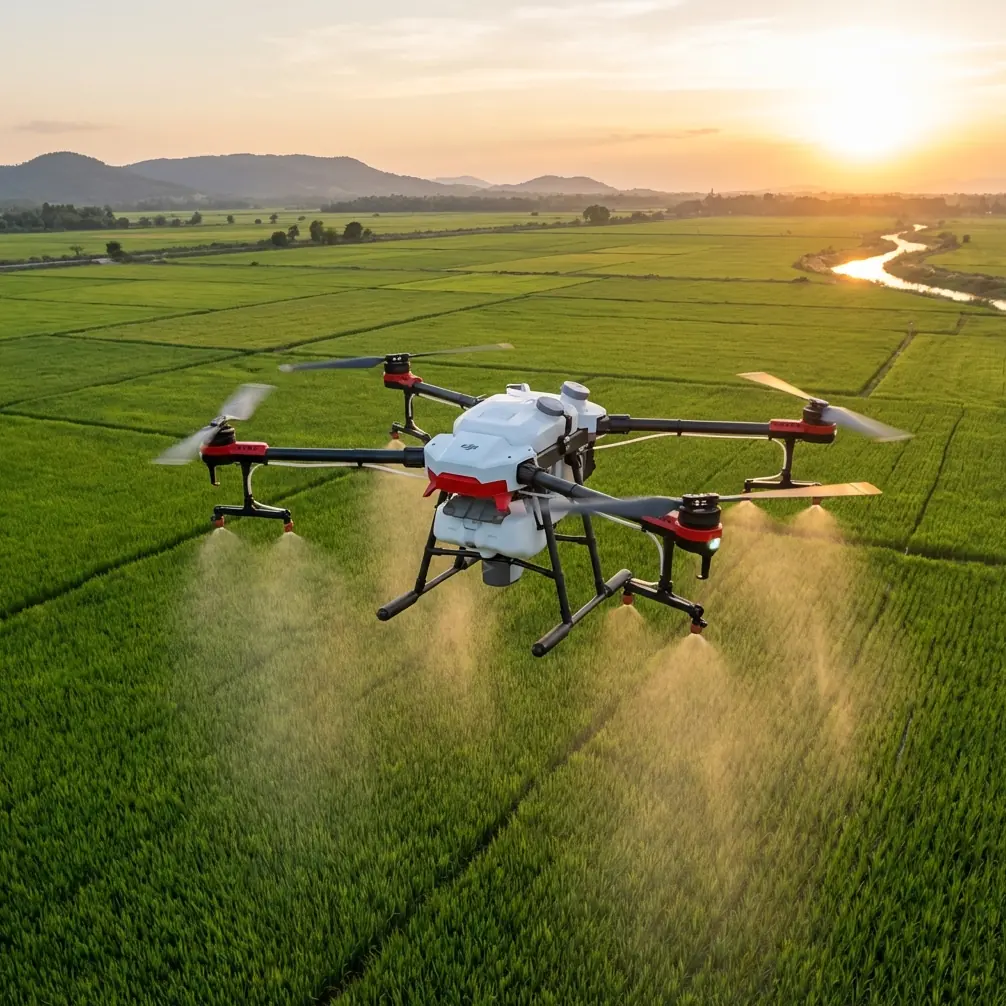
Chris Park, working as a creator with a strong technical bent, needed to capture a large venue from higher elevation angles without losing the reliability required for repeatable outputs. The brief was not just to produce dramatic aerials. The venue team wanted material that could support planning, marketing, and future site documentation. That changes everything. Once a flight has to serve both visual storytelling and measurable spatial reference, casual flying stops being enough.
What made this project interesting was the blend of a compact platform mindset with discipline borrowed from a formal aerial photogrammetry standard. The reference framework came from the low-altitude digital aerial photogrammetry field specification, which places unusual emphasis on two things many creators underestimate: proper technical design before flight, and strict instrument inspection and calibration before use. Those are not bureaucratic details. They directly affect what happens when a drone is asked to capture a venue cleanly from altitude.
Why this venue job was harder than it looked
High-altitude venue capture sounds simple on paper. Fly up, get the wide reveal, run a few QuickShots, maybe add a Hyperlapse pass, and call it a day.
In reality, height introduces a set of tradeoffs. The higher you go, the more the venue compresses into patterns instead of obvious visual landmarks. Rooflines begin to resemble each other. Surface textures flatten. A point that looked easy to identify at low level can become ambiguous in the final frame. If the project needs any mapping value, or even just repeatable matching between one pass and the next, that ambiguity becomes expensive.
This is where the photogrammetry reference becomes surprisingly useful even for a creator-led Flip mission. The standard states that technical design should be written in accordance with CH/T 1004, and that the arrangement of photo control points must follow the relevant requirements of the standard. Operationally, that means you do not improvise the whole mission on site. You define the image intent, the flight geometry, the control logic, and the terrain-related constraints before the props ever spin.
For Chris, that translated into a venue-first plan rather than a shot-first plan. The team separated the mission into three capture layers:
- A high-altitude establishing layer for full venue context
- A mid-altitude orbital layer for geometry and façade readability
- A lower-detail layer for selected entrances, circulation paths, and crowd-flow relevant features
Flip’s compact workflow made this segmentation practical. Instead of trying to capture everything in one cinematic improvisation, the drone was used as a structured data collection tool that also happened to create compelling visuals.
The standard’s most overlooked lesson: target clarity beats convenience
One line from the reference document stood out as especially relevant. It requires that image control point targets be clear in the photo, easy to interpret, and suitable for stereo measurement. It even gives directional guidance on choosing small linear feature intersections with good included angles, roughly in the 30 to 150 degree range. Another detail is even more concrete: the original image representation of a point feature should not exceed 3 by 3 pixels, and the point should be stable and easy to position accurately.
That sounds like a surveyor’s concern. It is also a venue capture concern.
At height, Chris found that some features that looked ideal from the ground were poor reference choices from the air. Decorative paving patterns were visually busy. Shadows from lighting rigs shifted too much. Temporary objects around the venue edge created false visual anchors. Instead, the best reference features were stable corners, clean path intersections, and small high-contrast structural points that remained legible from multiple altitudes.
This matters because Flip’s visual intelligence features, including ActiveTrack and subject tracking behaviors, work best when the visual scene is readable and the subject environment is not cluttered by ambiguous patterns. The more stable the scene references are, the more consistently the aircraft can maintain the intended framing and route logic. Even if the mission is not a formal survey, target discipline improves flight repeatability.
In other words, picking better ground references helps both the map and the movie.
Instrument checks are not optional if the venue only gives you one window
The same standard also requires that all applicable instruments and equipment be inspected and calibrated, and that they remain within the valid period of passed inspection. In commercial venue work, this is one of those rules that separates hobby habits from professional execution.
Chris had a narrow weather window and limited venue access. There was no appetite for discovering sensor drift, storage issues, or accessory fit problems on site. So the preflight routine was unusually strict for a compact drone operation: aircraft calibration status, controller update confirmation, storage verification, gimbal behavior check, obstacle sensing confirmation, and a rehearsal of route logic on the ground.
A third-party accessory played a bigger role than expected here. An aftermarket sun hood and monitor enhancement setup for the controller did not change the aircraft’s specs, but it changed decision quality in the field. At high altitude over a broad venue, small differences in glare management affect whether the operator can truly judge edge spacing, roof texture detail, and control point visibility. That accessory improved screen legibility enough to tighten shot acceptance standards during the live mission. It is a small operational upgrade, but one that had real downstream value.
For operators working in bright open venues, this kind of enhancement can do more than make the experience comfortable. It can reduce unnecessary re-flights.
Applying regional network thinking to a Flip mission
Another useful part of the reference document deals with regional network layout. It says the network division should be determined by considering map scale, ground resolution, terrain characteristics, actual survey area division, and sheet distribution, then selecting the optimal implementation plan based on those combined factors. It also notes that the network size and the span between control points should satisfy aerial triangulation accuracy requirements.
That sounds highly technical, but the venue application is straightforward.
Chris did not treat the entire venue as one visual block. He divided it into logical aerial zones based on altitude effectiveness, geometry complexity, and likely output use. The main stadium structure was one zone. Adjacent parking and circulation corridors were another. Landscape edge areas became a third, because they behaved differently in the image due to texture repetition and elevation changes.
This zoning method solved two common problems.
First, it prevented overreliance on one dramatic top-down pass. Second, it maintained a more consistent ground resolution where it actually mattered. When operators climb too high for convenience, they often gain coverage and lose interpretation. The reference standard’s insistence on balancing scale, resolution, and terrain is a reminder that coverage alone is not success.
That was particularly important on the venue’s sloped perimeter. The document advises that elevation control point targets should be selected in places with smaller elevation variation, and that ravines, sharp hilltops, and steeper slopes with major elevation change are poor choices. Chris used that logic indirectly by avoiding key framing decisions based on highly irregular edge terrain. Instead, the stable interior and circulation geometry carried the mission’s reference structure, while the perimeter was captured as supplemental context.
How Flip’s flight features helped without replacing planning
This project also clarified what Flip’s smart features are good at, and what they cannot do for you.
Obstacle avoidance was valuable, especially during lower transition segments near lighting poles, signage, and roof protrusions. But obstacle avoidance is not a substitute for route design. It is there to protect the aircraft during execution, not to invent a coherent capture framework.
QuickShots helped create clean, repeatable reveal sequences for stakeholders who wanted immediate preview assets. Hyperlapse was useful for showing venue access patterns and environmental movement around the site. D-Log gave Chris better flexibility in managing contrast between the roof surfaces and the surrounding paved areas, especially in the harder midday light. ActiveTrack and subject tracking were less about chasing people and more about maintaining smooth relation to moving support vehicles and guided walk-through sequences where venue scale needed to stay visually legible.
The key point is that these features worked best after the venue had already been broken into structured mission segments. Smart modes are multipliers. They do not replace judgment.
The 150-pixel rule changed framing decisions
One of the most practical details in the source standard says the point position should not be closer than 150 pixels to the image edge. That number seems small, but it drove a meaningful change in Chris’s capture method.
At first, some of the most striking compositions placed important venue corners and path intersections near the outer frame. They looked dramatic, but they were weak for later interpretation and matching. By adjusting flight lines and allowing a bit more breathing room around reference features, Chris preserved edge information that would remain usable in both visual edits and technical review.
This is the kind of detail only experienced operators tend to appreciate. A beautiful frame can still be a bad working frame if the actionable geometry hugs the boundary. The 150-pixel concept is really a reminder to protect your margins.
For teams building venue records, event setup archives, or marketing libraries that may later be reused for planning overlays, that discipline pays off long after the initial shoot.
A note on communication and on-site support
Because venue projects often involve coordination with marketing staff, facilities teams, and external production partners, Chris kept a simple field communication path open for quick technical decisions. For crews that need the same kind of rapid coordination during a live capture day, this direct planning channel can help: message the flight coordination desk.
That kind of support matters most when the mission has mixed output goals. One stakeholder may care about cinematic reveals. Another needs parking flow visibility. Another wants documentation of roof conditions and access routes. Without disciplined communication, the flight gets pulled in three directions.
What this case really says about Flip
The lesson from this venue capture is not that a compact drone suddenly becomes a full survey system by ambition alone. The real takeaway is more useful: Flip becomes dramatically more effective when flown with survey-grade thinking.
The reference standard contributed at least four operationally significant ideas:
- write the technical plan before the mission, not during it
- verify instruments and accessories before deployment
- choose image targets for clarity and stability, not convenience
- divide the capture area according to resolution, terrain, and output purpose
Those principles improved both safety and output quality. They also made Flip’s onboard intelligence more dependable because the aircraft was operating inside a well-designed visual framework.
For high-altitude venue capture, that is the difference between getting footage and building an asset library. One is consumed quickly. The other keeps working.
Chris’s final deliverables reflected that difference. The cinematic sequences were there, but so was clean overhead context, repeatable geometry, and a structure that the venue team could use again on future dates. The project looked polished because it was planned precisely.
That is where many Flip operators can raise their level fastest. Not by chasing exotic settings or overcomplicating post-production, but by borrowing discipline from aerial photogrammetry and applying it to real commercial capture.
A venue from above is not just a spectacle. It is a network of edges, surfaces, elevation changes, circulation lines, and stable reference points. Once you start flying it that way, Flip stops being just a camera in the sky and starts becoming a reliable documentation tool with creative range.
Ready for your own Flip? Contact our team for expert consultation.