How I’d Plan a Flip Coastline Mission When a New Aircraft Hi
How I’d Plan a Flip Coastline Mission When a New Aircraft Hits Flight Test Milestones
META: A practical expert tutorial on planning Flip coastline work in complex terrain, using the Gulfstream G300 first flight as a real-world lesson in testing discipline, reliability, and field battery management.
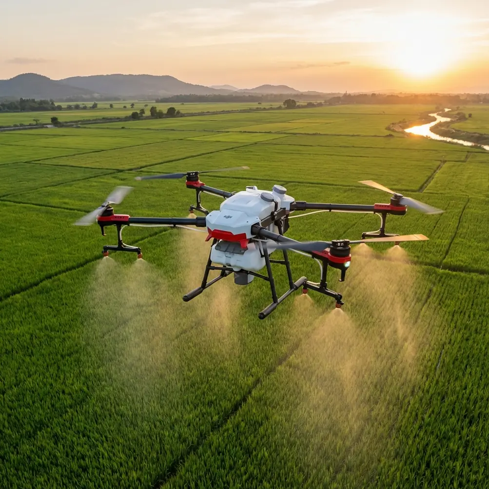
Coastlines look simple on a map. They never are in the air.
Cliffs create abrupt wind changes. Wet sand throws glare back into the lens. Sea spray, uneven launch points, and gulls can turn a neat plan into a rushed recovery. If you’re flying Flip along a rugged shoreline, the challenge is not just getting beautiful footage. It’s building a workflow that stays stable when the environment does not.
That is why one recent aviation milestone is more relevant to Flip operators than it may seem at first glance. On December 5, Gulfstream announced that its new G300 super-midsize business jet completed its first flight. That single event matters because it marks the point where a design leaves presentation mode and enters flight-test reality. In this case, the first G300 test aircraft departed Ben Gurion International Airport at 8:05 a.m., flew for 2 hours and 25 minutes at 30,000 feet and Mach 0.75, and completed the mission successfully. Gulfstream had only unveiled the aircraft publicly on September 30, 2025 in Savannah, with the stated goal of setting a new benchmark in its market segment.
That sequence should sound familiar to any serious drone operator. Reveal is one thing. Proven air behavior is another.
For Flip users working coastlines in complex terrain, the lesson is straightforward: your best results come from treating every demanding shoot like a miniature test program. Not dramatic. Just disciplined. You do not assume the route is clean because it looked fine from a parking area. You do not assume battery timing from flat inland flights will hold above surf and rock faces. You verify. You iterate. You build confidence through repeatable data.
This tutorial is how I approach that process.
Start with the air, not the camera
Many pilots begin with the shot list. I begin with wind structure.
Along a coastline, especially where bluffs or steep slopes meet the sea, wind rarely moves in one tidy direction. It can hit the face of a cliff, roll upward, spill over, then curl back into pockets. Flip’s obstacle avoidance can help in constrained airspace, but no sensor suite can flatten moving air. Your route has to respect the shape of the terrain.
Before launch, I separate the location into three zones:
Stable access zone
A safe takeoff and recovery area with good visibility and enough clearance for a manual landing if GPS position shifts or gusts increase.Transition zone
The stretch between your launch point and the coastline edge, where altitude changes and wind exposure begin to increase.Working zone
The actual cliff line, beach contour, or headland where I intend to use ActiveTrack, subject tracking, QuickShots, or a Hyperlapse sequence.
That simple zoning changes how you use Flip. Instead of asking the aircraft to solve everything in one continuous move, you segment the mission so each flight mode is used where it has the highest margin.
Why the G300 first flight actually matters to a Flip operator
There are two details from the G300 story worth stealing for your own field process.
The first is timing. The aircraft was unveiled on September 30, 2025 and reached first flight on December 5. That gap matters because development maturity is not proven at launch. It is proven in structured execution afterward. For drone work, the operational takeaway is this: never judge a coastline workflow from a single successful outing. A route you flew once in mild conditions is still only a reveal. Real confidence starts when you repeat it in different light, tide, and wind conditions and understand where the weak points show up.
The second is test profile discipline. The G300’s first flight was not random sightseeing. It had a known departure time, a specific altitude of 30,000 feet, a speed of Mach 0.75, and a defined duration of 2 hours 25 minutes. That tells you something fundamental about aviation culture: useful testing is measurable. For Flip, that means every coastline mission should have a basic log. Not fancy. Just enough to improve the next sortie:
- wind estimate at launch
- battery percentage at departure and recovery
- maximum distance offshore
- altitude near cliffs
- whether obstacle avoidance triggered unexpectedly
- signal quality at turn points
- whether ActiveTrack held or dropped the subject
If you do this for even five flights at the same location, your risk drops and your creative options expand.
Build the coastline route backward from your landing reserve
This is where battery discipline separates experienced field operators from people who merely know the controls.
A battery tip from my own coastal work: treat the return leg as if it will be slower than the outbound leg, even when conditions look balanced. Sea winds and cliff turbulence often make that true. I never plan a shoreline push based on how efficient the first half of the flight feels. I build the route backward from the reserve I want at landing.
For Flip, my practical rule is to assign battery in four blocks:
- 20 percent protected reserve for unexpected headwind, repositioning, or a second landing attempt
- 10 percent terrain buffer for cautious maneuvering near bluffs, rock stacks, or narrow recovery spaces
- the remaining flight budget for actual image capture
- a small mental margin because field conditions are rarely as tidy as telemetry suggests
The common mistake is staying out too long because the footage is getting good. Coastlines tempt you to chase one more pass. Don’t. Salt air and changing gusts make late-flight corrections less forgiving.
A second battery habit that has saved me more than once: after landing, I let the battery cool before immediately sending Flip back up for another complex pass. Quick relaunches are tempting when the light turns perfect, but heat plus a demanding route can affect consistency. If the scene matters, cycle batteries deliberately rather than squeezing everything from one pack.
Use obstacle avoidance as a margin tool, not a planning substitute
Coastal terrain is full of awkward geometry. Jagged outcrops, isolated trees above beaches, cable lines near access roads, and sudden rock faces all complicate pathing. Flip’s obstacle avoidance is useful here, but I use it as a backup layer, not a promise.
A practical method is to perform a high reconnaissance pass first. Stay well above the intended shooting line and read the terrain in motion. This is when I’m looking for:
- invisible elevation rises behind the ridge edge
- birds using the same wind lift band I planned to fly
- places where the cliff face leans outward, reducing safe lateral room
- reflective water zones that may make visual judgment harder
Only after that pass do I descend into the working zone for lower-angle footage or tracking. This is also where ActiveTrack and subject tracking need restraint. On a beach path or coastal road, tracking a moving cyclist or vehicle can look effortless until the route bends behind a bluff or passes under vegetation. I keep extra lateral distance whenever the subject line intersects changing terrain.
The smarter approach is to decide in advance where tracking starts and where it ends. If a section includes uncertain topography, I stop tracking and fly manually.
QuickShots and Hyperlapse work best when the landscape is pre-read
QuickShots can be excellent on coastlines because the geography already provides dramatic separation between land, sea, and elevation. But automation should only happen after you know the air and the obstacles.
My recommendation:
- Use QuickShots in open sections with obvious clearance and minimal bird activity.
- Avoid automated patterns near protruding cliff shelves or where surf noise makes auditory awareness impossible.
- Save more intricate motion for the second or third battery, once the site has been read properly.
Hyperlapse is different. It rewards patience. Along the coast, stable light and predictable wind matter more than spectacle. If I’m shooting a Hyperlapse from a headland, I’ll often lock in a conservative position rather than forcing a dynamic route. The resulting sequence usually feels cleaner because the ocean itself supplies movement.
D-Log helps when coastlines become contrast traps
One reason shoreline footage disappoints in post is tonal imbalance. Dark rock, white foam, reflective water, and pale sky can sit in the same frame. D-Log is useful in exactly these conditions because it gives you more flexibility to manage highlight retention and shadow detail later.
But D-Log is not a fix for poor timing. Midday glare over water can still flatten the image and complicate exposure judgment. If the mission allows, I prefer early or late light when cliff texture separates naturally and the sea surface is less punishing.
My field rule is simple: if I need both the cliff face and the water detail to hold, I check exposure against the brightest reflective patch, not the land. Coastline scenes can trick you into exposing for the rocks while quietly clipping the water.
A sample Flip coastline workflow in complex terrain
Here’s the kind of structure I use for a real session:
Flight 1: Survey pass
Launch from a stable access zone. Climb to a safe altitude. Fly the intended route without cinematic pressure. Watch the wind behavior near ridge edges and note any obstacle avoidance warnings. This is your data flight.
Flight 2: Establishing shots
Use broad lateral movements, higher reveal angles, and simple line work. If visibility is clean and the cliff geometry is predictable, this is where QuickShots can begin to earn their place.
Flight 3: Subject work
Bring in ActiveTrack or subject tracking only after the route is proven. Keep the tracked subject in a section with reliable clearance and an obvious escape corridor.
Flight 4: Specialty sequence
This might be a Hyperlapse from a fixed point, a low surf-edge pass in safe open space, or a D-Log clip designed specifically for grading.
This progression matters for the same reason the G300’s first flight matters. Aviation rewards sequence. You do not jump to the hardest task first. You build from controlled verification toward higher-value execution.
Communication matters more on shorelines than people expect
If you’re working with a client, spotter, or on-camera talent, coastline acoustics can be messy. Wind and surf swallow instructions. I set visual checkpoints before takeoff and keep the operating language minimal.
If you need to sort out location planning or field workflow details before heading out, I’d use this direct WhatsApp line for mission coordination: https://wa.me/85255379740
That kind of clarity is underrated. Good flights often start with good pre-briefs.
The photographer’s mindset: don’t confuse drama with difficulty
As a photographer, I’ve learned that dramatic scenery invites overflying. You see layered cliffs, spray, moving clouds, and suddenly every shot feels like it needs to be closer, lower, faster. Usually it doesn’t.
The strongest coastline footage from Flip often comes from controlled composition:
- a stable side track showing the coastline unfolding
- a measured rise that reveals terrain depth
- a clean subject track with room around the moving element
- a patient hover sequence timed with surf rhythm
Complex terrain already brings tension to the frame. You do not need to manufacture more by flying aggressively.
What the G300 milestone teaches us about drone professionalism
The deeper value in the G300 first-flight news is not just that a new aircraft got airborne. It is that the event signals a transition from concept confidence to demonstrated performance. That mindset belongs in high-quality drone operations too.
A launch announcement tells the market what a platform hopes to become. A documented first flight tells operators the machine has entered the part that matters most: measured proof. For Flip users on demanding coastline assignments, the equivalent is not owning the drone or reading the feature list. It is understanding exactly how obstacle avoidance behaves near uneven rock faces, when ActiveTrack stays reliable in lateral motion, how D-Log performs against water glare, and how your battery reserve holds when the return leg fights coastal wind.
That is how good shoreline work gets made. Not through guesswork. Through deliberate repetition, useful notes, and enough restraint to land before the conditions ask for more than the flight can safely give.
Ready for your own Flip? Contact our team for expert consultation.