Delivering Construction Site Maps with Flip in Windy Conditi
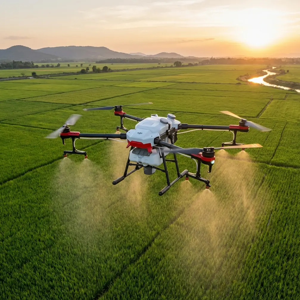
Delivering Construction Site Maps with Flip in Windy Conditions: A Practical Workflow That Protects Accuracy
META: Learn how to use Flip for construction-site mapping in windy conditions, with practical tips on image capture, aerial triangulation, DSM generation, and data editing for cleaner deliverables.
Wind changes everything on a construction site.
Not just for the aircraft in the air, but for the map that comes out at the end. A windy mission with Flip is not simply a flight challenge. It is a data-quality challenge. If your goal is to produce usable construction documentation rather than just collect pretty footage, you need to think beyond takeoff, battery swaps, and obstacle avoidance. The real work starts when those images become geometry.
That is where many operators fall short.
Flip is often discussed through familiar camera and flight-feature language: subject tracking, QuickShots, Hyperlapse, D-Log, ActiveTrack, obstacle avoidance. Those matter, especially for site progress visuals and stakeholder updates. But on a windy construction project, the stronger differentiator is not just how well the drone flies. It is how reliably the image set can be turned into a coherent mapping product when wind, motion, blur, and inconsistent overlap start to pressure the workflow.
This is the part competitors often gloss over. They focus on the aircraft. Experienced operators focus on the downstream chain: orientation, triangulation, surface generation, editing, and rework.
Why wind matters more for mapping than for general site filming
A construction site is full of edges, elevation changes, temporary structures, stockpiles, fencing, cranes, scaffolding, and partially completed surfaces. In calm conditions, a competent image plan can produce a solid model. In windy conditions, several things begin to break down at once:
- image sharpness can vary frame to frame
- overlap consistency becomes less reliable
- temporary objects may shift between passes
- vertical features become harder to resolve cleanly
- operators may rush captures to stay within battery and safety margins
For a casual video job, this may still be acceptable. For photogrammetry, it creates compounding errors.
The key concept from the reference material is aerial triangulation, also called air triangulation or aerial block adjustment. Its role is operationally central. Using a limited number of existing ground control points, it determines the exterior orientation elements for all images in the block and calculates coordinates for densified points needed for office mapping work. That sounds technical, but the practical meaning is simple: if your images do not support a stable adjustment, every later deliverable gets weaker.
On a windy site, the difference between a smooth project and a frustrating one is whether your Flip mission is planned for triangulation success, not just flight completion.
Start with the right mission goal: map first, media second
One of the easiest mistakes with Flip on construction work is trying to combine too many goals in one sortie. Operators want mapping, progress photos, cinematic clips, and tracked sequences all in the same battery window.
That usually leads to compromised data.
If the site requires accurate mapping, your first flight should be dedicated to structured image collection. Keep ActiveTrack, QuickShots, and Hyperlapse for separate media passes. Those features are useful, especially when presenting site updates to clients or documenting logistics flow, but they should not interfere with the core photogrammetry dataset.
This separation matters because aerial triangulation depends on image relationships across the whole block. The reference explains that each photo can be treated as a beam of light in the adjustment process, with the collinearity condition serving as the mathematical basis. Through rotation and translation of these beams in space, rays from shared points in adjacent models are brought into their best intersection, and the entire area is fitted into a known control-point coordinate system.
Operationally, that means consistency wins. In wind, any flight behavior or capture pattern that introduces irregularity makes the adjustment software work harder.
Use obstacle avoidance as a stability tool, not just a safety feature
Obstacle avoidance is usually marketed as crash prevention. On a construction site, it also supports route discipline.
Wind around unfinished buildings can produce unpredictable airflow. A drone that is constantly making abrupt pilot-corrected movements near structures may still stay safe, but it can generate uneven image geometry. Flip’s obstacle awareness should be treated as part of the capture strategy: maintain cleaner paths, reduce erratic close-proximity maneuvers during mapping runs, and preserve more uniform frame spacing.
This is one area where Flip can outperform less refined competitors in practical field use. Many aircraft can technically capture enough photos. Fewer help the operator maintain a repeatable flight pattern under site pressure. And repeatability is what protects the data chain later.
For windy deliveries, keep your mapping runs conservative. Leave dramatic low passes for visual documentation flights. A cleaner, calmer route usually gives the processing software a better chance to recover a stable block.
Ground control still matters, especially when wind reduces confidence
The reference material makes a valuable point: aerial triangulation is designed to work with a small number of existing field control points. That does not mean ground control is optional when conditions are difficult. It means those points become even more valuable when the image block is under stress.
Wind can magnify weak overlap or inconsistent viewing angles. Control points help anchor the project so the image network is not floating on assumptions. If you are mapping a construction site where access is limited, even a modest set of well-placed controls can make the office stage far more dependable.
This is also where disciplined site coordination helps. If your team needs a practical workflow for windy mapping jobs, message the project desk here before deployment and align the control layout with the flight plan.
The strongest construction mapping teams do not treat field and office work as separate silos. They plan control, capture, and editing as one chain.
Understand the DSM limitation before you promise deliverables
Another reference detail deserves more attention than it usually gets: DSM data generally cannot be obtained through traditional surveying methods such as traverse measurement or RTK alone. In practice, the most common way to obtain it is through fully digital photogrammetric processing after image acquisition, where the aerial triangulation software automatically generates it.
That matters because construction clients often ask for “a map” without understanding whether they really need a 2D plan, a DSM, contour product, or progress surface comparison.
A DSM is not just ground elevation. It represents the surface of objects in the scene, including vegetation, bridges, and building surfaces. On a construction site, that means stockpiles, equipment, temporary structures, and partially completed buildings can all shape the model.
In windy conditions, this becomes even more significant. Tarps flap. machinery moves. suspended materials shift. lightweight temporary features may not appear consistently across image sets. If the operator does not explain this in advance, the client may misread the output as a pure terrain product.
Flip can absolutely support useful site surface documentation, but your deliverable language should match what the data actually represents.
Why the office team is the hidden bottleneck
Most people imagine the hard part happens in the air. The source material argues otherwise, and I agree.
Data editing is where raw site capture becomes a deliverable that meets project requirements. The reference describes editing as the work of refining the first-pass map: stitching map sheets, trimming contours, removing excess elevation annotations, adding borders, and adding text notes. That may sound administrative, but it has direct operational impact.
Construction projects do not want raw geometry. They want readable outputs.
And those outputs often do not emerge in one pass. The reference explicitly notes that one-time production is frequently unrealistic because stereo image pairs may contain missing, blurry, or uncertain areas. Editors identify those zones, mark them, and send a semi-finished product back to field staff for supplemental survey work. Once the additional measurements are collected, the map is updated with the missing content.
This is one of the most useful realities to communicate when flying Flip on a windy job: the mission is not over when the drone lands, and not every problem should be “fixed in software.”
If wind caused blur across one section of the site, or if reflective surfaces and partial structures created uncertainty, the professional response is to flag the gap, resurvey the area, and fold the new data back into the product. That is not failure. That is disciplined mapping.
A practical how-to workflow for Flip on a windy construction site
Here is the workflow I would use.
1. Define the mapping deliverable before flight
Decide whether the client needs orthomosaic-style site documentation, a DSM, contour output, or annotated progress mapping. Do not assume these are interchangeable.
2. Separate mapping capture from visual storytelling
Use one flight for structured mapping and another for media. Save ActiveTrack, QuickShots, and Hyperlapse for supplementary documentation.
3. Keep flight geometry simple
In wind, consistency is more valuable than aggressive coverage. Prioritize stable altitude, reliable overlap, and predictable pathing.
4. Use obstacle avoidance to reduce erratic corrections
Treat avoidance systems as part of route quality management, especially near facades, cranes, and temporary structures.
5. Support the image block with field control
A small number of well-placed control points can stabilize the project when wind weakens image consistency.
6. Process with aerial triangulation in mind
Remember what the software is trying to do: solve the exterior orientation of all images and generate densified points by making shared rays intersect as cleanly as possible within the known coordinate framework.
7. Review for uncertain zones, not just global success
A project can “complete” in software and still contain weak areas. Check for blur, missing stereo detail, uncertain structures, and surface anomalies.
8. Edit for usability
Trim contours where needed, remove unnecessary clutter, add clear annotation, and format the map to match the end-user’s decision-making needs.
9. Resurvey what cannot be defended
If part of the site is unclear, mark it and send it back for supplemental capture. This step is standard, not exceptional.
Where Flip stands out against weaker alternatives
Some drones are perfectly capable in light-duty mapping but start to show their limits on active sites in wind. Not always because they crash or fail, but because they make the operator compensate too much. More manual correction in the air often leads to less consistency in the dataset.
Flip’s advantage in this kind of work is not just that it can capture site imagery. It is that its flight-assist features can help preserve a cleaner acquisition pattern under difficult conditions. That directly supports the later aerial triangulation stage.
For construction teams, this is the comparison that matters. The better aircraft is not the one that merely survives the mission. It is the one that helps produce a block of imagery that the office can actually trust.
If you also need polished visual content, D-Log can be useful for grading site footage, while ActiveTrack can help with progress storytelling around moving non-sensitive subjects such as logistics vehicles or supervised workflow sequences. But those are side benefits. The core story is still mapping integrity.
The human factor is still decisive
The source material points out that aerial survey office work remains labor-intensive and that there is a shortage of high-quality, well-rounded talent. That observation is not abstract. It explains why two teams using similar hardware can produce very different results.
Flip does not remove the need for expertise. It raises the ceiling for teams that understand the full chain from capture to edit.
A windy construction-site mission rewards operators who know when to trust automation, when to simplify the plan, when to place control, and when to send a questionable section back for supplemental survey instead of forcing a weak deliverable through production.
That is the difference between content collection and professional mapping.
And that is the real lesson from the reference material. Photogrammetry is not a single step. It is an interlocked workflow built on orientation, control, surface generation, editorial refinement, and field feedback. If you fly Flip with that workflow in mind, windy conditions become manageable. Ignore it, and the project will expose every shortcut.
Ready for your own Flip? Contact our team for expert consultation.