Flip for Fields in Low Light: What Airport
Flip for Fields in Low Light: What Airport-Scale Automation Signals for Real-World UAV Work
META: A field-focused expert analysis of Flip in low light, using recent airport automation news to explain obstacle avoidance, tracking, D-Log workflows, and why air-ground integration matters for civilian drone operations.
Low-light drone work in open fields sounds simple until you actually do it.
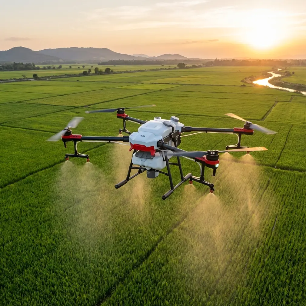
The terrain looks forgiving. There are no towers packed shoulder to shoulder, no urban canyons, no reflective glass everywhere. But dusk and early dawn hide the details that matter most: irrigation lines, fence wire, uneven tracks, tree edges, utility poles, shallow fog, and the kind of contrast loss that makes distance judgment unreliable. For photographers, survey teams, and agricultural operators, this is exactly where a compact platform like Flip has to prove itself.
A recent development in China’s civil aviation ecosystem puts that challenge into a much bigger frame. On March 17, Uisee Technology and Xinjiang Airport Group signed a strategic cooperation agreement centered on integrating autonomous driving technology with civil aviation scenarios. That is not just a transport headline. It is a signal about where professional unmanned operations are heading: less isolated hardware, more connected decision-making, and tighter links between what happens in the air and what happens on the ground.
Why does that matter if your job is flying Flip over fields at low light?
Because low-light field operations are no longer just about whether a drone can get airborne and return home. They are about whether the aircraft, the operator, the route, and the surrounding ground activity can work as one reliable system. The airport story makes that point at infrastructure scale. Flip users feel the same operational pressure at field scale.
The real problem with low-light field flying
As a photographer, I’ve always found low light seductive and unforgiving in equal measure. Fields at sunrise carry texture you simply cannot recreate at noon. The soft edge on soil ridges, the tonal layering in planted rows, the glow behind distant trees—this is where small drones can produce surprisingly cinematic work. But the same light that flatters a landscape can erase hazard cues.
That changes the pilot’s priorities.
In bright daylight, you can often rely on visual confirmation to supplement the drone’s onboard sensing. In low light, that buffer shrinks. Obstacle avoidance becomes less of a convenience feature and more of a risk-control layer. Subject tracking, which sounds like a creator tool on paper, becomes a practical aid when you are following a vehicle along a farm road or documenting a worker inspection route at civil-safe distances. QuickShots and Hyperlapse also take on a different role: not gimmicks, but repeatable movement templates that help reduce improvisation when visibility is less forgiving.
Flip fits this environment best when it is treated as a disciplined field platform rather than a casual flyer.
What the Xinjiang airport agreement actually tells us
The reference news is easy to summarize and easy to underestimate.
Xinjiang Airport Group, established in 2004, currently operates and manages 27 civil transport airports and 2 general aviation airports. It has built an airport system centered on the Urumqi international hub, with key gateway airports including Kashgar and Yining, plus coordinated development across several regional hubs.
That scale matters. Twenty-nine airports under management is not a boutique test case. It is a broad operating network spread across varied geographies, traffic demands, and ground-support conditions. When an organization of that size signs an agreement focused on the deep integration of autonomous driving technology into civil aviation scenarios, the message is operational, not theoretical. Large aviation systems are moving toward coordinated automation across surfaces, routes, and support layers.
The phrase “air-ground integrated” ecosystem is the key detail here.
For airports, that can mean smarter interactions between aircraft operations and autonomous ground services. For a Flip operator in agriculture, inspection, or rural imaging, the same principle translates into mission design. Air performance is only half the job. The other half is how the drone relates to field access roads, vehicles, people on site, handoff procedures, charging logistics, landing zones, and time-sensitive movement windows.
A low-light field mission becomes safer and more productive when it is built around that integrated logic.
Flip’s role in the field: not just camera-first, but workflow-first
A lot of small-drone discussions get trapped in the camera spec loop. Resolution matters, dynamic range matters, color profile matters. But in low-light field work, usability under pressure often decides whether the mission produces usable data or wasted battery cycles.
This is where several Flip-relevant capabilities deserve to be understood in operational terms.
Obstacle avoidance in fading contrast
Obstacle avoidance is frequently discussed as a beginner safeguard. That undersells it. In a field environment at dusk, subtle obstacles are often the problem, not obvious ones. A hedgerow that reads cleanly from one angle may hide protruding branches. A farm entrance can include gates, wires, and posts that visually compress in dim light. A canal edge can appear flatter than it is.
Obstacle sensing does not replace pilot judgment, especially in low light, but it helps preserve margins when visual perception loses precision. That is the kind of feature that shifts from “nice to have” to “mission-enabling” as daylight fades.
ActiveTrack and subject tracking for repeatable movement
If you are documenting agricultural operations, perimeter checks, or a vehicle route around a site, consistent framing is harder in low light because manual flying becomes more conservative and less fluid. ActiveTrack or related subject-tracking functions can help maintain composition and spacing while the pilot focuses more attention on route safety and surroundings.
The operational significance is straightforward: when tracking is stable, the pilot has more cognitive bandwidth for hazard awareness. In low-light work, that matters.
QuickShots and Hyperlapse as control tools
QuickShots and Hyperlapse are often treated as creator presets. In real field use, their value is repeatability. A pre-structured movement path can reduce ad hoc stick input, which means fewer abrupt corrections when depth cues are weak. Hyperlapse can also help tell the story of changing field conditions, vehicle movement, or weather transitions over a larger site without requiring aggressive, manually improvised motion.
For readers who work in documentation rather than social content, that repeatability is the point.
D-Log when the light is thin
Low light in open land usually creates a dynamic-range puzzle rather than a simple darkness problem. The sky may still hold brightness while ground detail falls away. D-Log or similar flat profiles become useful here because they preserve more grading flexibility in scenes where highlights and shadow detail need to be balanced carefully afterward.
That does not make low-light footage magically cleaner. It gives you room. And room is what you need when the field itself is muted, the sky is brightening or fading, and your final deliverable must still show texture in crops, access roads, structures, or equipment.
Why airport-scale automation is relevant to Flip users
The airport agreement is not about Flip specifically. But it highlights a pattern that serious UAV users should not ignore.
Civil aviation is treating automation as an ecosystem question. Not a single-device question.
Xinjiang Airport Group’s network, anchored by Urumqi and extending across gateway and regional airports, represents a complex environment where timing, routing, and support coordination all matter. The decision to work on autonomous technology integration in that context suggests that future-ready operations depend on connected workflows across multiple moving parts.
Now scale that down to a rural field deployment.
Your drone launch point may shift based on vehicle access. Your low-light window may be only 20 minutes. A worker on the ground may need coordinated visibility of the drone’s route. You may need to capture a perimeter pass, a fixed structure check, and a cinematic establishing shot in one battery cycle. If a third-party landing pad with reflective markers helps define a cleaner takeoff and recovery zone in dim conditions, that is not an accessory indulgence. It is air-ground integration in miniature.
I have seen simple add-ons make a real difference here. A high-visibility third-party landing pad is one of the most practical. In low light, it improves visual reference during launch and recovery, especially on uneven or dusty ground where the landing area can disappear into the scene. Small workflow upgrades like that often matter more than another line on a spec sheet.
A practical problem-solution view for Flip in low-light fields
Let’s keep this grounded in the reader’s scenario.
Problem: the field is open, but the mission is not simple
People assume fields equal freedom. In reality, low-light field flying compresses decision time. You are balancing battery, legal visibility requirements, route confidence, image quality, and safe separation from people, structures, and equipment. If you are creating visual content, you are also trying to preserve atmosphere without introducing avoidable risk.
Solution: build the mission around controlled automation
This is where Flip becomes useful when you lean into its smarter features instead of trying to outfly the environment manually.
Use obstacle avoidance as a margin layer, not as permission to get reckless. Use ActiveTrack where the subject movement is predictable and safe to follow. Use QuickShots for clean, repeatable camera paths when hand-flying precision starts to degrade with the light. Capture in D-Log when the scene has a bright horizon and dark foreground detail that will need grading balance later. Use Hyperlapse selectively when the story is about time passing across a site, not just movement through it.
And support the aircraft with better ground discipline: a marked launch zone, a pre-walked route, and a simple coordination plan with anyone on site.
That framework mirrors the lesson from the airport automation story. The aircraft succeeds when the system around it is organized.
Why the Xinjiang detail matters beyond headlines
Two reference facts stand out because they are easy to gloss over and genuinely significant.
First, the agreement was signed on March 17 as a formal strategic cooperation arrangement, not a vague discussion. That tells us the participating organizations are moving from concept toward structured implementation.
Second, Xinjiang Airport Group manages 27 civil transport airports and 2 general aviation airports. That breadth matters because automation tested or planned across such a network must account for real operational diversity. Desert conditions, regional connectivity, hub complexity, and varied support demands all force technology to be practical rather than merely impressive.
For Flip users, the takeaway is simple: the future of civilian UAV work belongs to operators who think in systems. Not just pilots who collect footage.
If you want to compare field setups, workflow accessories, or low-light operating habits with someone who understands compact drone use in real conditions, I’d suggest starting the conversation here: message a drone specialist directly.
The photographer’s view: what good low-light field footage actually requires
As someone coming from image-making first, I’d put it this way: low-light field footage fails less often because the camera is weak than because the operation is sloppy.
Great results usually come from restraint.
Fly lower only when the route is already known. Keep movement deliberate. Avoid relying on dramatic speed to make a scene feel alive. Let the field geometry do the work. Rows, tracks, hedges, irrigation lines, and silhouettes become your composition tools. ActiveTrack can help if the subject path is predictable. D-Log helps if the sky and ground are fighting each other. Obstacle avoidance helps you preserve a margin when visual confidence drops. A third-party landing pad helps make the beginning and end of the mission cleaner than they would otherwise be.
None of this is glamorous. All of it is effective.
And that is why the airport automation story resonates. Whether the environment is a major civil aviation network or a quiet agricultural site, the best unmanned operations are rarely about one dramatic capability. They are about coordinated reliability.
Flip makes sense in low-light fields when it is used that way.
Not as a toy. Not as a miracle device. As a compact tool inside a disciplined civilian workflow shaped by sensing, tracking, route planning, and smart ground support.
That is where the value is.
Ready for your own Flip? Contact our team for expert consultation.