Flip in the Mountains by the Sea: A Field Report
Flip in the Mountains by the Sea: A Field Report for Coastline Filming
META: A field-tested guide to using Flip for filming coastlines in mountain terrain, with practical tips on obstacle avoidance, ActiveTrack, QuickShots, Hyperlapse, D-Log, and battery management.
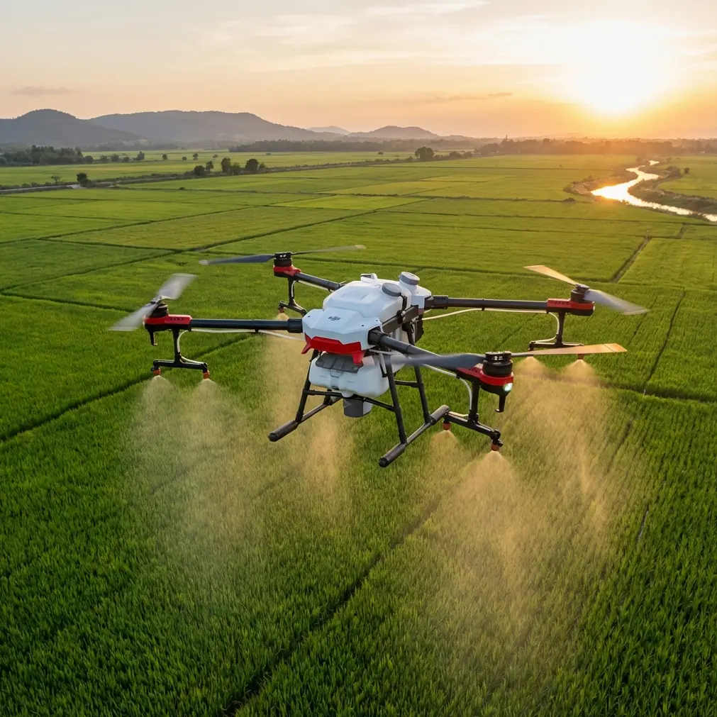
Coastlines in mountain country look simple on a map. In the field, they are anything but. Wind bends around ridgelines, sea glare fools exposure, and the terrain can shift from open beach to rock face in a few seconds. That is where a compact camera drone like Flip earns its place. Not because it makes flying effortless, but because its feature set can reduce workload when the environment gets busy.
This field report is built around that exact use case: filming coastlines in mountain terrain with Flip. Not a studio comparison sheet. Not a generic buyer roundup. The goal here is to explain how a creator actually gets useful footage when the shoreline, cliffs, and weather are all working against consistency.
As a rule, these locations reward two things: planning and restraint. Flip helps with both if you use its automation properly and know when to switch back to manual decision-making.
Why Flip makes sense for coastal mountain shoots
The appeal of Flip starts with portability, but portability alone is not enough. A small aircraft is only valuable in these environments if it can stabilize the shot, hold a subject reliably, and deal with changing terrain without turning every flight into a risk management exercise.
That is why obstacle avoidance and subject tracking matter more here than they do over open water or flat inland locations. A mountain coastline rarely gives you one clean backdrop. You may be tracking a hiker on a ridge trail, then sliding laterally to reveal surf below, then backing away from a rock outcrop while trying to preserve a clean horizon. Those transitions are where intelligent flight features stop being marketing terms and become operational tools.
ActiveTrack, for example, is not just about keeping a subject in frame. Along coastal ridges, it becomes a way to offload framing corrections while you focus on route awareness and altitude. That matters because vertical relief changes fast. A person walking on a contour trail can move from exposed ground into a section bordered by brush, rock, and uneven terrain in less than a minute. If the aircraft can maintain visual lock while you supervise spacing and line choice, your footage gets smoother and your cognitive load drops.
The same logic applies to obstacle avoidance. In mountain coastline filming, avoidance is less about dramatic last-second saves and more about preserving rhythm. A cautious aircraft behavior profile helps when flying near terrain transitions where cliff edges, isolated trees, signposts, and rising ground appear together. That keeps the mission from becoming jerky and reactive.
The coastline problem nobody talks about enough: light
Most first flights over dramatic coastlines fail visually before they fail technically. The ocean reflects hard light upward. Pale stone reflects from the side. Forested slopes and shadowed gullies pull exposure in the opposite direction. The result is footage that can feel brittle in highlights and muddy in darker sections if you do not leave room in the image.
This is where D-Log becomes useful in a practical sense. Not because every creator wants a cinematic color workflow, but because coastal mountain scenes often contain extreme contrast in a single pass. Shooting in a flatter profile gives you more flexibility when the drone pans from shaded ridge vegetation to sunlit water. It is one of the few feature choices that directly affects whether your edit feels coherent across an entire location.
I have found that creators who only switch to D-Log for “serious projects” often miss its best use case. Places with mixed rock, surf, and elevation changes are exactly where you want grading latitude. If your route includes a reveal from behind a dark headland into open reflective water, that extra control can save a shot that would otherwise look clipped and thin.
The operational significance is simple: less time fighting inconsistent footage later, and more confidence mixing sequences captured under shifting conditions.
When QuickShots actually help
QuickShots tend to be underestimated by experienced pilots and overused by beginners. On a mountain coast, they are most valuable as repeatable structure. If you are documenting a location with limited battery windows, a pre-programmed motion can give you one clean establishing shot without spending several attempts hand-flying a move that should be simple.
A reveal shot off a cliff edge, a pullback from a sea stack, or a rising orbit over a curved cove can all benefit from that repeatability. The point is not to let automation define the entire sequence. The point is to secure reliable coverage early, while conditions are still cooperative.
That matters because coastal wind often builds unevenly through the day. The shot that feels easy at 8:30 can become unstable by 10:00 once thermals and sea breeze start interacting with the terrain. A disciplined workflow is to use QuickShots for one or two anchor clips at the start, then move into more custom passes once you know you already have usable footage in the bag.
Hyperlapse is stronger in these locations than most people realize
Hyperlapse can feel like a novelty until you put it over geography that actually benefits from compressed movement. Mountain coastlines are ideal for it. Clouds slide over ridges. Tides shift texture across a bay. Light advances over layered slopes. Roads and trails snake through elevation in ways that become more legible when time is condensed.
The mistake is trying to hyperlapse in conditions that are too chaotic. You need a composition with a stable visual spine: a headland, a ridgeline, a lighthouse, a harbor curve. Once the frame has that anchor, the moving elements become expressive rather than messy.
Operationally, Hyperlapse gives you something standard video does not: a sense of environmental tempo. That is useful if your final piece is not just about scenic beauty but about place. Coastlines in mountain regions feel alive because sea and slope are always interacting. Hyperlapse can show that interaction in a single shot.
ActiveTrack on trails above the water
If your subject is moving along a trail above the sea, ActiveTrack can be excellent, but only if you respect what the system sees well and what it sees poorly. Paths near cliff edges often include patches of scrub, benches, handrails, and abrupt turns. The tracking mode is strongest when the subject is distinct and the route ahead is readable. It becomes less predictable when the subject passes under irregular cover or blends into the terrain.
For that reason, I treat ActiveTrack as a supervised assistant, not a permission slip to stop thinking. The best results come when you choose sections of trail with clean separation between subject and background, then pre-visualize where the drone will need more lateral room as the route bends.
This is especially true when filming solo creators. If you are both pilot and on-camera subject, subject tracking can make a difficult shoot possible. But the shot still depends on route design. Pick the stretch first. Walk it mentally. Identify the sections where the terrain narrows or rises. Then launch.
That is the difference between smart automation and lazy automation.
A battery management tip from the field
Here is the least glamorous lesson from filming coastlines in mountain terrain: battery percentage lies to people who only fly in easy conditions.
Over open level ground, battery drain feels predictable. Near ridges and shorelines, it often does not. Headwinds can appear halfway through the return leg, and climbing back above a launch point on uneven terrain can consume more reserve than expected. I have seen otherwise careful operators stay out too long because the outbound leg was aided by tailwind and mild descent, making the battery read deceptively healthy.
My field rule is simple. Split the flight into three mental blocks, not one continuous session: outbound setup, primary shot window, and return reserve. If the primary shot window starts late because you spent too long exploring angles, the return reserve does not become negotiable. It stays intact.
A practical version of that rule is to bring the aircraft back earlier than feels necessary when flying from elevated coastal launches. The number that matters is not just remaining battery. It is the energy required to fight changing wind and regain safe landing position with terrain in the way. On mountain coastlines, “I still have plenty left” can turn into “why is the return taking this long” very quickly.
Another tip: after landing, do not rush a hot battery back into immediate relaunch cycles if you are doing repeated scenic takes in strong sun and little shade. Give yourself a reset. Check cell balance, feel for heat, review the last flight, and decide whether the next sortie has a defined purpose. Random second launches waste more battery than demanding first launches.
That habit alone improves both safety margin and shot discipline.
Obstacle avoidance is not a substitute for route design
One reason pilots get into trouble in visually dramatic places is that beautiful terrain encourages improvised flying. You crest one bluff, see a better cove, then push farther than planned. Flip’s obstacle avoidance can help in these moments, but this is still the wrong workflow.
For coastline work in mountain terrain, route design should happen before takeoff. Identify your reveal line, your highest terrain point, your bailout path, and the direction of the cleanest return. Even a 2-minute preflight sketch in your head changes the quality of the mission.
The significance of obstacle avoidance is that it gives your route more resilience, not that it invents the route for you. Used properly, it adds a layer of confidence when sliding near terrain transitions or backing off from a formation while preserving composition. Used improperly, it tempts pilots into crowded airspace with poor visual buffers.
The shots that consistently work
After enough coastline sessions, a pattern emerges. The strongest footage is rarely the most aggressive. It is usually one of these:
- A slow lateral pass that keeps cliff texture in the foreground and water movement below
- A measured pullback that reveals how the mountain shoulder meets the sea
- A trail follow using ActiveTrack where the subject provides scale against the larger coastline
- A Hyperlapse anchored on a headland while cloud shadow moves over the slopes
- A simple rising reveal captured cleanly with a QuickShot before the wind builds
Each of these benefits from features mentioned earlier, but none depends entirely on them. That is really the theme of filming with Flip in places like this. The aircraft is most effective when its smart tools support clear visual intent.
A realistic creator workflow for Flip on a coastal mountain day
If I were arriving at a new location with Flip and limited time, I would structure the session this way:
First flight: secure one establishing QuickShot and one manual reveal while light is still manageable.
Second flight: use ActiveTrack on the best trail segment or shoreline path where background separation is strong.
Third flight: collect D-Log scenic passes focused on texture changes between rock, vegetation, and water.
Optional final flight: Hyperlapse only if the atmosphere has enough movement to justify it.
That sequence matters. It prioritizes guaranteed coverage first, then more experimental material later. It also protects battery planning. You are not burning your best conditions on indecision.
If you are comparing setups or planning a shoot strategy for a specific route, it can help to talk through launch options and terrain constraints with someone who knows the category. I’d use this direct WhatsApp line for flight planning questions before heading into a location where access and weather windows are tight.
Final take
Flip fits coastline filming in mountain terrain because its key features line up with the actual pressure points of the job. Obstacle avoidance helps maintain composure around mixed terrain. ActiveTrack reduces framing workload when subjects move through elevation. QuickShots deliver repeatable anchor footage. Hyperlapse turns changing weather and geography into storytelling. D-Log gives you room to handle punishing contrast.
None of that removes the need for judgment. It just gives good judgment better tools.
If you approach these locations with a clear route, disciplined battery management, and realistic expectations for automation, Flip becomes more than a compact flying camera. It becomes a very efficient field companion for one of the hardest scenic environments to film well.
Ready for your own Flip? Contact our team for expert consultation.