Flip for Fields at High Altitude: What Actually Matters
Flip for Fields at High Altitude: What Actually Matters When You’re Filming Above the Tree Line
META: A practical expert guide to using Flip for filming fields at high altitude, with insights on obstacle avoidance, subject tracking, QuickShots, Hyperlapse, D-Log, and ActiveTrack from a photographer’s perspective.
High-altitude field filming exposes every weakness in a drone workflow.
Light shifts faster. Wind is less forgiving. Distances look deceptively short until you are hiking another ridge because the angle was wrong. And when you are filming farmland or open grazing land in mountain regions, “open” terrain is rarely as open as it first appears. There are fence lines, lone trees, power routes on the margins, irrigation structures, uneven slopes, and wildlife moving through the scene when you least expect it.
That is where Flip becomes interesting.
I’m writing this from the perspective of a photographer, not a spec-sheet collector. When I evaluate a drone for field work at elevation, I’m not asking whether it looks good on a product page. I’m asking whether it keeps a shoot moving when air is thin, contrast is brutal, and the best moment lasts maybe twenty seconds. For that kind of work, features like obstacle avoidance, subject tracking, QuickShots, Hyperlapse, D-Log, and ActiveTrack stop being marketing labels and start becoming operational tools.
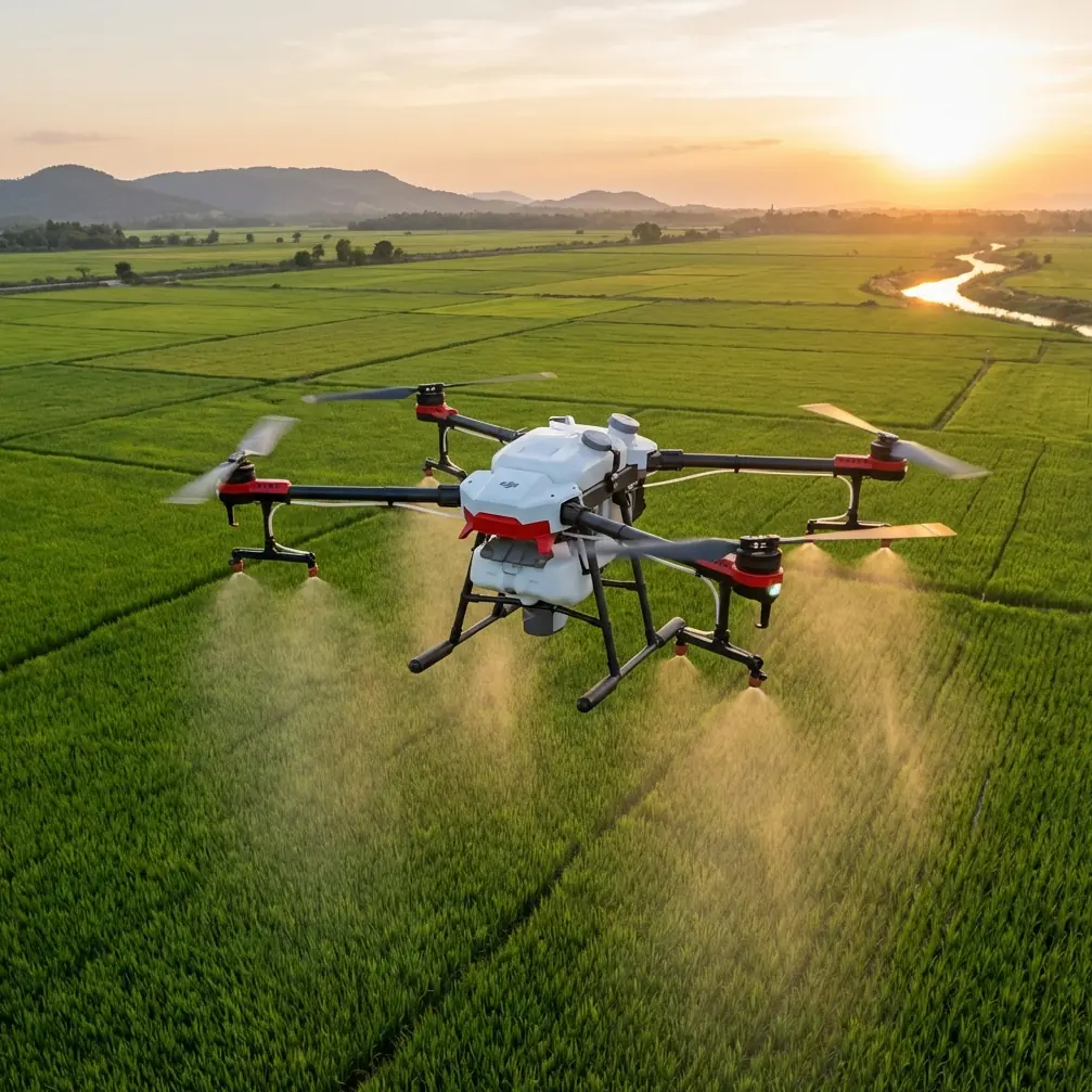
The core problem with filming fields in high altitude
On paper, high-altitude fields sound simple to capture. Wide landscapes. Clean lines. Natural patterns. In reality, they create a technical trap.
The scale is enormous, so camera movement has to be deliberate. If your drone drifts or your tracking breaks, the footage instantly feels small and uncertain. At the same time, the terrain tends to compress distance visually. A tree line that appears safely off to the side may sit much closer to your flight path than expected, especially when you are orbiting a tractor, following a farm vehicle, or trying to reveal the shape of terraced plots.
Then there is the light. Mountain and plateau environments can swing from flat haze to piercing highlights very quickly. If you are filming fields for tourism, agriculture, land management, or commercial storytelling, that creates a grading problem later unless you capture enough tonal information in the first place.
This is why Flip fits the assignment best when it is used as a system rather than as a flying camera. The camera mode, tracking behavior, obstacle sensing, and post-production latitude all affect whether the finished footage feels calm and cinematic or improvised and fragile.
Why obstacle avoidance matters more in fields than many pilots assume
People tend to associate obstacle avoidance with urban flying or forest edges. In agricultural and upland filming, it can be even more valuable.
Fields at elevation often contain isolated hazards rather than dense clutter. That changes how pilots make mistakes. You are not usually threading through a wall of obstacles. You are working in broad space and then suddenly dealing with one wind-bent pine, a utility pole near a boundary, a steep embankment, or a stand of reeds along a drainage cut. Those isolated objects are easy to underestimate because the eye relaxes in wide-open scenery.
On one shoot, I was framing a slow lateral move over patchwork pasture while a small group of deer emerged from the edge of a scrub line. That should have been the gift shot of the day. Instead, it became a test of how well the drone could stay composed while the scene changed unexpectedly. As the animals shifted direction, the more urgent problem was not the wildlife itself. It was the low, uneven vegetation and a dead branch protruding from a weathered tree on the field margin. Flip’s sensors gave me enough confidence to keep the composition alive rather than aborting instantly and losing the moment. That is the operational significance of obstacle avoidance in real field work: it preserves decision-making time.
Not reckless time. Useful time.
A drone that helps you recognize and negotiate those field-edge hazards lets you focus on line, motion, and timing. For photographers and content teams, that means fewer broken takes and less conservative footage.
ActiveTrack and subject tracking solve a very specific high-altitude problem
At elevation, subject separation can look beautiful to the eye but become messy on screen. Farm vehicles, horseback riders, survey teams, or even a single hiker crossing a field can disappear visually against textured ground. Long grass, plowed strips, grazing patterns, and terraced contours compete with the subject. Manual flying alone often produces little micro-corrections that make this worse.
That is where ActiveTrack and subject tracking earn their place.
The practical benefit is not just that Flip can follow a moving subject. The real value is consistency. When a subject is crossing uneven land, climbing gently, or shifting direction near a ridge shoulder, maintaining stable framing by hand can force the pilot to divide attention between stick inputs, altitude, camera direction, and route safety. Tracking support reduces that cognitive load.
For field filming, this matters in three common scenarios:
Agricultural documentation
If you are filming a utility vehicle moving along crop rows or pasture access lanes, smooth tracking creates footage that actually shows operational flow. Jerky reframing hides the logic of the land.Tourism and rural branding
A rider, walker, or guide moving through highland fields needs to remain visually central without the shot feeling robotic. Subject tracking helps preserve that balance.Land inspection and visual storytelling
When documenting movement across a property, a stable follow shot can reveal terrain transitions far better than a static overhead.
In other words, ActiveTrack is not just a convenience. It helps translate terrain into narrative.
QuickShots are more useful in mountain-field work than many professionals admit
There is a tendency among experienced operators to dismiss automated shot modes as beginner tools. That is a mistake.
QuickShots become especially useful when environmental conditions are changing faster than your setup time. In high-altitude fields, clouds move quickly, mist can roll through, and the difference between a flat image and a layered one may be only a few minutes. QuickShots can deliver repeatable motion patterns without the usual delays of planning every axis manually.
The hidden value here is previsualization. If a client or collaborator wants options, QuickShots give you structured variations fast: a pullback to reveal plot geometry, a rise to show elevation context, or an orbit to make a lone farmhouse or irrigation feature sit naturally within the wider landscape. Those moves are not inherently “creative.” Their value is that they can be executed cleanly under time pressure.
In field production, speed is not laziness. Speed is often what allows you to capture the conditions you came for.
Hyperlapse can turn weather instability into a strength
High-altitude environments are rarely static, and that is exactly why Hyperlapse can be so effective there.
Cloud shadows sliding over planted sections, fog lifting from a valley-edge meadow, grazing animals drifting through frame, and vehicles tracing narrow access roads all create layered motion that still footage cannot explain. Hyperlapse lets you show the field as a living system rather than a postcard.
This has clear civilian value across several sectors. Agricultural stakeholders can visualize land use patterns more dynamically. Tourism marketers can show how weather and terrain create atmosphere. Property teams can present scale and exposure in a way a standard clip often cannot.
The key is discipline. Hyperlapse over fields works best when the composition is anchored by a strong structure: a road, a boundary line, a ridge, a stand of trees, or the geometry of planting. Flip’s ease of repeatable movement is what makes this practical instead of experimental.
Why D-Log matters when you are filming bright fields and dark ridgelines in one frame
Anyone who has filmed high-altitude farmland knows this problem. The field itself may reflect intense light, while surrounding tree lines, stone walls, or mountain contours drop quickly into shadow. If you expose for the highlights, the land can lose richness. If you expose for the shadows, bright grass or cloud edges can clip harshly.
That is why D-Log matters.
For a photographer moving into hybrid stills-and-motion work, D-Log provides the grading headroom needed to preserve the shape of the scene. You are not just trying to make footage look “cinematic.” You are trying to protect usable detail across a difficult brightness range. In practical terms, that helps when you want the yellow-green variation of a field to remain distinct while still holding texture in a distant ridge or hedgerow.
This becomes even more significant if your field footage is destined for brand films, seasonal comparisons, or edited sequences alongside ground cameras. Flat capture profiles give editors a better chance of matching shots and maintaining a coherent visual style.
In tough mountain light, that flexibility is not a luxury. It is part of getting the land to look truthful.
The real workflow advantage: less interruption, more usable footage
The individual features matter, but the bigger story with Flip is continuity.
Obstacle avoidance helps prevent needless aborted passes. ActiveTrack and subject tracking help you hold visual intent on moving subjects. QuickShots shorten setup time for clean reveals. Hyperlapse turns unstable weather into material. D-Log protects image latitude when the scene is fighting your exposure.
Together, they reduce the number of times you have to stop, reset, and rebuild confidence in the shot.
That makes a measurable difference over a day in the field. Even without quoting a battery count or flight-time figure, any experienced operator knows what repeated interruptions do: you lose the light, you lose the weather, you lose the behavior of animals, and sometimes you lose the client’s understanding of why drone work takes time at all.
If you are planning a field-filming workflow and want to compare approaches for your location, this is a useful place to start: message a drone specialist directly.
A photographer’s way to think about Flip in this setting
I would not choose Flip for high-altitude field filming just because the landscape is pretty. Pretty footage is easy to overshoot and hard to make meaningful.
I would choose it because these landscapes demand restraint and responsiveness at the same time.
You need to react when weather opens a gap in the clouds. You need to trust obstacle sensing when a field edge proves tighter than it looked. You need tracking support when a moving subject crosses textured ground and manual framing starts to wobble. You need QuickShots when the conditions are changing too quickly for perfectionism. You need Hyperlapse when the atmosphere itself is the subject. And you need D-Log when the land presents extreme tonal contrast in a single frame.
That combination is what makes Flip practical for field work above the tree line.
Not because it replaces pilot judgment. Because it gives good judgment more room to operate.
Final take for real-world field shooters
If your work involves filming fields in high altitude, the challenge is not merely getting airborne. The challenge is returning with footage that explains the land clearly and elegantly.
Flip stands out here when used intentionally. Obstacle avoidance protects the margins where “open” landscapes become deceptive. ActiveTrack and subject tracking keep moving subjects readable against complex ground textures. QuickShots add speed without sacrificing structure. Hyperlapse gives shape to shifting weather. D-Log keeps difficult light from flattening your final edit.
For photographers, rural content creators, agricultural teams, and tourism producers, that is the difference between capturing scenery and capturing a place.
Ready for your own Flip? Contact our team for expert consultation.