Flip filming tips for dusty highways: what fast drone data
Flip filming tips for dusty highways: what fast drone data processing teaches us about getting cleaner 3D-ready footage
META: Learn how to film highways in dusty conditions with Flip by applying fast drone data-processing principles, single-camera 3D modeling discipline, and smart use of obstacle avoidance, ActiveTrack, D-Log, and Hyperlapse.
Dust changes everything.
On a highway shoot, it softens contrast, hides lane-edge detail, flattens distance cues, and turns what looked cinematic on-site into footage that can fall apart in editing or mapping review. If you are flying a Flip around road corridors, construction access routes, or transport infrastructure in dry conditions, the challenge is not only getting attractive video. It is capturing material that remains usable after the flight—whether for visual storytelling, progress documentation, or even lightweight 3D interpretation.
That is where an unlikely reference point becomes useful: a drone data workflow called Pixel-Mosaic, presented as a fast processing solution for UAV data, with a case example focused on single-lens image 3D modeling. Even from that narrow source, two details stand out and matter for Flip users filming highways in dust:
- The workflow is built around speed in post-flight data handling.
- The case example centers on 3D modeling from a single-camera image set.
Those points may sound technical, but they cut straight to how you should fly.
Most pilots treat a dusty highway session as a camera problem. It is really a capture-discipline problem. If your footage and stills are not consistent enough for quick downstream processing, dust will expose every weakness: uneven overlap, broken tracking paths, unstable altitude, mixed exposure, and dramatic framing changes that look exciting in the moment but reduce the usefulness of the material later.
Flip can do well here—often better than people expect—if you use its smart features as tools for consistency rather than just convenience.
Start with the end in mind: are you collecting images, or building usable road context?
The strongest lesson from the Pixel-Mosaic reference is that fast processing only happens when capture is structured. A single-lens 3D modeling case is especially revealing. Single-camera workflows depend heavily on image continuity because there is no multi-sensor redundancy to rescue gaps in coverage.
Flip belongs naturally in that kind of disciplined workflow.
If you are filming a dusty highway, ask yourself before takeoff: do I need dramatic social content, inspection-style visuals, progress documentation, or imagery that might support later spatial interpretation? The answer determines everything from flight height to whether QuickShots should stay off.
For highway work in dust, I usually divide a Flip mission into three capture layers:
- Reference passes for structure and continuity
- Cinematic passes for motion and atmosphere
- Detail passes for problem spots, intersections, barriers, signage, shoulders, or earthworks
This is the opposite of improvising your whole shoot through one battery. It also mirrors the logic behind rapid post-processing solutions: gather clean, predictable inputs first, then add the expressive material.
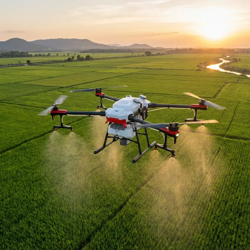
Why Flip is surprisingly strong for this kind of job
A lot of small drones look fine in clean air and fall apart when the environment gets messy. Dust is a brutal test because it punishes weak stabilization, inconsistent subject framing, and poor route discipline.
Flip has an advantage when you lean on features like obstacle avoidance, ActiveTrack, subject tracking, QuickShots, Hyperlapse, and D-Log selectively instead of all at once.
Here is where it can outperform less thoughtful flying on competing compact drones:
1. Obstacle avoidance matters more on highways than many creators admit
Road corridors are visually open, but operationally cluttered. Light poles, sign gantries, bridge edges, utility lines, barriers, and roadside vegetation create hazards that are easy to misread when dust reduces contrast. A drone with reliable obstacle awareness gives you more confidence to maintain a smoother line instead of over-correcting every few seconds.
That matters not only for safety, but for processing quality. Smooth, repeatable motion creates footage and stills that are easier to review, sort, and reuse. If your output may feed into a single-camera reconstruction mindset later, abrupt yaw changes and evasive stick inputs are poison.
So use obstacle avoidance as a stability aid, not an excuse to fly aggressively.
2. ActiveTrack is useful—but only on support vehicles or predictable motion
Highway filming tempts pilots to track moving subjects because the result feels dynamic. In dusty conditions, though, tracking can become visually messy fast. Dust plumes may obscure the target vehicle, and the drone may choose framing adjustments that look fine for a reel but break continuity for documentation.
This is where Flip can excel if you are selective. Use ActiveTrack or subject tracking on a lead or survey vehicle moving at a controlled pace, ideally on a service road, frontage lane, or low-complexity segment. Keep the framing repeatable. Do not ask the drone to solve every cinematic problem for you.
A competitor may advertise aggressive autonomous tracking, but in dusty road conditions, the better system is often the one that helps you maintain boring consistency. That consistency is exactly what a fast-processing workflow rewards.
The practical setup I recommend for dusty highway shoots
Before diving into creative modes, build a base dataset. Think like someone who may need to review the material quickly after landing.
Pass 1: High, slow, straight
Fly a clean corridor pass at a moderate height with steady speed. Keep yaw corrections minimal. Your goal is to establish the highway’s geometry, surrounding terrain, and visible traffic pattern.
Why this matters: the Pixel-Mosaic reference highlights a rapid UAV data processing solution. Rapid processing depends on material that is easy to organize and interpret. A simple top-oblique establishing pass gives editors, engineers, or project stakeholders immediate context.
Pass 2: Lower lateral pass for surface texture
Drop lower and move parallel to the roadway. Dust often hides pavement condition and shoulder detail when you stay too high. A lower side angle can reveal lane markings, drainage edges, median form, and construction staging more clearly.
If you are working near active vehicles, keep the line conservative and predictable. This is where obstacle avoidance earns its keep around poles, temporary site equipment, and signs.
Pass 3: Reverse direction
Dust does not behave evenly. One direction may be washed out; the reverse may suddenly reveal edge definition. Always capture the corridor from both directions if conditions allow.
This is a small discipline choice with big payoff. In single-lens 3D-oriented thinking, alternate viewing geometry can rescue weak detail areas. Even if you never build a model, your editor will thank you.
Pass 4: Controlled cinematic motion
Only after the coverage passes do I move into QuickShots or Hyperlapse.
This is where many pilots get it backward.
How to use QuickShots without ruining the shoot
QuickShots are fun. On highways in dust, they are also easy to misuse.
A dramatic automated reveal may produce a beautiful clip, but if it is your first move of the day, you risk spending prime visibility on footage that tells little about the road itself. Dust tends to thicken unpredictably, so gather your usable core material first.
When you do use QuickShots:
- Use them at interchange nodes, bridges, or staging yards
- Avoid scenes with chaotic mixed traffic
- Watch for dust plumes that can confuse the visual read
- Keep enough altitude that the move remains smooth and legible
QuickShots work best here as supplementary context, not primary coverage.
Hyperlapse on highways: when it works and when it becomes visual noise
Hyperlapse can be excellent for showing traffic rhythm, construction progression, or changing light over a corridor. It can also become a dust-heavy blur with no operational value.
Use Hyperlapse if:
- The atmosphere is stable enough that the road remains readable
- You are showing broader site evolution
- The traffic pattern itself is part of the story
Skip it if:
- Dust is dense enough to erase lane contrast
- The corridor has too many moving visual distractions
- Your main need is documentation accuracy
Again, this loops back to the reference point. A workflow built for fast post-flight use benefits from footage that is easy to interpret quickly. Hyperlapse is powerful when it clarifies change, not when it stylizes confusion.
D-Log is your friend in flat, dusty light
Dust often compresses the scene before your camera even sees it. Highlights turn milky. Shadows lose shape. Colors drift toward a tired haze.
That is exactly why D-Log can be useful on Flip for highway filming.
It gives you more room to recover subtle tonal separation in grading—especially in pale road surfaces, gravel shoulders, concrete barriers, and earth embankments. If your footage is meant to support both visual storytelling and analytical review, preserving latitude matters.
A caution, though: D-Log is not magic. If exposure varies wildly between passes, your footage becomes harder to compare and process. Lock your exposure strategy as much as the scene allows. Consistency beats heroic correction later.
Dust management is really route management
Pilots often ask how to “beat” dust in the camera settings. The bigger win comes from changing the route.
Here are the adjustments that make the biggest difference:
Fly offset from dust trails
If you track directly behind vehicles, you are filming the dust, not the highway. Move laterally off-axis and let the road remain visible in frame.
Avoid low tailing shots in dry aggregate zones
They look dramatic for two seconds, then become unusable. If the road shoulder is loose or there is active earthmoving nearby, expect airborne haze to linger.
Use cross-angle passes
A slight diagonal can reveal shape better than a dead-on chase line, especially when the air is dirty.
Pause between passes
Dust hangs. Give the corridor time to clear before repeating a route at a different height.
This kind of discipline is what separates attractive footage from dependable footage.
Why single-lens 3D modeling is such a useful mental model for Flip operators
The Pixel-Mosaic example specifically points to 3D modeling from single-lens drone imagery. That is not just a technical footnote. It is a very practical benchmark for how carefully your images need to relate to one another.
A single-lens workflow demands:
- Overlap
- Stable perspective changes
- Repeatable exposure
- Readable surface texture
- Minimal random motion artifacts
Those same qualities happen to produce better highway video and stills in dust.
Even if your assignment is purely media-focused, flying as if your imagery might need structured downstream use makes your output stronger. You get cleaner edits, better before-and-after comparisons, and more reliable frame grabs for reports or client presentations.
A sample Flip workflow for a dusty highway morning
Here is a simple field sequence I would use:
- Arrive early, before traffic and wind increase dust load.
- Perform one high oblique establishing pass.
- Run one lower side pass on the cleaner side of the corridor.
- Reverse direction for a second structural pass.
- Capture targeted details near ramps, barriers, shoulders, or work areas.
- Switch to D-Log for your premium cinematic clips if grading is planned.
- Use ActiveTrack only on a controlled moving subject with room to breathe.
- Finish with one Hyperlapse or QuickShot sequence if visibility still supports it.
- Review immediately on-site for continuity gaps.
That final review step matters more than people think. A fast-processing philosophy only helps if you catch missing coverage before leaving. If you want a practical discussion about planning that kind of flight, you can message the team here.
The real competitive edge is not a flashy feature
If I had to compare Flip’s strengths against the broader compact drone field for this exact scenario, I would put it this way:
Many drones can shoot a pretty highway clip. Fewer help you return with a coherent, reusable dataset when visibility is compromised by dust.
That is where Flip stands out when flown properly. Obstacle avoidance supports smoother corridor work. ActiveTrack can be useful when applied conservatively. D-Log preserves grading latitude in hazy light. QuickShots and Hyperlapse can expand the story once your essential coverage is secure.
And the Pixel-Mosaic reference gives us the deeper principle behind all of that: the value of drone capture is not finished at takeoff or landing. It is proven in how quickly and reliably the material can be processed, interpreted, and put to work afterward.
For dusty highway filming, that means one thing above all else: fly for continuity first, style second.
Do that, and Flip becomes more than a convenient camera in the air. It becomes a disciplined capture tool capable of producing footage that still holds up when the dust settles.
Ready for your own Flip? Contact our team for expert consultation.