Expert Inspecting with Flip Along Difficult Coastlines
Expert Inspecting with Flip Along Difficult Coastlines
META: Learn how Flip can support coastline inspection in complex terrain, with practical flight planning, antenna positioning advice, and photogrammetry workflow insights grounded in real UAV survey productivity data.
Coastline inspection sounds straightforward until you actually try to do it.
Cliffs break line of sight. Wet rock reflects light unpredictably. Salt haze softens contrast. Access points are rarely where you need them, and the areas that matter most are often the least forgiving: unstable slopes, narrow ledges, tidal edges, revetments, drainage outlets, retaining structures, and scattered erosion scars that refuse to fit neatly into a ground crew’s walking route.
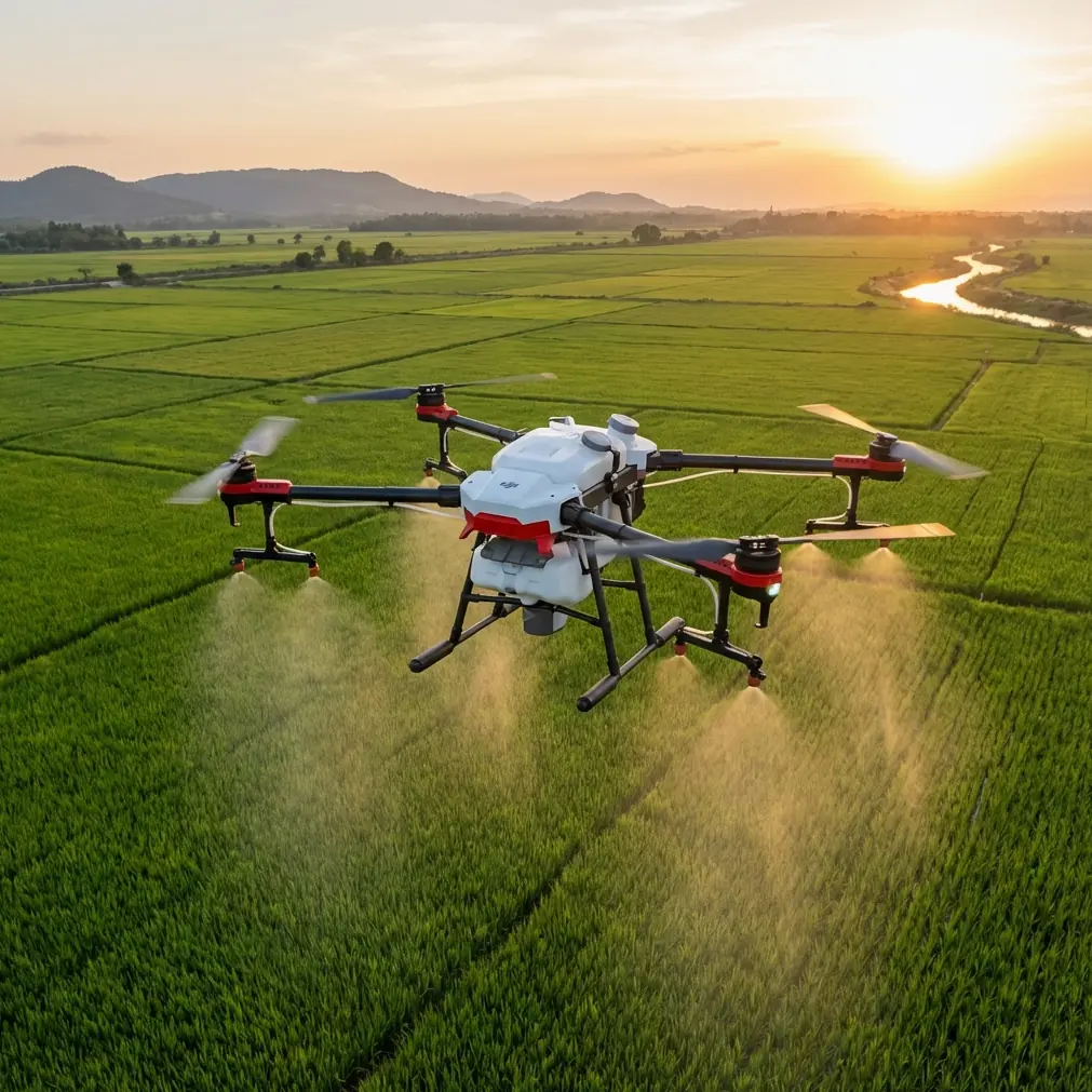
This is where a compact platform like Flip becomes more than a convenient camera drone. In the right hands, it becomes a serious field tool for capturing visual condition data, short-interval repeat imagery, and photogrammetry inputs without committing a survey team to slow, exposed traverses on foot.
The interesting part is not simply that drones are faster. Everyone already says that. The real question is what that speed changes operationally when the terrain is coastal, irregular, and time-sensitive.
A useful reference point comes from a photogrammetry workload comparison in a Chinese aerial survey knowledge system. For a 10 square kilometer UAV mapping job, the source breaks the work down by scale and production stages such as aerial photography, ground control measurement, aerial triangulation, stereo collection, field annotation, and final data outputs. At 1:500 scale, the workflow indicates 3 flight sorties, 3 days for 90 control points, 3 days with one person for one processing stage, and much longer durations downstream such as 40 days and 20 days for later production tasks. At 1:1000, it drops to 2 sorties, 50 control points over 3 days, then 20-day production blocks. At 1:2000, it falls again to 1 sortie, 30 control points over 3 days, with a 15-day stage and another 20-day stage.
Those figures matter for a coastline operator because they show something that often gets lost in drone marketing: the aircraft is only one piece of the timeline. Resolution requirements drive everything. If you’re inspecting seawalls, slope failures, crest cracking, displaced armor units, or vegetation encroachment along narrow corridors, your flight method has to match the output you actually need. Flying fast is useless if you force your office into weeks of unnecessary processing because the image capture standard was poorly chosen.
Flip fits this problem well when used with discipline.
The coastline problem: complexity, not distance
On paper, a coastal inspection route may only cover a few kilometers. In practice, it behaves like a much larger survey.
Why? Because coastline work is fragmented. You stop frequently. You reframe constantly. You deal with elevation swings, rock outcrops, sparse launch sites, moving water, and changing wind behavior around headlands. Some segments need overview mapping. Others need close visual documentation. A straight-line mission plan almost never survives the first field hour.
That’s why features people usually treat as lifestyle extras—obstacle avoidance, ActiveTrack, subject tracking, QuickShots, Hyperlapse, and D-Log—start taking on practical inspection value.
- Obstacle avoidance matters near cliffs, poles, and uneven terrain transitions where GNSS stability alone is not enough to protect the aircraft during lateral repositioning.
- ActiveTrack and subject tracking can help when documenting moving inspection targets such as small support boats or walking team members along a breakwater, especially for contextual footage and progress records.
- QuickShots are not just for pretty reveals. They can help generate standardized orbit-style visual records around towers, outfalls, or isolated rock features when consistency matters more than creativity.
- Hyperlapse becomes useful for showing change across a long shoreline transect or demonstrating tidal movement, sediment transport cues, and weather windows to nontechnical stakeholders.
- D-Log is valuable because coastal inspection often includes bright water, dark rock, and reflective concrete in the same frame. A flatter profile preserves more flexibility for grading and for pulling usable detail from high-contrast scenes.
These functions do not replace formal mapping workflows, but they do reduce friction between documentation, inspection, and stakeholder reporting. That matters when one field day has to serve engineers, environmental reviewers, asset managers, and communications teams at once.
What the photogrammetry numbers really mean in the field
The source data also states that UAV efficiency is more than 6 to 8 times that of RTK plus total station methods, and that for 10 square kilometers, UAV deployment can save more than 100,000 in labor cost. Another note says the UAV may only need to fly one day, while conventional ground equipment remains occupied continuously, limiting how many projects the team can take on at the same time.
For coastline inspection, the operational significance is bigger than the headline.
A traditional ground-heavy method ties progress to physical access. If your team can only cover unstable shoreline segments on foot, productivity collapses in exactly the areas where risk is highest. The extracted source even cites a conventional pace of roughly 0.8 square kilometers per month per crew, with two or more people per group, amounting to a dramatically longer path to data completion. That gap is not just about labor. It affects asset decisions.
If a retaining edge is deforming or a drainage outlet is undermining a slope, waiting months for complete ground collection is not a neutral choice. It delays maintenance triage, contract scoping, and change detection.
Flip is particularly effective in this gap between “full survey campaign” and “simple visual visit.” It gives teams a way to collect dense visual and positional information early, then decide which locations truly deserve a larger survey package.
In other words, Flip helps you avoid spending premium survey effort everywhere just because a few shoreline segments are difficult.
How I would use Flip on a complex coastline
If I were building a repeatable inspection workflow around Flip for this kind of terrain, I would separate each mission into three layers.
1. Corridor reconnaissance
This is the first pass. Fly higher than you think you need, but not so high that erosion signatures disappear. The aim is to understand exposure, access, signal quality, and terrain behavior before attempting tighter passes.
Use a broad shoreline run to identify:
- collapsed edges
- fresh slip zones
- blocked drainage lines
- toe erosion
- wave overtopping marks
- damaged revetment sections
- vegetation stress
- ad hoc human access trails that may indicate hidden defects or unsafe public movement
This pass also reveals where line of sight will fail. That becomes central to antenna setup.
2. Close visual inspection
Now shift from coverage to evidence.
Use obstacle-aware approaches and short segment flights rather than one continuous mission. Coastline inspection punishes overconfidence. A compact aircraft can tempt operators into squeezing through every notch and ledge. Don’t. Keep your geometry conservative, especially where wind rolls upward off cliff faces.
For documentation, mix:
- nadir or near-nadir stills for plan-view context
- oblique passes for wall faces, slopes, and rock armor articulation
- low-speed lateral tracking to capture crack continuity and drainage paths
- repeatable orbit or arc patterns around structures for visual comparison over time
If the brief includes communications or stakeholder updates, capture supplementary D-Log footage during this stage. You’ll be glad you did later when harsh sunlight and deep shadow need balancing.
3. Light photogrammetry where it actually pays off
Not every coastline inspection needs a full dense model. But selected sections often do.
The reference data’s split between 1:500, 1:1000, and 1:2000 scale outputs is a useful reminder that your deliverable should drive your capture standard. If you only need broad corridor condition assessment, a lower-intensity data package may be enough. If you’re evaluating wall movement, drainage alignments, or detailed erosion pockets near infrastructure, you may need a tighter image network and more control discipline.
The key is not to over-collect indiscriminately. On the coast, office time can consume more resources than flight time. That is exactly what the source’s multi-day and multi-week downstream production figures illustrate.
Antenna positioning advice for maximum range
This is the practical field note many operators learn the hard way.
If you want the best range and the most stable control link with Flip along a coastline, your antenna positioning matters as much as your launch point.
Here’s the rule set I recommend:
Keep the controller facing the aircraft, not the scenery
A lot of pilots unconsciously turn their body to watch the shoreline or speak with the team. That shifts the antenna orientation away from the aircraft. Along cliffed coasts, even a small mismatch can weaken signal quality quickly.
Raise your operating position when possible
A few meters of elevation can make a major difference. If you can legally and safely stand on a higher, open point above the shoreline, do it. Coastal terrain often blocks the lower half of the link path first. Regaining line of sight is usually more effective than trying to brute-force distance.
Avoid standing directly behind vehicles, railings, or concrete parapets
Metal and reinforced structures can interfere with signal behavior and create unnecessary obstruction. Move into a clear zone with open sky and a clean forward path toward the aircraft.
Point the antenna broadside to the aircraft, not the tip
With many controller antenna designs, the strongest transmission pattern projects from the face or side area, not the end. Operators who “aim” the tip directly at the drone often reduce link efficiency. Know your controller geometry and keep the active face aligned properly.
Don’t hug the cliff edge for range
Counterintuitive, but common. Standing right at the edge may improve visibility downward while exposing you to unstable footing, rotor wash confusion, and poor team coordination. Often the better spot is a few meters back on a stable, elevated line with uninterrupted visual alignment.
Break long shoreline runs into relay points
Maximum range is not always the smartest goal. In complex coastal terrain, it is usually better to move the operator position every few segments than to stretch one link across headlands, coves, and rock projections. Better geometry beats theoretical distance.
If your team wants a field checklist for coastal signal setup and inspection routing, you can ask for one here: https://wa.me/85255379740
Why Flip works especially well for repeat inspections
The strongest argument for Flip in coastline work is repeatability.
Big survey systems are powerful, but they are not always the right answer for frequent, localized revisits. Coastal assets change incrementally, then suddenly. You might need to revisit the same drainage cut after a storm, recheck a revetment toe after high tide, or compare bluff edge retreat over a short interval.
A compact drone lowers the threshold for going back out.
That matters because inspection quality is not only about precision. It is also about timing. A modest dataset captured this week can be more useful than a perfect dataset captured too late. The source material’s emphasis on UAV time savings and reduced labor burden reinforces that point. When the aircraft can gather what you need in a day, and when the downstream workload can be scaled by the required map standard, you gain decision speed—not just field convenience.
Where operators go wrong
Most failed coastline drone inspections are not caused by hardware limitations. They come from workflow mistakes:
- trying to map every segment at maximum detail
- underestimating post-processing time
- selecting poor launch points
- treating obstacle sensing as a substitute for route planning
- forgetting that glare and tide state can ruin otherwise clean imagery
- pushing range instead of preserving signal geometry
- capturing beautiful footage without a usable inspection sequence
Flip is best when the operator is intentional. Use cinematic tools only when they serve the inspection. Use mapping discipline only where the output justifies it. Build each flight around access, line of sight, and the actual question the client needs answered.
That is how a compact platform becomes a serious coastal inspection instrument rather than just a camera in the air.
For teams working complex shorelines, the bigger takeaway from the reference data is simple: UAVs are not merely faster than conventional ground-only methods. They reshape the economics and timing of information capture. When one source shows 6 to 8 times the efficiency advantage and indicates substantial labor savings over a 10 square kilometer job, the lesson is not “fly more.” It is “match your drone workflow to the decisions that matter most.”
On a difficult coastline, that mindset is the difference between collecting data and actually producing usable insight.
Ready for your own Flip? Contact our team for expert consultation.