Inspecting Remote Fields With Flip: Practical Flight Tips
Inspecting Remote Fields With Flip: Practical Flight Tips Backed by Faster Mapping Workflows
META: Learn how to inspect remote fields with Flip using smart flight altitude choices, obstacle awareness, and a mapping workflow inspired by high-volume drone data processing and automatic 3D model generation.
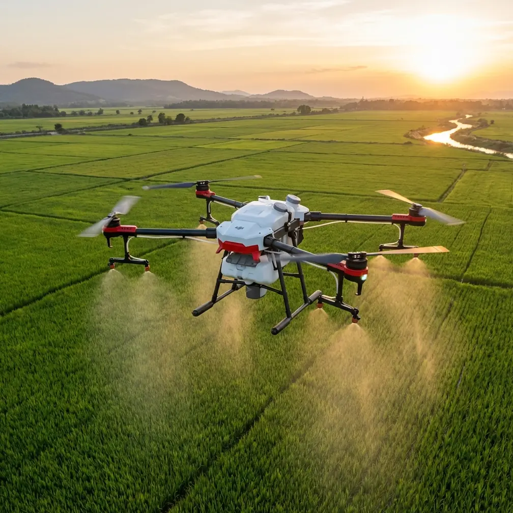
Remote field inspection sounds simple until you’re standing at the edge of a large property with patchy signal, changing light, and a memory card full of imagery that still has to become something useful. That is where the real difference shows up—not just in the aircraft, but in the workflow behind it.
If you are using Flip for field inspections, the most valuable habit is not flying lower, faster, or more aggressively. It is flying with the end product in mind. You are not just collecting video clips. You are building a visual dataset that needs to hold together when you get back from the field.
That is why a processing reference like Pixel-Mosaic matters here. Its stated strengths—one-click automated processing, compatibility with any GIS software, resumable processing after interruptions, multi-machine parallel handling on the network version, and automatic 3D model generation even without IMU or POS data—tell us something operationally important for Flip users in rural inspection work: your field capture strategy can be simpler and more resilient than many operators assume.
Why this matters for remote field inspections
Field inspections in remote areas often break the neat assumptions people make in office demos. You may not have perfect positioning metadata. You may combine flights from different times of day. You may need to revisit a section because wind shifted or a battery swap interrupted the mission. Sometimes the job is not a formal survey at all. It is a practical need: check drainage, crop stress patterns, access roads, fencing lines, or changes around irrigation assets.
In those situations, a drone like Flip becomes much more useful when its footage can feed a processing chain that tolerates imperfection.
The reference material highlights support for aerial triangulation with or without POS data, support for different flight heights, multiple sorties, multiple platforms, and both metric and non-metric cameras. For a field operator, that is not just technical language. It means your inspection flight does not become worthless if you are working with a lightweight camera platform, inconsistent telemetry, or stitched coverage from several passes. That flexibility is a real advantage when inspecting large or remote agricultural land.
The best flight altitude for Flip in remote fields
Let’s get specific. If your goal is inspection rather than cinema, the ideal altitude is usually the lowest height that still gives you clean coverage and stable overlap without forcing too many passes.
For most remote field inspections with Flip, a practical starting point is:
- 30 to 50 meters for detailed checks of crop irregularities, irrigation lines, access tracks, erosion edges, and small assets
- 50 to 80 meters for broader pattern analysis across larger fields where you need efficient coverage first and detail second
The right altitude depends on what question you are trying to answer.
If you suspect localized issues—standing water, patchy germination, fence damage, or visible plant stress—stay closer to the 30 to 40 meter range. That altitude tends to preserve enough ground detail for later review while still giving Flip room to fly smoothly and maintain framing.
If you are trying to understand the whole field quickly, especially in a remote area where battery efficiency matters, climbing toward 60 meters or a bit higher can be the smarter move. You get fewer turns, cleaner route logic, and more consistent coverage. That matters because downstream processing performs better when image geometry is predictable.
A lot of pilots make the mistake of flying too low because low altitude feels “more detailed.” But for mapping-style inspection, too low can create its own problems: too many images, uneven overlap, longer flight time, and more visual inconsistency between passes. A cleaner dataset often beats an ultra-close one.
Fly for overlap, not just for visibility
The Pixel-Mosaic reference puts a spotlight on automation. It describes fully automatic aerial triangulation, automatic camera self-calibration, and automatic rejection of weak tie connections or images separated from the main block. Those are powerful features, but they work best when the source capture is disciplined.
For Flip operators, this translates into one rule: fly with overlap in mind, even if your mission is “just inspection.”
Why? Because remote field inspections often evolve. Today’s visual review can become tomorrow’s orthomosaic request or 3D reconstruction task. If you collect images with consistent spacing and repeated coverage, you preserve that option.
A good field routine is:
- Start with one higher reconnaissance pass.
- Identify problem zones.
- Run a second, lower pass over those areas.
- Add a few oblique angles around features that may benefit from 3D context, such as embankments, drainage cuts, pump enclosures, or uneven terrain.
That last point connects directly to another fact in the reference: automatic 3D model generation without requiring IMU or POS data. Operationally, that matters because many real-world field inspections are not flown with high-end survey-grade orientation systems. If the processing engine can still solve the geometry from image relationships, your Flip mission becomes more versatile.
When obstacle avoidance actually helps in open farmland
Field environments look open until they aren’t. Tree lines, utility poles, pivot equipment, sheds, netting, and elevated irrigation hardware can appear suddenly, especially on return legs or when flying near boundaries.
Obstacle avoidance is useful here, but don’t treat it as a substitute for route planning. In remote field work, it is best used as a protective layer while you focus on maintaining a repeatable flight path. If Flip supports intelligent subject tracking or ActiveTrack-style framing, reserve those features for documenting moving equipment or following a clear path, not for broad inspection mapping. Automated tracking is great for storytelling and targeted review, but it can pull attention away from the structured image collection that processing software prefers.
The better balance is to use obstacle awareness and smart flight assistance to reduce pilot workload while keeping the mission geometry intentional.
Make lighting work for you, not against you
The source notes that processing can automatically enhance image color, even out illumination, remove texture color differences, apply dehazing, and correct geometry before generating TDOM, DOM, and DSM outputs. That tells us the software is designed to clean up inconsistency. Still, you should not depend on software to fix everything.
For field inspection, the easiest win is flying when shadows are manageable and repeatable. Mid-morning and late afternoon can be excellent for visual texture, but if the sun angle is too low, long shadows can hide or exaggerate problems. Near solar noon often works better for uniform review of large agricultural blocks, especially when your goal is consistent interpretation rather than dramatic footage.
If you plan to use D-Log or a flatter profile for video review, that can help preserve highlight and shadow detail. But if your images are intended for mapping-style processing, consistency matters more than stylistic flexibility. Keep exposure changes under control and avoid switching visual settings mid-mission unless you are separating cinematic capture from inspection capture.
A real lesson from the processing numbers
One of the most revealing details in the reference is the scale it cites: a single node handling not less than 10,000 images, and a test involving 10,082 oblique drone images processed with fully automatic aerial triangulation, without POS data, in 17 hours 28 minutes total. The breakdown is also telling: 7 hours 58 minutes for tie point extraction and 9 hours 30 minutes for aerial triangulation.
This is not just a bragging statistic. It changes how you think about capture in the field.
For remote inspections, operators often hesitate to collect more imagery because they worry the processing burden will be too high later. But modern multi-core plus GPU architecture is built for exactly this kind of image volume. If your workflow can absorb large datasets efficiently, you do not have to undershoot coverage just to save computer time.
That does not mean overshoot blindly. It means you can afford to capture enough overlap and enough perspectives to preserve analytical value. For Flip users, that is liberating. A remote field trip is expensive in time and logistics. Re-flying because you were too conservative with coverage is usually worse than coming home with a fuller image set.
Handling interrupted missions and patchy field conditions
Another practical detail in the reference is resumable processing after a breakpoint. This is especially relevant for rural operators. Remote work gets interrupted all the time: weather shifts, battery swaps, blocked access roads, livestock movement, crew schedule changes, or simple fatigue.
A resilient workflow accepts that a field inspection may happen in stages. You might fly one section in the morning, another later, and return on a second day for a problematic corner. If the software environment supports continuing work rather than restarting from scratch, that makes segmented Flip missions far more usable.
The same applies to multi-sortie field collection. The source explicitly supports multiple flight sessions and differing flight altitudes. Operationally, that means a mixed strategy is valid. You can run a broad overview at one height, then revisit with lower-altitude detail passes where needed, without treating the whole job as compromised.
QuickShots, Hyperlapse, and what they’re actually good for
These creative modes are often dismissed in inspection work, but they have a place—just not as your primary data capture method.
QuickShots can help create a short contextual record of a site entry point, access road junction, or key infrastructure cluster. Hyperlapse can be useful for showing cloud movement, irrigation operation patterns, or activity changes over time if you are documenting a broader operational story. But keep those outputs separate from your structured inspection imagery.
Think of them as communication tools, not analytical foundations.
If you are preparing findings for a land manager or remote stakeholder who was not on site, these features can add fast clarity. A static orthographic output tells one story. A short motion-based context clip tells another. Used carefully, both can support decision-making.
Building a simple Flip field workflow
Here is a practical sequence I recommend for remote field inspections:
1. Define the inspection question first
Are you checking crop uniformity, drainage, access, infrastructure, or general change over time? Your altitude and route depend on that answer.
2. Begin with a wide pass
Fly high enough to understand the full field pattern. This is your orientation layer.
3. Mark anomalies and revisit lower
Drop to a more detailed altitude for suspected problem areas. Capture both nadir-style and slight oblique views if terrain shape matters.
4. Keep route geometry consistent
Even if you are hand-flying, think in lanes and overlap. Good structure pays off later.
5. Avoid over-relying on tracking automation
ActiveTrack-style tools are useful in narrow situations, but inspection mapping needs discipline more than spectacle.
6. Capture enough, not endlessly
Because modern processing can handle serious image volume, you can be generous with coverage—but still deliberate.
7. Plan for post-processing from the start
If your outputs may need to enter GIS, support a 3D model, or generate DOM/DSM layers later, collect images accordingly.
The hidden value of GIS compatibility
One understated but highly useful fact in the reference is compatibility with any GIS software. For commercial field inspection, this matters as much as flight performance. Data only becomes operational when it can be compared with boundaries, irrigation layouts, historical layers, soil zones, road alignments, or asset records.
That means a Flip mission is not just about airborne capture. It is part of a wider information chain. If the processed outputs can move cleanly into GIS, then field observations become measurable and shareable. That is where remote inspection starts to scale beyond pilot memory and screenshot-based reporting.
If you’re planning your own field workflow and want to compare capture approaches for your site, this direct chat link can save time: message the team here.
Final thought: Fly like the processing stage already started
The strongest lesson from the Pixel-Mosaic material is not that automation is fast. It is that capture and processing are inseparable. A one-click workflow, automatic calibration, 3D generation without POS dependence, resumable processing, and support for more than 10,000 images per node all point in the same direction: robust results come from treating field collection as part of a complete system.
For Flip in remote field inspection, that means your best move is not chasing flashy maneuvers. It is choosing the right altitude, preserving overlap, using intelligent features selectively, and collecting imagery that can survive real-world processing demands.
Do that, and the trip out to the field keeps paying off long after the batteries are back on charge.
Ready for your own Flip? Contact our team for expert consultation.