How I’d Use Flip to Inspect Urban Forests Without Slowing Do
How I’d Use Flip to Inspect Urban Forests Without Slowing Down the Field Team
META: A practical case study on using Flip for urban forest inspection, covering obstacle avoidance, ActiveTrack, D-Log, Hyperlapse, QuickShots, and accessory choices for safer, faster documentation.
Urban forest inspection sounds simple until you’re actually on site.
Tree canopies sit between apartment towers. Footpaths are crowded. Light changes block by block. One minute you’re documenting crown health over a park edge, the next you’re trying to follow a drainage corridor lined with mature trees, power infrastructure, benches, cyclists, and reflective glass. In that setting, the drone matters less as a flying camera and more as a field instrument that can move quickly, stay predictable, and gather usable footage without creating extra work back in the office.
That is where Flip becomes interesting.
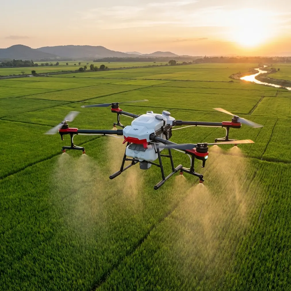
This is not because it is the biggest aircraft for forestry work. It isn’t. The reason Flip fits urban forest inspection is that the feature mix lines up unusually well with the actual friction points of this job: obstacle-rich environments, moving around trunks and branches, keeping a subject or corridor centered, capturing context for reports, and producing footage that is still flexible enough for analysis and stakeholder communication afterward.
If I were building a workflow for inspecting forests in urban areas with Flip, I would treat it as a compact visual survey platform designed for repeatable, low-friction site work.
The assignment: tree condition in a constrained city corridor
Let’s make this concrete.
A municipal contractor needs a same-day visual inspection of a green corridor running through a dense urban district. The brief is familiar: identify canopy thinning, limb interference over pedestrian routes, possible storm damage, blocked sightlines near intersections, and early signs of stress around construction edges. Ground crews can inspect from below, but they will miss crown-level patterns and spatial relationships that become obvious from a drone.
The problem is that conventional aerial work in this setting can become inefficient fast. You spend time repositioning around branches. You lose framing while trying to keep one tree line centered. You collect footage that looks impressive but lacks consistency, which makes side-by-side review harder.
Flip addresses that problem through a few specific capabilities that matter operationally, not just on a spec sheet.
Why obstacle avoidance changes the job in urban tree work
Urban forest inspection is a branch-and-structure environment. Every flight path is shaped by trunks, canopies, lamp posts, signs, and building edges. In those conditions, obstacle avoidance is not a luxury feature. It directly affects mission pace and pilot workload.
With Flip, obstacle avoidance matters because it reduces the need to fly every pass as a manual threading exercise. That changes how you inspect. Instead of treating each approach to a canopy edge as a high-stress maneuver, you can dedicate more attention to what you’re actually evaluating: deadwood presence, asymmetry, branch conflicts, crown density, and the relationship between tree growth and adjacent infrastructure.
Operationally, this means two things.
First, you can hold tighter, more useful lines along tree rows and pathway edges. That improves consistency across clips, which makes post-flight comparison easier.
Second, you reduce the stop-start rhythm that often ruins field efficiency in dense sites. For urban forestry teams working on short access windows, that’s a real advantage.
It also improves handoff quality. If the pilot captures smoother, more controlled passes through constrained spaces, the arborist or project manager reviewing footage later spends less time deciphering camera movement and more time spotting actual condition issues.
ActiveTrack and subject tracking are more useful here than most people think
Many drone users associate subject tracking with action footage. In urban forest inspection, that undersells the feature.
ActiveTrack and subject tracking become valuable when the “subject” is not a person but a linear inspection target: a tree corridor, a path under canopy cover, a drainage edge, or a maintenance vehicle moving slowly beneath a work zone. When used carefully in a civilian inspection context, this lets Flip maintain cleaner framing while the operator concentrates on altitude, spacing, and safety margins.
That changes data quality.
For example, if the team needs a visual record of overhanging branches along a shared-use path, a tracking-assisted pass can maintain a steadier relationship to the corridor. The result is footage that is easier to review for recurring clearance issues. You’re not just collecting images; you’re building a more readable record.
The same applies when documenting specific trees flagged from a prior ground survey. A stable tracking-assisted orbit or reveal shot can show canopy shape, trunk lean, and adjacent obstacles in one pass rather than three loosely matched ones.
This is where QuickShots also become more practical than their name suggests.
QuickShots are not just for presentation footage
I’ve seen many field teams ignore automated camera modes because they sound recreational. In practice, QuickShots can save time when used deliberately.
If an inspection report needs context around a particular tree cluster near roads, buildings, or public amenities, a repeatable automated shot can provide a clean overview without requiring the pilot to hand-fly a complex move every time. That consistency is useful for before-and-after comparisons after pruning, storm response, or construction impact assessments.
The key is to use QuickShots as documentation tools, not decoration.
A controlled reveal from below canopy line to upper crown level can show how a tree sits relative to nearby roofs. A short orbital move can expose branch spread toward infrastructure. These are visual relationships that clients and non-technical stakeholders understand immediately.
For urban forestry, that matters because reports often need to speak to more than arborists. Planners, facilities managers, developers, and resident committees all read them. A clear aerial sequence can settle questions that a written note alone cannot.
Hyperlapse has a legitimate place in inspection work
Hyperlapse sounds like a creative feature, but there is a practical use for it in urban tree management.
If the team is documenting a longer green corridor, Hyperlapse can compress spatial context into a format that reveals continuity. You can show the progression from healthy canopy sections to stressed zones near paving, utilities, or recent construction. That macro view helps decision-makers understand that isolated tree issues are often part of a broader pattern.
I would not use Hyperlapse as primary inspection evidence. I would use it as a corridor-level communication asset. That distinction matters.
The primary evidence still comes from controlled passes, close visual review, and site notes. The Hyperlapse sequence supports planning discussions by showing how the forested route behaves as a connected system inside the city.
For municipal teams, that can be the difference between approving isolated maintenance actions and recognizing a recurring urban stress pattern.
Why D-Log matters for urban forests
Lighting in urban tree inspections is messy.
Canopies create deep shade. Pavement and glazing kick back harsh highlights. A single pass may include dark bark, bright sky, reflective windows, and sunlit leaves. If footage clips too early or collapses shadow detail, you lose inspection value.
That is where D-Log becomes operationally significant.
Recording in D-Log preserves more flexibility for grading and balancing difficult scenes later. In simple terms, it gives the reviewer a better chance of recovering detail across high-contrast urban environments. That is not only about making footage look polished. It is about keeping subtle visual cues visible: limb structure inside shadow, discoloration across a crown edge, branch separation against a bright background.
For teams building inspection records over time, this matters even more. Better tonal control improves consistency across different weather windows and times of day. When you compare repeat flights, you want image differences to reflect tree condition, not just exposure volatility.
The accessory that made Flip more useful on real sites
The feature set gets you most of the way there, but one third-party accessory can meaningfully improve field performance: a tablet sun hood.
That may sound minor until you’ve tried to inspect trees at midday beside concrete, water, or glass. Screen visibility becomes a real operational issue. If the pilot struggles to read fine branch detail or exposure on the display, framing accuracy drops and verification becomes slower.
Adding a third-party sun hood to the controller or attached display improves monitor readability in bright urban conditions. That leads to cleaner assessment passes, faster confirmation of target details, and fewer unnecessary re-flights.
This is one of those upgrades that does not change the aircraft, but it improves the decision-making loop during the mission. For inspection work, that is often more valuable than an accessory that simply sounds technical.
In one workflow I’d recommend, the sun hood pairs with a disciplined shot list:
- corridor overview
- crown-level side pass
- trunk-to-canopy reveal
- conflict point documentation near structures
- repeatable context shot for report appendix
With that structure, Flip becomes a tool for systematic collection rather than ad hoc flying.
A realistic field workflow for Flip in urban forest inspection
Here’s how I’d run the case.
1. Start with a broad context pass
Use a high, conservative overview to map the corridor visually. This identifies canopy density changes, likely obstacle pinch points, and areas where building proximity may affect signal, lighting, or safe maneuvering.
2. Move into segment-based inspection
Break the site into short sections rather than one long continuous flight. Urban forests are too variable for a single generic pass to be efficient. Obstacle avoidance helps here because you can work tighter to useful viewing angles without overcomplicating every move.
3. Use ActiveTrack selectively
If a path, linear tree row, or maintenance route needs stable framing, use ActiveTrack or subject tracking to maintain visual consistency while you manage spacing and altitude. The value is steadier documentation, not flashy movement.
4. Capture a repeatable QuickShot where stakeholder context matters
For trees adjacent to roads, rooftops, or civic spaces, use one automated shot style consistently. This creates a standard visual language in your reports.
5. Record key clips in D-Log
Any high-contrast area gets captured with grading flexibility in mind. This is especially useful when crowns are backlit or when the inspection target sits between heavy shade and bright reflective surfaces.
6. Add one Hyperlapse for corridor communication
This is the planning asset. It helps non-field stakeholders understand the entire urban forest segment as a connected environment.
7. Review on site before demobilizing
With the tablet sun hood in place, confirm branch detail, target coverage, and context shots before leaving. That final verification step saves more time than any editing shortcut later.
What Flip does well in this role
Flip is strongest when the inspection goal is visual clarity, efficient movement, and report-friendly documentation in complex but compact urban spaces.
It is not trying to replace every forestry platform. Large-area rural canopy analysis, highly specialized sensing, and broad-acre mapping are different conversations. But for urban forest inspection, especially where access, safety, and public environment constraints shape the mission, Flip fits the job unusually well.
The combination of obstacle avoidance and ActiveTrack reduces pilot friction in cluttered environments. QuickShots and Hyperlapse help transform raw field collection into communication assets that planners and clients can actually use. D-Log preserves the visual flexibility needed for difficult mixed-light scenes. And a simple third-party sun hood improves the practical reality of flying and reviewing footage in bright city conditions.
That is the real story here.
Not that Flip can fly around trees. Plenty of drones can do that.
The useful part is that Flip helps an inspection team collect more consistent, more interpretable visual information in places where urban complexity usually gets in the way. If your work involves city parks, roadside tree lines, campus landscapes, residential green belts, or construction-adjacent canopy checks, that combination is worth attention.
If you’re planning a workflow around similar sites and want to compare setup ideas, field accessories, or reporting approaches, you can start the conversation here: message us on WhatsApp
Ready for your own Flip? Contact our team for expert consultation.