Field Report: Using Flip to Inspect Power Lines in Complex
Field Report: Using Flip to Inspect Power Lines in Complex Terrain
META: Expert field report on using Flip for power line inspection in rugged terrain, with practical guidance on obstacle avoidance, ActiveTrack, D-Log capture, and managing electromagnetic interference.
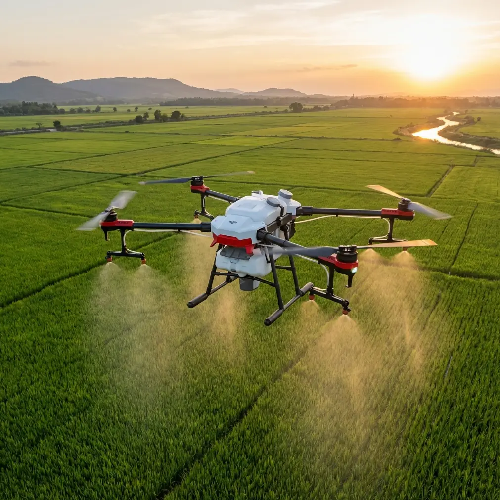
Power line inspection gets more difficult precisely where good data matters most. Steep draws, broken ridgelines, dense tree cover, and uneven access roads create a workflow problem before the aircraft even leaves the ground. In that kind of terrain, a small, agile platform like Flip can be surprisingly useful—not because it replaces every heavy-lift inspection drone, but because it can reach awkward vantage points quickly and document trouble spots with less setup friction.
That distinction matters. When crews talk about “inspecting lines,” they often mean several different jobs rolled into one: checking conductor clearance over vegetation, documenting damaged poles after weather events, verifying insulator condition from safe offsets, and collecting visual context around spans that are hard to access on foot. In complex terrain, the operational bottleneck is usually positioning. You need to move the aircraft through narrow corridors, maintain line of sight, stay stable near branches and structures, and bring back footage that is actually useful for a maintenance decision. Flip fits this kind of assignment best when the pilot treats it as a precision visual tool rather than a generic flying camera.
I’ve used compact aircraft in exactly these conditions, and the lesson is always the same: features only matter when they reduce workload in the field. On paper, terms like obstacle avoidance, ActiveTrack, QuickShots, Hyperlapse, and D-Log read like a mixed list of consumer and professional functions. Around transmission and distribution assets, though, each one can play a very specific role if you understand its limits.
The most immediate advantage with Flip in hilly line corridors is obstacle avoidance. That does not mean you hand control over to the aircraft and let automation sort everything out. It means the aircraft gives the pilot a second layer of spatial awareness when working near tree lines, access roads, guy wires, or terrain transitions that distort depth perception. In mountain cuts and wooded easements, your eye can misread closure rate badly, especially when the background is a tangle of foliage and poles. Obstacle sensing can buy you time to stop, reframe, and approach with better geometry.
That extra margin becomes operationally significant when you’re inspecting spans that run diagonally across a slope. In flat ground, it is easier to maintain a clean lateral offset from conductors and structures. On a hillside, your horizontal movement and altitude changes are constantly interacting. A safe line offset one moment can disappear after a small drift, especially when wind spills over ridges unevenly. Flip’s compact form factor helps here because it can be repositioned quickly without feeling like you are dragging the mission through a long setup cycle. You can launch, capture a pole top from one angle, descend to evaluate vegetation encroachment, then shift to a safer orbit point without overcomplicating the sortie.
ActiveTrack and subject tracking also deserve a more practical interpretation in utility work. No pilot should treat a power line as a casual “subject” and assume autonomous tracking is enough in a high-consequence environment. But there are legitimate uses for tracking modes during adjacent operations. For example, if a crew vehicle or walking inspector is moving along a right-of-way and you need situational footage showing access conditions, washouts, or storm debris, subject tracking can reduce camera workload while you manage flight path and separation. That is a real efficiency gain. The key is disciplined use: tracking should support documentation around the line environment, not replace manual judgment near energized infrastructure.
QuickShots and Hyperlapse may sound less relevant to inspection until you think about reporting. Maintenance teams, asset managers, and landowners do not always need a cinematic sequence, but they do need context. A short automated reveal of a span over a ravine can establish how inaccessible the structure is. A Hyperlapse sequence over a corridor can show changing light, weather movement, or site progression during multi-day repair work. Used sparingly, those modes create visual evidence that explains the operational environment better than a stack of still images taken from inconsistent positions. That makes downstream decision-making faster.
D-Log, meanwhile, is often misunderstood as an aesthetic feature. In inspection work, its value is not about making footage “look better” in a vague sense. It is about preserving tonal information in harsh lighting. Power corridors in rugged areas produce ugly contrast: dark timber, bright sky, reflective hardware, and occasional snow or pale rock all in the same frame. Shooting in D-Log can retain detail across those extremes so the final footage holds more usable information when reviewed later. If you have ever tried to examine insulator surfaces or conductor attachments in clipped midday footage, you know why this matters. The point is not artistic grading. The point is visibility.
One field issue rarely discussed outside experienced pilot circles is electromagnetic interference. Power line corridors do not produce the same environment everywhere; line voltage, structure design, surrounding topography, and your standoff distance all influence what the aircraft experiences. Still, interference management needs to be part of the plan, especially in tighter terrain where your options for repositioning are limited. I have seen pilots blame the aircraft when the real problem was antenna orientation and their own placement on the ground.
With Flip, antenna adjustment is not a glamorous skill, but it can make the difference between a clean control link and a distracting signal drop at the wrong moment. In broken terrain, the pilot may be standing in a notch, below the line, with partial masking from trees or the hillside itself. Add nearby energized infrastructure and the link environment becomes messy. Instead of pushing farther and hoping the connection stabilizes, I prefer a deliberate reset: step laterally to improve line of sight, rotate body position, adjust the controller antenna orientation to match the aircraft’s relative position, and then reacquire the inspection angle. That sounds simple because it is. But it is one of those field habits that prevents rushed decisions. When crews ask how to deal with electromagnetic interference around utility assets, my answer usually starts with aircraft separation and pilot location, then moves straight to antenna alignment.
This is where a compact platform earns its keep. If you are flying a larger system with a more involved deployment cycle, every reposition feels expensive in time and energy. Flip encourages short, controlled adjustments. That is exactly what complex terrain demands. You launch from the safest practical spot, take the first look, evaluate the radio environment, then shift your stance or launch point if the corridor geometry is working against you. Small changes in elevation or lateral position can materially improve both link quality and camera perspective.
There is also a human-factor benefit. Power line inspection can become mentally cluttered fast: obstacle proximity, wind shifts, terrain, radio link, asset separation, camera exposure, and mission objectives all compete for attention. A system that shortens setup and supports intuitive repositioning reduces cognitive load. That matters more than spec-sheet bragging. In the field, you want enough automation to handle routine burdens, but not so much that you stop actively thinking about where the aircraft is relative to conductors, shield wires, poles, and surrounding vegetation.
For readers building a real workflow around Flip, I would structure a mission in complex terrain like this. First, use the initial ascent to read the corridor rather than rushing straight to the asset. Wind over terrain can be deceptive, and you want to understand how the aircraft behaves before bringing it near trees or structures. Second, capture an establishing pass from a conservative offset. This gives you context footage and helps expose any signal instability early. Third, move into closer visual documentation only after confirming control confidence and obstacle behavior. If the aircraft starts acting oddly near the line environment, back out, reassess your position, and check antenna orientation before trying again.
That sequencing sounds almost too basic, but basic discipline is what keeps small-aircraft inspection useful instead of merely dramatic. A pilot trying to force one heroic close pass often comes home with less usable material than the pilot who collects a clean set of medium-offset angles, environmental context, and stable follow-up footage. Maintenance decisions are usually made from clarity and consistency, not bravado.
Another practical point: not every inspection objective belongs in a single flight profile. ActiveTrack might help on an access-road documentation leg. Obstacle avoidance may be your priority while easing through a tree-lined corridor edge. D-Log may be most valuable during high-contrast midday capture. Hyperlapse may be reserved for a reporting sequence that shows terrain exposure across an entire route segment. When pilots try to use every feature all the time, they create distraction. When they assign each feature a job, the aircraft becomes more effective.
That is the larger case for Flip in this role. It is not that compact drones suddenly erase the complexity of utility inspection. They do not. It is that the right compact platform can make visual assessment more repeatable in places where terrain usually steals time and attention. If you are inspecting power lines across ravines, wooded slopes, or uneven right-of-way access, the aircraft’s usefulness comes from how well it supports careful positioning, stable footage, and fast adaptation when conditions change.
If your team is refining field procedures, one worthwhile habit is to document not only the asset but also the pilot’s successful launch and control positions for recurring sites. In many line corridors, the best inspection angle is only half the story; the best signal location on the ground is the other half. A simple site note about terrain masking, preferred approach direction, and antenna orientation can save time on the next mission. For teams comparing notes or coordinating recurring corridor work, it helps to share those field observations directly through a quick message channel like send a mission note here.
The bottom line is practical. Flip can be a strong inspection companion in complex terrain when the operator uses its tools with intent. Obstacle avoidance reduces surprise near cluttered corridors. ActiveTrack and subject tracking can support surrounding site documentation when used conservatively. QuickShots and Hyperlapse can add operational context to reports. D-Log preserves detail in punishing contrast. And when electromagnetic interference starts muddying the control picture, smart antenna adjustment and better pilot positioning often solve more than people expect.
That is the kind of usefulness that stands up in the field. Not abstract capability. Not marketing shorthand. Just an aircraft that helps you get in, capture what matters, and get out with footage a utility team can actually use.
Ready for your own Flip? Contact our team for expert consultation.