Flip Field Report: Inspecting Urban-Edge Vineyards
Flip Field Report: Inspecting Urban-Edge Vineyards With a Smarter Workflow
META: A practical field report on using Flip for urban vineyard inspection, covering obstacle avoidance, ActiveTrack, QuickShots, Hyperlapse, D-Log, and useful accessory choices.
Urban vineyard work is awkward in a way open-country flying never is. Rows are tighter than they look from the ground. Utility lines appear where you do not want them. Wind tumbles unpredictably around nearby buildings, tree breaks, retaining walls, and road corridors. Add the pressure of documenting vine health without disturbing staff, neighbors, or traffic, and the drone stops being a gadget. It becomes a workflow decision.
That is why Flip makes for an interesting inspection platform in this setting.
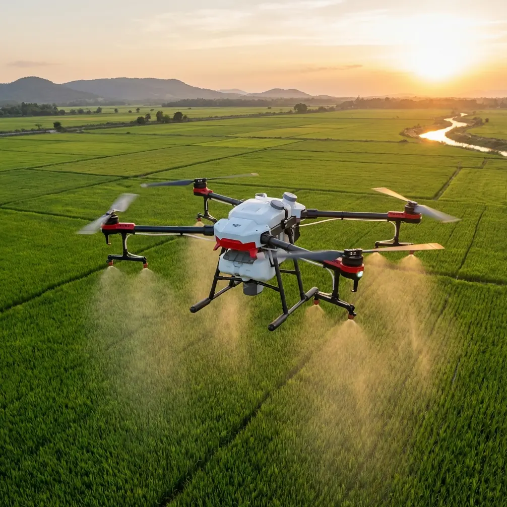
This is not a story about flying a drone over a postcard vineyard at sunrise for social media. It is about getting usable visual information in a constrained civilian environment: row-by-row observation, repeatable passes, safer movement near obstructions, and footage that can be reviewed by growers, consultants, and property managers without a lot of post-production rescue.
Why urban vineyard inspection is different
A vineyard on the edge of a city asks more from a pilot than acreage alone would suggest. The mission is rarely a single wide orbit. You are often checking perimeter fencing, row uniformity, irrigation signs, canopy gaps, drainage issues, access lanes, and neighboring encroachments in one session. The flying style shifts constantly.
One minute you need a stable, elevated overview to compare blocks. The next, you want a lower-angle pass along a row to spot irregular growth or shadowed weak spots beneath the canopy edge. In that environment, obstacle avoidance is not a comfort feature. It has direct operational value. When you are weaving a route near trellis systems, poles, sheds, and bordering trees, that extra layer of spatial awareness reduces the friction of the job. You spend less attention on basic survival and more on framing the inspection correctly.
That matters because inspection quality depends on consistency. If the aircraft makes the operator hesitant every time the route narrows, the result is patchy footage and poor comparison data from one visit to the next.
The real advantage of Flip in this job
Flip fits urban-edge inspection work because it lowers the cost of switching between inspection modes. That sounds abstract until you are in the field.
A vineyard manager does not always want the same thing. Some days they need a fast perimeter scan after wind. On another visit, they want a visual baseline before pruning crews arrive. Later, they may need marketing footage that also doubles as a site-condition record for stakeholders. Flip’s practical value comes from handling those transitions without turning each task into a separate production.
ActiveTrack is a good example. Most people hear that term and think of following a cyclist or runner. In vineyard operations, the more useful interpretation is supervised tracking of a moving utility vehicle, worker path, or inspection route along access lanes. Used carefully in a civilian commercial setting, subject tracking can document how teams move through the property, identify bottlenecks at loading points, or create repeatable route references for future site reviews. The significance is not novelty. It is documentation with less stick input and fewer abrupt corrections.
QuickShots also sound like a consumer feature until you use them for standardized site context. A short automated reveal of a block, lane intersection, or storage area can give managers a reliable opening frame for recurring reports. If every inspection starts with a similar establishing sequence, comparisons become easier. That is operationally meaningful, especially when different people review the footage later.
Working the rows: what the flight actually looks like
On a typical inspection at an urban vineyard, I would divide the mission into four segments.
First, a high overview pass. This is where Flip helps build a reference map in your head, even if the deliverable is video rather than a formal survey. You identify where shadows are forming, where neighboring structures affect light, and which rows deserve a closer look.
Second, low and medium-altitude row runs. These are the money shots for practical inspection. You are looking for canopy inconsistencies, skipped growth, signs of water stress visible from pattern shifts, and access issues between rows. In an urban setting, these runs benefit directly from obstacle avoidance because trellis geometry and nearby landscaping create visual clutter. Without reliable situational support, the pilot tends to stay too conservative and too high. Then the footage loses diagnostic value.
Third, perimeter and boundary checks. This is where urban adjacency becomes a real factor. Property edges next to roads, walls, residential lots, or mixed-use buildings need careful visual confirmation. You are often documenting not just vine condition but the relationship between the vineyard and everything pressing against it.
Fourth, a short creative segment. Not vanity footage. Usable, polished clips for stakeholders who respond better to visual summaries than raw inspection files. Hyperlapse is especially helpful here. A controlled Hyperlapse sequence over a service road or across a block edge can show changing weather, shadow movement, vehicle access patterns, or progression between sections in a compressed format. For managers with no time to watch a full flight log, this can communicate site context quickly.
D-Log matters more than many growers realize
If you are documenting vineyards under mixed urban light, D-Log earns its place.
Morning flights can shift from hard reflective light near paved access roads to softer shadows inside the rows. Late afternoon is even trickier, especially where nearby buildings throw uneven shade across sections of the block. Standard color profiles can clip highlights or bury detail in darker vine areas. D-Log gives more room to recover that contrast during editing.
This is not about cinematic indulgence. It is about keeping leaf detail, trellis visibility, and soil separation readable in one frame. If a grower wants to compare the right side of a row against a shaded left edge, image flexibility matters. You do not want an exposure decision made in the air to erase evidence you needed later.
For teams that hand files off to consultants or content managers, D-Log also creates a more stable master file for different outputs. One version can be graded for inspection clarity. Another can be trimmed into a presentation clip for owners or investors. Same flight, more utility.
The accessory that genuinely improved the job
One third-party accessory made a bigger difference than expected: a high-brightness sun hood for the controller display.
That sounds almost too modest to mention, but in urban vineyard inspection it was one of the most practical upgrades. Rows often force you into odd body positions while maintaining line of sight, and reflective surfaces nearby can wash out your screen. A good sun hood improved framing confidence during low-angle row runs and reduced the temptation to overcorrect because of poor visibility on the monitor.
Operationally, that meant cleaner passes, fewer re-flights, and better judgment when checking fine canopy edges against cluttered backgrounds. It also helped when reviewing D-Log footage live, where flatter color can otherwise appear less informative in harsh daylight.
A quality landing pad is another accessory worth carrying, particularly in dusty vineyard margins or gravel access points, but the sun hood had the bigger day-to-day impact.
Subject tracking in a vineyard: use it with intent
There is a right way to use subject tracking here and a wrong one.
The wrong way is treating ActiveTrack like an entertainment mode and letting the drone improvise around unpredictable obstacles. Urban-edge properties have too many variables for that mindset.
The right way is to use it selectively where movement is structured and background complexity is manageable. For example, tracking a utility cart along a clearly defined service lane can document route condition, worker visibility, and adjacent vine access in one pass. It reduces manual workload while preserving a coherent perspective. That becomes useful when operations teams want to review circulation patterns or identify where lane edges are deteriorating.
Again, the significance is practical. A feature often marketed for dynamic lifestyle shooting becomes a lightweight documentation tool when paired with disciplined route planning.
QuickShots and Hyperlapse are not just “creative modes”
Inspection teams often dismiss automated capture modes because the names sound unserious. That is a mistake.
QuickShots can create repeatable visual templates. If you inspect the same vineyard every month, using a similar short automated move from the same launch point provides a fast before-and-after archive. Over time, those clips become a visual index of canopy development, access changes, and seasonal progress.
Hyperlapse has a different strength. In urban vineyards, time-based compression can reveal how neighboring structures affect late-day shade or how traffic and service movement interact with vineyard entry points. This is especially valuable when the vineyard doubles as a hospitality, education, or mixed-use site where timing matters as much as plant condition.
Those modes save time, but the bigger point is standardization. Anything that helps make one month’s footage comparable to the next has inspection value.
A few field habits that made Flip more useful
The biggest gains did not come from flying faster. They came from making the footage easier to compare later.
I started launching from the same edge whenever possible. I kept my first establishing clip at a similar height and angle. I used one D-Log workflow instead of changing profiles mid-session. I reserved ActiveTrack for only the clearest lanes. I used obstacle avoidance as a safety aid, not a substitute for route planning.
That last point matters. In vineyard environments, obstacle avoidance can protect the mission from small mistakes, but it should not encourage casual flying near wires or dense structures. The best results came when the route was already conservative and the system simply helped smooth the execution.
If you are building a repeatable vineyard inspection routine and want to compare setups, accessory choices, or controller visibility options, this is the easiest place to ask directly: message the field team on WhatsApp.
Where Flip fits best
Flip is strongest when the job sits between pure inspection and visual reporting.
If you need a heavy survey platform with specialized sensors, that is a different category. But if the brief is to inspect vineyards in a dense or semi-urban context, gather clear visual evidence, produce presentable footage, and operate with minimal friction, Flip has a very workable profile.
Its key features become more valuable precisely because the site is constrained. Obstacle avoidance supports safer movement around trellis lines and property-edge clutter. ActiveTrack can document structured movement along lanes. QuickShots and Hyperlapse help standardize recurring reports. D-Log protects detail when urban lighting conditions are uneven.
That combination is what makes the aircraft useful, not any single headline feature on its own.
Final field take
Urban vineyard inspection is not glamorous flying. It is detail work. You are balancing plant visibility, property context, lighting inconsistency, and airspace awareness in a setting that punishes sloppy inputs. Flip earns its place by reducing those compromises.
For me, the real test is simple: did the aircraft help produce footage that a grower can actually act on? In this case, yes. Especially once paired with a small third-party screen hood and a disciplined capture routine.
That is the difference between owning a drone and running a useful aerial workflow.
Ready for your own Flip? Contact our team for expert consultation.