Flip mapping tips for construction sites in extreme temperat
Flip mapping tips for construction sites in extreme temperatures: a field case study
META: A practical case study on using Flip for construction site mapping in extreme heat and cold, with pre-flight cleaning, obstacle avoidance checks, ActiveTrack use, D-Log planning, and safer data capture workflows.
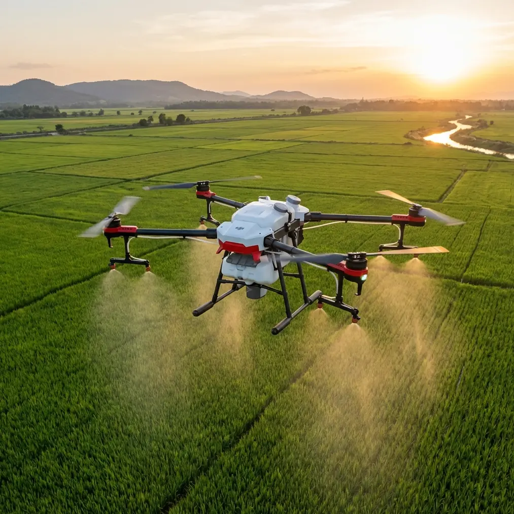
Construction mapping looks straightforward on paper: fly the site, capture repeatable imagery, build progress records, move on. In the real world, temperature swings complicate everything. Frost can dull sensors before sunrise. Dust and heat shimmer can distort the confidence of both pilot and aircraft by midday. On active construction sites, those problems stack on top of cranes, rebar, concrete trucks, temporary structures, and changing access routes.
That is where Flip becomes interesting.
This is not because compact drones magically erase environmental risk. They do not. It is because a small aircraft with modern automation features can be adapted into a disciplined site-documentation tool if the operator understands what those systems actually need to work well. For construction teams mapping in extreme temperatures, the real advantage is not a flashy spec sheet. It is repeatability. Safe, consistent, usable repeatability.
I approach this from the perspective of a visual operator first. As a photographer, I care about image fidelity, motion, light, and sequencing. On a construction site, though, photography alone is not enough. Every flight has to produce information someone can act on: site progress, material staging changes, facade sequencing, drainage work, roof completion, or perimeter conditions after a weather event. A drone like Flip sits at the point where visual storytelling and operational documentation overlap.
The site problem: temperature changes break otherwise good workflows
One recent workflow I developed for a contractor involved repeated mapping flights over a large mixed-phase project. The site had poured foundations on one end, steel rising on another, and partially enclosed structures trapping heat in the afternoon. Morning temperatures were close to freezing. Later in the day, exposed slab areas radiated enough heat to create visible shimmer in the frame.
That kind of thermal variation affects more than batteries.
It changes how reliable obstacle sensing can feel when dust builds up. It influences how quickly condensation may appear if equipment moves from a warm vehicle into cold air. It can reduce confidence when trying to follow a predictable route near vertical structures. And it makes one quiet habit extremely valuable: cleaning the aircraft before every serious flight.
Most pilots think of pre-flight cleaning as cosmetic. On construction sites, it is operational.
The pre-flight cleaning step that protects safety features
Before any mapping session, I clean Flip’s vision and sensing surfaces with the same seriousness I apply to lens prep. Construction sites are hostile places for sensors. Fine dust, dried moisture spots, mud flecks, and oily residue from transport cases can all interfere with what should be simple visual interpretation by the aircraft.
That matters because obstacle avoidance is only as trustworthy as the surfaces feeding it. If a sensor window has a haze of dust, you are no longer asking the drone to detect site hazards under normal conditions. You are asking it to interpret the world through contamination. On a narrow site corridor bordered by scaffolding and temporary fencing, that is not a minor issue.
The same goes for subject-based automated functions like ActiveTrack and subject tracking. Even if you are not using them as your primary mapping mode, they can support inspection-style passes around moving site supervisors, vehicles in designated safe areas, or exterior progress walk-throughs. If those systems are going to help, they need clear eyes.
My standard pre-flight cleaning sequence is simple:
- Inspect camera glass first.
- Wipe obstacle sensing surfaces with a clean microfiber cloth.
- Check for moisture or fogging after bringing the drone out of a vehicle.
- Look at propellers and motor vents for construction dust.
- Confirm the gimbal moves freely before power-up.
That routine takes only a few minutes, but on difficult weather days it can be the difference between a smooth data collection mission and an interrupted flight with inconsistent imagery.
Why obstacle avoidance matters differently on construction sites
Obstacle avoidance on an open field is one thing. Obstacle avoidance on a construction site is a different discipline entirely.
Sites are full of partial obstacles: angled braces, cable runs, protruding formwork, temporary handrails, stacked pallets, and machinery that may not remain in the same place from one week to the next. A pilot cannot treat obstacle sensing as permission to work casually. What it does provide, when properly maintained and validated, is an extra layer of situational resilience.
With Flip, that becomes useful during perimeter runs, facade documentation, and transitions between capture points where conditions are busy but not fully chaotic. The operational significance is obvious: reducing abrupt interruptions improves consistency in the image set. Consistency is what construction teams need if they are comparing weekly progress or trying to align visual records with schedule milestones.
I have found that this also changes pilot behavior for the better. When the aircraft is clean, sensor visibility is checked, and the route is planned with obstacle-aware margins, the operator stops improvising and starts executing. That shift is what makes compact drones effective on professional jobs.
Mapping versus cinematic capture: use the smart features carefully
The keywords around Flip often point toward creator-friendly functions like QuickShots, Hyperlapse, and ActiveTrack. On a construction project, those can sound secondary to mapping. They are secondary, but they are not irrelevant.
QuickShots are not a substitute for a mapping grid or a documented manual route. They are useful, however, for client-facing progress summaries. A short automated reveal of a newly completed structure can help stakeholders understand the relationship between current work and the broader site footprint. Operationally, that saves time. One flight can deliver both technical documentation and communication assets if the pilot separates the objectives cleanly.
Hyperlapse can also be more than a creative effect. On projects with visible schedule change over a day, such as concrete pours, crane assembly, material laydown, or roof panel staging, a controlled Hyperlapse sequence can create a compact visual record of process. For project managers, that can help explain logistical bottlenecks or sequencing decisions without requiring them to sort through hours of video.
The caution is obvious: these modes should be flown only in conditions and locations where site safety, airspace compliance, and operational spacing are fully under control. For actual mapping deliverables, predictability still wins.
ActiveTrack and subject tracking on a jobsite: useful, but only in defined scenarios
ActiveTrack and subject tracking get oversold in casual drone content. On a professional construction site, they are not magic follow modes. They are tools for specific shots and controlled inspection workflows.
I have used subject tracking effectively when documenting supervised site walks along cleared routes. Instead of manually juggling framing while also maintaining orientation, the aircraft can hold attention on the subject while the pilot focuses on separation, altitude, and path discipline. That can produce cleaner visual updates for remote stakeholders.
The operational value is not just aesthetic. It reduces pilot workload during a narrow category of flights. When temperatures are extreme, reducing workload matters because environmental stress affects human performance too. Cold hands, glare, fatigue, and heat exposure all degrade small decision-making tasks over time.
Still, for dense construction geometry, I treat tracking features as optional support, never as the backbone of a flight plan.
Extreme temperatures and image quality: why D-Log can help
On sites with reflective metal, pale concrete, dark excavation areas, and deep shadows under partially completed structures, lighting contrast can become severe. Add bright winter glare or hard summer sun and the camera has a difficult job.
This is where D-Log becomes operationally valuable, not just stylistically attractive.
A flatter recording profile preserves more flexibility when balancing highlights and shadows across a mixed-contrast scene. That matters for progress documentation because construction teams need to see detail in both exposed surfaces and shaded work zones. A standard look can clip one side of the scene too aggressively, especially in snow-adjacent winter conditions or bright midday summer light.
For repeat site coverage, I prefer to keep the imaging approach as standardized as possible: similar altitude, similar angle, similar flight timing, and a consistent profile choice. D-Log supports that consistency when conditions are visually harsh. It gives more room to normalize footage from one flight date to another, which makes comparisons easier and final reporting more credible.
Heat, cold, and repeatability
The biggest lesson from mapping in extreme temperatures is that environmental management is really a repeatability problem.
In cold conditions, I pay close attention to acclimatization. Moving the aircraft too quickly from warmth into cold can create fogging on optics or sensing surfaces. In heat, the issue shifts toward dust, glare, and faster pilot fatigue. In both cases, the answer is not to rush the flight because the weather feels inconvenient. It is to tighten the sequence.
My site routine with Flip tends to follow this order:
- Walk the launch area and identify new obstacles.
- Clean the camera and sensing surfaces.
- Check propellers and frame for dust or residue.
- Power on and verify stable gimbal behavior.
- Confirm the intended route against current crane, vehicle, and personnel activity.
- Capture the repeatable mapping sequence first.
- Only then collect supplemental content such as QuickShots, Hyperlapse, or supervised tracking footage.
That order protects the main deliverable. It also reflects a truth many teams learn the hard way: once site activity accelerates, your available flight window can disappear quickly.
A compact drone can still support serious site records
There is sometimes skepticism around small drones on professional construction projects. The assumption is that compact aircraft are mainly for marketing visuals, not disciplined site documentation. I think that view misses the point.
A compact platform like Flip can be extremely effective if the operator builds a procedure around it. The aircraft’s obstacle avoidance and tracking-related systems are not there to replace planning. They are there to support cleaner execution. The camera modes are not there to distract from mapping. They are there to expand the value of a single site visit when used with intent.
For builders, engineers, and project stakeholders, the output matters more than the category of aircraft. They need clear progress records, safe workflows, and footage that remains readable under difficult lighting and temperature conditions. If those needs are met consistently, the platform has earned its place.
What I would tell any construction team considering this workflow
If your team is using Flip for mapping in extreme temperatures, do not start by chasing complex flight patterns. Start by making the aircraft reliable in the conditions you actually face.
Clean it every time, especially the sensing surfaces. That single habit directly affects obstacle avoidance performance and the trust you can place in automation-assisted features. Standardize your route before experimenting with cinematic extras. Use D-Log when the site contrast is difficult and long-term image consistency matters. Keep ActiveTrack and subject tracking for controlled scenarios, not cluttered improvisation. And gather the core mapping dataset before trying anything creative.
That is the difference between owning a drone and operating one professionally.
If you need help refining a site-specific Flip workflow, including repeatable capture planning for harsh weather conditions, you can message a specialist here and compare notes on your setup.
Construction mapping is rarely glamorous. It is repetitive, weather-sensitive, and unforgiving of shortcuts. But when the process is tight, the results are genuinely useful. You get a site record that supports decisions instead of just decorating reports. And in extreme temperatures, that kind of discipline is what keeps a compact drone practical.
Ready for your own Flip? Contact our team for expert consultation.