Flip Field Report: Mapping Construction Sites in Complex
Flip Field Report: Mapping Construction Sites in Complex Terrain With a Pocket-Sized Drone
META: A field-tested look at using Flip for construction mapping in steep, uneven terrain, with notes on obstacle avoidance, ActiveTrack, D-Log, Hyperlapse, and safe flight planning.
Construction mapping gets messy the moment a site stops being flat.
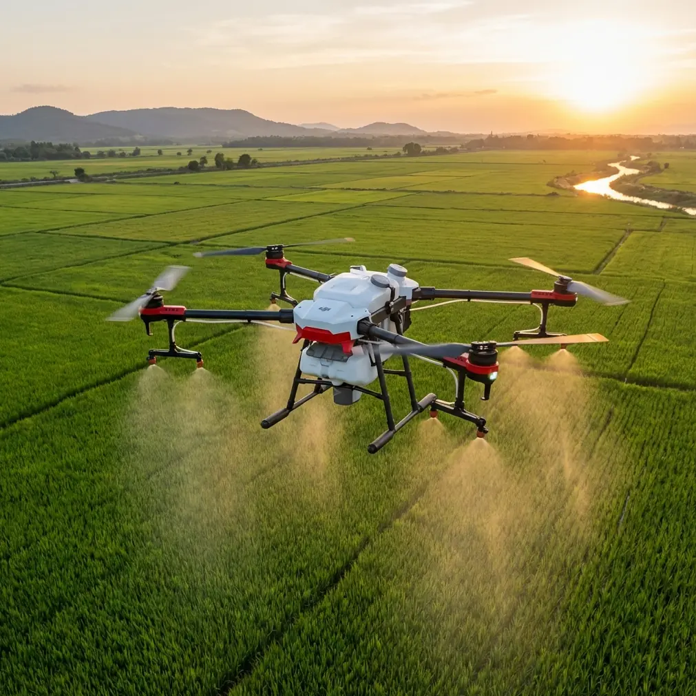
A clean grid mission on level ground is one thing. A half-cut hillside with temporary haul roads, stockpiles, drainage channels, scaffold lines, and shifting machinery is another. That is where a small drone like Flip becomes surprisingly useful—not because it replaces a full survey workflow, but because it handles the daily reality of complex terrain with less friction than larger aircraft.
I have been looking at Flip through the lens of a practical site tool, not a lifestyle gadget. If your job is documenting cut-and-fill progress, checking access routes after rain, creating visual records for clients, or building a repeatable map of a site that changes every week, the real question is simple: can this aircraft move through a difficult environment quickly and safely enough to produce material you can actually use?
On that front, Flip has a strong case.
Why Flip fits construction terrain better than its size suggests
Complex terrain punishes awkward workflows. By the time a drone is assembled, calibrated, and launched, the light may have changed, a truck may have blocked your takeoff zone, and the foreman may already be asking for updated visuals of the retaining wall on the north edge.
Flip’s advantage starts with portability, but that only matters because it changes behavior in the field. A drone that is easy to carry tends to get flown more often. More frequent flights mean denser visual records. Denser records mean fewer gaps when teams compare slope stabilization, drainage progression, excavation boundaries, or material movement over time.
That matters on construction sites where the landscape can change in a matter of days.
The bigger operational story, though, is not size. It is how the aircraft manages motion and awareness when the terrain is irregular. Obstacle avoidance is one of those features that gets treated like a marketing checkbox until you actually need it. On a broken site with tree lines, utility poles, temporary fencing, and parked equipment, directional sensing can be the difference between finishing a flight and cutting it short.
I saw that value in a way no spec sheet could explain.
The deer moment that proved the sensors mattered
On one site visit, we were flying a perimeter pass above a graded access track that ran along scrub vegetation and a drainage swale. Conditions were calm, visibility was good, and the goal was straightforward: capture an updated visual record of earthworks and compare it against imagery from the prior week.
Mid-flight, a deer moved out from the brush line below and crossed near the path we were documenting. Nothing dramatic. No collision risk. But it changed the rhythm of the operation. Instead of forcing a rigid path through a live environment, Flip’s sensing and route awareness made it easier to adjust smoothly while maintaining visual separation from the terrain and the vegetation edge.
That is the part people miss about obstacle avoidance on civilian job sites. Its value is not only about preventing impacts with fixed objects. It also reduces pilot workload when the environment becomes dynamic, whether that means wildlife, moving vehicles, shifting personnel, or newly placed site materials. The sensor stack gives the pilot more margin to make better decisions.
In mapping work, margin is productivity.
ActiveTrack and subject tracking are more useful on site than many teams expect
Construction mapping is not always a pure orthomosaic exercise. Plenty of site documentation work sits in the gray area between mapping, inspection, and progress communication. That is where ActiveTrack and subject tracking become relevant.
If a project manager wants a repeatable visual record of a haul route, drainage corridor, or concrete delivery path through uneven ground, tracking tools can help create consistent, readable footage around moving site activity without demanding constant manual reframing. Used carefully and within safe operating practices, this makes the drone a better documentation instrument.
The operational significance is straightforward: consistency.
When a drone can maintain framing on a vehicle route, a slope face, or a moving site reference point while the pilot focuses on terrain and separation, the resulting footage is easier to compare over time. For client updates, subcontractor coordination, and internal review meetings, that consistency often matters more than cinematic flair.
This is also where QuickShots, often dismissed as consumer-friendly automation, have a quiet role on construction projects. Not every stakeholder needs a dense technical output. Some need a fast, clear overview of how a hillside excavation relates to access roads, stormwater controls, and staging zones. Automated flight patterns can produce those overviews efficiently if the operator understands the site geometry and chooses positions with enough clearance.
The trick is to use automation as a controlled capture method, not as a substitute for planning.
Mapping in uneven terrain requires more than just flight time
The hard part of mapping construction sites in complex terrain is not simply staying airborne. It is maintaining repeatability when elevation changes distort perspective and compress your margin for error.
On a steep site, a route that looks safe on a tablet may place the drone too close to a tree line on one pass and much farther away on the return. Stockpiles rise unexpectedly. Temporary drainage berms appear between visits. Scaffold and steel members create vertical clutter. Flip’s compact footprint helps here because it is easier to launch from constrained positions, but the real operational gain comes from pairing that portability with active sensing and careful manual oversight.
For weekly site mapping, I would treat Flip as a high-frequency documentation platform. It is especially effective for:
- progress baselines before major earthmoving
- visual comparison after weather events
- access road condition checks
- slope and drainage observation
- communication packages for owners and contractors
- tight-space capture where larger aircraft are inconvenient
That distinction matters. If you are expecting one tiny aircraft to solve every survey-grade requirement on a harsh topographic site, you are asking the wrong question. But if you want a drone that can capture high-value visuals often, safely, and with less setup drag, Flip becomes a very practical tool.
D-Log matters when the site has brutal lighting
Construction terrain rarely gives you kind light. You get bright aggregate, dark trench edges, reflective puddles, exposed concrete, shadowed tree lines, and hard midday contrast all in one frame. This is where D-Log becomes more than a post-production buzzword.
A flatter capture profile preserves more flexibility when balancing highlights and shadows in mixed-light scenes. On a complex terrain site, that can make the difference between seeing detail in a cut slope and losing it to contrast. It also helps when you are trying to build a consistent archive across different weather conditions and flight days.
The operational significance is not artistic. It is interpretive.
Teams reviewing site imagery need to see enough tonal detail to identify changes in grade condition, drainage patterns, vegetation encroachment, erosion exposure, or material placement. If your footage clips too aggressively in the highlights or crushes shadow detail around retaining features, it becomes less useful as a record.
That is one reason I like the idea of Flip for field reporting. It is small enough to carry casually, but with D-Log in the workflow, it can produce footage that holds up far better when the site’s lighting is working against you.
Hyperlapse is not just for pretty edits
Hyperlapse has a practical role on active construction sites, especially when the terrain itself is changing.
A repeatable time-compressed sequence from the same vantage can reveal movement patterns that still images often miss: water collecting along a newly cut path, truck circulation around a constrained switchback, shadow progression across a work face, or equipment congestion near a temporary material laydown zone. On complex terrain, understanding how activity flows through elevation changes is often as useful as a static map.
That does not make Hyperlapse a mapping substitute. It makes it a context layer.
When paired with regular overhead passes and still captures, it helps explain not just what the site looks like, but how it behaves across time. For site managers and clients who are not drone specialists, that kind of visual interpretation can be unusually effective.
Flight discipline still decides the outcome
Even with obstacle avoidance and smart tracking, Flip rewards disciplined operation. On broken ground, pilots should think in layers:
First, terrain clearance. Not the clearance you think you have from a map, but the actual clearance created by cuts, mounds, poles, tree canopies, and temporary structures.
Second, route repeatability. If the goal is weekly comparison, use identifiable ground references and keep your passes consistent.
Third, lighting consistency. If possible, capture at similar times of day. D-Log helps, but it does not erase poor planning.
Fourth, movement management. Subject tracking and ActiveTrack are useful, but they should support the mission, not lead it. On a construction site, the safest flight is the one where the pilot remains fully ahead of the environment.
That is also why I would keep the output strategy simple. Capture a standard overhead progression set, one or two oblique perimeter passes, a contextual reveal for stakeholder communication, and a short tracked sequence only if it serves a defined purpose. Complexity in flight planning is not a badge of competence. Clarity is.
What Flip does especially well for weekly site reporting
If I had to summarize Flip’s strongest role on a construction site in difficult terrain, it would be this: it lowers the threshold for useful aerial reporting.
That sounds small, but it is not. On many projects, the biggest failure is not bad footage. It is inconsistency. Flights do not happen often enough. Documentation gets delayed. The visual record becomes patchy. Then everyone tries to reconstruct what changed from incomplete evidence.
A compact drone with obstacle avoidance, ActiveTrack, QuickShots, Hyperlapse, and D-Log encourages a more regular capture rhythm. Those features are not all equal in importance, but together they make the aircraft adaptable. Obstacle avoidance supports safer operation around site clutter. D-Log supports better interpretation in difficult light. Tracking modes help standardize dynamic documentation. Hyperlapse adds context when flow and sequence matter.
That combination is what makes Flip interesting for construction teams working in uneven ground.
It is not about flying flashy missions. It is about coming back with material that helps the project team answer real questions: How much did the cut face change? Is runoff moving where it should? Has the access route degraded? How does the current site layout compare with last week’s record? Can we show the client a clear aerial narrative without sending a full media crew?
If that is your use case, Flip deserves a serious look.
A practical field setup I would recommend
For complex construction terrain, I would structure a Flip session like this:
Start with a high, cautious perimeter read to identify new obstacles and changes since the last visit.
Then capture your repeatable mapping set over the most critical work areas—especially any cut slopes, drainage features, retaining structures, or temporary access roads.
Follow with oblique passes that show elevation relationships. Flat overhead views miss too much on uneven ground.
Use D-Log when contrast is severe or when the footage may need later adjustment for reporting consistency.
Reserve ActiveTrack or subject tracking for clearly defined site documentation tasks, such as following a route or capturing movement through a terrain-constrained corridor.
Finish with a short Hyperlapse or QuickShot only if it adds decision-making value for stakeholders.
That sequence keeps the operation focused. It also reduces the temptation to chase interesting footage at the expense of useful footage.
If you are building a drone workflow around Flip and want a practical discussion rather than a generic pitch, you can message the team here.
Final assessment
Flip makes sense for construction mapping in complex terrain because it aligns with what these sites actually demand: mobility, fast deployment, enough intelligence to navigate visual clutter, and image options that remain useful when lighting and topography get ugly.
The deer encounter on the brush line was a reminder that no site is ever truly static. Terrain changes. Activity shifts. Even the surrounding environment can alter the flight in an instant. A drone that helps the pilot adapt calmly and keep the mission on track has real value.
That is the standard I would apply to Flip. Not whether it sounds advanced on paper, but whether it helps a site team create a more consistent, safer, and more readable aerial record of difficult ground.
On that measure, it has a credible place in the field kit.
Ready for your own Flip? Contact our team for expert consultation.