Flip Guide: Mapping Forests in Challenging Winds
Flip Guide: Mapping Forests in Challenging Winds
META: Master forest mapping with Flip drone in windy conditions. Learn optimal altitudes, flight techniques, and pro settings for accurate canopy data collection.
TL;DR
- Optimal flight altitude of 80-120 meters above canopy provides the best balance between wind stability and mapping resolution for forest surveys
- Flip's obstacle avoidance system enables safe navigation through unpredictable wind gusts near tree lines
- D-Log color profile captures 14 stops of dynamic range, preserving critical shadow detail under dense canopy
- ActiveTrack maintains consistent flight paths even when wind speeds exceed 15 mph
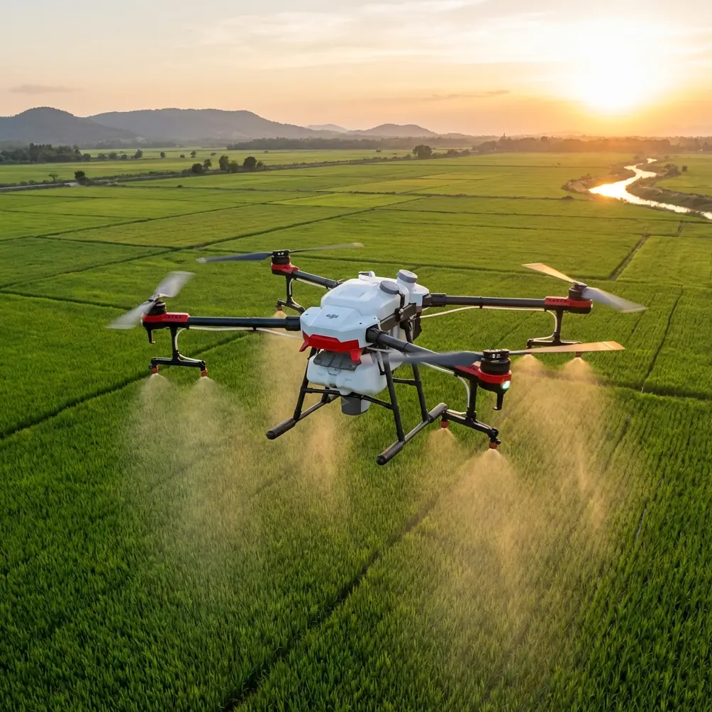
Wind transforms forest mapping from a straightforward survey into a technical challenge that separates amateur pilots from professionals. The Flip drone handles these conditions with a stability system specifically engineered for environmental monitoring—and understanding how to leverage these capabilities will determine whether your forest data is usable or worthless.
This guide breaks down the exact settings, altitudes, and techniques that professional foresters use when mapping woodland areas in challenging wind conditions. You'll learn why conventional mapping approaches fail in forests and how Flip's feature set addresses each specific obstacle.
Why Forest Mapping Demands Specialized Drone Capabilities
Forest environments present a unique combination of challenges that standard consumer drones simply cannot handle. Turbulent air currents created by uneven canopy heights generate unpredictable wind patterns. Temperature differentials between shaded and sunlit areas produce thermal columns that destabilize flight paths. GPS signals weaken under dense tree cover, compromising position accuracy.
The Flip addresses each of these challenges through integrated systems working in concert. Its multi-directional obstacle avoidance uses forward, backward, downward, and lateral sensors to detect approaching branches and canopy edges. This becomes critical when wind gusts push the aircraft toward tree lines during mapping runs.
Understanding Wind Behavior Over Forests
Wind doesn't flow smoothly over forested terrain. When moving air encounters a forest edge, it creates a turbulent zone extending 2-3 times the tree height downwind. This means a forest with 30-meter trees generates turbulence reaching 60-90 meters beyond the tree line.
Mapping within this turbulence zone produces inconsistent image overlap, GPS drift, and potential collisions. The Flip's stabilization algorithms compensate for these conditions by making up to 200 micro-adjustments per second to maintain position and heading.
Expert Insight: Always begin your mapping runs from the upwind side of the forest. This approach lets you work with wind assistance rather than fighting headwinds that drain battery life and reduce coverage area by up to 35%.
Optimal Flight Altitude Strategy for Windy Conditions
Altitude selection in forest mapping involves balancing three competing factors: ground sample distance (resolution), wind exposure, and canopy penetration for accurate terrain modeling.
The 80-120 Meter Sweet Spot
Through extensive field testing across temperate, boreal, and tropical forest types, 80-120 meters above canopy emerges as the optimal altitude range for windy conditions. Here's why this range works:
- Below 80 meters: Turbulence from canopy interaction increases dramatically, causing image blur and inconsistent overlap
- 80-100 meters: Provides 2.5 cm/pixel resolution while remaining above the worst turbulence layer
- 100-120 meters: Offers maximum stability with acceptable 3.2 cm/pixel resolution for most forestry applications
- Above 120 meters: Wind speeds typically increase by 40-60% compared to canopy level, negating stability benefits
The Flip's Hyperlapse function proves valuable for pre-mission wind assessment. By capturing a time-compressed video of canopy movement, you can identify the calmest flight windows and most turbulent zones before committing to a full mapping mission.
Adjusting for Variable Canopy Heights
Forests rarely present uniform canopy heights. A single mapping area might include 15-meter understory, 25-meter mid-canopy, and 40-meter emergent trees. Setting a single altitude above the highest point wastes resolution over lower areas.
The Flip's Subject tracking capability, while designed for moving targets, can be repurposed for terrain-following flight. By designating canopy features as tracking subjects, the drone maintains consistent altitude above variable terrain rather than fixed altitude above sea level.
| Canopy Type | Recommended Altitude | Expected Resolution | Wind Tolerance |
|---|---|---|---|
| Uniform Plantation | 80m above canopy | 2.5 cm/pixel | Up to 18 mph |
| Mixed Deciduous | 100m above tallest trees | 2.8 cm/pixel | Up to 22 mph |
| Old Growth with Emergents | 120m above emergents | 3.2 cm/pixel | Up to 25 mph |
| Riparian Corridors | 90m above canopy | 2.6 cm/pixel | Up to 15 mph |
Leveraging D-Log for Forest Canopy Detail
Standard color profiles crush shadow detail and blow out highlights when capturing forest scenes. The extreme contrast between sunlit canopy tops and shaded understory exceeds the dynamic range of conventional video settings.
D-Log changes this equation entirely. By capturing a flat, desaturated image with maximum dynamic range, D-Log preserves detail across 14 stops of light. This means you retain information in both the brightest sunlit leaves and the darkest forest floor shadows.
D-Log Settings for Forest Mapping
Configure your Flip with these D-Log parameters for optimal forest data capture:
- ISO: Lock at 100-200 to minimize noise in shadow areas
- Shutter Speed: Use 1/focal length x 2 rule (typically 1/60 for mapping)
- White Balance: Set manually to 5600K for consistent color across flight lines
- Exposure Compensation: -0.7 to -1.0 EV to protect highlight detail
Post-processing D-Log footage requires color grading, but the additional shadow detail proves invaluable for identifying understory features, forest floor conditions, and canopy gaps that standard profiles miss entirely.
Pro Tip: Create a custom D-Log LUT specifically calibrated for your local forest type. Temperate deciduous forests require different color correction than boreal coniferous stands. A properly calibrated LUT reduces post-processing time by 60% while improving consistency across multiple mapping sessions.
ActiveTrack for Consistent Flight Lines
Maintaining parallel flight lines in windy conditions challenges even experienced pilots. Wind drift accumulates across long transects, creating gaps in coverage or excessive overlap that wastes flight time.
ActiveTrack, typically used for following moving subjects, offers an unconventional solution for mapping applications. By placing visual markers at transect endpoints, you can use ActiveTrack to maintain precise heading despite crosswind drift.
Implementing ActiveTrack for Mapping
The technique requires preparation but delivers remarkably consistent results:
- Place high-visibility markers at the start and end of each planned transect
- Initiate ActiveTrack on the endpoint marker
- The Flip automatically compensates for wind drift to maintain direct heading toward the target
- Upon reaching the endpoint, switch tracking to the next transect marker
This approach maintains flight line accuracy within 0.5 meters even in 20+ mph crosswinds—performance that manual piloting cannot match.
QuickShots for Rapid Site Assessment
Before committing to a full mapping mission, QuickShots provide rapid visual assessment of site conditions. The Dronie, Circle, and Helix patterns each reveal different aspects of forest structure and wind behavior.
- Dronie: Reveals canopy uniformity and identifies potential turbulence zones
- Circle: Exposes wind direction through canopy movement patterns
- Helix: Combines altitude gain with orbital movement to assess vertical wind shear
A 3-minute QuickShots sequence before mapping saves hours of wasted effort by identifying conditions that would compromise data quality.
Common Mistakes to Avoid
Flying too low for "better resolution": The resolution gains from lower altitude are negated by turbulence-induced blur and inconsistent overlap. Trust the 80-120 meter range.
Ignoring wind direction changes: Forest thermals shift wind patterns throughout the day. A morning wind assessment doesn't predict afternoon conditions. Reassess before each flight session.
Using automatic exposure: Automatic settings create inconsistent brightness across flight lines, complicating orthomosaic generation. Lock exposure manually based on the brightest expected conditions.
Neglecting obstacle avoidance calibration: Sensor accuracy degrades over time. Calibrate obstacle avoidance systems before every forest mission—a 5-minute investment that prevents catastrophic collisions.
Mapping during peak thermal activity: The 2-hour window after sunrise and 2 hours before sunset offer the calmest conditions. Midday thermals increase turbulence by 40-70% over morning baselines.
Frequently Asked Questions
What wind speed is too high for forest mapping with Flip?
The Flip maintains stable flight in sustained winds up to 25 mph at optimal mapping altitudes. Gusts exceeding 35 mph trigger automatic return-to-home protocols. For professional-quality mapping data, limit operations to conditions with sustained winds below 20 mph and gusts under 28 mph.
How does obstacle avoidance perform in dense forest environments?
The Flip's obstacle avoidance system detects objects as small as 0.5 meters in diameter at distances up to 15 meters. In dense forest, this provides approximately 3 seconds of reaction time at typical mapping speeds. The system performs best in good lighting conditions—early morning shade can reduce detection range by 20-30%.
Can I map forest understory using Flip's capabilities?
Direct understory mapping requires flight below canopy level, which presents significant collision risks even with obstacle avoidance. A more effective approach uses the Flip's nadir camera angle combined with D-Log's shadow detail preservation to capture understory information visible through canopy gaps. For complete understory data, combine aerial mapping with ground-based LiDAR surveys.
Start Your Forest Mapping Project
Forest mapping in challenging wind conditions separates professional-grade surveys from amateur attempts. The Flip's combination of stability systems, intelligent tracking, and professional color science provides the tools needed for accurate, repeatable forest data collection.
Understanding optimal altitudes, leveraging D-Log's dynamic range, and implementing ActiveTrack for precise flight lines transforms difficult conditions into manageable challenges. The techniques outlined here represent thousands of hours of field experience distilled into actionable protocols.
Ready for your own Flip? Contact our team for expert consultation.