Flip for Solar Farms at High Altitude: A Field
Flip for Solar Farms at High Altitude: A Field-First Guide from the Mapping Side
META: A practical expert guide to using Flip for high-altitude solar farm mapping, with insights on obstacle avoidance, ActiveTrack, D-Log, Hyperlapse, and workflow decisions that matter in the field.
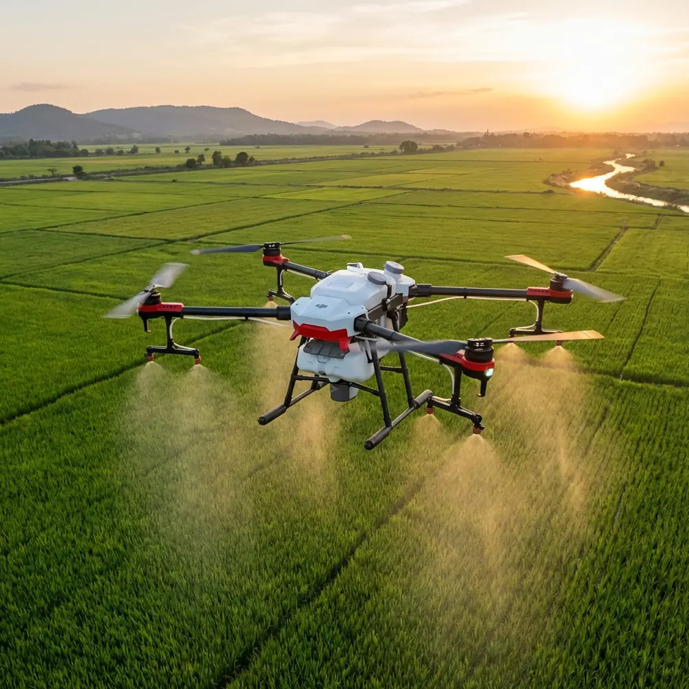
High-altitude solar sites look clean on paper. Long rows. Repeating geometry. Open sky. Once you actually fly them, the job becomes less tidy.
Wind behaves differently above exposed ridgelines. Light changes fast as clouds move over reflective glass. Battery planning gets tighter. The terrain that looked flat in a planning app turns out to be broken by service roads, drainage channels, inverter stations, and fencing that can interrupt line-of-sight if you are working from the wrong edge of the array. On top of that, solar farms are full of surfaces that challenge both exposure and situational awareness.
That is where a compact aircraft like Flip becomes interesting, not as a toy-grade camera drone, but as a practical tool for fast visual documentation and supplementary mapping support when the site environment is working against you.
I’m writing this from the perspective of someone who came into drones through imaging first. As a photographer, I care about what the aircraft captures. In solar work, though, the camera is only half the story. The rest is repeatability, safe movement around reflective infrastructure, and whether the aircraft can help you finish a mission before weather and altitude start taxing the operation.
The real problem with high-altitude solar mapping
Solar farm mapping at elevation introduces a stack of small penalties that add up.
Air density drops as you climb. That affects thrust efficiency and can make the aircraft feel less planted, especially when the wind spills across open panel fields. Even if the site itself is not on a dramatic summit, many utility-scale projects sit in exposed areas where the weather never really settles. The result is a flight environment where stability matters more than people expect.
Then there is the visual environment. Solar modules are highly repetitive. Repetition is great for infrastructure planning, but not always ideal for pilot orientation or image review. When every row looks the same, it becomes easier to drift off the intended corridor, harder to judge closure speed against the array, and more time-consuming to verify coverage afterward if the capture pattern was not disciplined.
Add in the reflective challenge. Midday sun on panels can create bright specular highlights next to dark ground strips, tracker motors, cabling, or vegetation. If your capture settings are not controlled, you can come home with footage that looks dramatic but tells an operations manager almost nothing useful.
That’s why a drone for this kind of work needs three things more than flashy marketing labels:
- Reliable obstacle awareness in a cluttered infrastructure setting
- Predictable tracking and framing when following inspection paths
- Flexible image capture that can handle harsh contrast
Flip checks those boxes in ways that matter operationally.
Why Flip fits this niche better than people assume
A lot of pilots dismiss smaller drones for industrial environments because they associate compact size with compromise. That can be a mistake.
On a solar site, portability is not just convenience. It directly affects how fast you can reposition between sections, launch from constrained maintenance roads, and adapt when weather windows shrink. At altitude, your best flight window may be narrow. A system that can be deployed quickly has a real advantage over a larger setup that takes longer to stage.
Flip’s obstacle avoidance is one of the first features that changes the field experience. Around solar farms, “obstacles” are not skyscrapers or dense forest. They are lower-profile hazards: perimeter fencing, poles, wiring runs, equipment housings, maintenance sheds, and occasional terrain breaks that appear suddenly when you crest a section line. If the aircraft can sense and react to that environment, the pilot gets more margin to focus on framing and route consistency rather than pure collision avoidance.
That margin matters even more in high-altitude sites where wind gusts can push the aircraft off the ideal track. A drone that can maintain composure while giving the pilot environmental awareness is not a luxury. It is the difference between efficient coverage and a mission that drifts into constant correction.
A wildlife moment that proved the point
One of the clearest reminders that sensors are not just for infrastructure happened during a solar perimeter pass on a mountain-edge site. The aircraft was running low over a service corridor beside the panel rows, with scrub vegetation on one side and fencing on the other. A deer broke from cover and crossed the route just ahead of the drone.
That is not the kind of event most preflight plans account for, but it happens. Solar farms, especially remote ones, often overlap with wildlife movement corridors. Flip’s sensing and obstacle-aware behavior gave enough reaction margin to avoid turning a routine documentation run into a safety incident for both the animal and the aircraft.
That single moment changed how I think about “obstacle avoidance” in industrial work. It is easy to imagine the feature as protection against poles or walls. In reality, on remote energy sites, it is also part of operating responsibly around living environments that still exist inside commercial infrastructure footprints.
Using ActiveTrack and subject tracking the right way on solar sites
The phrase “subject tracking” sounds like something built for sports clips and lifestyle shooting. On a solar farm, it can be surprisingly useful if you define the “subject” correctly.
You are not tracking people for dramatic visuals. You are using ActiveTrack and subject tracking to maintain consistent framing on moving inspection elements, utility vehicles, or a technician’s route along a maintenance corridor where spatial consistency helps tell the story of a site condition. That could mean documenting access conditions after weather events, creating progress visuals for construction-to-operations handoff, or recording movement patterns around inverter stations and access roads.
The operational significance is simple: consistency reduces reshoots. At high altitude, where battery efficiency and weather windows can tighten your mission envelope, avoiding extra flights is a meaningful benefit.
That said, tracking should never replace site discipline. On solar arrays, repetitive geometry can confuse human perception even when the drone is performing well. The smart approach is to use tracking as a controlled assist, not as permission to stop piloting.
QuickShots and Hyperlapse are not just “creative modes”
I know those two features can trigger eye-rolls in technical circles, but that usually comes from people who have only seen them used for social media clips.
QuickShots can help generate repeatable, readable overview sequences for project stakeholders who need orientation before reviewing closer inspection imagery. Not every viewer understands a top-down still set immediately. A well-executed automated reveal can establish site layout, terrain relationship, and access context far faster than a stack of static images.
Hyperlapse has even more value on solar projects. At high-altitude sites, weather and light move quickly. Clouds race across the array. Tracker shadows slide. Maintenance activity progresses over large footprints that are difficult to appreciate in real time. A Hyperlapse sequence can compress these changes into a usable visual reference for planners, project managers, or marketing teams documenting installation phases without needing a full cinema workflow.
Used properly, these modes are not fluff. They are communication tools. They help non-pilots understand the scale and operational rhythm of a site.
D-Log matters when solar panels fight your exposure
If I had to pick one imaging feature that makes the biggest difference for solar visuals, it would be D-Log.
Solar farms are exposure traps. Bright panel reflections sit beside dark equipment enclosures, dusty access roads, and shadowed terrain. Standard profiles can clip highlights or crush the lower tones too quickly, which means you lose detail that may be useful later for analysis, presentation, or archival records.
D-Log gives you more room to preserve tonal information across those extremes. For anyone building stakeholder reports, progress updates, or promotional footage for renewable energy portfolios, that extra flexibility in post can be the difference between footage that merely looks bright and footage that actually explains the site.
This is especially relevant at high altitude because atmospheric conditions can exaggerate contrast in ways that are visually appealing but operationally unhelpful. Clean mountain light is beautiful. It is also unforgiving. Shooting flatter gives you a better chance of balancing panel detail, sky, and ground texture afterward.
A practical field workflow for Flip on elevated solar projects
If I were planning a Flip mission for a high-altitude solar farm, I would structure it around three capture layers.
1. Orientation pass
Start with a broad overview to establish terrain, access roads, inverter blocks, and row direction. This is where a controlled QuickShot or a simple manual orbit can provide context without wasting battery.
2. Corridor documentation
Move into straight, disciplined passes along panel rows or maintenance lanes. Keep altitude and speed consistent. This is the part of the mission where obstacle avoidance is doing quiet but valuable work, especially near fencing, equipment clusters, and terrain changes.
3. Narrative and condition footage
This is where Hyperlapse, ActiveTrack, or slower cinematic passes can help show traffic flow, maintenance access, weather movement, or project scale. If the goal includes presentation-ready media, switch to D-Log here so you have better latitude in finishing.
That layered approach keeps the flight useful even if conditions deteriorate. If wind picks up or visibility starts shifting, you at least come back with the essential coverage already complete.
Why the compact format matters more at altitude
There is another advantage to Flip that does not get enough attention: low-friction deployment.
On high-altitude sites, crews are often moving between disconnected sections of infrastructure, sometimes on rough access routes with limited staging room. A compact aircraft is easier to carry, easier to launch safely from a small clear zone, and easier to integrate into a broader site walk. That sounds mundane until you are three repositionings into a windy morning and every extra piece of gear starts slowing down the work.
In commercial drone operations, efficiency is rarely about one dramatic feature. It comes from shaving friction out of dozens of small actions. Faster setup. Faster relocation. Less hesitation about pulling the aircraft out for a short but valuable capture window. Over the course of a project, that adds up.
The photographer’s perspective: clarity over spectacle
Because my background is visual, I understand the temptation to make solar farms look purely cinematic. Rows of glass in alpine light can be stunning. But the best drone work on these sites does not chase spectacle first. It builds clarity.
A good Flip mission on a solar farm should answer practical questions:
- How does the site sit in the terrain?
- What does access look like?
- Are the rows and service corridors clearly documented?
- Can stakeholders understand scale quickly?
- Is the footage flexible enough for both technical review and polished communication?
Features like obstacle avoidance, ActiveTrack, QuickShots, Hyperlapse, and D-Log only matter if they improve those answers. On elevated solar projects, they do.
If you want to compare flight approaches or talk through a specific site challenge, you can message the team here.
Final take
Flip makes sense for high-altitude solar farm work because it addresses the actual field problems instead of just promising polished footage. Obstacle avoidance helps when winds, fencing, service structures, and even wildlife create unexpected complexity. ActiveTrack and subject tracking can support consistent route-based storytelling when used with discipline. D-Log gives solar imagery the dynamic range it needs. QuickShots and Hyperlapse, when handled professionally, turn sprawling infrastructure into something stakeholders can understand at a glance.
For solar mapping teams, consultants, photographers, and site communicators, that combination is practical. Not flashy. Useful.
And in this type of work, useful wins.
Ready for your own Flip? Contact our team for expert consultation.