Flip for Solar Farms in Complex Terrain: A Field Tutorial
Flip for Solar Farms in Complex Terrain: A Field Tutorial That Actually Helps
META: Learn how to use Flip for mapping solar farms in uneven terrain, with practical flight altitude advice, obstacle avoidance tips, ActiveTrack use, and image settings for cleaner site data.
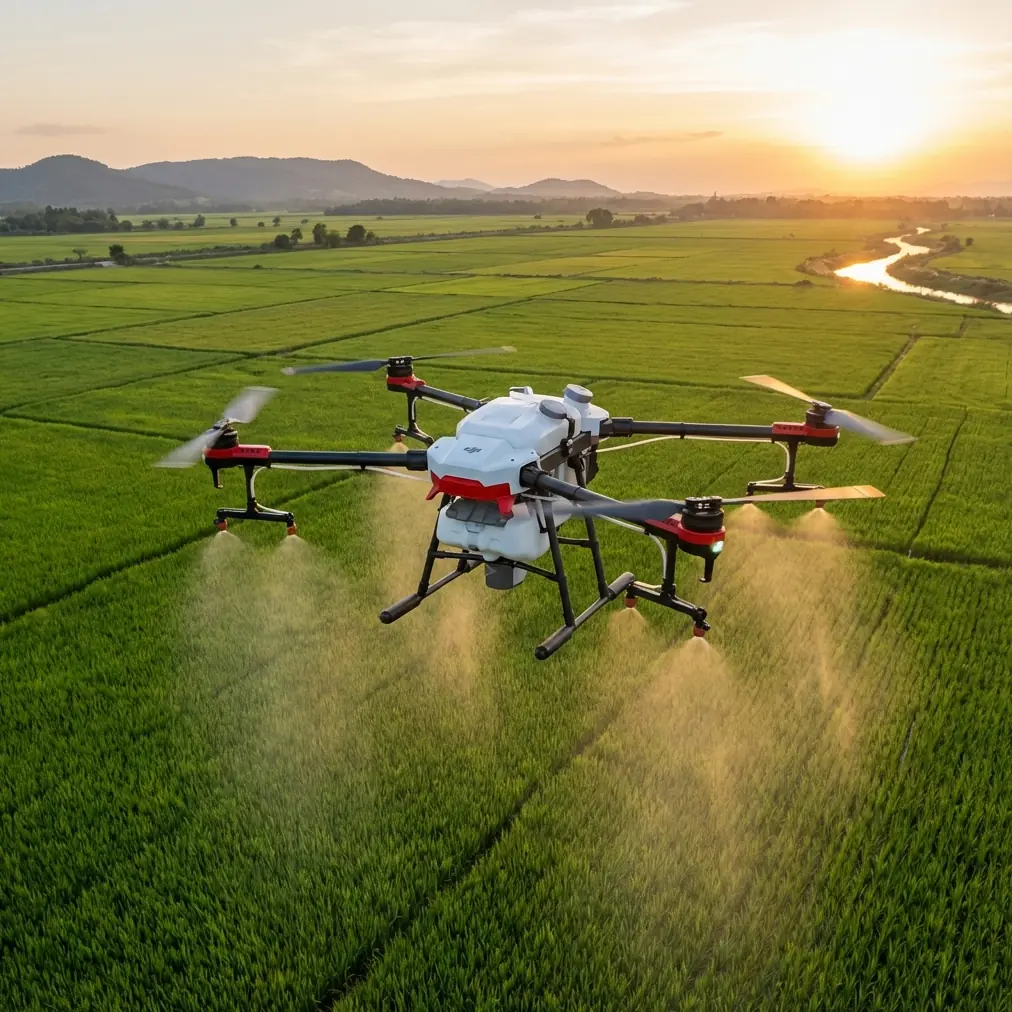
Solar farms built across rolling ground, stepped embankments, drainage cuts, and access roads are rarely as simple as they look from a planning map. Panels follow contour lines. Service roads bend around slopes. Fencing, inverter pads, and vegetation create elevation changes that punish sloppy flight planning. If you are using Flip to document, inspect, or visually map one of these sites, the difference between a clean mission and a frustrating reshoot often comes down to how you manage terrain, altitude, and obstacle behavior.
This guide is built for that exact scenario: mapping solar farms in complex terrain with Flip.
I am not treating Flip here as a generic camera drone. The useful part is how its flight intelligence and imaging features work together in a real site workflow. Obstacle avoidance matters when you are moving along panel rows broken by uneven ground. ActiveTrack and subject tracking become practical when you want smooth follow shots of maintenance vehicles or walking inspection teams for progress documentation. QuickShots and Hyperlapse are not just “creative modes”; on a large solar site, they can produce fast, readable visual context for stakeholders who do not want to parse a hundred stills. D-Log matters when bright panels, dusty roads, shadows, and sky highlights all sit in the same frame.
Let’s get into the part that saves time in the field.
Start with the right altitude, not the right camera mode
For mapping solar farms in mixed terrain, my preferred starting point with Flip is 45 to 60 meters above the local surface, not a fixed height above takeoff point. That distinction matters.
If you launch from a high edge of the site and then fly toward a lower drainage section, a fixed altitude referenced only to takeoff can put you far higher than necessary. Your panel detail drops. Gaps between rows become harder to read. Conversely, if you launch from a low area and fly upslope over elevated arrays, your clearance can collapse quickly. That is where obstacle avoidance helps, but it should not be your primary terrain management strategy.
Why 45 to 60 meters? On most solar layouts, that range gives a strong balance between three competing needs:
- Row readability: You can still distinguish panel blocks, aisle spacing, maintenance paths, and obvious defects in layout continuity.
- Safer terrain margin: You keep enough height for mild undulation, fence lines, poles, and scattered vegetation without flying so high that the imagery turns into abstract geometry.
- Efficient coverage: Battery use stays reasonable because you are not forcing repeated low, cautious passes over every elevation change.
If the terrain is especially broken, with terraces or abrupt level shifts, start closer to 60 meters and then reduce altitude for selected detail passes over areas of interest. If the ground is only moderately uneven and the arrays are densely packed, 45 to 50 meters often produces better visual interpretation of row alignment and access conditions.
The real lesson is simple: for solar farms, altitude is not just about legal ceiling or image style. It is about preserving a consistent look angle and workable clearance across a site that keeps changing shape beneath the aircraft.
Use obstacle avoidance as a buffer, not a crutch
Obstacle avoidance sounds reassuring until pilots let it replace planning. On a solar farm, Flip’s obstacle avoidance is most useful in three specific situations.
First, it helps when crossing from one block of arrays to another over service roads lined with light poles, signs, or vegetation that may not stand out in bright midday conditions.
Second, it reduces stress when terrain rises unexpectedly near the edge of a row, especially if scrub or fencing intrudes into your planned corridor.
Third, it is valuable during lower cinematic passes for stakeholder footage, where your attention is split between framing and route management.
Operationally, this matters because solar sites often create false confidence. The panel rows look orderly, but the non-panel infrastructure introduces a surprising amount of vertical clutter. Combiner boxes, monitoring stations, perimeter features, and maintenance staging areas can break what looks like an open flight path.
My approach with Flip is to map high first, observe the site behavior, then descend for controlled lower sequences only where the route is already understood. Obstacle avoidance is there to catch the small stuff you did not perfectly model, not to excuse poor route design.
Build two passes, not one
A lot of operators try to get every deliverable from a single flight. That usually leads to compromised altitude, inconsistent framing, and wasted battery.
With Flip, divide your work into two practical passes:
Pass 1: Structural overview
Fly the site at your baseline altitude, typically 45 to 60 meters above local ground, and aim for clean, repeatable coverage. This pass is about understanding the spatial logic of the farm. You want panel block relationships, access lanes, drainage patterns, nearby vegetation, and slope transitions visible in one coherent dataset.
Pass 2: Operational storytelling
Now use Flip more dynamically. This is where subject tracking, ActiveTrack, and controlled lower flight shine. Follow a maintenance cart along a service road. Track a technician walking a string inspection route. Capture a low oblique pass that shows how a panel field sits against the terrain. Stakeholders often understand operational constraints much faster from a moving visual sequence than from a top-down map alone.
This is one of the underappreciated advantages of Flip in commercial site documentation: you can move from structured mapping to readable visual narrative without changing aircraft or overcomplicating the workflow.
Where ActiveTrack actually helps on a solar site
ActiveTrack is often discussed as if it only belongs in lifestyle filming. That misses its value for infrastructure work.
On solar farms, ActiveTrack and subject tracking are useful when documenting repetitive maintenance activity across long distances. If a technician or utility vehicle is moving along a pre-cleared road, Flip can maintain visual continuity while you monitor site context rather than manually correcting every small lateral drift. That makes your footage smoother and easier to use in progress reports, training clips, or contractor updates.
The operational significance is not just “better video.” It is repeatability. When you can reliably track movement along service corridors, you produce footage that decision-makers can compare over time. That is useful for vegetation management checks, access condition monitoring, and documenting work completed in awkward areas of the site.
Just do not use tracking where roads are hemmed in by poles, fencing, or abrupt grade changes without first previewing the route from a safer height. Tracking tools are strongest on known paths, not uncertain ones.
QuickShots and Hyperlapse are useful if you stop treating them like gimmicks
Many pilots ignore QuickShots and Hyperlapse on industrial jobs because they sound too consumer-oriented. That is a mistake.
A short, controlled QuickShot sequence can establish the scale and topography of a difficult solar site faster than a stack of static images. If the terrain folds around the array field, a concise automated move can reveal the relationship between slope, road access, and panel placement in seconds. That is a practical briefing asset.
Hyperlapse is even more interesting for solar work. Use it to show cloud movement across an installation, traffic flow around inverter stations, or the cadence of maintenance activity during a work window. On a site with changing light and reflective surfaces, time-compressed movement makes exposure behavior, shadow sweep, and access patterns much easier to evaluate.
This matters because complex terrain often creates localized shading and uneven maintenance burden. A still frame can show where something is. A time-based sequence can show how the site behaves.
D-Log is the safer choice under reflective panel conditions
Solar arrays are unforgiving to cameras. The contrast can be extreme: bright panel reflections, dark undersides of structures, pale gravel roads, and a bright sky above ridgelines. If you are shooting only in a standard look, you can easily lose highlight control or muddy the shadow detail that helps explain site conditions.
That is where D-Log becomes operationally useful, not stylistically trendy.
D-Log gives you more flexibility when balancing high-contrast scenes common on solar farms. If your footage is going into stakeholder reports, investor updates, or engineering reviews, preserving detail in both reflective surfaces and darker infrastructure areas is worth the extra grading step. Especially in complex terrain, where the camera angle to sun and slope can change constantly during a single pass, a flatter capture profile gives you room to normalize the sequence later.
If your team needs a fast-turn result with minimal post work, keep your exposure disciplined and avoid dramatic angle changes in the same clip. But if quality matters, D-Log is the more forgiving option on reflective sites.
A practical flight pattern for uneven solar terrain
Here is the pattern I recommend most often.
1. Launch from the highest safe accessible point
This gives you a better initial read on clearance and a more conservative visual of downslope sections.
2. Make a short reconnaissance orbit or lateral scan
Before committing to full coverage, inspect tree lines, poles, fencing, and elevation breaks. This is where Flip’s obstacle awareness supports your visual check.
3. Fly your overview pass at 45 to 60 meters above local terrain
If the site includes major elevation changes, segment the farm mentally into zones. Adjust altitude as the ground changes rather than preserving one absolute figure tied to takeoff.
4. Review for trouble spots
Look for compressed clearance over ridges, overexposed reflective sections, and route segments where rows visually merge.
5. Drop lower for selective oblique passes
This is the moment for cleaner cinematic context, not random low flying. Use known paths and road corridors.
6. Use ActiveTrack only on predictable movement
Service carts, technicians on open roads, or walkers in clear aisles are good candidates.
7. Capture one Hyperlapse or QuickShot sequence for site context
One well-planned sequence is usually enough. It should explain terrain or workflow, not just decorate the edit.
Common mistakes with Flip on solar farms
The first is flying too high because the site feels “industrial” and therefore spacious. High altitude can flatten the terrain and erase the very access challenges you are trying to document.
The second is trusting obstacle avoidance to sort out terrain transitions near the edges of rows. It may save you from a mistake, but it does not fix poor altitude planning.
The third is ignoring reflective exposure management. Panel glare can vary dramatically across the same site depending on orientation and slope. If you are not watching that, your footage becomes harder to interpret.
The fourth is mixing mapping and storytelling into one chaotic flight. Separate the mission types.
If you only remember three things
For complex solar terrain, keep these in mind:
- Start around 45 to 60 meters above local ground, then adapt by zone.
- Use obstacle avoidance as a safety layer around roads, fencing, poles, and uneven terrain transitions.
- Treat ActiveTrack, QuickShots, Hyperlapse, and D-Log as operational tools for documentation, not extras.
That combination is what makes Flip genuinely useful on a solar farm. Not because any one feature is flashy, but because together they let you read the site clearly, move safely, and produce footage people can actually use.
If you are planning a specific solar mapping workflow and want to compare flight setups for hilly or terraced sites, you can message us here.
Ready for your own Flip? Contact our team for expert consultation.