Flip Mapping Guide for High-Altitude Vineyards
Flip Mapping Guide for High-Altitude Vineyards: Practical Flight Strategy, Safer Coverage, Better Data
META: Learn how to use Flip for high-altitude vineyard mapping with practical flight planning, obstacle avoidance tactics, camera setup, and terrain-aware workflow tips.
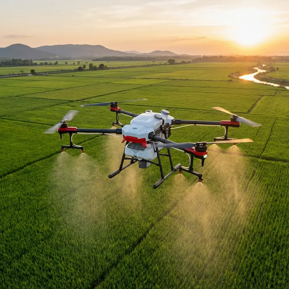
High-altitude vineyard mapping asks more from a drone than a flat-field survey ever will. Vine rows climb and dip. Wind curls over ridgelines. Light changes quickly as clouds move across slope faces. Even a short mission can include tree lines, trellis wires, service roads, workers, and wildlife sharing the same narrow corridor of airspace.
That is exactly where Flip becomes interesting.
This is not a broad overview of what the aircraft can do on paper. It is a field-focused tutorial for operators using Flip in mountain or hillside vineyards, where terrain compression, visual clutter, and changing elevation can punish lazy planning. If your goal is useful visual mapping, repeatable coverage, and fewer surprises in the air, the details matter.
I’ll walk through how I’d set up Flip for this kind of work, which features actually help, where the limits show up, and how to think about obstacle avoidance, subject tracking, QuickShots, Hyperlapse, D-Log, and ActiveTrack without turning a mapping mission into a gimmick.
Start with the terrain, not the drone
The first mistake in vineyard mapping is treating the site like a rectangular grid. High-altitude vineyards are rarely that cooperative. Blocks may be split by contour changes, retaining walls, equipment paths, or mixed plantings. Before powering on Flip, stand at the highest accessible point and read the land.
Look for four things:
- the steepest grade change across the block
- the dominant wind direction at canopy height
- vertical hazards such as cypress windbreaks, poles, and cable runs
- likely areas of signal interruption caused by folds in terrain
On a hillside property, a 40-meter altitude decision can mean the difference between a clean pass and a safety intervention. Even when the drone maintains a constant takeoff-relative altitude, the true clearance above vines may shrink fast as the aircraft moves uphill. That is why terrain awareness has to be a manual habit even when the aircraft gives you confidence through obstacle sensing.
Flip’s obstacle avoidance is useful here, but it should be treated as a secondary layer, not the primary plan. Sensors help when the scene presents clear, recognizable objects. Vineyard environments are messier. Thin wires, narrow trellis elements, and low-contrast branches at certain sun angles are exactly the kind of details that can challenge any vision-based system. In practical terms, that means you build the route for safety first, then allow obstacle avoidance to serve as insurance against the unexpected.
Break the property into mapping zones
Do not try to map an entire mountain vineyard in one sweep unless the terrain is exceptionally simple. Divide the property into zones based on slope orientation and elevation band. I usually think in three buckets:
- lower access rows and service tracks
- mid-slope production blocks
- upper ridge or exposed terraces
Why does this matter operationally? Because each zone creates a different flight environment. The lower section often has more vehicle movement and dust. The mid-slope zone is where changing relative altitude can catch pilots out. The upper ridge tends to expose the aircraft to gusts and crosswind drift that can distort overlap and consistency.
Splitting the mission gives you cleaner data and easier re-flights. If one section needs to be repeated because of glare, shadow, or wind-induced yaw variation, you are not redoing the entire property.
This also improves battery discipline. High-altitude work is rarely where you want to stretch a pack to the edge. Cold mornings, gust loading, and repeated climbs all reduce your margin. A shorter zone-based workflow is usually the more professional workflow.
Set camera intent before takeoff
A lot of poor “mapping” footage is really just scenic flying with no data discipline. Decide what the output is supposed to be.
If your objective is row condition review, you need consistency above all else. Lock in a repeatable altitude profile, maintain steady speed, and avoid dramatic tilt changes. If your objective includes marketing footage for the estate alongside inspection passes, separate those missions mentally and technically.
For analytical visual review, I favor a flatter, more controlled image profile. D-Log is valuable when you expect strong contrast between bright sky and shaded vine rows. In high-altitude vineyards, that contrast can be severe by late morning. D-Log gives you more room to recover highlight detail in pale soil and preserve darker leaf zones when reviewing footage later. That is not just an aesthetic point. It can improve your ability to distinguish irrigation inconsistency, edge stress, and canopy variation across slope faces.
But there is a tradeoff. If your team needs immediate on-site review with minimal post-processing, a more baked-in look may be faster. The correct choice depends on who is consuming the output and how quickly decisions must be made.
Obstacle avoidance is most valuable near transitions
The most dangerous parts of a vineyard mission are usually not the long straight runs. They are transitions:
- entering a block from a staging area
- turning along a tree line
- climbing toward an upper terrace
- passing near retaining structures
- repositioning after a paused run
This is where Flip’s obstacle avoidance earns its keep. In mapping-style work, your attention is split between flight path, image consistency, wind response, and land features. The sensor suite reduces the chance that a brief attention shift becomes a branch strike or an avoidable stop.
I saw this most clearly during a hillside wildlife encounter that could have become a distraction. A roe deer broke from cover near a stone wall on the edge of a vine block, and a second later a large hawk lifted from a nearby tree, crossing the route ahead. The correct response was not to chase the moment. It was to hold composure, reduce forward input, and let the aircraft’s sensing support a safe reposition while maintaining separation from the trees bordering the row. That kind of event is exactly why obstacle systems matter in agricultural environments. Not because they replace pilot judgment, but because they buy you a little extra room when the scene changes without warning.
Use ActiveTrack carefully, and mostly outside primary mapping runs
ActiveTrack and subject tracking can be genuinely useful in a vineyard context, just not for the reason many people assume.
They are not replacements for structured mapping passes. They are best used for documenting moving field operations around the survey itself. Think of a worker walking an irrigation line, a utility vehicle moving between blocks, or a manager traversing a terrace edge to point out disease pressure or drainage issues.
In that role, ActiveTrack gives you contextual footage that complements your mapping record. It shows scale, access difficulty, and operational conditions in a way top-down coverage cannot.
There is one hard rule: do not mix tracking logic with precision coverage logic. If you need row-by-row consistency, stay in manual control or whatever repeatable route method you trust most. Subject tracking is for context collection, not structured block capture.
A good sequence is to complete your mapping passes first, then record a short tracked walkthrough for human context. That footage can be surprisingly valuable when the viticulture team reviews terrain constraints later.
QuickShots and Hyperlapse have a place, but a narrow one
A vineyard operator might dismiss QuickShots and Hyperlapse as purely cinematic features. That is too simplistic. Used sparingly, both can help document site conditions and communicate topography to non-pilots.
QuickShots are helpful when you need a quick, repeatable establishing perspective of a specific block, a ridge-edge parcel, or the relationship between a winery structure and adjacent rows. The key is restraint. One or two structured establishing clips can save time in reporting or stakeholder communication. Ten flashy clips only dilute the mission.
Hyperlapse can be useful for showing fog movement, cloud shadow progression, or the way afternoon wind patterns move across exposed terraces. In high-altitude vineyards, those patterns directly affect irrigation timing, spray windows, and harvesting decisions. A time-compressed visual record can make that obvious in minutes.
Neither feature should consume your primary battery budget. Capture your operational footage first. If conditions and reserves allow, then use automation creatively and briefly.
Flight height and angle choices matter more than most pilots think
If your rows are on a severe incline, a single fixed altitude may create uneven visual detail from one end of the block to the other. The upper rows can become too close while lower rows appear less resolved. The solution is not always to fly lower. It is often to break the pass into segments that better match the terrain.
As a rule, choose flight geometry that preserves interpretability rather than maximizing drama. Straight, calm, slightly elevated passes often produce the best vineyard review footage. Oblique angles can help expose missing vines, canopy gaps, and erosion channels between rows, especially when the sun is low enough to create subtle shadow separation.
Watch your gimbal decisions. Frequent tilt adjustments make side-by-side comparison harder. Keep the visual language disciplined.
Build a repeatable preflight routine
For high-altitude vineyard work, I use a strict preflight order:
- confirm wind on site, not just from forecast
- inspect takeoff and return paths for vertical hazards
- identify wildlife activity near hedgerows and tree lines
- set home point where ascent and return are clean
- choose image profile before launch
- brief any assistants on vehicle or worker movement below
This sounds basic until you skip one item and pay for it with a compromised mission. High-elevation properties create microclimates. Wind at the parking area can be mild while the upper block is dealing with a much stronger crossflow. Likewise, a return-to-home path that looked clear from one angle may intersect taller vegetation as the aircraft comes back over rising ground.
If you need a second opinion on flight setup for a difficult site, send your mission outline through this WhatsApp planning link and get another set of eyes on the terrain logic before launch.
Review footage with viticulture questions in mind
The best mapping workflow does not end when the props stop. Review with a purpose.
Ask:
- where does vigor visibly change across elevation bands
- are there recurring weak rows near drainage breaks
- do terrace edges show erosion or access problems
- are there shadow-heavy sections that need a reflight at another hour
- did wind affect stability enough to reduce comparison value
This is where a disciplined capture strategy pays off. If your passes were consistent and your camera settings stable, operational patterns stand out more clearly. If you flew impulsively, you will spend more time guessing.
D-Log footage can be especially useful here when sun and shadow were aggressive. Properly handled, it preserves subtle tonal information across vine canopy and soil that can otherwise disappear in harsher baked-in contrast.
Common mistake: trusting automation too much in a complex vineyard
Flip brings useful intelligence to the job. That does not mean the job becomes automatic.
Obstacle avoidance does not guarantee detection of every trellis wire or branch tip. ActiveTrack does not know your agronomic objective. QuickShots do not create a survey. Hyperlapse does not replace disciplined repeat flights. Good output still comes from good operational thinking.
That is the central point for high-altitude vineyard mapping: use Flip’s smart features as force multipliers, not substitutes for flight planning.
When pilots get this right, the aircraft becomes more than a camera in the sky. It becomes a practical tool for reading terrain, documenting vineyard health, and communicating site reality to people who are not standing on the slope with you.
My recommended Flip workflow for this scenario
If I were mapping a steep vineyard block tomorrow, I would do it this way:
- split the site into slope-based zones
- fly the most exposed upper section early, before wind builds
- use obstacle avoidance as a safety layer during transitions and turns
- keep primary mapping passes manual and highly consistent
- record a short ActiveTrack sequence only after the main coverage is complete
- use D-Log when high-contrast light threatens canopy detail
- reserve QuickShots or Hyperlapse for one clear storytelling purpose, not as filler
- review footage immediately for shadow problems and terrain-induced inconsistency
That sequence keeps the mission grounded in usable output rather than feature-chasing.
Flip is at its best in vineyards when the pilot respects the site. High-altitude blocks are unforgiving, but they are also visually rich and operationally revealing. With a careful route, disciplined camera setup, and smart use of sensing features, you can come back with footage that is safer to collect and far more useful once you are back on the ground.
Ready for your own Flip? Contact our team for expert consultation.