How to Map Wildlife in Complex Terrain With Flip
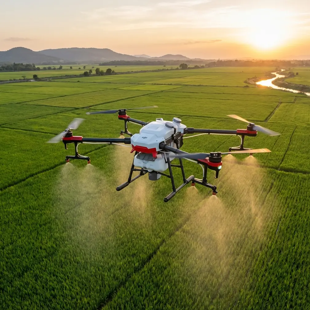
How to Map Wildlife in Complex Terrain With Flip
META: A practical how-to for using Flip to map wildlife in steep, unpredictable terrain, with field tips on obstacle avoidance, ActiveTrack, D-Log, QuickShots, Hyperlapse, and flying through changing weather.
Wildlife mapping sounds tidy on paper. Pick a site, launch the drone, collect imagery, go home with a neat folder of geotagged files. In the field, it rarely behaves that way.
Terrain folds in on itself. Light changes faster than your settings menu. Animals move when your plan assumes they will stay still. Wind slips through ridgelines one minute and dies in the next. That is exactly why Flip is interesting for this kind of work. It sits in a category many people first associate with ease of use and creator-friendly flight features, yet some of those same features become genuinely useful when the assignment is not making pretty footage, but building a usable record of wildlife presence in difficult ground.
This article is for that scenario: mapping wildlife in complex terrain with Flip, especially when the weather turns mid-flight and you still need stable, actionable coverage.
Start with the mission, not the drone
Before touching the controller, define what “mapping wildlife” means for your outing. In practice, it usually falls into one of three jobs:
- documenting animal movement corridors
- recording habitat condition over a defined area
- capturing repeatable visual references of nests, herds, trails, or water access points
Those goals demand different flight patterns. If your purpose is habitat mapping, consistency matters more than cinematic movement. If your purpose is tracking animal movement along a tree line or ridge, controlled following behavior matters more. Flip’s value shows up when you use the right feature for the right job instead of flying everything manually out of habit.
The strongest mistake I see is treating every wildlife sortie like a classic grid mission. In broken terrain, that can be inefficient and, in some spots, unsafe. A narrow ravine, a sloped meadow, a marsh edge, and a forest opening all reward different techniques.
Step 1: Build a terrain-first flight plan
Complex terrain changes three things immediately: line of sight, obstacle density, and wind behavior.
With Flip, obstacle avoidance is not just a comfort feature. In wildlife work, it has operational significance because it reduces the workload on the pilot when the environment becomes visually busy. Tree trunks, uneven canopy height, rock faces, and sudden rises in ground elevation all compete for attention. If the aircraft can help maintain spatial awareness around obstacles, you gain more mental bandwidth for the actual job: monitoring subject position, checking framing, and preserving continuity in the dataset.
That matters most when you are flying near edges. Many wildlife habitats are transitional zones, forest to grassland, cliff to beach, wetland to scrub. Those are productive ecological boundaries, and they are also places where manual flying gets messy fast.
A practical pre-flight routine looks like this:
- Identify the highest terrain hazard in the area.
- Mark likely animal movement lines.
- Choose one primary route and one fallback route.
- Launch from the most open ground available, even if it adds a short walk.
- Set your camera profile and tracking method before takeoff.
Do not improvise the whole mission in the air. In wildlife mapping, rushed decisions create gaps in coverage.
Step 2: Use ActiveTrack and subject tracking selectively
Flip includes subject tracking tools, and this is where people either overuse them or dismiss them too quickly.
For wildlife mapping, ActiveTrack and related subject tracking functions are not ideal for every species or every habitat. They are best used when the goal is to document movement through terrain while keeping a consistent visual relationship to the subject. Think larger animals crossing a valley shoulder, moving along a shoreline, or following a visible game trail through broken vegetation.
Operationally, the significance is simple: tracking can preserve framing consistency while the pilot manages terrain and changing air conditions. That consistency makes later review far easier. If you are comparing movement patterns, body condition, or habitat interaction across multiple clips, stable composition saves time and improves interpretability.
Still, you need judgment. In dense woodland, branches may interrupt line of sight. In mixed terrain, subjects can vanish behind rock outcrops. In those cases, use tracking for short segments rather than trusting it to carry an entire flight.
A good field method is to alternate between:
- short ActiveTrack passes over clear movement corridors
- manual repositioning for habitat context shots
- hovering observation at stand-off distance when animals become erratic
That gives you both movement data and environmental context.
Step 3: Capture repeatable habitat context with QuickShots and Hyperlapse
QuickShots and Hyperlapse sound like features built for social media. Used properly, they can serve field documentation.
QuickShots can help create repeatable establishing views of a site. If you return to the same hillside, nesting area, or water source across multiple dates, a standardized automated movement can produce comparable visual records. The advantage is not style. The advantage is repeatability. Similar camera paths make changes in vegetation cover, water level, erosion, or animal congregation patterns easier to detect.
Hyperlapse is useful in a different way. It can compress environmental change into a short reviewable sequence, which matters when animal activity is tied to shifts in weather, light, or human disturbance. If a herd tends to emerge after fog lift, or birds change their use of a ridge once wind direction turns, a well-planned Hyperlapse can reveal patterns that isolated stills miss.
The key is restraint. Do not scatter these modes randomly throughout the mission. Assign them to specific documentation needs:
- QuickShots for site reference and repeatable vantage capture
- Hyperlapse for time-based habitat or movement observation
When used with intent, these tools become part of a field method rather than an editing gimmick.
Step 4: Shoot in D-Log when light is unstable
Wildlife terrain rarely gives you flat, predictable lighting. One side of a slope is blown out. The other drops into deep shadow. Clouds move. Mist lifts. By late afternoon, the contrast can become severe enough that standard profiles feel brittle.
This is where D-Log earns its place.
The practical benefit of D-Log is not that it makes footage look “cinematic.” For mapping and wildlife review, its real value is preserving more flexibility in high-contrast scenes. If an animal moves from open grass into a dark tree line, or if a white bird crosses a shaded ravine into direct light, you have a better chance of holding detail that would otherwise clip or crush.
That matters after the flight, when researchers, land managers, or field teams need to inspect details instead of just watching attractive footage. Feather edges, coat patterns, vegetation structure, ground disturbance, and water boundaries all benefit from a file that grades cleanly.
If your team does not have a color-managed workflow, keep the mission simple: use D-Log on your critical passes, and make sure everyone downstream knows those files need post-processing. A technically richer file is only useful if the team can interpret it properly.
Step 5: When the weather changes mid-flight, slow down and let the drone help
This is the moment that separates a tidy demo from an actual field operation.
Imagine you are halfway through a ridge-side survey. The air was calm at launch. Ten minutes later, a crosswind starts spilling over the crest, and the light goes flat under a sudden cloud layer. The birds you were documenting shift lower into cover. Your original path now feels exposed.
This is where Flip’s blend of obstacle avoidance and intelligent flight assistance becomes more than convenience. In changing weather, pilot workload spikes. You are adjusting position, reading gust behavior, watching battery state, preserving subject awareness, and rethinking your route. Any system that helps reduce collision risk or maintain smoother subject handling has direct operational value.
Here is the field response I recommend:
Reassess altitude immediately
Do not continue the original flight path just because it was safe three minutes ago. Wind often strengthens at ridge level and near exposed saddles. Drop to a more protected operating height if terrain clearance allows.
Shorten the task
Abandon the full-area coverage plan if conditions are degrading. Prioritize your highest-value segment, such as the known wildlife crossing or the water source boundary.
Use tracking only in clean airspace
If gusts are pushing the drone toward branches or uneven rock faces, switch from automated tracking to more conservative manual control. Flip can assist, but poor judgment cannot be automated away.
Watch how cloud cover changes your exposure
A fast weather shift can flatten contrast and trick you into overcorrecting. If you are shooting D-Log, keep your exposure discipline steady and avoid chasing every passing light change.
Preserve a safe recovery corridor
In rough terrain, your return path is as important as your survey path. Do not finish the mission in a boxed-in pocket of airspace.
I have seen many pilots treat weather change as either a crisis or a badge of toughness. It is neither. It is simply a prompt to simplify the operation. The drone’s smart features help most when the pilot responds with fewer variables, not more.
Step 6: Work in layers, not one giant flight
For wildlife mapping with Flip, smaller structured flights usually outperform one long ambitious sortie.
A layered approach works well:
- first flight: broad habitat orientation
- second flight: targeted movement corridor coverage
- third flight: detail passes over signs, tracks, nesting zones, or water edges
- fourth optional flight: repeatable QuickShot or Hyperlapse reference
This method improves both safety and data quality. It also gives you decision points between flights. If the weather changes after the first sortie, you can adapt. If animal activity shifts, you can reassign your next battery to the more valuable zone.
That adaptability is often worth more than raw airtime.
Step 7: Review for ecological usefulness, not just image quality
After landing, do not judge the mission only by sharpness and smoothness. Ask harder questions:
- Can I identify movement patterns?
- Do I have enough terrain context to explain what the animals were doing?
- Is the footage repeatable for comparison on another date?
- Did the changing weather alter visibility or behavior in a way I should document?
This is where many otherwise capable pilots leave value on the table. They collect clips, but not evidence.
One useful habit is to tag your files by habitat function, not just location. For example:
- ridge transit
- water access
- resting zone
- edge habitat
- weather shift sequence
That makes later interpretation much faster, especially if multiple people are reviewing the flight records.
A practical Flip workflow for wildlife teams
If you are helping a field crew or building your own repeatable process, this simple structure works well:
Pre-flight
- define the biological objective
- inspect terrain hazards
- choose manual, ActiveTrack, or mixed capture
- set D-Log if contrast will be difficult
In-flight
- start with context coverage
- move to subject tracking only when sight lines are clean
- use obstacle avoidance as support, not a replacement for route discipline
- capture one repeatable reference movement with QuickShots or Hyperlapse if it serves the study
Weather shift response
- reduce complexity
- lower exposure to gusty terrain
- narrow the mission objective
- maintain a clean return route
Post-flight
- organize by ecological relevance
- note weather change timing
- compare automated and manual segments for consistency
If you need to discuss a field setup or compare capture strategies before your next survey, you can reach out directly here: https://wa.me/85255379740
Why Flip fits this specific job
Flip makes sense for wildlife mapping in complex terrain not because it turns fieldwork into something easy, but because it compresses several useful capabilities into one platform. Obstacle avoidance supports safer navigation in visually cluttered habitats. ActiveTrack and subject tracking help maintain continuity when animals move across uneven ground. D-Log protects detail when terrain and weather create punishing contrast. QuickShots and Hyperlapse, used carefully, can produce repeatable environmental records rather than throwaway effects.
Those are not isolated features. Together, they shape a practical workflow for civilian conservation, habitat monitoring, and observational field documentation.
And when the weather turns halfway through the flight, as it often does, that combination matters even more. The best wildlife mapping flights are not the most dramatic ones. They are the flights that return with usable evidence, stable coverage, and enough consistency to support the next survey.
Ready for your own Flip? Contact our team for expert consultation.