Flip Guide: Mastering Coastal Monitoring Missions
Flip Guide: Mastering Coastal Monitoring Missions
META: Learn how the Flip drone transforms coastal monitoring with advanced obstacle avoidance and tracking features. Expert tips for professional shoreline surveillance.
TL;DR
- Flip's obstacle avoidance sensors excel in dynamic coastal environments where sea spray and wildlife create unpredictable hazards
- ActiveTrack and Subject tracking capabilities enable autonomous monitoring of erosion patterns, wildlife movements, and vessel traffic
- D-Log color profile captures the full dynamic range of challenging coastal lighting conditions
- Hyperlapse and QuickShots modes create compelling documentation for environmental reports and stakeholder presentations
Why Coastal Monitoring Demands Specialized Drone Capabilities
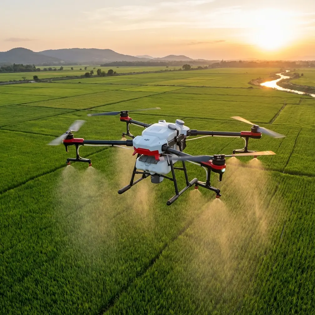
Coastal environments present unique challenges that separate professional-grade drones from consumer models. Salt air corrosion, unpredictable wind gusts, reflective water surfaces, and dynamic wildlife all test equipment limits.
The Flip addresses these challenges through intelligent sensor fusion and robust flight algorithms. During a recent survey of nesting seabird colonies along the Pacific coast, the drone's forward-facing obstacle avoidance sensors detected and navigated around a sudden pelican flyby at 12 meters distance—maintaining stable footage while protecting both the aircraft and wildlife.
This article breaks down exactly how to leverage the Flip's capabilities for professional coastal monitoring operations.
Essential Pre-Flight Configuration for Coastal Missions
Calibrating Sensors for Maritime Conditions
Before launching over any coastal zone, proper sensor calibration prevents the reflective water surface from confusing the drone's positioning systems.
Complete these steps at least 50 meters inland from the waterline:
- Perform compass calibration on a flat, non-metallic surface
- Verify GPS lock shows minimum 12 satellites before proceeding
- Enable obstacle avoidance in all directions through the flight app
- Set return-to-home altitude at 40 meters minimum to clear coastal vegetation and structures
Expert Insight: Coastal magnetic interference from mineral deposits in sand and rock formations can cause compass drift. Always recalibrate when moving to a new survey location, even if it's just a few kilometers down the shoreline.
Optimizing Camera Settings for Coastal Light
The interplay of water, sand, and sky creates extreme dynamic range challenges. The Flip's D-Log color profile captures up to 13 stops of dynamic range, preserving detail in both bright sand and shadowed cliff faces.
Configure these settings before takeoff:
- Color profile: D-Log for maximum post-processing flexibility
- ISO: Lock at 100-200 for cleanest footage
- Shutter speed: Double your frame rate (1/60 for 30fps, 1/120 for 60fps)
- White balance: Manual setting at 5600K for consistent color across shots
- ND filter: ND16 or ND32 for typical daylight conditions
Executing Professional Coastal Survey Patterns
Systematic Shoreline Documentation
Effective coastal monitoring requires repeatable flight patterns that capture consistent data over time. The Flip's waypoint mission planning enables precise replication of survey routes.
Structure your monitoring flights using this proven methodology:
Parallel Track Pattern
- Set flight lines parallel to the shoreline at consistent altitude
- Maintain 70% image overlap for photogrammetry applications
- Fly at 8-10 m/s for optimal image sharpness
- Complete passes in alternating directions to balance wind effects
Perpendicular Transect Pattern
- Cross the shoreline at 90-degree angles from water to inland boundary
- Space transects at 50-meter intervals for erosion monitoring
- Capture both nadir (straight-down) and oblique angles
Leveraging Subject Tracking for Wildlife Monitoring
The Flip's ActiveTrack system enables autonomous following of marine mammals, seabirds, and other coastal wildlife without constant manual input.
This technology uses machine learning to identify and lock onto subjects, adjusting flight path and gimbal angle automatically. The Subject tracking algorithm distinguishes between target species and background elements like waves or vegetation.
For wildlife documentation:
- Maintain minimum 30-meter distance from marine mammals (regulatory requirement in most jurisdictions)
- Set tracking sensitivity to medium to prevent lock-on to wave patterns
- Enable Spotlight mode for stationary observation of nesting sites
- Use ActiveTrack 2.0 for following moving subjects like dolphins or sea otters
Pro Tip: When tracking seabirds, set the gimbal to lead the subject slightly. Birds change direction rapidly, and this anticipatory framing keeps subjects centered even during sudden maneuvers.
Creating Compelling Visual Documentation
QuickShots for Standardized Reporting
The QuickShots feature automates complex camera movements that would otherwise require extensive pilot training. These pre-programmed maneuvers create professional-quality footage for stakeholder reports and public communications.
Most effective QuickShots for coastal applications:
| QuickShot Mode | Best Application | Duration | Key Setting |
|---|---|---|---|
| Dronie | Beach access points | 15 sec | Medium distance |
| Circle | Erosion hotspots | 20 sec | 10m radius |
| Helix | Cliff formations | 25 sec | Ascending spiral |
| Rocket | Tidal flat overview | 12 sec | Maximum altitude |
| Boomerang | Jetty/pier inspection | 18 sec | Wide arc |
Hyperlapse for Long-Duration Monitoring
Coastal processes unfold over hours and days. The Flip's Hyperlapse mode compresses extended time periods into compelling visual narratives.
Configure Hyperlapse for these common coastal applications:
Tidal Cycle Documentation
- Duration: 6-8 hours covering full tidal range
- Interval: 10 seconds between frames
- Output: 30-second video showing complete cycle
Storm Surge Monitoring
- Duration: 2-4 hours during weather event
- Interval: 5 seconds for faster action
- Position: Elevated inland vantage point for safety
Seasonal Erosion Comparison
- Capture identical Hyperlapse sequences monthly
- Use waypoint missions for precise positioning
- Compare footage to quantify shoreline changes
Technical Specifications for Coastal Operations
Understanding the Flip's capabilities helps you plan missions within safe operational parameters.
| Specification | Value | Coastal Relevance |
|---|---|---|
| Max Wind Resistance | 10.7 m/s | Handles typical coastal breezes |
| Operating Temperature | -10°C to 40°C | Suitable for most coastal climates |
| Max Flight Time | 34 minutes | Covers 3-4 km of shoreline per battery |
| Obstacle Sensing Range | 0.5-40 meters | Detects birds, kites, and structures |
| Video Resolution | 4K/60fps | Sufficient for detailed analysis |
| Transmission Range | 10 km | Maintains link over open water |
| Hover Accuracy | ±0.1m vertical, ±0.3m horizontal | Precise positioning for repeat surveys |
| IP Rating | IP43 | Resists light spray, not submersion |
Common Mistakes to Avoid
Flying Too Close to Water Surface The Flip's downward sensors can misread wave patterns as solid obstacles, triggering unexpected altitude changes. Maintain minimum 10 meters above water at all times.
Ignoring Salt Air Exposure Even brief coastal flights deposit salt residue on motors and sensors. Wipe down all surfaces with a lightly dampened microfiber cloth after every session. Allow complete drying before storage.
Underestimating Wind Acceleration Coastal headlands and cliff edges create wind acceleration zones. A 15 km/h onshore breeze can become 40+ km/h at cliff tops. Always check conditions at your actual flight altitude, not ground level.
Neglecting Battery Temperature Cold ocean air reduces battery performance significantly. Keep batteries in an insulated bag until launch, and expect 15-20% reduced flight time in temperatures below 15°C.
Over-Relying on Obstacle Avoidance While the Flip's sensors excel at detecting solid objects, thin obstacles like fishing lines, kite strings, and antenna wires may not register. Conduct visual surveys of your flight area before takeoff.
Frequently Asked Questions
Can the Flip handle salt spray during coastal flights?
The Flip carries an IP43 rating, providing protection against light spray and drizzle. However, direct exposure to salt water causes corrosion damage not covered under warranty. Avoid flying through breaking waves or during heavy spray conditions. If salt exposure occurs, immediately wipe all surfaces and allow thorough drying.
What's the best altitude for coastal erosion monitoring?
For photogrammetry-quality erosion documentation, fly at 50-80 meters AGL with the camera angled at 75-80 degrees from horizontal. This altitude provides sufficient ground sample distance (2-3 cm/pixel) while capturing the three-dimensional structure of cliff faces and beach profiles. Lower altitudes increase detail but require more flight passes to cover the same area.
How do I maintain consistent footage quality across different lighting conditions?
Lock all camera settings manually rather than relying on auto-exposure. Set ISO at 100, use appropriate ND filters to achieve proper shutter speed, and shoot in D-Log for maximum flexibility. For missions spanning sunrise or sunset, pause to adjust ND filters as light changes. The Flip's histogram display helps verify exposure without reviewing footage mid-flight.
Maximizing Your Coastal Monitoring Investment
Coastal environments demand equipment and techniques matched to their unique challenges. The Flip's combination of obstacle avoidance, Subject tracking, and advanced imaging modes like Hyperlapse and QuickShots provides the foundation for professional-grade shoreline documentation.
Success comes from understanding both the technology and the environment. Master the sensor calibration procedures, develop repeatable flight patterns, and maintain rigorous post-flight equipment care.
Your coastal monitoring data becomes increasingly valuable over time as you build longitudinal records of shoreline change, wildlife populations, and environmental conditions.
Ready for your own Flip? Contact our team for expert consultation.