Flip Monitoring Tips for Construction Sites in Mountain Terr
Flip Monitoring Tips for Construction Sites in Mountain Terrain
META: A technical review of using Flip for mountain construction site monitoring, with practical tips on obstacle avoidance, battery management, ActiveTrack, D-Log, and QuickShots in demanding field conditions.
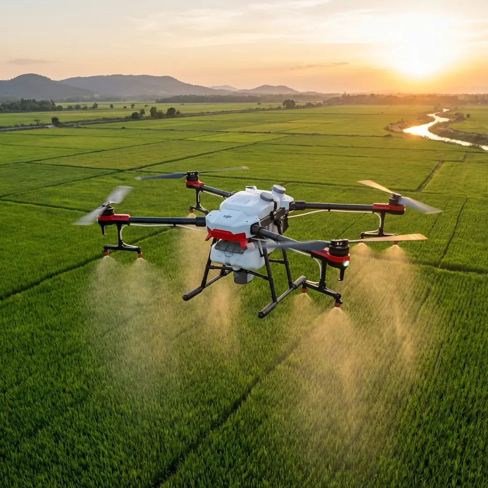
Mountain construction work exposes every weakness in an aircraft and every shortcut in a pilot. Wind rolls over ridgelines without warning. Light shifts fast as clouds move across rock faces. GPS reception can look solid in one corner of a site and get messy near steep walls, cranes, or cut slopes. In that environment, the appeal of Flip is not just portability. It is whether the platform can deliver stable, repeatable visual data when the site itself keeps changing.
I approach Flip less like a casual travel drone and more like a compact field camera for difficult terrain. That distinction matters. On a mountain jobsite, pretty footage is useful only if it also helps the site team understand haul road conditions, slope protection progress, material staging, drainage routing, and safety exposure around active work zones. The aircraft has to be quick to deploy, predictable in tight spaces, and forgiving when the operator is balancing weather, terrain, and moving equipment.
That is where core flight intelligence becomes operational rather than decorative. Obstacle avoidance, for example, is often discussed as a convenience feature. In mountain construction, it is closer to a margin-preserving system. Sites like these tend to have uneven vertical references: temporary scaffolds, cable runs, rock anchors, tower cranes, excavator booms, spoil piles, and cut faces that visually blend into the background. A drone that can recognize and respond to nearby hazards reduces the odds of pilot overload during short inspection windows. That does not replace disciplined route planning, but it does make low-altitude passes near structures more manageable.
The same goes for subject tracking and ActiveTrack. On paper, these sound like creator features. In practice, they can support site documentation when used carefully. If you need consistent visual follow footage of a haul truck route, a utility vehicle moving between laydown areas, or a walking inspection along a retaining structure, a robust tracking mode can maintain framing while the pilot concentrates on altitude, terrain, and separation. The benefit is not cinematic flair. It is consistency. Repeated runs framed in a similar way make it easier to compare progress over time and identify surface changes, washouts, access issues, or bottlenecks in material flow.
Still, automation is only useful when you understand its limits. Mountain sites are full of partial obstructions that can confuse automated behavior: rebar cages, netting, partially completed structures, or narrow access corridors with irregular edges. I would trust ActiveTrack more on open access roads and less in constrained zones with mixed vertical clutter. That is not a flaw in the aircraft. It is simply the difference between using smart tools and outsourcing judgment to them.
Image quality also deserves a more technical discussion than it usually gets. Construction documentation often fails not because the drone camera is weak, but because the footage is captured for immediate visual punch rather than future analysis. D-Log can help here. In high-contrast mountain conditions, you may be dealing with snow patches, pale aggregate, reflective metal, dark forest edges, and deep trench shadows in the same frame. A flatter recording profile preserves more flexibility for later grading and detail recovery. If the goal is reporting, claims support, stakeholder updates, or progress comparison, that extra headroom can matter more than a saturated out-of-camera look.
I have seen this become especially valuable late in the day, when the sun drops behind the ridge but part of the work zone is still catching hard side light. Standard footage may look attractive in the moment yet lose detail in shadows where crews need to inspect erosion control, shoring conditions, or formwork alignment. D-Log gives you a better chance of extracting usable information later. For a photographer, that is not an abstract specification. It changes whether the image remains evidence or just atmosphere.
QuickShots and Hyperlapse sit in a similar category. They are often treated as social-first features, but on a mountain build they can serve real reporting functions if used with restraint. A QuickShot can establish context at the beginning of a weekly update by showing how a narrow site bench relates to surrounding terrain, access roads, and adjacent work faces. A Hyperlapse can show cloud movement, equipment staging changes, or traffic buildup around a constrained work area. Used sparingly, these modes compress time and geography in a way that helps non-technical stakeholders understand why a task is taking longer or why sequencing has changed.
The mistake is using them as substitutes for disciplined repeatable captures. Progress monitoring still depends on consistent launch points, repeat altitudes, repeat headings, and a naming system that does not collapse after the third site visit. Flip becomes much more valuable when every creative feature is subordinated to documentation logic. The best construction drone footage is often the least flashy because it was captured with comparison in mind.
Battery management is where mountain experience separates smooth operations from rushed compromises. Here is the field tip I give to anyone flying compact aircraft on high-elevation jobs: never trust the battery percentage alone after a cold start. In mountain conditions, especially early morning, the pack can appear ready and still sag faster than expected once you climb into wind or accelerate over a ridge. I prefer to keep flight batteries insulated during transport, avoid leaving them exposed on cold tailgates or concrete surfaces, and give the aircraft a short, controlled hover to confirm stable output before committing to a long inspection leg.
That short hover sounds minor, but it has saved time more than once. You learn quickly whether the battery is behaving normally, whether gusts are stronger than expected, and whether the aircraft is holding position cleanly before you move over a steep drop or active work area. On paper, this adds a minute. In practice, it can prevent an aborted mission halfway through a pass you cannot easily repeat.
I also recommend planning mountain site flights around a stricter reserve than you would use in open flat terrain. Not because the aircraft is weak, but because the return leg is rarely symmetrical. You may launch in calm air and come back against channelized wind moving up a valley. Add elevation changes, a cautious descent near structures, and occasional repositioning to avoid equipment, and your margin disappears faster than the percentage display suggests. The operational significance is simple: if you want repeatable monitoring, land with enough reserve to stay selective rather than desperate.
Another overlooked point is how obstacle avoidance interacts with battery discipline. In cluttered environments, automated braking and rerouting behavior can increase hover time and micro-corrections. That is a fair trade for safety, but it means battery forecasts based on ideal forward motion may not reflect what actually happens during close visual inspection of retaining walls, drainage channels, or temporary access routes. Pilots who understand this tend to capture the essential footage first and leave optional cinematic passes for the end, not the reverse.
For monitoring construction sites in the mountains, workflow matters as much as airframe capability. I prefer a four-part capture sequence with Flip. First, a high contextual orbit or angled overview to document terrain relationship. Second, fixed stills or slow passes over key work packages such as excavation limits, foundation pads, drainage, or slope stabilization. Third, a route-based tracking or manual follow segment to document access and logistics flow. Fourth, one selective creative clip, often a Hyperlapse or a controlled reveal, for stakeholder communication. This structure keeps the mission useful even if weather shortens your window.
There is also a communication advantage to using a compact system like Flip. Large aircraft tend to change the energy of a site. Crews notice them more. Supervisors may pause movement. In some locations, a smaller and quieter platform is easier to integrate into an active inspection routine without turning the flight into an event. That matters when the real goal is frequent, low-friction capture rather than occasional spectacle.
Photographers entering construction work sometimes underestimate how much framing discipline affects site value. ActiveTrack can help keep a moving subject centered, but the more useful skill is learning what not to include. A mountain background can make any shot look dramatic. That does not mean it is informative. If the purpose is to show the condition of a switchback haul road, compose for road crown, shoulder integrity, drainage edge, and equipment interaction. If the purpose is to inspect a cut slope, prioritize scale, angle, and consistency. Visual beauty is welcome, but clarity wins.
The same thinking applies to color and post-production. D-Log offers flexibility, but construction deliverables benefit from restraint in grading. Keep rock, soil, concrete, and vegetation believable. Overprocessed footage may look polished while making material differences harder to read. On a site where image records may influence planning discussions or dispute resolution, neutrality is part of professionalism.
One practical habit worth adopting is pairing aerial footage with a simple shot log immediately after landing. Note wind behavior, battery used, temperature feel, route deviations, and any automation anomalies. That note can explain later why one week’s footage frames differently or why a repeated pass had to be flown higher. It also helps identify patterns, such as certain batteries underperforming in cold morning flights or specific site corners consistently triggering obstacle avoidance near cable lines or equipment booms.
If you are building a repeatable monitoring program around Flip, I would treat three capabilities as the backbone: obstacle avoidance for risk reduction in visually complex work zones, ActiveTrack or subject tracking for consistent moving-sequence documentation, and D-Log for preserving detail in harsh mountain light. QuickShots and Hyperlapse are worthwhile, but they should support the record, not define it. The aircraft becomes most effective when its intelligent features are used to reduce field friction, not to chase novelty.
There is a reason compact drones have become more credible in professional workflows. It is not because they replace larger survey platforms or dedicated enterprise systems. It is because many site teams need fast visual intelligence more often than they need maximum payload complexity. A well-managed Flip flight can answer practical questions in minutes: Has drainage control been installed where planned? Is the access road degrading after weather? Has material spread beyond the designated laydown? Are crews approaching a slope edge more closely than last week?
That kind of routine visibility has real value in mountain construction, where conditions change quickly and site access is never as simple as it looks on a map. If your team is refining its workflow or comparing capture setups, you can message the field team here and talk through practical deployment questions.
Flip works best on mountain jobs when it is flown with discipline, not optimism. Use automation where it genuinely reduces workload. Protect battery performance before takeoff, not after the warnings start. Capture for comparison, not just for impact. Do that, and a compact aircraft stops being a gadget and starts becoming a reliable site instrument.
Ready for your own Flip? Contact our team for expert consultation.