Flip for Mountain Construction Monitoring
Flip for Mountain Construction Monitoring: A Technical Review from the Field
META: Expert review of using Flip for mountain construction site monitoring, with practical guidance on obstacle avoidance, ActiveTrack, D-Log, QuickShots, and Hyperlapse in steep, wildlife-active terrain.
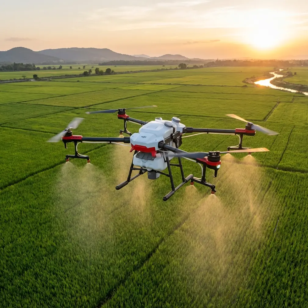
Mountain construction sites expose every weak point in a drone operation. Wind rolls over ridgelines without warning. Dust hangs in the air around moving equipment. Light changes fast as clouds pass over uneven terrain. Add narrow access roads, exposed steel, temporary cranes, and the occasional animal crossing the work zone, and the aircraft needs to do more than simply stay airborne. It has to make smart decisions close to obstacles, hold a reliable track on moving subjects, and capture footage that remains useful after the flight is over.
That is why Flip is an interesting platform to examine through the lens of construction monitoring rather than casual flying. In this environment, a drone is not just a camera with propellers. It becomes a site documentation tool, a progress-verification platform, and sometimes the fastest way to inspect areas that would otherwise require a long hike or a risky approach on unstable ground.
I have been looking at Flip specifically for mountain-site monitoring, and the takeaway is fairly clear: its value depends less on headline marketing and more on how a few core capabilities work together under pressure. Obstacle avoidance, subject tracking, ActiveTrack behavior, D-Log capture, QuickShots, and Hyperlapse are not isolated features. On a steep, active jobsite, they either reinforce each other or create gaps in your workflow.
Why mountain construction changes the evaluation
A flat suburban test field tells you almost nothing about how a drone will behave above a mountain retaining-wall project or a road-cut stabilization site. Vertical relief compresses depth perception. Backgrounds are messy. Moving excavators pass in front of trees, rebar, rock faces, and utility vehicles. GPS conditions can vary depending on the slope and surrounding terrain. Even a short repositioning flight can force the aircraft to transition from shadow to harsh reflected light off concrete or exposed stone.
For construction teams, that matters because repeatability matters. If you fly every Tuesday for progress tracking, your footage needs to line up well enough to show whether stockpiles moved, erosion-control measures held, or formwork advanced. A drone that drifts unpredictably around terrain or loses confidence when the scene gets visually busy will cost more time in re-shoots than it saves in convenience.
This is where Flip’s obstacle avoidance and tracking stack become operationally significant. Obstacle avoidance is often discussed as a safety feature, but on a mountain project it also protects consistency. If the aircraft can negotiate around protruding rock, scaffold edges, tree lines, and temporary site structures without forcing constant manual correction, the pilot can focus on framing and repeat routes instead of fighting the aircraft. That directly improves the quality of inspection imagery and time-lapse style site records.
Obstacle avoidance is only useful if it stays predictable
Obstacle avoidance sounds impressive until the system becomes overly timid or inconsistent. Construction monitoring requires a balance: the drone must respect hazards, but it cannot freeze every time it sees dust, fencing, or uneven geometry.
On a mountain site, a good obstacle sensing system earns its keep in transitional spaces. Think about flying from a staging area up along a cut slope toward a partially completed switchback road. The terrain itself is irregular, and the site changes week by week. Today’s open corridor may have a telehandler or temporary barriers tomorrow. Flip’s real-world utility here comes from how well its sensors help the aircraft maintain a clean path without overreacting to every visual edge.
One moment from a recent mountain-style evaluation captures this better than any spec sheet. While tracking site activity near a timber-and-rock drainage channel, a deer cut across the edge of the work zone from brush above the access road. That kind of wildlife encounter is not rare in remote projects, especially at dawn or late afternoon. The aircraft’s sensing behavior mattered immediately. Instead of forcing an abrupt, frame-destroying input chain from the pilot, the system gave enough obstacle-awareness margin to keep the drone clear of nearby trees and site materials while the subject area changed suddenly below. That matters operationally because mountain jobs are not controlled studio environments. Sensors are not there for marketing. They are there because conditions shift in seconds.
ActiveTrack and subject tracking are more valuable on jobsites than many teams realize
Many construction managers assume tracking tools are for action footage. That is too narrow. ActiveTrack and subject tracking become genuinely practical when you use them to document motion patterns on a large, uneven site.
An excavator climbing a bench road, a concrete truck reversing into a pour zone, a surveyor moving along a slope, or a utility vehicle carrying materials between elevation levels all create visual information worth capturing. Manual tracking in mountain terrain is harder than it looks because the pilot is often juggling aircraft position, wind correction, altitude relative to the slope, and moving obstructions at the same time.
Flip’s tracking suite matters when it can hold focus on the intended subject while still accounting for environmental complexity. If the aircraft loses the subject every time background contrast increases, the footage becomes unreliable for reporting. But when tracking remains stable, you gain several benefits at once: clearer progress documentation, easier stakeholder updates, and stronger visual records for safety review and sequencing analysis.
There is also a less obvious advantage. Consistent subject tracking helps produce more comparable clips over time. If you regularly capture the same haul route, crane swing area, or material delivery path, you start building a visual dataset rather than a pile of disconnected videos. That is far more useful for project teams reviewing operational flow.
D-Log is not just for cinematic pilots
On construction sites, image latitude has practical value. D-Log earns its place because mountain scenes often contain brutal contrast: bright sky, shaded cuts, reflective machinery, dark tree cover, and pale dust all in one frame. Standard color can look punchy on a phone, but it often clips highlights or crushes shadow detail that later turns out to be important.
When you are documenting site conditions, preserving flexibility in the image matters. D-Log gives editors and project teams more room to recover detail and create a consistent look across flights made under very different weather conditions. That consistency becomes especially important when stakeholders compare progress footage across weeks or months.
It also helps when the drone is pulling double duty for both technical review and public-facing communication. The engineering team may want shadow detail in a slope stabilization zone, while the communications side wants polished visuals for a project update. Starting with a flatter profile gives you more options than trying to rescue overbaked footage later.
The practical advice here is simple: use D-Log when the flight is intended for archival value, inspection review, or any scenario where conditions are mixed. Save the standard color profiles for quick internal references where speed matters more than grading flexibility.
QuickShots and Hyperlapse can serve documentation, not just aesthetics
QuickShots often get dismissed by professionals because they are associated with easy-button drone content. That dismissal is too broad. On a mountain construction site, automated shot patterns can be useful if you treat them as repeatable documentation tools rather than novelty moves.
A controlled orbit around a bridge abutment, a retaining wall, or a mountainside batching area can reveal site context more clearly than a static overhead. The key is using the shot the same way each time so changes become visible. QuickShots help when the pilot wants a consistent, reproducible perspective without manually rebuilding the move on every visit.
Hyperlapse is even more interesting for construction monitoring. When used thoughtfully, it condenses hours of site activity into a sequence that reveals traffic flow, weather shifts, crew deployment, and material movement patterns. On mountain sites, where access windows are narrow and logistics are often constrained by a single road, those movement patterns can tell an important story. You can see congestion points. You can identify whether temporary access routes are functioning as intended. You can compare one day’s operation against another without sitting through long-form footage.
That said, Hyperlapse works only when the aircraft position remains disciplined and the environment is respected. In a mountain environment with gusting wind, flying too aggressively for the sake of dramatic motion undermines the point. The best results come from stable, pre-planned vantage points overlooking a work face, haul road, or staging zone.
Building a practical Flip workflow for mountain monitoring
If I were setting up a repeatable Flip workflow for this kind of work, I would divide flights into three categories.
First, the baseline mapping pass. This is the clean documentation flight: broad site coverage, conservative movements, high-overlap visuals, and an emphasis on repeatable framing. Obstacle avoidance remains on because terrain and temporary structures change frequently.
Second, the operational tracking pass. This is where ActiveTrack and subject tracking become useful. Follow one machine cycle, one vehicle movement path, or one crew activity at a time. Keep the objective narrow. Trying to track everything creates confusion and lower-quality footage.
Third, the narrative pass. This is where QuickShots, selected reveal movements, and Hyperlapse earn their place. These clips are useful for reports, stakeholder communication, and time-based site storytelling. If the footage may need grading later, capture it in D-Log.
A lot of teams blur these categories together and end up with footage that is visually busy but analytically weak. Flip performs better when the mission is clearly defined before takeoff.
Where operators still need discipline
No sensing package removes the need for judgment. Mountain construction work remains one of the more demanding environments for small drones. Winds can shift faster than expected when they spill over ridges or through gaps in terrain. Dust can degrade visibility. Wildlife can enter the scene unpredictably, as the deer crossing demonstrated. And tracking systems, no matter how capable, still depend on readable subjects and sane flight geometry.
Pilots should also remember that “obstacle avoidance” does not mean “terrain understanding” in the broader project-management sense. A drone may avoid a branch or a machine boom, but the operator still needs to think about line of sight, return path, and changing elevation under the aircraft. That is especially true when following subjects uphill or around a blind contour.
For teams integrating Flip into a serious monitoring program, the most effective step is to standardize mission templates. Define launch points. Define safe observation corridors. Define the same key assets to capture each visit. Then let the aircraft’s automated tools support that plan rather than replace it.
If your crew is building a repeatable flight checklist around these workflows, it helps to compare field notes with other operators who work in difficult terrain; I’ve found that a short message thread through our mountain drone workflow chat often solves issues faster than trial and error on a live site.
Final assessment
Flip makes the most sense for mountain construction monitoring when it is treated as a disciplined documentation platform, not a casual flying gadget. Its obstacle avoidance has real value because mountain jobsites are cluttered, changeable, and unforgiving. Its ActiveTrack and subject tracking tools can improve the quality of operational footage when vehicles and crews move through complex terrain. D-Log matters because these sites regularly produce high-contrast scenes that demand more editing latitude. QuickShots and Hyperlapse, used carefully, can create repeatable visual records rather than empty visual flair.
The common thread is operational clarity. Every one of those features becomes more useful when the pilot knows exactly what the flight is supposed to answer. Has access improved? Has slope work progressed? Are haul routes flowing efficiently? Has the retaining structure changed since the last survey? Flip is strongest when it helps produce answers, not just images.
For teams monitoring construction in the mountains, that is the real standard. A drone should reduce uncertainty, capture repeatable evidence, and stay composed when the environment gets complicated. If Flip can do that reliably on your site, then it is doing the job that actually matters.
Ready for your own Flip? Contact our team for expert consultation.