Monitoring Urban Forests With Flip: A Technical Review
Monitoring Urban Forests With Flip: A Technical Review Focused on Safe, Repeatable Data Capture
META: A technical review of using Flip for urban forest monitoring, with practical guidance on obstacle avoidance, ActiveTrack, D-Log, Hyperlapse, and a critical pre-flight cleaning step.
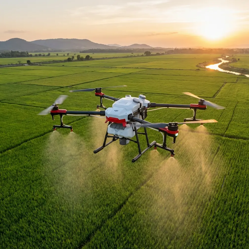
Urban forest monitoring sounds simple until you try to do it well. Trees sit close to roads, power lines, lamp posts, rooflines, footpaths, fences, and people. Light shifts fast between open sky and dense canopy. GPS performance can vary near buildings. Wind tumbles unpredictably through narrow corridors. If you are using Flip in this environment, the aircraft is not just a flying camera. It becomes a field instrument, and that changes how you should evaluate it.
This review looks at Flip through that lens: not as a lifestyle drone, but as a practical platform for monitoring forests in urban settings. The goal is not cinematic novelty. The goal is repeatable observation, safe flight near clutter, and footage that remains useful after the excitement of launch has worn off.
The most overlooked part of that job starts before takeoff.
Why pre-flight cleaning matters more in urban tree work
Flip’s obstacle avoidance and subject-aware flight features only perform as well as the sensors can see. In urban forest work, dust, pollen, moisture residue, and oily fingerprints build up faster than many operators expect. A drone that launches from a park edge, a paved car park, or a maintenance vehicle often carries a thin film over its vision surfaces after only a few sessions. That can blunt contrast, reduce detection reliability, and create hesitation or inconsistency in braking behavior.
A simple pre-flight cleaning step should be standard procedure: inspect and gently clean the vision sensors and camera cover before every mission, especially during high-pollen periods or after flying near damp foliage. This is not housekeeping for its own sake. It directly affects the aircraft’s ability to interpret branches, trunks, and narrow gaps. In an urban forest environment, where obstacle avoidance is expected to distinguish between a clean corridor and a dead-end under canopy, reduced sensor clarity can quietly erode your safety margin.
That matters operationally. When a drone misreads fine branch structure or struggles with glare across a smudged surface, the result may not be a dramatic failure. More often, it is subtle: inconsistent slowing, less confident pathing, or a tendency to stop short when attempting a repeated route. For anyone documenting canopy changes over time, those small deviations can reduce the usefulness of comparison footage.
Obstacle avoidance is the feature that earns its keep here
Many drone buyers fixate on image quality first. For urban forest monitoring, obstacle avoidance deserves equal attention. Trees in city environments do not present clean, isolated trunks in open air. You are often dealing with mixed geometry: low branches, irregular crowns, wires nearby, railings below, and moving traffic outside the tree line.
In that context, obstacle avoidance is not just crash insurance. It expands the kind of route you can fly consistently. A drone that can better recognize and respond to cluttered surroundings gives the operator more confidence to hold a precise inspection line along a row of trees, hover near a canopy edge to assess crown density, or pull back slowly to reveal the relationship between vegetation and built infrastructure.
There is a catch. Obstacle avoidance should be treated as a support layer, not permission to become casual. Branch tips, thin twigs, reflective surfaces, and high-contrast light transitions remain challenging for any small UAV. Flip’s value is that it lowers workload in dense urban greenery, but the pilot still needs a route designed with escape options and conservative standoff distance. If you are trying to monitor disease spread, storm damage, or pruning effects, you want consistency more than bravado.
That is why the cleaning step above has real technical importance. Obstacle avoidance is only as trustworthy as the visual information feeding it.
ActiveTrack and subject tracking have a place in forestry work
At first glance, subject tracking sounds more relevant to athletes and cyclists than trees. In practice, Flip’s ActiveTrack-style capabilities can be useful in urban forestry operations when the “subject” is not the vegetation itself but the workflow around it.
For example, if an arborist or inspection lead is moving along a tree line identifying problem areas, subject tracking can help capture a coherent visual record of the route and observations. Instead of manually juggling framing while also watching branches and pedestrians, the operator can use tracking to maintain a stable relationship with the moving worker. That produces more usable footage for post-mission review, especially when mapping where issues were found relative to surrounding streetscape elements.
The operational significance is straightforward: tracking reduces pilot workload during documentation of moving inspections, and that can improve both safety and data continuity. In a park, boulevard, or campus setting, where workers move between specimen trees and pause under mixed canopy, that matters more than flashy autonomous movement.
Subject tracking can also help when documenting maintenance vehicles or field teams during restoration or storm response. Used carefully, it creates context around the forest condition rather than isolated close-ups with no geographic story.
Still, it should be deployed selectively. Dense canopy, frequent occlusion, and tight urban spaces can interrupt tracking logic. The best use is in partially open corridors where the drone has room to maintain spacing and the operator has clear visual awareness of side hazards.
QuickShots are not just for social media if used with discipline
QuickShots usually get dismissed by technical users. That is a mistake. Automated camera moves can be valuable in urban forest monitoring if they are treated as standardized capture templates rather than novelty effects.
A repeatable pullback from a focal tree, for instance, can show how crown spread relates to adjacent buildings across seasons. A controlled orbit can reveal asymmetry after storm damage or pruning. A vertical rise can demonstrate canopy layering and encroachment around lighting or utility corridors. The advantage of an automated move is consistency. If the same path can be reproduced over multiple visits, even approximately, the resulting visual set becomes more analytically useful.
This is where Flip can bridge professional discipline and accessible automation. The operator does not have to hand-fly every reveal from scratch. Instead, QuickShots can function as field shortcuts for repeated visual evidence collection. The caveat, again, is environmental complexity. In urban tree environments, automated maneuvers must be chosen only where branch clearance and lateral space are generous enough to avoid unnecessary risk.
Hyperlapse is underrated for change detection
Hyperlapse can look like a purely creative mode until you apply it to environmental observation. In urban forestry, change often happens slowly, then suddenly. Seasonal leaf-out, construction encroachment, root zone disturbance, pedestrian pattern shifts, and the aftermath of wind events all benefit from time-compressed visual comparison.
Flip’s Hyperlapse capability is useful when you need to communicate change over a corridor rather than at a single tree. A route along a street canopy, greenway, or park edge can condense movement and time into a sequence that planners and maintenance teams actually watch. Static reports are necessary. Short, intelligible aerial summaries are often what gets cross-functional attention.
The operational value here is communication efficiency. Hyperlapse is not replacing survey-grade measurement, but it can expose patterns that prompt deeper inspection. If canopy thinning becomes visually obvious over a repeated route, that may justify a more targeted on-site assessment. Used this way, Hyperlapse is not decoration. It is a screening tool.
D-Log is worth the effort when conditions are difficult
Urban forests create hard exposure problems. You may frame bright pavement, shaded understory, reflective glass, and dark bark in the same shot. Standard color profiles can produce footage that looks punchy on first viewing but clips highlights or crushes shadow detail that would have been useful later.
D-Log earns its place in this kind of work because it preserves more flexibility in post-processing. If your purpose includes identifying canopy stress, branch structure against bright sky, or subtle contrast shifts in foliage, retaining more tonal information can help. You are not chasing a stylized grade. You are protecting image data from the compromises of harsh mixed lighting.
That does require discipline. A log workflow is only valuable if your team is prepared to normalize footage consistently and archive it with metadata that makes future comparison possible. But for organizations that revisit the same urban forest zones over time, D-Log can improve the reliability of visual interpretation, particularly when light conditions vary from one inspection day to the next.
Where Flip fits in a real urban monitoring workflow
The strongest case for Flip is not that it does one thing no other drone can do. It is that it bundles several genuinely useful functions into a platform that supports frequent, efficient field deployment.
A practical workflow might look like this:
Start with a pre-flight inspection focused on prop condition, battery health, local airspace checks, and that sensor cleaning step. Launch from a clear zone with enough vertical and lateral buffer to assess wind behavior before approaching the tree corridor. Capture an establishing pass manually to confirm GNSS stability, obstacle behavior, and glare conditions. Use a standardized QuickShot or slow manual reveal on key specimen trees. If a field arborist is moving the site, use ActiveTrack selectively in open stretches. Record a Hyperlapse over the wider corridor for context. Switch to D-Log when the scene includes extreme contrast that may matter in review.
This layered approach gives you three different kinds of evidence from one flight: close inspection visuals, contextual corridor footage, and communication-friendly time-compressed sequences. That combination is particularly effective in urban forestry because stakeholders rarely share the same priorities. Tree officers may care about crown structure. Operations teams may care about access and interference risks. Community stakeholders may need a broader visual narrative to understand why action is being proposed.
Flip works best when the operator knows which mode serves which question.
Limits that matter more in cities than in open countryside
Urban forest monitoring exposes weaknesses quickly. Even with good obstacle avoidance, dense overhead cover can affect route confidence. Wind can funnel unpredictably between buildings. Pedestrian presence raises the bar for operational discipline. Repeated missions require attention to launch location, camera angle, altitude, and time of day if visual comparisons are going to mean anything.
That is why a technical review of Flip cannot stop at features. The aircraft may offer obstacle avoidance, subject tracking, QuickShots, Hyperlapse, and D-Log, but those functions only become valuable when wrapped in a repeatable field method. The biggest gains come from reducing variability: same route logic, same standoff habits, same cleaning routine, same review process.
If you want help shaping that workflow for your own site conditions, this direct chat option can speed up planning: message our UAV team on WhatsApp.
Final assessment
Flip makes sense for urban forest monitoring when safety support and repeatable capture matter as much as image aesthetics. Obstacle avoidance has real value around branches and infrastructure, provided the operator respects its limits. ActiveTrack can improve documentation of moving inspection teams. QuickShots can become repeatable evidence templates. Hyperlapse can surface corridor-level change. D-Log helps preserve detail in the mixed, punishing light common to city trees.
The most practical insight is also the least glamorous: keep the sensing surfaces clean before every flight. In this category of work, that small habit directly supports both safety features and data quality. It is the kind of detail professionals rely on because it changes outcomes without adding complexity.
Urban forest monitoring rewards systems, not improvisation. Flip is most effective when treated as part of that system.
Ready for your own Flip? Contact our team for expert consultation.