Flip for Power Line Work in the Mountains
Flip for Power Line Work in the Mountains: A Field Report from the Edge of the Weather
META: A field report on using Flip for mountain power line monitoring, covering obstacle avoidance, pre-flight cleaning, tracking, color workflow, and practical flight planning.
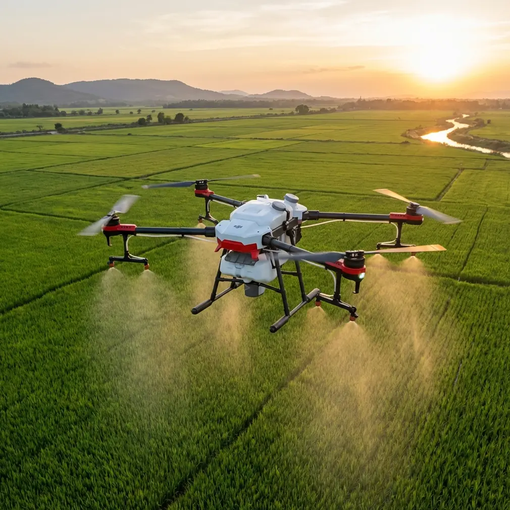
Mountain power line inspection is rarely about the line alone. The line is the easy part. The hard part is everything wrapped around it: slope lift, cold batteries, gusts that hit one ridgeline and skip the next, branches that drift into view at the wrong second, and light that changes faster than your checklist.
That is why a small aircraft like Flip earns attention in this kind of work. Not because small automatically means simple, and not because every compact drone belongs near critical infrastructure. It does not. But in steep terrain, portability changes behavior. A drone that is quick to stage, easy to reposition, and realistic to carry to uneven access points often gets used more deliberately than larger gear that encourages “one launch, do everything” thinking. For mountain line monitoring, that difference matters.
I have spent enough time around exposed ridges to know that the flight starts before the props move. In this environment, one of the most overlooked safety steps is also one of the least dramatic: cleaning the aircraft before takeoff, especially the sensors and camera surfaces tied to obstacle avoidance and image clarity.
That sounds mundane until you are flying parallel to a power corridor cut into a hillside.
Dust from service roads, pine pollen, moisture residue, and oily fingerprints can all degrade how a drone reads space. On a consumer-facing platform like Flip, obstacle avoidance is only as trustworthy as the surfaces feeding it clean information. If the aircraft is relying on forward or downward sensing to judge terrain transitions, then a smudged lens or dirty sensor window is not a cosmetic issue. It is an operational issue. In mountain work, where rock faces, guy wires, trees, and terrain shelves can compress distance very quickly, that pre-flight wipe can have more impact on the flight than changing a camera setting ever will.
So my routine is blunt and repeatable. Before I even power up, I check for grit around the body seams, clean the camera glass, and carefully wipe the sensing surfaces with the kind of cloth I trust on optics. Then I inspect propellers, confirm the gimbal moves freely, and only after that do I step into compass, battery, and airspace checks. If you are using Flip to monitor power lines in the mountains, this cleaning step is not housekeeping. It is part of your risk control stack.
The second reason Flip fits this scenario is how its automation can be used selectively rather than theatrically. Features such as ActiveTrack, subject tracking, QuickShots, and Hyperlapse are often marketed for creative work, but their value in field conditions is really about repeatability and perspective management.
Take ActiveTrack and subject tracking. No, you should not blindly hand line inspection over to an automated follow mode near critical assets. But tracking tools can still help in adjacent tasks. If a ground crew vehicle is moving between towers on a narrow mountain road, for example, subject tracking can be useful for maintaining visual context on the broader operation while you stay offset from the actual line. That is not the same as inspecting conductors autonomously. It is using the aircraft’s tracking logic to maintain situational awareness around the corridor.
The same idea applies to QuickShots. Most experienced operators are not launching canned moves for entertainment during utility work. But the underlying value of preprogrammed camera paths is that they reveal geometry. A short orbit or pull-back, flown safely and well away from conductors, can help document how a line corridor sits relative to tree encroachment, access routes, erosion zones, or adjacent structures. In mountainous terrain, that wider spatial read is often what field teams need. A single close shot of insulators rarely tells the whole story. A wider, stable sequence can show whether a maintenance crew will even have safe access to the location.
Hyperlapse is another feature people underestimate in utility-adjacent reconnaissance. In changing mountain weather, time-based imaging can help document cloud buildup, shadow progression across a slope, or how valley fog is moving into a line corridor. That is not a substitute for a meteorological briefing, but it can produce practical visual evidence of deteriorating conditions. If your objective is monitoring, not just filming, then understanding how visibility changes over a 15- or 20-minute window can inform whether you continue, reposition, or abort.
Then there is the camera profile question, which matters more than many field teams admit. If you are capturing footage for later review by engineers, vegetation managers, or operations staff, D-Log can be genuinely useful. Flat profiles preserve more flexibility for post-processing, especially when you are shooting dark forest against bright cloud or snow patches against shaded rock. Mountain scenes can break a standard profile very quickly because the contrast ratio is unforgiving. D-Log gives you room to recover detail without locking your exposure decisions too early in the field.
That said, D-Log is only helpful if your workflow can support it. If the footage needs to be handed over quickly to a crew that wants immediate visibility into hardware condition or corridor clearance, a standard profile may be more practical. I have seen operators capture everything in a flat profile and then create unnecessary review delays because nobody downstream wanted to grade footage before checking a pole-top condition. The right answer depends on who needs the image and how soon. Flip gives value here not because one mode is universally better, but because the choice exists.
The terrain itself is where Flip’s compact design can become either an advantage or a trap. Carrying a lighter aircraft up a rough service route is obviously easier. So is launching from a narrow turnout or a small clearing. But mountain flying punishes overconfidence in small systems. A compact drone can tempt operators into pushing into tighter spaces because the machine feels less imposing. That is exactly when obstacle avoidance needs to be treated as a backup layer, not permission.
Power lines complicate that judgment. Conductors and smaller line components can be visually difficult for any drone sensing system, especially in variable light, cluttered backgrounds, or when the aircraft is approaching at awkward angles. Add wind funneling through a saddle or rising air along a sunlit slope, and your margin shrinks fast. The operational takeaway is simple: obstacle avoidance is helpful for terrain and larger objects, but it should never be your primary strategy around utility lines. Route selection, standoff distance, altitude discipline, and visual observation still carry the load.
In practice, the most effective mountain flights with Flip tend to be the least flashy. Launch from a stable point with a clear escape route. Build your first leg to read the wind, not to capture hero footage. Watch how the aircraft behaves crossing a ridgeline. Check whether the live feed is hiding branch movement in foreground clutter. Confirm how the battery is responding in the temperature you actually have, not the one forecast on your phone. Then decide how close the mission truly needs to get.
That is also where the photographer’s mindset helps. I come from image-making, and one habit from that world translates directly to field utility work: do not chase every angle. Define the story you need from the flight. If the mission is corridor context, gather that clearly. If it is vegetation encroachment, fly for separation and scale. If it is documenting access constraints, show the relationship between road, slope, and tower position. Flip’s small form factor and intelligent modes can support this discipline, but they cannot create it for you.
One detail I always share with newer operators is that clear footage starts with clear assumptions. If you expect obstacle avoidance to save a rushed line-adjacent pass, you are already behind. If you expect ActiveTrack to understand the difference between a target worth following and background clutter in a mountain valley, you are asking the software to solve a judgment problem that belongs to the pilot. But if you treat these tools as controlled aids, Flip becomes more capable than its size suggests.
For teams building a repeatable field method, I would structure a mountain power line mission with Flip in four phases.
First, site read. Stand still for a minute longer than feels necessary. Look at wind in vegetation, cloud movement, the slope under your feet, and any possible emergency landing options. Small drones make quick launches easy, which also makes rushed launches easy.
Second, aircraft prep. This is where the cleaning step belongs. Wipe optics and sensing areas. Check propellers. Verify the gimbal is unobstructed. In dusty or damp mountain environments, this should happen every flight, not just the first launch of the day.
Third, conservative reconnaissance pass. Stay wider than your ego wants. Use that first flight leg to understand airflow and signal behavior in the actual terrain. If needed, capture broad corridor context with stable movement rather than forcing close inspection angles.
Fourth, targeted capture. Once the environment has told you how it wants to be flown, then use the relevant tools. A controlled tracking shot for crew movement. A QuickShot-style path for corridor geometry. Hyperlapse if weather movement is operationally relevant. D-Log when downstream analysis benefits from greater grading latitude.
That process sounds slower on paper than it feels in the field. In reality, it saves time because it reduces re-flights and bad assumptions.
If you are building a field workflow and want to compare notes with someone who thinks about both imagery and operational discipline, this is the easiest place to start the conversation: message me here.
The broader point is that Flip makes sense for mountain power line monitoring only when it is used with respect for the environment. Its portability helps on difficult access routes. Its obstacle avoidance can add protection when terrain gets messy. Its ActiveTrack and subject tracking tools can support context gathering around the mission. Its QuickShots and Hyperlapse modes can document geometry and changing conditions. Its D-Log profile can preserve detail in harsh contrast. Those are real advantages.
But none of them remove the core realities of utility-adjacent flying in the mountains: the air moves strangely, the terrain lies to your eyes, batteries fade faster in cold conditions, and infrastructure deserves wider margins than most recreational pilots are used to giving.
That is why the smallest habit in this whole workflow still deserves emphasis. Clean the aircraft before you fly. Clean the camera. Clean the sensor windows that support obstacle avoidance. In mountain environments, contamination is not an afterthought. It is one of the easiest causes of degraded performance to prevent, and one of the easiest to ignore until the aircraft is already airborne.
Flip is at its best here when it is treated neither like a toy nor like a miracle. It is a compact aerial tool that can be genuinely effective for monitoring line corridors in difficult terrain if the operator respects what the platform can do, what it cannot see reliably, and how quickly mountains punish lazy preparation.
That balance is the whole job.
Ready for your own Flip? Contact our team for expert consultation.