Flip Monitoring Guide for Mountain Solar Farms
Flip Monitoring Guide for Mountain Solar Farms: Smarter Routes, Better Angles, Fewer Missed Defects
META: A practical tutorial on using Flip for mountain solar farm monitoring, with lessons drawn from DJI’s Matrice 4 Series emphasis on multi-angle data capture and work in hard-to-reach terrain.
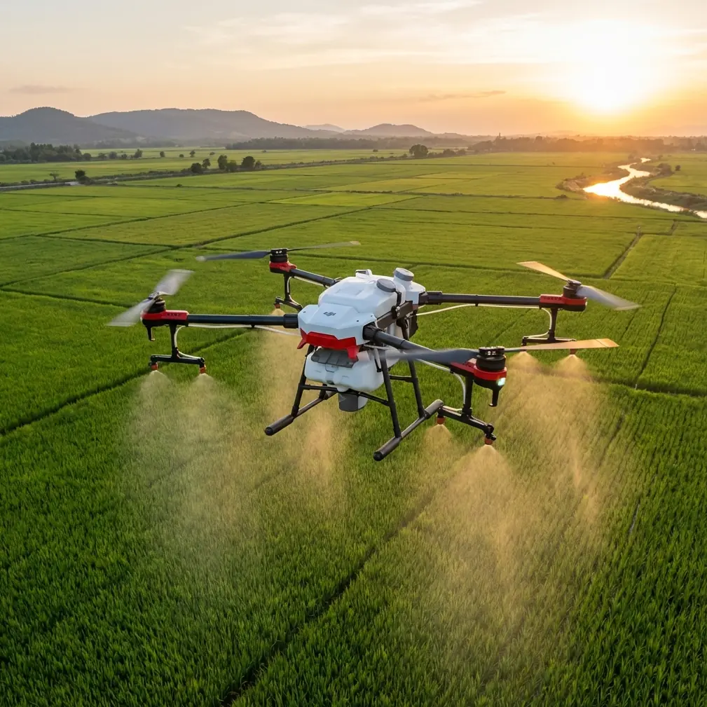
Mountain solar farms expose every weakness in an aerial workflow.
Panels sit on uneven grades. Access roads twist through ridgelines. Wind changes by the minute. Shadows move faster than crews expect. A drone that performs well over flat industrial land can start to feel clumsy when the site climbs, dips, and disappears behind terrain. That is exactly why the latest messaging around DJI’s Matrice 4 Series deserves attention, even for readers focused on Flip.
DJI introduced the Matrice 4 Series on 2025-01-08 as a lineup built for “everyday aerial work,” with a clear emphasis on two ideas: capturing data from multiple angles and operating in less-traveled or hard-to-reach areas. Those are not abstract claims. For anyone monitoring a mountain solar installation, they point directly to the two operational problems that matter most: seeing enough of the array to make decisions, and reaching enough of the site to inspect it consistently.
This guide looks at how to apply that thinking with Flip in the field.
I’m approaching this from the perspective of Jessica Brown, a photographer by instinct but practical in operation. That matters here, because mountain solar monitoring is not just about flying over panels. It is about framing information properly. A panel row seen from the wrong angle can hide soiling, hotspot clues, vegetation encroachment, structural tilt issues, or drainage patterns along the slope. The aircraft is only part of the job. The camera path is the real inspection tool.
Why the Matrice 4 Series announcement matters to Flip users
The Matrice 4 Series was presented as a drone family for daily tasks, not occasional specialty flights. That is a useful benchmark when evaluating how to use Flip around solar assets. Monitoring is not a cinematic one-off. It is repetitive, structured, and often dull in the best sense. The goal is consistency.
DJI also highlighted multi-angle data gathering. In mountain solar work, that single detail has operational significance far beyond image variety.
A top-down pass may tell you panel alignment and broad coverage. It may also miss:
- glare-driven visibility problems on specific rows,
- edge damage hidden by frame geometry,
- cable irregularities tucked under panel margins,
- erosion channels running beside support structures,
- snow or debris buildup trapped by terrain.
A second or third angle changes what is visible. On sloped arrays, oblique imagery often reveals what overhead imagery flattens. That is why the Matrice 4 Series positioning is relevant: it reinforces a field truth many teams learn the hard way. One angle is rarely enough in complex terrain.
The other phrase from DJI’s launch, “roads less traveled”, is not marketing fluff when you are dealing with remote mountain infrastructure. It points to another operational fact: inspection quality falls apart when aircraft setup, launch planning, and route design are built for easy access only. Some faults occur at the very edge of a site, beyond the simplest launch point and well outside the operator’s most comfortable visual geometry. A drone used for this work needs a workflow that remains reliable when the terrain is the problem.
Flip enters the conversation here because its portability and accessible flight intelligence can make frequent monitoring more realistic for smaller teams. But to get useful results, you have to fly it with inspection discipline rather than casual capture habits.
Start with the site, not the drone
Before the first battery goes in, divide the mountain solar farm into three visual zones:
Primary production rows
The main panel blocks where output anomalies are most likely to matter at scale.Terrain-transition edges
Places where the slope shifts, retaining structures begin, or drainage cuts through the site.Access and balance-of-site areas
Roads, inverter pads, fencing, service paths, and vegetation boundaries.
This matters because each zone benefits from a different camera angle and flight rhythm.
If you treat the whole solar farm as one continuous cinematic route, Flip will produce footage. It may even look excellent. But it will not necessarily produce inspection clarity. Mountain sites punish vague planning.
The three-pass method that works with Flip
If DJI is emphasizing multi-angle collection in the Matrice 4 Series, the practical takeaway for Flip is simple: build your inspection around angle variation.
Pass 1: High overview for context
Fly a stable, conservative route high enough to map the relationship between panel fields, slope contours, and access roads.
What you are looking for:
- broad shading patterns,
- standing water or runoff traces,
- maintenance access constraints,
- visible row misalignment,
- obvious obstruction growth.
This pass is not where you diagnose every issue. It is where you establish the site story for the day.
If your Flip workflow includes D-Log capture for later grading or analysis review, this can be a good pass to use it. The flatter profile preserves tonal flexibility in harsh mountain light, especially where bright panels and dark terrain coexist in the same frame. For a photographer, that extra headroom matters. For an operations team, it means less chance of losing detail in the extremes.
Pass 2: Oblique row inspection
This is where mountain monitoring becomes real.
Fly at a shallower viewing angle across panel faces rather than directly above them. The point is to reveal geometry, surface variation, and contextual clues around the arrays. On a mountain slope, oblique views often expose problems hidden by pure nadir coverage.
This is one place where obstacle avoidance becomes more than a convenience. Terrain rise, service poles, fencing, and uneven launch relationships can complicate lateral movement. A competitor model may force the pilot to fly more cautiously and farther away from structures, reducing usable detail. Flip’s ability to support more confident proximity work in constrained topography can be the difference between a pass that identifies a suspect section and a pass that simply documents that the site exists.
Keep your speed down. The goal is not coverage for its own sake. It is readable visual evidence.
Pass 3: Targeted detail capture
Once you have identified suspect zones, use shorter flights to document them intentionally.
This is where ActiveTrack or subject tracking logic can help, though not in the usual consumer sense. You are not tracking a runner or vehicle for social media. You are using flight intelligence to maintain framing consistency on a section of infrastructure while adjusting your own position along a slope or around a service corridor.
That can be especially helpful when the terrain forces you to move your body or launch point to maintain line of sight. Instead of fighting framing manually in gusty conditions, you let the aircraft assist with stable composition while you focus on the inspection objective.
How to monitor mountain solar without creating useless footage
A lot of bad site documentation comes from using creative features at the wrong time.
QuickShots and Hyperlapse both have a place, but not as your default inspection mode.
When QuickShots help
QuickShots can be useful for repeatable, standardized context clips at the start or end of an inspection block. For example, a brief automated motion around an inverter zone or row intersection can give your maintenance team a quick geographic reference before they review stills or closer video.
Used sparingly, this saves time in reporting. Used carelessly, it creates dramatic motion that looks polished but hides detail.
When Hyperlapse helps
Hyperlapse can show environmental change around the site, especially cloud movement, shadow sweep, or maintenance traffic flow over time. On mountain solar farms, shifting shadows can materially affect what a panel row looks like during inspection. A short hyperlapse sequence can explain why one section appeared clean at one moment and visually inconsistent twenty minutes later.
That is valuable context. It is not a substitute for close inspection.
Best practices for obstacle avoidance in mountain terrain
Obstacle avoidance is one of those features people mention casually until the site becomes difficult.
On a mountain solar farm, obstacle risk is not limited to trees. You may be dealing with:
- abrupt terrain rise behind your intended path,
- utility structures near access routes,
- fence lines that disappear visually against scrub,
- narrow launch clearances,
- changing wind vectors near ridge breaks.
Here is the practical rule: do not treat obstacle avoidance as permission to improvise. Treat it as a safety layer that protects a preplanned route.
With Flip, that means:
- scouting your launch point for elevation relationships, not just open space;
- setting your initial climb to establish separation before lateral movement;
- using slower approaches on downhill-facing passes, where depth perception can mislead the pilot;
- avoiding low, fast returns across terrain edges where the background drops away.
Competitor drones may advertise similar protection, but the real advantage shows up when the aircraft supports smooth, confidence-building operation during repeated site work. Inspection teams do not need drama. They need a drone that behaves predictably on the tenth flight of the day.
Why subject tracking matters even in infrastructure work
Some operators ignore subject tracking because they associate it with people, bikes, or action scenes. That is a mistake.
In solar monitoring, the “subject” can be a physical work target: a service vehicle moving through the site, a maintenance team walking a row, or a defined equipment zone you want to document consistently from changing terrain positions.
In mountain conditions, subject tracking reduces the pilot’s workload. Instead of constantly correcting framing while also avoiding topographic surprises, you can preserve visual continuity. That helps later when comparing clips, tagging defects, or sending footage to another stakeholder.
If you need a field workflow discussion tailored to your site layout, it can be easier to sort route design in a quick message before deployment—use this direct planning chat when you need to sanity-check an inspection approach for steep terrain.
Camera discipline: what a photographer sees that operators sometimes miss
The “multiple angles” theme in the Matrice 4 Series announcement lands hard for me because photography teaches a simple truth: angle is interpretation.
The same panel row can look:
- uniform from overhead,
- warped from low oblique,
- partially masked in side light,
- diagnostic in flatter midday illumination.
For Flip users, that means every inspection should account for sun position, slope direction, and reflective behavior. Solar farms are not passive surfaces. They fight back visually. If you only capture when the panels are glaring into the lens, you are recording reflections, not conditions.
A practical rhythm:
- begin with context while the light is still manageable,
- shift to oblique detail once you understand the site’s reflective pattern,
- revisit suspect zones from the opposite side if glare suppresses visibility.
D-Log can help preserve image latitude, but no color profile fixes a bad angle.
A repeatable tutorial workflow for Flip on mountain solar sites
Here is the field sequence I recommend:
1. Pre-flight terrain read
Stand at the launch point and identify:
- the highest terrain in your likely flight area,
- the strongest wind channel,
- the least accessible inspection zone,
- the side of the array most likely to produce glare.
2. Establish a clean overview route
Make one stable pass for site context and row mapping.
3. Build two oblique inspection lines
One line should favor the uphill view of the rows. The second should favor the downhill side. This dual-angle method reflects the exact logic behind DJI’s emphasis on collecting data from multiple angles.
4. Use tracking only where it reduces workload
If ActiveTrack or subject tracking will keep your composition stable around a target area, use it. If it introduces ambiguity, go manual.
5. Reserve automation for context, not diagnosis
QuickShots and Hyperlapse are supporting tools. They are not the inspection.
6. Capture short targeted clips of every anomaly
Do not rely on one long master video. Segmented evidence is easier to review and share.
7. Log location context immediately
Mountain sites are visually repetitive. If you wait until later, row identification becomes guesswork.
The real lesson from the Matrice 4 Series launch
DJI’s Matrice 4 Series announcement may be brief, but it says something meaningful. The company framed the platform around everyday aerial work, multi-angle collection, and hard-to-reach environments. Those three details line up almost perfectly with the demands of mountain solar monitoring.
That matters for Flip users because it clarifies what good aerial operations actually look like. Not bigger specs on paper. Not flashy clips. Better coverage logic.
If you want useful monitoring outcomes on a mountain solar farm, do this:
- capture the site from more than one meaningful perspective,
- design routes for terrain reality, not idealized flat ground,
- use flight intelligence to reduce workload, not to mask poor planning,
- prioritize repeatability over spectacle.
That is how you turn a compact drone into a serious field tool.
Ready for your own Flip? Contact our team for expert consultation.