Flip for mountain vineyards: a field report on range
Flip for mountain vineyards: a field report on range, tracking, and cleaner scouting flights
META: Expert field report on using Flip in mountain vineyards, with practical advice on antenna positioning, obstacle avoidance, ActiveTrack, D-Log, and Hyperlapse for safer, more useful aerial monitoring.
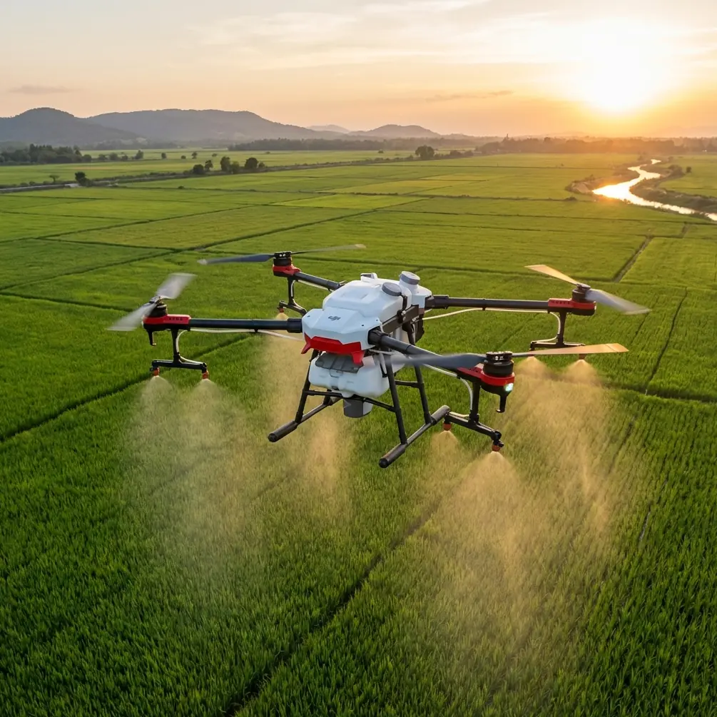
Mountain vineyards expose every weakness in a small drone. Steep rows break line of sight. Wind rolls over ridges and changes character by the minute. Trellis wire, poles, isolated trees, and service roads create a cluttered scene that looks simple from the ground and becomes far less forgiving once you are in the air. That is exactly why Flip is interesting for this job.
This is not a broad buyer’s overview. It is a field-focused look at how Flip fits vineyard monitoring in mountainous terrain, where the pilot is usually trying to answer practical questions quickly: Which rows are lagging? Where is water stress appearing first? Did a storm damage the upper block? Can I fly the same path again tomorrow and compare footage without turning the sortie into a production?
For that kind of work, a drone succeeds or fails on operational details. Range is one of them, but not in the way people often think. The limiting factor in mountain vineyards is usually not headline transmission performance. It is antenna positioning, terrain shielding, and how disciplined the pilot is about maintaining a clean radio path between controller and aircraft.
Why Flip makes sense in vineyards with elevation
Flip sits in an appealing middle ground for this environment. It is compact enough to deploy between vineyard roads without turning setup into a project, but it still brings the kind of intelligent flight features that save time when you are inspecting repeating patterns across long rows. That matters because vineyard monitoring is repetitive by nature. You are rarely searching for a dramatic cinematic reveal. You are trying to spot subtle change.
Features like obstacle avoidance and subject tracking are often marketed for ease of use, but in vineyards they have a different operational value. They reduce workload when the aircraft is flying parallel to terrain or moving near trellis infrastructure. Even a careful pilot benefits from extra situational awareness when a hillside forces the drone to move in a narrower corridor than expected.
ActiveTrack is another example. In a mountain vineyard, it is not only about following a person or vehicle for dynamic footage. It can help maintain framing on a utility cart, inspection vehicle, or worker moving along rows, allowing the pilot to document workflow or problem areas while keeping more attention on altitude, lateral clearance, and the slope ahead. That is useful if the goal is to review field conditions later rather than simply observe them in real time.
QuickShots and Hyperlapse may sound less essential for agricultural work, but they are not throwaway features here. A short automated reveal over a ridge can show how one block sits relative to another and can be surprisingly effective for communicating drainage or sun exposure patterns to an owner, manager, or consultant. Hyperlapse is valuable when you want to document moving fog, shifting shadow lines, or the progression of a weather front over upper and lower parcels. In mountain viticulture, timing is often as important as location.
Then there is D-Log. For pure scouting, standard color is usually enough. But if you are building a repeatable visual record across a season, D-Log gives you more room to normalize footage shot under inconsistent light. That can make side-by-side comparisons more honest. In mountains, a cloud passing over one slope while another remains in direct sun can distort perceived vigor or canopy density in ordinary footage. A flatter capture profile gives you a better chance of bringing clips into a consistent visual baseline.
The range question vineyard operators should ask differently
Most pilots ask, “How far can it go?” In mountain vineyards, the better question is, “How long can I preserve line of sight and a clean signal path before terrain begins to choke the link?” Those are very different things.
A vineyard on a valley floor with open approaches is forgiving. A vineyard draped across folds in terrain is not. You can lose transmission quality surprisingly fast if the aircraft drops behind a shoulder of land, even if the physical distance is modest. Trees at the edge of the block, stone buildings, metal sheds, parked equipment, and even your own body position can make a measurable difference.
This is where antenna orientation becomes more important than many pilots realize. The instinct is often to point the controller antennas directly at the drone, as if the strongest part of the signal comes off the tips. In practice, you usually want the broad side of the antenna pattern facing the aircraft, not the narrow end. Think less like aiming a laser pointer and more like presenting a signal surface toward the flight path.
In vineyard work, that means a few habits are worth adopting:
- Stand where you have the longest unobstructed view down-row or across the target block.
- Avoid setting up immediately behind a vehicle, retaining wall, or metal fence.
- If the slope falls away sharply, move upslope before takeoff when possible so the aircraft does not vanish behind terrain after only a short outbound leg.
- Reorient your body as the drone moves. Do not lock yourself into one stance and assume the controller is still presented optimally.
- If the aircraft must inspect a lower terrace or dip behind a fold, climb first, cross second, and descend only when the radio path is clean again.
That last point is the one that saves flights. Pilots focused on close inspection often descend early to get a better look at leaves, irrigation lines, or erosion scars. On mountain properties, that can place the aircraft behind terrain relative to the controller, which is exactly when signal strength starts to erode. A better method is to hold altitude long enough to clear the terrain feature, then step down into the inspection area once the path is open.
A practical antenna workflow for maximum range
Here is the field method I recommend for Flip in mountain vineyards.
Before launch, identify the “shadow zones” on the property. These are places where a hill crest, tree belt, building, or terrace wall is likely to block direct radio path. If you can, visit the site on foot once and mark the spots where the aircraft disappears visually sooner than expected. Those are usually the same places where transmission performance degrades.
During flight, keep the controller at chest level rather than low at the waist. That small change can improve signal consistency because your body is less likely to shield part of the radiation pattern. If you are wearing a backpack radio, hydration pack, or carrying metal tools, do not let them sit between the controller and aircraft.
As the drone moves left or right across the slope, rotate with it. Smoothly. There is no need for exaggerated movement, but antenna orientation should follow the aircraft’s arc. In mountain terrain, even a clean signal can drop quickly when the aircraft transitions from an open face into a side-hill position where the path becomes oblique.
If you are flying from a turnout road below the block, expect shorter practical range than you would get from a ridge road above it, even when the map distance is identical. Elevation of the pilot station matters. In my own field routines, I will often spend an extra few minutes walking to a higher launch point because those few minutes can save multiple interruptions, reconnections, and reposition flights.
That tradeoff is rarely discussed enough. Better launch geometry often beats a theoretically stronger link.
Obstacle avoidance is useful, but not a substitute for row discipline
Mountain vineyards lure people into trusting automation too much. The environment looks structured, so pilots assume the aircraft will interpret it cleanly. Sometimes it does. Sometimes rows, wires, posts, and partial branches create awkward geometry that is not as machine-friendly as it appears.
Obstacle avoidance on Flip is best treated as a buffer, not a permission slip. It helps when backing away from a row end, sliding laterally near a tree line, or transitioning from one terrace to another. But vineyard work still demands disciplined routing. Fly above the highest likely obstacle until you are committed to the inspection lane. Slow down when crossing from one visual texture to another, especially from open sky into a darker background of trees or cliff shadow.
This is where subject tracking and ActiveTrack need judgment. Tracking a moving vehicle through a vineyard road can produce efficient documentation, but if the route passes under branches, beside netting, or close to utility structures, it is smarter to interrupt the automated pass and hand-fly through the tighter segment. The feature is useful because it reduces camera workload. It is not useful if it encourages lazy spacing.
Building a repeatable scouting routine with QuickShots, Hyperlapse, and D-Log
The strongest vineyard drone programs are consistent. They are not random flights whenever something looks off. Flip can support a more disciplined rhythm if you use its creative features as documentation tools rather than novelty buttons.
Start each survey with a short establishing move over the same edge of the property. A QuickShot-style opening pass can provide a consistent visual reference for canopy fullness, road condition, and surrounding vegetation. Keep the direction and altitude similar each time. After a few weeks, changes become easier to see.
Use Hyperlapse from a fixed viewpoint overlooking upper and lower blocks when weather is unstable. In mountain vineyards, light changes quickly, and fog or cloud shadow can alter field conditions within minutes. A condensed time sequence helps explain why one section dried later or why another stayed cooler longer after a storm.
Capture selected inspection clips in D-Log when you expect to compare them over time or share them with multiple stakeholders. This is especially useful for vineyard managers who want visual continuity in reports. Standard footage may look more attractive straight from the drone, but D-Log gives you more flexibility to equalize bright rock faces, dark tree lines, and reflective leaves in the same frame.
What Flip is actually good at in this scenario
For vineyard monitoring in mountainous terrain, Flip stands out when the mission is broad visual intelligence rather than lab-grade measurement. It is good at helping you move quickly, keep framing under control, and document terrain-linked patterns that are hard to appreciate from the ground.
That includes:
- spotting uneven canopy development along elevation bands
- identifying washout, ruts, or drainage problems after rain
- checking access roads and turnaround areas for field crews
- reviewing exposure differences between upper and lower parcels
- creating visual records for consultants, owners, and operations teams
It is less about replacing specialized agronomic tools and more about giving the operator a fast aerial read on where to look next. In many vineyards, that first-pass intelligence is the most valuable part because it guides the deeper inspection that follows.
A note on flying style in wind and terrain
Small aircraft in mountain environments need a margin. Not a heroic one. Just a real one.
Do not plan routes that demand perfect performance at the far edge of reception. Leave enough battery and enough signal quality to climb, reposition, and come home without improvising. If ridge wind is pulsing, make outbound legs into the more demanding direction when practical, not the easier one. That way, the return is less likely to become a fight.
And if you want a tailored setup discussion for your site, row orientation, and launch points, you can message our flight team here.
That kind of preplanning pays off with Flip because the platform shines when it is used with intention. The aircraft can do a lot, but mountain vineyards reward pilots who think in terms of geometry, visibility, and repeatability.
The takeaway is simple. Flip is not merely a convenient camera for vineyard owners who want occasional aerial views. In mountain terrain, it becomes a genuinely effective monitoring tool when you use its obstacle avoidance, ActiveTrack, QuickShots, Hyperlapse, and D-Log with a field workflow that respects terrain shielding and antenna orientation. Get those fundamentals right and your practical range improves, your footage becomes more useful, and your flights start answering operational questions instead of just collecting pretty images.
Ready for your own Flip? Contact our team for expert consultation.