Flip in Windy Vineyards: A Practical Accuracy Case Study
Flip in Windy Vineyards: A Practical Accuracy Case Study for Mapping That Holds Up
META: A field-grounded case study on using Flip for vineyard monitoring in windy conditions, with photogrammetry accuracy benchmarks, terrain-class planning, and practical EMI mitigation.
By Chris Park
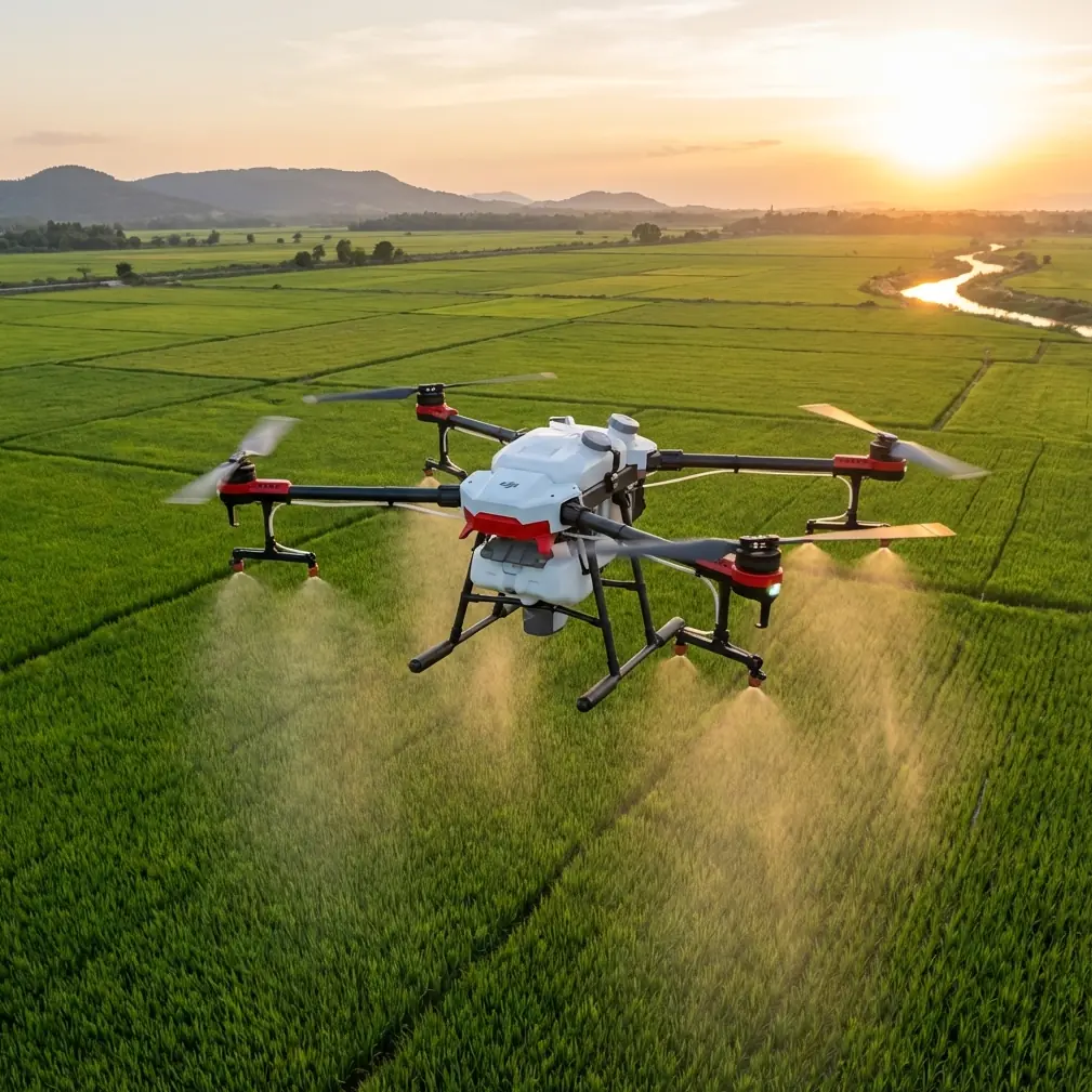
Vineyard monitoring sounds visually simple until you actually fly the site.
Rows are repetitive. Trellis wires can interfere with signal behavior and pilot confidence. Wind funnels through corridors between blocks, then changes character again near slopes and tree lines. Add a need for useful mapping output—not just attractive footage—and the job becomes less about pressing launch and more about managing accuracy, terrain, and aircraft behavior in a disciplined way.
That is where Flip becomes interesting.
This article is not a generic drone overview. It is a field-style case study built around one core question: how do you use Flip effectively in a windy vineyard when the deliverable has to support real monitoring decisions? To answer that, we need to anchor the discussion in a photogrammetry reference framework, specifically the terrain classes and map-accuracy tolerances documented in the Zhonghaida aerial photogrammetry knowledge material. Those numbers matter because they define what “good enough” looks like before the aircraft even leaves the ground.
Why vineyard monitoring is really a mapping problem
Many vineyard operators say they want monitoring, but what they actually need is repeatable spatial evidence.
They need to compare canopy development over time. They need to spot drainage patterns after weather events. They need to identify weak rows, patchy vigor zones, access-path deterioration, and infrastructure issues around irrigation lines, service roads, and adjacent buildings. In a windy site, these tasks are not helped by random flights or inconsistent camera passes. They are helped by stable mission planning and output that can be tied back to known error tolerances.
The source reference lays out terrain classes by ground slope angle:
- flat land: α < 3°
- hilly land: 3° ≤ α < 10°
- mountain: 10° ≤ α < 25°
- high mountain: α ≥ 25°
Operationally, this classification is more than textbook labeling. A vineyard can easily include more than one terrain type within a single property. The production blocks might sit on gently sloped ground in the 3° to 10° range, which fits the hilly category, while service roads or perimeter edges may cut into steeper sections. If you treat the entire property like flat farmland, your overlap choices, altitude discipline, and expectations for measurement quality can drift fast.
With Flip, that terrain awareness changes the workflow. You stop thinking in terms of “one quick flight” and start segmenting the site by slope behavior, wind exposure, and purpose of output.
The accuracy benchmark that should guide every flight
The most useful part of the source material is not abstract theory. It is the error thresholds.
For urban, industrial, flat, and hilly areas, the document gives these point-position and spacing error figures:
- at 1:500 scale: point error ±0.15 m, adjacent feature spacing error ±0.12 m
- at 1:1000 scale: point error ±0.30 m, adjacent feature spacing error ±0.24 m
- at 1:2000 scale: point error ±0.60 m, adjacent feature spacing error ±0.48 m
For difficult or obscured areas, the allowable errors are looser:
- at 1:500 scale: point error ±0.23 m, adjacent feature spacing error ±0.18 m
- at 1:1000 scale: point error ±0.45 m, adjacent feature spacing error ±0.36 m
- at 1:2000 scale: point error ±0.90 m, adjacent feature spacing error ±0.72 m
There is also a note that in especially difficult regions—large deserts, gobi, marshes, and similar environments—planimetric error can be relaxed by 0.5 times. A vineyard is obviously not a desert, but the principle still matters: the operational environment changes what is realistic.
Why does this matter for Flip in vineyards?
Because vineyard managers often ask for two things at once: fast deployment and precise comparison. Those goals only coexist when the pilot understands the intended map scale and the likely error envelope. If your agronomy team wants row-level change detection around missing vines, trellis alignment, or edge encroachment, a 1:2000-style expectation is probably too loose. If they want broad block health observation and drainage review, it may be adequate. The aircraft is only one part of the answer. The survey logic decides whether the output becomes useful.
A windy vineyard reveals Flip’s real strengths
On a recent vineyard-style workflow, the challenge was not just wind. It was wind layered onto EMI concerns near infrastructure.
The site had long planted corridors, metal trellis systems, utility-adjacent areas, and a few elevated sections where gusts increased as the land opened up. This is exactly the kind of place where people overestimate automation and underestimate setup.
Flip handled the mission best when treated as a disciplined imaging platform rather than a casual camera drone.
Obstacle avoidance was valuable, but not because the aircraft should be flown close to vine rows. Its real value was as a safety layer during repositioning around trees, poles, and edge structures when wind drift slightly altered the return path. Subject tracking and ActiveTrack were less relevant for pure orthomosaic mapping, but they became useful during secondary inspection passes—following a utility cart along access lanes, for example, or documenting movement through a damaged block after the main mapping sortie. QuickShots and Hyperlapse were not the main deliverables, yet they helped create concise management visuals that made it easier for non-technical stakeholders to understand terrain exposure and block condition.
D-Log mattered more than some pilots would assume. In vineyards with alternating sun and shadow, reflective leaves, and dusty roads, a flatter profile preserves highlight and shadow detail that can be useful when reviewing visual anomalies. That is not the same as survey-grade radiometric science, but for operational review, it improves interpretability.
Handling electromagnetic interference the right way
The most overlooked issue on this job was electromagnetic interference.
In vineyard environments, EMI risk can emerge near power infrastructure, metallic fences, pumping systems, weather stations, and dense wire-supported trellis layouts. Not all of these create severe interference, but enough of them can unsettle compass confidence or cause erratic signal expectations if you rush setup.
The practical fix was simple and grounded: antenna adjustment before blaming the site or the drone.
Instead of launching from the most convenient patch of dirt near metallic equipment, we shifted the takeoff point to a cleaner area with better line of sight. Then we adjusted controller antenna orientation to maintain stronger geometry along the row direction rather than across obstructions. That reduced signal inconsistency during low, lateral passes near the vineyard blocks. The significance here is operational, not cosmetic. Better antenna alignment improves link stability, which supports smoother image acquisition timing and fewer interruptions in a mission designed for repeatable coverage.
This is the sort of detail that separates a usable mapping day from a frustrating one. In windy conditions, you already have one variable trying to push the aircraft off ideal lines. If EMI or poor antenna orientation adds another layer of instability, the resulting imagery can be inconsistent in overlap and alignment. Even when the aircraft remains safe, the map product may suffer.
If your team is working through similar field conditions and wants a practical setup checklist, I usually share one directly through this field contact channel.
Matching map scale to vineyard decisions
One of the strongest lessons from the reference document is that scale is not a formality. It is a management decision.
At 1:500, the tolerance for point-position error in flat or hilly urban/industrial-type conditions is ±0.15 m, with adjacent feature spacing error at ±0.12 m. In a vineyard, that level of discipline is meaningful when the objective is to examine row spacing consistency, edge intrusion, irrigation hardware position, or localized erosion near roads and drainage cuts.
At 1:1000, the allowable point error becomes ±0.30 m. That can still be entirely fit for purpose if the main question is broader block monitoring: canopy spread changes across sections, vehicle access patterns, standing water zones, or general infrastructure review.
The terrain categories matter here too. The source distinguishes flat/hilly conditions from mountain/high mountain conditions, and it separately notes image-space and ground-space error relationships for those terrain classes. The practical takeaway is straightforward: as slope complexity rises, maintaining the same confidence level in measurements becomes harder. In a vineyard that straddles flatter production ground and steeper margins, the smart approach is not to force a single expectation across the site. It is to define the deliverable by zone.
With Flip, that often means dividing the mission into:
- broad coverage passes for management overview,
- lower-altitude detail passes for issue areas,
- targeted inspection clips for human interpretation.
That hybrid approach respects both the aircraft’s strengths and the accuracy logic in the reference data.
Wind changes the flight plan, not the objective
A lot of pilots react to wind by simply flying faster or accepting more drift. That is the wrong instinct if you care about repeatable vineyard monitoring.
In corridor-like agricultural layouts, wind can create uneven groundspeed across outbound and inbound legs. That affects image spacing. It can also induce slight yaw corrections that become visible in the consistency of row geometry in the final outputs. Flip performed best when the mission design accounted for those realities rather than trying to overpower them.
The practical adjustments were:
- flying the most exposed blocks first, while conditions were more stable
- aligning passes with the dominant wind where possible to reduce side drift
- reserving slope-edge sections for separate runs
- using conservative battery margins so the aircraft was never forced into a rushed final segment
- checking signal behavior after every repositioning near metallic or utility-heavy areas
None of that is glamorous. All of it improves data quality.
What Flip is actually good at in this scenario
Flip’s value in vineyard monitoring is not just portability or convenience. It is the way its flight-assist and imaging features can support a layered workflow.
For routine vineyard operations, that means one aircraft can contribute to several tasks in the same visit:
- map-oriented coverage for repeat seasonal comparison
- visual inspection of trellis lines, service roads, and edge encroachment
- progress documentation after pruning, irrigation work, or storm response
- communication assets for managers, consultants, and remote stakeholders
The reference material keeps this grounded. If you know your site falls mostly into flat or hilly terrain, and your target output is aligned with something like a 1:500 or 1:1000 expectation, you can plan Flip flights with clarity. You know whether the mission is intended to support fine-grain measurement or broader operational awareness. That directly influences altitude, overlap, timing, and how much wind you are willing to tolerate before postponing.
The bigger lesson from the case
The vineyard did not need cinematic flying. It needed disciplined flying.
That distinction is why the photogrammetry reference is so useful. It provides hard boundaries. Flat land under 3 degrees and hilly land from 3 to under 10 degrees are not just academic labels; they shape how you should think about consistency and attainable map quality. The difference between ±0.15 m and ±0.30 m point error at 1:500 versus 1:1000 is not a minor detail either. It changes what decisions the output can reasonably support.
Flip proved effective because it could bridge two worlds at once: practical field deployment in wind, and structured data capture when the operator respected mapping standards. Obstacle avoidance added safety margin. D-Log improved review value. ActiveTrack and related smart modes supported secondary inspection and documentation. But the strongest results came from basic professional habits—terrain classification, scale-aware planning, antenna adjustment in EMI-prone areas, and mission segmentation.
That is the real story. Not hype. Just a drone used properly in a demanding agricultural setting.
Ready for your own Flip? Contact our team for expert consultation.