Flip for Coastlines in the Mountains: A Photographer’s
Flip for Coastlines in the Mountains: A Photographer’s Field Report
META: A practical expert field report on using Flip for mountainous coastlines, with flight altitude strategy, obstacle avoidance, ActiveTrack, D-Log, Hyperlapse, and QuickShots tips.
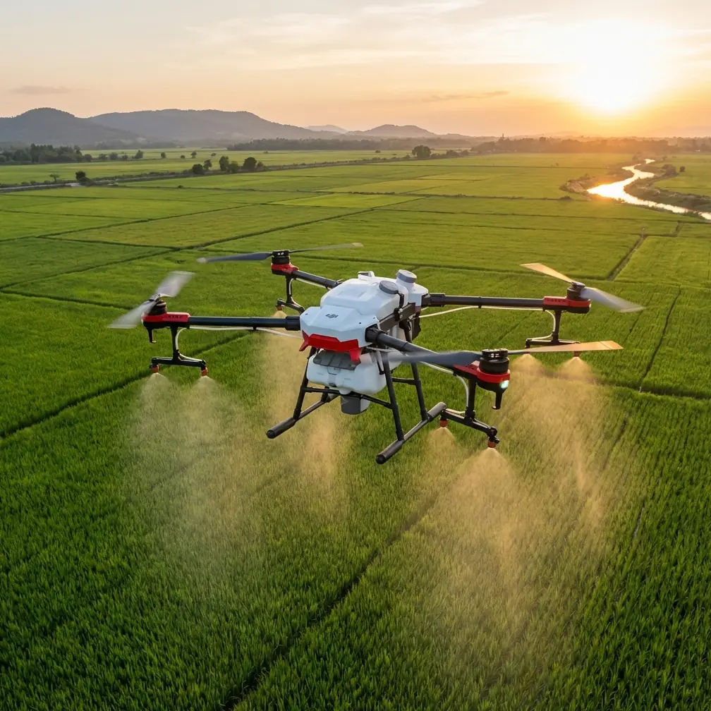
Mountain coastlines force a drone pilot to solve two problems at once. The terrain rises hard and fast, while the shoreline pulls your eye outward into open space. That mix is exactly why Flip is such an interesting aircraft for this kind of scouting work. It is not just about getting a pretty top-down frame. It is about managing wind, changing elevation, cliff-side obstructions, moving subjects, and rapidly shifting light without turning every flight into a wrestling match.
I have spent enough time photographing rugged shorelines to know that the best drone is rarely the one with the longest spec sheet. It is the one that lets you work cleanly when the scene gets complicated. For mountain-adjacent coasts, Flip makes sense when the mission is equal parts exploration and image-making. Its value shows up in the details that matter in the field: obstacle avoidance when your flight path crosses rock faces and tree lines, ActiveTrack and subject tracking when a hiker or vehicle becomes the visual anchor, QuickShots for fast location previews, Hyperlapse for showing weather movement, and D-Log when the contrast between sea haze and dark ridges demands more grading room later.
That combination gives Flip a practical role in a very specific workflow: scouting first, composing second, committing to hero shots third.
Why this setting is harder than it looks
A coastline in the mountains is not one environment. It is several stitched together. You might launch near a turnout above the water, fly across a descending slope, then suddenly face an updraft near a cliff wall and stronger lateral wind over the ocean. A route that seems simple on a map can create major visual and operational complications in the air.
The biggest mistake I see is choosing altitude based only on legal ceiling or visual preference. That approach misses the geometry of the place. Along mountain coastlines, altitude should be chosen relative to the terrain transition, not just your takeoff point. If you launch from an overlook, flying “low” over the water may already mean you are far below your starting elevation. If you launch near the beach, climbing too aggressively can flatten the relationship between the cliffs and sea, making the scene look smaller and less dramatic than it feels in person.
For Flip, the sweet spot for scouting passes is often around 45 to 70 meters above the nearest active terrain or waterline in front of the aircraft, not necessarily above your home point. That is the altitude band where you can usually preserve depth between foreground rock, surf texture, and ridgeline shape while still giving the obstacle avoidance system enough room to react meaningfully around protruding terrain and isolated trees. In practical terms, this height also makes subject tracking more reliable when following a moving person on a coastal path, because the angle is steep enough to separate the subject from the background without reducing them to a dot.
If the coastline is especially jagged, I will often begin even lower for a reconnaissance pass, then climb in stages rather than jumping straight to a high overview. A staged climb tells you more about how the landscape reads on camera.
Flip’s obstacle avoidance matters more here than over flat shoreline
Obstacle avoidance is easy to undervalue until the terrain stops being predictable. On a broad beach, it is mostly a safety net. In a mountainous coastal zone, it becomes part of your decision-making. A flight line that cuts diagonally across a slope, then exits over water, creates a scenario where your relative distance to objects changes very quickly. One second you have open air, the next you are visually compressed against a stand of pines or a rock outcrop.
That is where Flip earns trust. Not because a pilot should rely on automation blindly, but because obstacle awareness changes how aggressively you can compose moving shots. If I am sliding sideways to reveal a cove while keeping a cliff edge in the near frame, I need the aircraft to help manage the margin. The operational significance is simple: obstacle avoidance allows tighter, more informative scouting lines. You spend less time making oversized safety buffers that ruin perspective, and more time reading whether a shot can actually work.
The other advantage is mental bandwidth. In difficult terrain, every bit of reduced pilot workload can be redirected into exposure checks, horizon control, and watching how the light is rolling across the landscape.
Subject tracking on coastal trails is not a gimmick
A lot of pilots talk about subject tracking as if it only exists for lifestyle clips. That misses the point. Along mountainous coastlines, a moving subject is often the best scale reference you can add to a scene. A lone walker, cyclist, or vehicle on a cliff road tells the viewer how big the landscape really is.
Flip’s ActiveTrack and subject tracking tools matter because these locations are full of interrupted lines of sight. Trails disappear behind brush. Roads slip under headlands. The frame keeps changing because the terrain keeps changing. When the tracking is dependable, you can choose a composition that emphasizes the shape of the coast rather than spending the whole shot manually correcting for the subject’s movement.
Operationally, this is huge. If your subject is moving along a switchback trail above the water, you do not want to devote all your attention to keeping them centered. You want to watch for wind shear, evaluate whether the sea line is drifting off-level, and decide whether the background ridge is becoming too dominant. Tracking turns the subject into a stable reference while you refine the image.
That said, I would not use subject tracking in this setting at the lowest possible altitude. Give the system room. This is another reason that 45 to 70 meter band works well. It keeps the subject legible while maintaining a safer and more stable tracking envelope around uneven terrain.
QuickShots are useful for scouting, not just sharing
QuickShots are often dismissed as beginner features. I think that is lazy. In serious field work, they are efficient sketch tools. When I arrive at a new mountain coastline, I rarely know which reveal angle will best explain the place. A QuickShot can answer that in seconds.
A short automated movement around a sea stack, lookout point, or cliff edge helps you evaluate visual hierarchy. Does the ridge dominate too much? Does the shoreline curve read clearly enough? Is the ocean texture interesting from that side, or does it flatten out? Those are scouting questions, not vanity questions.
For Flip users, this means you can build a fast location map in the air. Run two or three QuickShots from different launch zones, review them on-site, then decide where the serious manual flying should happen. It saves battery, reduces guesswork, and keeps you from wasting the best light on indecision.
That matters even more in mountain coastal weather, where a clean sky can collapse into haze or low cloud surprisingly fast.
Hyperlapse has real value when weather is part of the story
Mountain coasts are never static. Clouds form behind ridgelines. Fog creeps along the water. Sun patches move across slopes in ways that completely reshape the scene over a short period. If the brief is scouting rather than only capturing stills, Hyperlapse can show the timing of the place.
I do not use it as an afterthought. I use it to study rhythm. You can see where shadows collect, how fast fog banks move through a cove, and whether the cliff face catches directional light long enough to justify waiting for a second pass. That kind of knowledge changes the next flight.
Flip is especially useful here because Hyperlapse turns a landscape mood into an actionable planning tool. The output is creative, yes, but it is also diagnostic. If the cloud movement suggests the ridge will remain blocked for the next twenty minutes, you stop forcing wide hero shots and move lower for coastline detail.
Why D-Log belongs in this environment
The contrast on a mountainous coastline is often brutal. Bright water reflections. Dark tree cover. Sunlit rock on one side of the frame and dense shadow on the other. Standard profiles can make you choose which part of the scene gets sacrificed.
D-Log gives you more room to hold both ends together. That is not a luxury feature here. It is central to preserving realism. The operational significance is obvious the moment you bring the footage into a grade: you have a better chance of keeping texture in the water while retaining shape in the cliffs and vegetation. For scouting teams, tourism shooters, and photographers building a location plan, that extra tonal flexibility means your footage remains useful even when the light is imperfect.
I would still avoid treating D-Log as permission to get sloppy. Expose with care. Watch the highlights over the ocean. But on these coastlines, a flatter profile gives you breathing room that standard capture often does not.
If you are coordinating a field day and want a second opinion on route planning or camera setup, I would share notes here: message me from the trailhead.
A practical flight pattern for Flip on mountain coasts
When I scout a coastline like this, I split the session into three passes.
The first is a low reconnaissance pass, usually conservative and slow. I am looking for hidden obstacles, wind behavior, and whether the shoreline geometry is stronger from an oblique angle or a direct outward push.
The second is the mid-altitude structural pass, most often inside that 45 to 70 meter range. This is where Flip’s obstacle avoidance, subject tracking, and QuickShots become most valuable. I identify one or two compositions worth repeating and test whether a moving subject improves scale.
The third is the selective high pass. Not every location needs this. Sometimes a high overview weakens the image because it detaches the viewer from the cliff drama. But when the coastline folds into multiple bays or ridges, that higher angle can explain the layout beautifully.
What matters is resisting the urge to start high and stay there. Mountain coastlines reveal themselves in layers. Flip works best when you let the aircraft help you uncover those layers methodically.
What photographers tend to miss
The instinct is to chase the biggest vista. I understand it. Wide views are seductive. But on these coastlines, the strongest drone footage often comes from preserving tension between near and far elements. A dark foreground ridge against bright water. A tracked subject moving along a path with a cliff face beyond. A Hyperlapse showing fog slipping through a saddle above the sea.
That is why Flip’s feature set aligns so well with the task. Obstacle avoidance supports closer structural flying. ActiveTrack and subject tracking preserve human scale. QuickShots accelerate composition testing. Hyperlapse reveals environmental timing. D-Log protects the image when the contrast gets harsh.
None of those tools matter in isolation. Together, they let you turn a difficult location into a readable one.
My altitude rule for this exact scenario
If I had to give one altitude rule for scouting coastlines in the mountains with Flip, it would be this: start by measuring your flight visually against the terrain in front of you, not the place you launched from, and aim for a working band of roughly 45 to 70 meters above the immediate scene. Adjust lower if you need stronger foreground tension, and higher only when the coastline’s larger structure is the actual story.
That single change solves a surprising number of problems. It improves obstacle awareness, helps subject tracking maintain a useful angle, preserves the relationship between sea and slope, and keeps your footage from looking generic.
A drone can flatten a dramatic place very quickly if the pilot flies from habit instead of reading the land. Flip gives you enough control and enough assistance to avoid that trap.
For photographers, that is the real pitch. Not hype. Usability where the landscape is trying to outsmart you.
Ready for your own Flip? Contact our team for expert consultation.