Flip Field Report for Coastal Construction Scouting
Flip Field Report for Coastal Construction Scouting: What a Mobile Emergency Mapping System Taught Me About Speed
META: A field-tested look at using Flip for coastal construction site scouting, inspired by emergency vehicle-based UAV mapping systems built for fast image capture, on-site processing, and reliable data delivery.
A lot of drone advice falls apart the moment you leave the office and drive into a real site.
Coastal construction is where that usually happens first. Wind shifts without warning. Access roads flood or disappear into mud. Cellular coverage drops just when a project manager wants updated visuals. And if you are scouting a site before crews move in, delay is not just annoying—it can distort planning, sequencing, and risk assessment.
I was reminded of that while reviewing a Chinese emergency mapping system built around a vehicle-mounted UAV workflow. It was not designed as a lifestyle drone story or a content creator setup. It was designed for disaster response: get to the scene fast, collect imagery immediately, process it on site, and transmit what matters back to decision-makers without waiting for ideal conditions. That mindset matters far beyond emergencies. For coastal construction scouting, it is one of the best ways to think about how a compact drone like Flip should actually be used.
The reference system is striking because it treats drone work as an end-to-end field operation, not just a flight. It combines five linked components: a base geographic information database and mission planning system, an on-site data acquisition system, a rapid UAV image processing system, a remote data transmission system, and the vehicle transport and support system. That five-part structure explains something many small-team operators learn the hard way: the aircraft is only one piece. The real bottleneck is usually what happens before takeoff and after landing.
That was the challenge I ran into on a coastal site scout a while back.
We had a shoreline-adjacent construction parcel with uneven access, shifting tide influence near temporary works, and a client who wanted quick visual confirmation of haul routes, staging zones, drainage behavior, and edge conditions around the buildable area. On paper, this was simple. In reality, the day became a chain of small friction points. We could capture footage, but turning that into something immediately useful for the project team took too long. Files sat on cards. Notes were fragmented. By the time we organized the imagery, some of the urgency was gone.
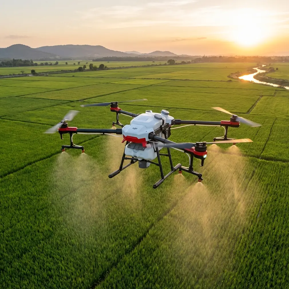
That is why the emergency mapping model stuck with me. It sets a very clear standard for field performance. One technical indicator in the document calls for a mapping UAV system, after arriving on site, to complete remote sensing image acquisition over 20 square kilometers within 2 hours, at 5 to 20 centimeter resolution. For a larger emergency response framework, that metric is about operational readiness. For a coastal construction scout using Flip, the lesson is different but just as valuable: speed on site is not only about how fast the drone launches. It is about how fast the whole information loop closes.
Flip is obviously not a vehicle-scale emergency mapping platform with onboard full processing and print output. But the operating philosophy transfers surprisingly well.
Start with the mission, not the flight mode
The emergency mapping vehicle concept begins with mission planning tied to a geographic information base. That matters because too many site scouts start with “let’s get some aerials” instead of defining what questions the flight has to answer.
On a coastal construction site, those questions are usually practical:
- Where are the current access constraints?
- How close are temporary routes to soft edges or water influence?
- What has changed since the last survey or contractor walk?
- Are material laydown areas actually viable at this stage?
- What visual evidence can be shared immediately with remote stakeholders?
Flip works best when you treat it as a fast reconnaissance platform inside that framework. Its compact form helps because you can move from vehicle to launch point quickly without turning setup into a production. For scouting, that matters more than many spec-sheet arguments. If the aircraft is easy to deploy, you are more likely to fly at the right moment—between gusts, before light shifts, or while a site window is still open.
Why obstacle avoidance and ActiveTrack matter at a construction edge
The LSI terms people throw around—obstacle avoidance, ActiveTrack, subject tracking—often sound like consumer conveniences. On active or semi-active construction ground, they become workflow stabilizers.
Coastal sites are cluttered in odd ways. You are not just dealing with buildings. You may have temporary fencing, stockpiles, rebar cages, crane components, utility vehicles, drainage cuts, portable offices, berms, and partially finished roadbeds. Obstacle avoidance helps reduce the mental load when you are trying to frame assets and document circulation paths rather than constantly micro-managing every movement. It is not a replacement for pilot judgment, especially in wind or around reflective surfaces, but it gives you a margin that is genuinely useful during low-altitude site reconnaissance.
ActiveTrack and subject tracking can also be more practical than they sound. If you need to document how a truck or machine navigates a temporary route near a coastal edge, tracking tools can produce more consistent visual records than manually chasing the movement. You are not using the feature for cinematic novelty. You are using it to show site logistics behavior clearly enough for planners and supervisors to evaluate route suitability.
That distinction is worth making. Good site scouting is not about dramatic footage. It is about removing ambiguity.
The hidden operational lesson: process on site, not later
The most useful detail in the emergency mapping reference may be the emphasis on 现场及时处理—processing on site immediately—rather than simply collecting data and leaving. The system was designed so imagery could be captured, handled in the field, and transmitted quickly to a command center. That is exactly the discipline small construction drone teams should borrow.
If you scout with Flip in coastal conditions, do not wait until you are back at the desk to discover you missed the drainage outfall, the shoreline toe condition, or the haul road pinch point. Review footage and stills while still on site. Confirm coverage. Label key clips immediately. Build a simple field checklist around what the stakeholders need.
I now treat this as non-negotiable:
- Fly a broad orientation pass.
- Capture targeted stills and short clips for known decision points.
- Review immediately in the vehicle or field shelter.
- Flag missing angles before packing up.
- Share a concise same-day package.
That approach sounds basic, but it is the difference between scouting and merely filming.
The emergency system also specifies 3 hours to process 20 square kilometers of imagery into corrected outputs and DOM products, with A1 map printing available on site. Again, that is a much heavier mapping workflow than Flip is built for. Still, the operational message is sharp: useful output has to be close in time to acquisition. In construction, if your visuals do not reach the team while decisions are still fluid, their value drops fast.
Coastal wind changes how you use QuickShots and Hyperlapse
QuickShots and Hyperlapse are often filed under content features. On a coastal construction scout, they can be useful if you are disciplined about when and why you use them.
QuickShots can create fast, repeatable contextual sequences that help non-technical stakeholders understand site placement relative to shoreline, access routes, and adjacent works. That can be helpful in update briefings where a static image lacks spatial clarity. The key is restraint. A clean, predictable automated move is useful; a flashy one is noise.
Hyperlapse can also support observation, especially when you want to show environmental rhythm—cloud shadow movement over work zones, traffic into a staging area, or water influence around temporary protections. But coastal conditions punish sloppy use. Strong gusts, changing light, and airborne moisture can compromise consistency. If you use Hyperlapse, use it to reveal pattern over time, not to dress up a routine scout.
This is where Flip’s convenience helps. If a site window is short, compact deployment increases your chances of grabbing a useful sequence without dedicating the whole visit to one fancy shot.
D-Log is not just for editors
On bright coastal sites, contrast is brutal. Pale aggregate, reflective water, light concrete, weathered steel, and cloud breaks can all coexist in one frame. That is where D-Log becomes operationally useful.
A flatter capture profile preserves more flexibility when you need to recover detail in hard highlights or maintain visibility in shaded site elements. For inspection-style scouting, that can help when you are reviewing edge protection, erosion indicators, surface runoff traces, or material placement under inconsistent light. You do not need to turn every site visit into a full post-production exercise, but having more latitude in the footage can save an otherwise compromised capture day.
I would still separate outputs by purpose. Give the project team simple, readable files first. Keep D-Log masters for cases where further analysis or polished reporting is needed.
Transmission matters more than most pilots admit
One of the strongest details in the emergency mapping document is its focus on remote transmission. The system targets 2 gigabytes per hour in image data transfer efficiency and supports real-time remote video display. That figure comes from a serious field response context, but the principle is universal: aerial data is only useful when it reaches the people who must act on it.
Coastal construction teams are often dispersed. The site superintendent may be in the field, the civil engineer off-site, and the owner’s rep somewhere else entirely. If you can scout with Flip and push selected images or short annotated clips quickly, the drone becomes a decision tool instead of a documentation archive.
That is why I recommend building a lightweight communication path before you launch. Decide who needs what. Define whether they need overview, close-up evidence, or a narrated walkthrough. If coordination is needed for your next site visit, I usually suggest using a direct field message channel like this WhatsApp contact line so planning does not get buried in email threads.
Fast sharing is not about being impressive. It keeps the momentum of site decisions intact.
Vehicle support is the unglamorous advantage
The emergency system also includes a vehicle transport and support element, with at least 10 hours of sustained on-site power specified for field work. That sounds like infrastructure talk, but it gets to a major truth about drone operations in remote or weather-exposed places: batteries, charging discipline, shade, and data organization often shape the success of a scout more than aircraft features do.
For Flip operators working coastal construction jobs, the vehicle becomes the real field base. It is where you protect equipment from salt air, review captures, recharge, log observations, and stage the next launch. A compact drone only delivers its full value when the support routine around it is equally lean.
That means having:
- a repeatable battery rotation plan
- a protected place for memory card handling
- immediate file backup habits
- a checklist for key construction views
- a short debrief format before leaving site
Once you build that muscle, Flip becomes much more than a casual camera in the truck.
What changed for me
The biggest shift was mental, not technical.
I stopped thinking of compact drone scouting as a smaller version of traditional aerial photography. I started treating it more like a fast-response information workflow. The emergency mapping vehicle reference made that clear. Its architecture is built around arrival, acquisition, processing, transmission, and support. Every part exists to compress the time between “something happened on the ground” and “someone can make a better decision because of the aerial view.”
That is exactly what coastal construction scouting needs.
Flip fits that role well when used with discipline. Obstacle avoidance reduces friction in cluttered field conditions. ActiveTrack and subject tracking help document movement through temporary access paths. QuickShots and Hyperlapse can communicate context and change over time when used carefully. D-Log helps preserve visual information under harsh coastal light. But none of those features matter much if the workflow around them is loose.
The lesson from emergency mapping is simple: speed is not about flying fast. It is about turning field reality into usable information before the opportunity passes.
For coastal site scouts, that is where Flip earns its place.
Ready for your own Flip? Contact our team for expert consultation.