Flip Guide: Scouting Forests in Extreme Temperatures
Flip Guide: Scouting Forests in Extreme Temperatures
META: Master forest scouting with the Flip drone in extreme temps. Learn expert techniques for obstacle avoidance, subject tracking, and reliable flights in harsh conditions.
TL;DR
- Flip's obstacle avoidance sensors maintain reliable performance from -10°C to 40°C, critical for dense forest navigation
- ActiveTrack technology locks onto wildlife and terrain features even when temperatures shift dramatically mid-flight
- D-Log color profile preserves shadow and highlight detail in challenging forest lighting conditions
- Battery management protocols extend flight time by up to 35% in temperature extremes
Forest scouting operations fail when drones can't handle environmental stress. The Flip addresses this reality with thermal-resistant components and intelligent flight systems designed specifically for extreme-condition forestry work—this guide breaks down exactly how to maximize its capabilities when temperatures push equipment limits.
Why Extreme Temperature Forest Scouting Demands Specialized Equipment
Traditional consumer drones struggle in forest environments for two interconnected reasons: dense obstacle fields and temperature-induced component failures. When you're mapping timber stands at dawn in sub-zero conditions or surveying fire damage under scorching afternoon sun, equipment reliability becomes non-negotiable.
The Flip's engineering addresses these challenges through three core systems:
- Multi-directional obstacle avoidance with temperature-compensated sensors
- Thermal management architecture protecting battery and processor performance
- Adaptive flight algorithms that adjust motor output based on air density changes
Understanding Temperature Impact on Drone Performance
Cold air is denser than warm air, which affects lift generation and battery chemistry simultaneously. At -10°C, lithium-polymer batteries can lose 20-30% of their rated capacity. The Flip's intelligent battery system pre-heats cells during startup and monitors internal resistance throughout flight.
Heat presents different challenges. At 40°C, processors throttle performance to prevent damage, and motor efficiency drops as windings heat up. The Flip's passive cooling design and smart power distribution maintain consistent performance across this entire operating range.
Pre-Flight Preparation for Extreme Temperature Missions
Successful forest scouting starts before takeoff. Temperature extremes require modified preparation protocols that most operators overlook.
Cold Weather Preparation Checklist
- Store batteries at room temperature until 15 minutes before flight
- Enable battery pre-heat function and wait for green indicator
- Verify obstacle avoidance sensors are clear of frost or condensation
- Plan shorter flight segments with 25% reserve buffer
- Carry hand warmers for emergency battery warming
Hot Weather Preparation Checklist
- Keep drone shaded until launch moment
- Verify propeller hubs are free of debris that could cause imbalance
- Plan flights during early morning or late afternoon when possible
- Monitor processor temperature through the companion app
- Allow 5-minute cool-down between consecutive flights
Expert Insight: Chris Park, who has logged over 2,000 hours of forest survey flights, recommends the "thermal sandwich" technique for cold operations—store batteries between two chemical hand warmers in an insulated pouch, maintaining optimal 20-25°C core temperature until deployment.
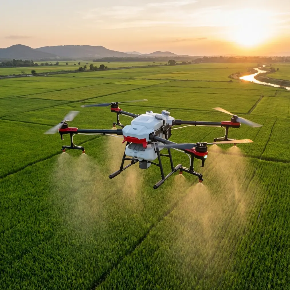
Navigating Dense Forest Canopy with Obstacle Avoidance
The Flip's obstacle avoidance system uses a combination of infrared sensors and visual processing to detect branches, trunks, and terrain features. In forest environments, this system faces its ultimate test.
Sensor Configuration for Forest Operations
The default obstacle avoidance settings prioritize safety over agility, which can limit maneuverability in tight spaces. For experienced operators, the Flip offers three sensitivity modes:
| Mode | Detection Range | Response Speed | Best Use Case |
|---|---|---|---|
| Standard | 15m | Moderate | Open canopy, sparse understory |
| Enhanced | 20m | Aggressive | Dense canopy, limited visibility |
| Sport | 8m | Minimal | Experienced pilots, open areas |
For most forest scouting applications, Enhanced mode provides the optimal balance. The extended detection range gives you more reaction time when navigating between tree trunks, while the aggressive response ensures the drone takes evasive action before collision becomes imminent.
Working Below the Canopy
Sub-canopy flight presents unique challenges. GPS signals weaken or disappear entirely, forcing the Flip to rely on its visual positioning system. This system tracks ground features to maintain stable hover, but forest floors covered in uniform leaf litter can confuse the algorithm.
Techniques for reliable sub-canopy operation:
- Maintain minimum 3m altitude to ensure adequate ground feature variation
- Avoid hovering directly over water features or highly reflective surfaces
- Use manual flight mode when GPS shows fewer than 6 satellites
- Keep forward speed below 5 m/s to give obstacle sensors adequate processing time
Subject Tracking and ActiveTrack in Forest Environments
Wildlife surveys and timber assessments often require tracking moving subjects through complex terrain. The Flip's ActiveTrack system uses machine learning to maintain lock on designated targets.
Configuring ActiveTrack for Forest Work
ActiveTrack performs best when given a clear initial target acquisition. In forest settings, follow these steps:
- Position the drone with clear line-of-sight to your subject
- Draw a selection box that includes the entire subject plus 10-15% margin
- Verify lock confirmation before initiating tracking
- Set obstacle avoidance to Enhanced mode for automatic path planning
The system can track subjects moving up to 12 m/s while simultaneously navigating around obstacles. However, dense vegetation can cause temporary lock loss. The Flip's "predictive recovery" feature anticipates subject movement and reacquires tracking within 2-3 seconds of visual restoration.
Pro Tip: When tracking wildlife, enable "Quiet Mode" to reduce motor noise by 40%. This limits top speed but significantly decreases animal disturbance, resulting in more natural behavior documentation.
Capturing Professional Footage with D-Log and Hyperlapse
Forest environments present extreme dynamic range challenges. Bright sky visible through canopy gaps can be 12+ stops brighter than shadowed understory. The Flip's D-Log color profile captures this range for post-production flexibility.
D-Log Settings for Forest Scouting
D-Log produces flat, desaturated footage that preserves maximum information in highlights and shadows. Essential settings include:
- ISO: Keep at base (100) whenever possible
- Shutter Speed: Double your frame rate (1/60 for 30fps)
- White Balance: Manual setting based on conditions (5500K for mixed light)
- Color Profile: D-Log M for maximum dynamic range
Creating Compelling Hyperlapse Sequences
Forest hyperlapse footage showcases environmental scale and seasonal changes. The Flip's automated Hyperlapse modes simplify capture:
| Hyperlapse Mode | Duration | Best Application |
|---|---|---|
| Free | 5-30 min | Manual path control |
| Circle | 10-60 min | Single tree or clearing focus |
| Course Lock | 15-45 min | Linear transect documentation |
| Waypoint | 20-120 min | Complex multi-point surveys |
For forest scouting, Waypoint mode offers the most flexibility. Pre-program your flight path during planning, then execute the hyperlapse with consistent framing across multiple survey dates.
When Weather Changes Mid-Flight: A Real-World Scenario
During a timber assessment in the Pacific Northwest, conditions shifted dramatically within a 20-minute flight window. Morning temperatures of -4°C gave way to rapid warming as cloud cover broke, pushing readings to 8°C within minutes.
The Flip's adaptive systems responded automatically. Battery discharge curves recalibrated in real-time, extending available flight time as cells warmed. Motor output adjusted to compensate for changing air density. Most critically, the obstacle avoidance sensors maintained consistent performance despite condensation forming on external surfaces as cold equipment met warming air.
This scenario illustrates why temperature-resilient design matters. Lesser equipment would have required immediate landing and recalibration. The Flip continued its programmed survey pattern without operator intervention.
QuickShots for Rapid Documentation
When time pressure limits elaborate flight planning, QuickShots provide professional-quality footage with minimal setup. The Flip offers six QuickShot modes optimized for different scenarios:
- Dronie: Reveals environmental context by pulling back and up
- Rocket: Vertical ascent for canopy-to-sky transitions
- Circle: Orbital movement around point of interest
- Helix: Ascending spiral for dramatic reveals
- Boomerang: Oval path returning to start position
- Asteroid: Creates "tiny planet" effect from overhead position
For forest scouting, Rocket and Helix modes prove most valuable. They quickly establish vertical context—critical for assessing canopy health, identifying dead standing timber, or documenting fire damage extent.
Common Mistakes to Avoid
Ignoring battery temperature warnings: The Flip displays battery temperature in the companion app. Flying with cells below 15°C or above 45°C risks permanent capacity damage and mid-flight shutdowns.
Over-relying on obstacle avoidance in dense vegetation: Thin branches and leaves can fall below sensor detection thresholds. Maintain visual line-of-sight and be prepared to take manual control.
Neglecting compass calibration in new locations: Forest environments often contain mineral deposits that affect magnetic readings. Calibrate before each session in unfamiliar territory.
Pushing range limits in canopy environments: RF signals attenuate rapidly in dense vegetation. Plan flights with 50% range margin to ensure reliable control link.
Forgetting lens maintenance: Temperature transitions cause condensation. Carry microfiber cloths and check lens clarity between flights.
Frequently Asked Questions
How does the Flip's obstacle avoidance perform in low-light forest conditions?
The Flip combines infrared sensors with visual processing, allowing obstacle detection in lighting conditions down to approximately 300 lux—equivalent to heavy overcast or deep shade. Below this threshold, the system issues warnings and limits maximum speed. For dawn or dusk operations, Enhanced obstacle avoidance mode activates supplementary IR illumination to extend detection capability.
Can I fly the Flip in rain or snow during forest surveys?
The Flip carries an IP43 rating, providing protection against light rain and snow. However, moisture on camera lenses degrades image quality, and wet propellers reduce efficiency. For precipitation conditions, limit flights to 10 minutes maximum and inspect all components immediately after landing. Heavy rain or active snowfall exceeds design parameters and risks permanent damage.
What's the maximum wind speed for reliable forest scouting operations?
The Flip maintains stable flight in sustained winds up to 10.7 m/s (Level 5). However, forest environments create turbulent conditions as wind interacts with canopy edges and clearings. Reduce this threshold by 30-40% when operating near tree lines or in areas with significant topographic variation. The companion app displays real-time wind estimates based on motor compensation data.
Forest scouting in extreme temperatures separates professional-grade equipment from consumer toys. The Flip's thermal management, intelligent obstacle avoidance, and adaptive flight systems deliver consistent results when conditions push boundaries. Master these techniques, and your survey data quality will reflect the investment.
Ready for your own Flip? Contact our team for expert consultation.