Flip scouting tips for highways in extreme temperatures
Flip scouting tips for highways in extreme temperatures: a field case study
META: A practical Flip case study for highway scouting in extreme heat and cold, covering UAV remote sensing, image transmission, flight stability, obstacle avoidance, and pre-flight sensor cleaning.
Highway scouting sounds simple until weather gets involved.
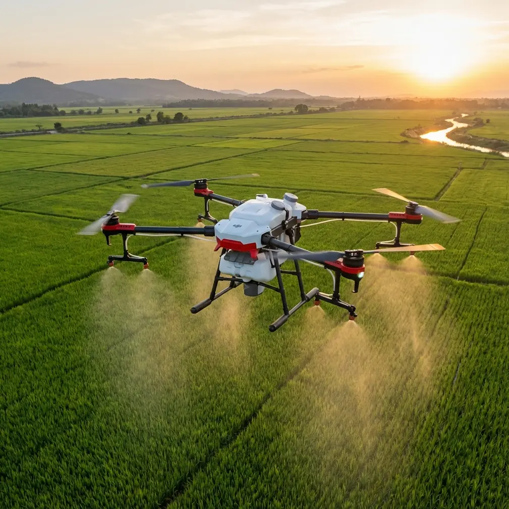
A straight corridor of pavement can turn into one of the harder places to fly well. In summer, rising heat distorts the scene and punishes electronics. In winter, fine road grit, moisture, and temperature swings can compromise cameras and forward sensing. Add long distances, repetitive terrain, moving vehicles, and the need for dependable image capture, and the mission stops being casual aerial photography. It becomes a remote sensing job.
That distinction matters for anyone evaluating Flip for highway work.
As a photographer, I tend to notice image texture first: glare off guardrails, shimmer above asphalt, the way low-angle light reveals surface wear. But on a real scouting mission, the aircraft is only one part of the system. The more useful way to think about Flip is the same way the remote sensing field has framed UAV work for years: an unmanned aircraft carries digital imaging equipment, captures and records the scene, then relies on data processing and synchronized transmission so teams can investigate and monitor ground information in near real time.
For highway scouting, that is the whole game. The flight is just the visible part.
Why Flip fits the highway scouting problem
A lot of drone discussions stay stuck on headline features. Obstacle avoidance. ActiveTrack. QuickShots. D-Log. Hyperlapse. Those all matter, but not equally, and not in the same way on a highway corridor.
Highway scouting is less about cinematic flourish and more about continuity. You need stable coverage across long, repetitive segments. You need enough image quality to identify shoulder conditions, drainage patterns, signage visibility, roadside encroachment, and surface anomalies. You need reliable flight behavior in crosswinds and thermally unstable air. Most of all, you need a workflow that gets usable information back quickly enough to support decisions.
That aligns closely with the core development themes in UAV remote sensing: platform integration, sensor capability, attitude control, and data transmission and storage.
Those aren’t abstract engineering categories. They describe what separates a pleasant flight from a productive one.
Start with the pre-flight cleaning step most pilots skip
If I were sending a Flip team out to scout highways in extreme temperatures, I would insist on one habit before every launch: clean the safety and imaging surfaces before powering into the mission.
Not just the main camera lens. Clean the obstacle sensing windows too.
That small step becomes operationally significant on roads because highways throw contamination into the air constantly: dust, salt residue, oily film, fine grit from tires, insect impacts in warm months, and condensation when the aircraft moves from a climate-controlled vehicle to outdoor cold. Any of that can degrade obstacle avoidance performance or create false confidence in what the aircraft “sees.” On a route with sign gantries, light poles, overpasses, cables near service roads, and irregular roadside vegetation, that margin matters.
The same goes for subject tracking and ActiveTrack. If you are using automated follow behavior to monitor a maintenance vehicle or pace a moving inspection target from a safe offset, a smeared sensing surface or softened image can reduce reliability. People often treat cleaning as cosmetic. In highway work, it is risk control.
My preferred routine is simple: let the aircraft acclimate briefly after leaving the vehicle, inspect for condensation, clean the lens and forward/downward sensing surfaces with a proper microfiber, then verify the live feed is crisp before takeoff. In extreme heat, I also check for any haze or film that becomes obvious only when bright sun hits the optics. One minute on the ground can save an entire sortie.
The real value of image quality isn’t “looking good”
One useful fact from the remote sensing reference material stands out: digital aerial survey cameras produced domestically have surpassed 80 million pixels and can capture color, infrared, and panchromatic imagery at high precision. Even if Flip is not operating in that exact large-format survey category, the significance is clear. The UAV world has shifted from basic visual capture to richer, more precise digital sensing.
Why does that matter on highways?
Because road scouting often depends on subtle differences, not dramatic objects. A shoulder edge beginning to unravel. Heat stress affecting pavement appearance. Water pooling patterns after runoff. Vegetation encroachment that is still minor but spreading. A sign face losing contrast at distance. These are interpretation problems, not just flying problems.
Higher-fidelity capture helps, but only if the workflow preserves that quality. The source document also highlights a persistent challenge: high-resolution airborne sensors generate large amounts of data, and real-time downlink often relies on high-compression lossy methods. That introduces errors, which can limit use in applications with stricter standards.
This is exactly the trap many teams fall into during highway scouting. They judge the mission by what the live feed looked like in the field. But the transmission stream is often not the same thing as the best recorded file onboard. If compression artifacts or unstable bitrate make the downlink look soft, you may miss a developing issue in real time. If you trust only the live view, you underuse the platform. If you ignore the transmission limits entirely, you risk making field decisions on degraded imagery.
The smart Flip workflow is to separate real-time awareness from final analysis. Use the live feed to maintain route context, safety, framing, and immediate anomaly spotting. Then review full-quality footage after landing for finer interpretation, especially when scouting in hot conditions where air shimmer can affect apparent detail.
Heat and cold expose the importance of flight stability
Remote sensing literature often sounds technical until you put it into a roadside environment. The reference points out that a UAV performing autonomous aerial imaging needs solid control of attitude loops, horizontal position, and altitude loops. It also notes that flight control has evolved through nonlinear dynamics, adaptive backstepping, and intelligent neural-network-based methods to improve stability across the flight envelope.
Operationally, here’s what that means for Flip on highways: stable flight is data quality.
When you are flying parallel to traffic lanes, crossing open sections where wind sweeps through cuttings, or hovering near bridge approaches in rising midday heat, even small attitude corrections affect image consistency. Jitter changes framing. Altitude drift changes scale. Yaw instability makes repeat passes harder. If your goal is comparing road segments or documenting conditions methodically, stability is not a luxury feature.
This is where obstacle avoidance and controlled automated features can be genuinely useful rather than decorative. In a corridor environment, they help reduce pilot workload while maintaining predictable movement. Subject tracking can support repeated observation of a support vehicle moving at controlled speed along a shoulder or access road. ActiveTrack can be practical when used conservatively and with clear stand-off from traffic complexity. The key is not to hand over judgment to automation, but to let automation reduce unnecessary pilot input so the operator can pay attention to lighting, edge detail, and safety spacing.
Extreme temperatures amplify the need for this discipline. Heat creates convection and image shimmer. Cold can stiffen fingers, slow decision-making, and shorten the patience people usually have for checklists. A stable platform and an orderly flight plan become part of data hygiene.
Data transmission is the hidden bottleneck on long road missions
One of the most relevant details in the source material is the warning that UAV image streams are vulnerable to environmental interference and large bitrate fluctuations, especially over bandwidth-limited wireless channels. That challenge feels very familiar on highway work.
Road corridors are messy RF environments. Passing vehicles, roadside infrastructure, open stretches alternating with built-up interchanges, and long linear routes can produce inconsistent transmission behavior. In practical terms, your live image may look strong one minute and unstable the next, even when the aircraft itself is flying well.
For a Flip team scouting highways, that means planning around transmission reality rather than assuming a perfect continuous feed.
A few tactics help:
- Break the route into shorter, logical segments rather than chasing uninterrupted distance.
- Use defined observation points for critical assets such as ramps, culverts, overpasses, and barriers.
- Record onboard at the best practical quality, especially if D-Log is part of the workflow for preserving highlight and shadow information in harsh midday light.
- Treat the downlink as a tactical tool, not the final evidence set.
The source also emphasizes the ground side of remote sensing: fixed or mobile receiving stations, large-capacity storage and management, image databases, and processing steps such as radiometric and geometric correction. That framework is easy to overlook with compact drones, yet it is exactly what makes repeated highway scouting scalable. Once your Flip flights are organized into consistent storage, segment labeling, and review procedures, you stop collecting “drone footage” and start building a usable roadway record.
That is the difference between a cool flight and an inspection program.
A highway use case where Flip’s creative tools still earn their place
I rarely recommend creative modes for serious corridor assessment without a reason. But there are exceptions.
Hyperlapse can be effective when the mission is not defect detection but contextual change reporting—documenting traffic pattern shifts around a work zone, for example, or visualizing how heat haze and visibility conditions evolve along a corridor during a weather event. QuickShots are less central for inspection, though certain controlled reveals can help communicate site context to nontechnical stakeholders after the mission.
D-Log, on the other hand, is more than a creator feature in this setting. Highways often present brutal contrast: bright reflective pavement, dark underpasses, white lane markings, shadowed embankments, and sunlit signs. A flatter capture profile can preserve detail that would otherwise clip or crush, giving analysts more flexibility in post when reviewing roadside conditions. That matters more in summer scouting, when overhead sun turns ordinary surfaces into high-contrast traps.
What impressed me most from the reference material
The source mentions an example where the Chinese Academy of Surveying and Mapping combined multiple Hasselblad cameras and stitched the outputs through dedicated software to improve aerial remote sensing efficiency. That detail says something larger than “better photos.” It shows that efficiency in UAV remote sensing often comes from system design, not just aircraft capability.
That lesson applies directly to Flip.
If your highway scouting operation depends on one pilot improvising every route, checking files later on a laptop with no naming convention, and relying on memory to compare segments, you are leaving value on the table. But if you pair Flip with a disciplined workflow—pre-flight cleaning, repeatable route plans, onboard high-quality recording, structured data handoff, and consistent post-flight review—you multiply what the aircraft can actually deliver.
The aircraft matters. The system matters more.
My field takeaway for teams scouting highways in extreme temperatures
Flip makes sense for this kind of mission when you treat it as a compact remote sensing platform rather than just a camera drone.
That mindset changes everything. You pay more attention to sensor cleanliness because obstacle avoidance depends on clean surfaces. You care about stable automated flight because image consistency matters on long linear assets. You respect transmission limits because compressed live feeds can hide detail. You build a review workflow because highway value comes from comparison over time, not one-off visuals.
If you’re setting up a corridor scouting routine and want help pressure-testing the workflow, I’d point you to this quick field contact option: message a Flip specialist here.
Highway environments are unforgiving teachers. They expose weak habits fast. But they also reward careful operators. Clean the sensors before launch. Segment the mission. Record for analysis, not just for viewing. Use automation with restraint. And remember that every useful frame is the product of four things working together: platform, control, transmission, and processing.
That is where Flip becomes genuinely effective.
Ready for your own Flip? Contact our team for expert consultation.