Flip Guide for Scouting Vineyards in Complex Terrain
Flip Guide for Scouting Vineyards in Complex Terrain
META: Expert guide to using Flip for vineyard scouting in steep, irregular terrain, with practical insights on flight control, sensor behavior, EMI handling, and stable image capture.
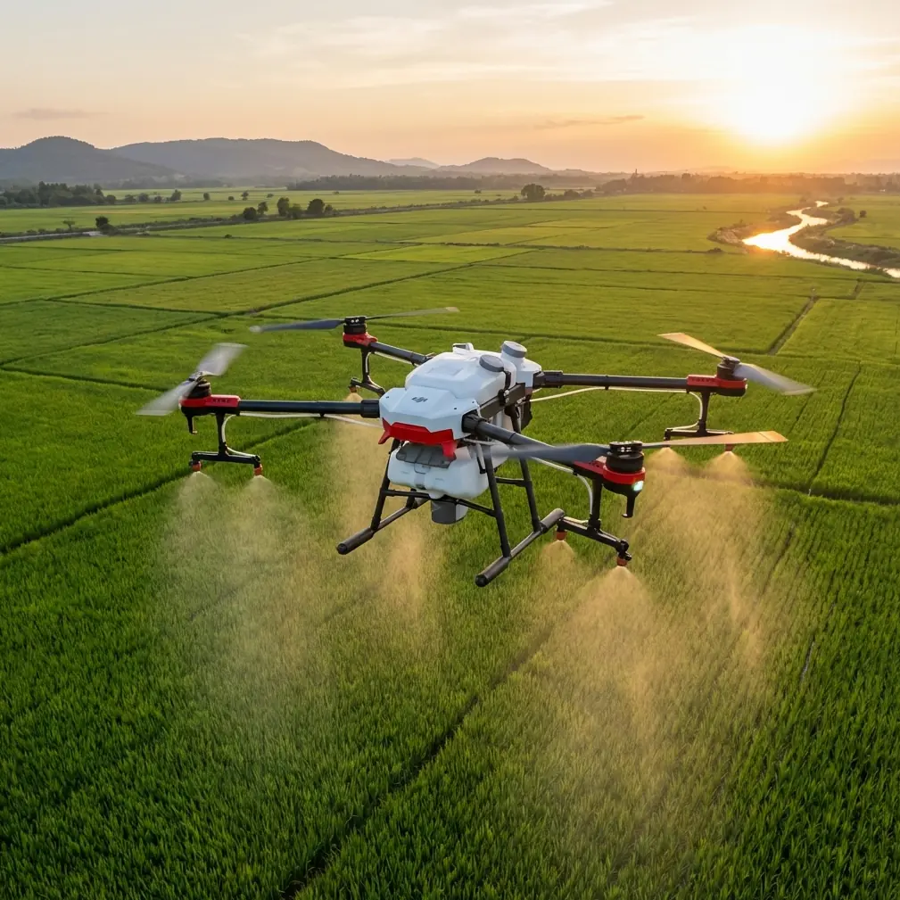
Vineyards have a way of exposing every weakness in a drone workflow.
Rows bend around slopes. Trellises create repeating visual patterns that can confuse tracking. Wind channels through narrow valleys, then drops off without warning near ridgelines. Add power lines, metal irrigation hardware, and scattered farm equipment, and suddenly a clean scouting run becomes a test of flight stability, sensor confidence, and pilot judgment.
That is why Flip deserves to be discussed less as a casual camera drone and more as a field tool. If your job is scouting vineyards in complex terrain, the real question is not whether it can fly. It is whether it can hold a reliable attitude, preserve usable image data, and stay predictable when the environment starts working against it.
A useful way to think about this comes from a classic hexacopter design framework laid out in a Harbin Institute of Technology undergraduate thesis, Design of a Hexarotor UAV. Even from the table of contents alone, the engineering priorities are revealing: mathematical modeling, flight mechanism analysis, frame selection, power system design, wireless communication links, attitude sensors, altitude sensors, position sensors, control algorithms, vibration reduction and filtering, speed allocation strategy, ultrasonic sensor filtering, and sensor fusion between a height sensor and accelerometer. That sequence matters. It reflects a truth every vineyard operator eventually learns: good results come from the interaction of airframe behavior, sensing, control logic, and environmental management—not from one spec sheet bullet.
Flip use in vineyards should be approached the same way.
The actual problem in vineyard scouting
Most vineyard scouting missions are not cinematic. They are diagnostic.
You are trying to inspect canopy uniformity, spot irrigation anomalies, check row access, document erosion, review replant zones, or produce visual references before crews move in. In flatter parcels, this is straightforward. In broken terrain, it becomes more technical.
The first challenge is altitude consistency. A drone crossing terraces or rolling rows can appear stable from the pilot’s perspective while producing uneven stand-off distance to the vines. That affects image consistency and makes comparisons harder. The second challenge is directional stability. Vineyard corridors can pull the aircraft into visual and aerodynamic traps, especially when long, repetitive rows dominate the scene. The third is signal integrity. Electromagnetic interference around pumps, utility lines, metal sheds, or even temporary field infrastructure can create small disturbances that become big problems if ignored.
This is where the engineering logic behind six-rotor research helps frame a practical method, even if Flip itself is a different platform.
The thesis dedicates major sections to attitude sensors, height sensors, position sensors, and then later to attitude controller structure, vibration isolation and filtering, and sensor fusion. Operationally, that tells us something valuable: stable scouting is never just about GPS or just about the camera. It is about how multiple sensing layers support the control loop when one input becomes noisy or weak.
For vineyard work, that translates into a simple rule. Do not rely on one mode or one automation feature to carry the whole mission.
Why obstacle avoidance is useful—but not sufficient
Obstacle avoidance sounds like the perfect vineyard feature. In reality, it helps most when used with restraint.
Rows, trellis posts, wires, and edge trees create a cluttered environment with mixed spacing. Flip’s obstacle avoidance can reduce pilot workload when transitioning between parcels or following access tracks, but vineyard scouting often demands more deliberate line choices than generic obstacle logic can provide. Narrow row gaps and branch overhang can present low-contrast obstacles, especially in changing light.
So obstacle avoidance should be treated as a layer of protection, not as permission to fly casually near the canopy.
This aligns with the control-focused structure in the hexacopter thesis. In Chapter 4, the work separates attitude control, height control, and speed allocation strategy. That separation is operationally significant. In the field, your path management, height discipline, and directional stability are related, but they are not the same task. If you let one automation layer dominate the mission, you may get acceptable safety margins while losing the image consistency needed for scouting decisions.
In practice, I recommend a tiered approach with Flip:
- Use obstacle avoidance for transitions and conservative proximity work.
- Use manual or tightly supervised flight paths when documenting rows for comparison.
- Keep ActiveTrack and subject tracking for moving vehicles, workers, or utility inspections around the vineyard perimeter—not for autonomous row flying where repetitive geometry can mislead the system.
ActiveTrack is excellent when the subject is clear and distinct. Vineyard rows are not. They are repetitive, textured, and often visually ambiguous from above and at oblique angles.
The hidden factor: electromagnetic interference
Most pilots notice interference only after the drone begins acting strangely. By then, they are already behind the aircraft.
In vineyards, electromagnetic interference can come from overhead lines, pump installations, communications hardware, or metal-dense service zones near storage and maintenance areas. The symptoms are not always dramatic. Sometimes it is a slightly unstable heading, inconsistent telemetry confidence, or erratic behavior at the start of a flight near equipment.
The smartest response is often very simple: adjust your takeoff position and antenna orientation before you chase software explanations.
This is where the thesis reference to a wireless communication link in Chapter 3 becomes especially relevant. Communication architecture is not a background feature. It is part of flight reliability. If the link quality is compromised, every automated promise on the aircraft becomes less trustworthy.
When scouting vineyards, I use a basic EMI protocol:
- Start away from obvious metal clutter and powered infrastructure.
- Face the controller antennas deliberately toward the operating area, not casually downward or off-axis.
- If telemetry or responsiveness feels inconsistent, land and reposition instead of pushing through.
- Repeat the first pass from a slightly different angle if the problem area sits near a utility corridor.
That antenna adjustment step sounds minor, but in real fieldwork it often makes the difference between a flight that feels “off” and one that settles into predictable control. If you need help setting up a stable field workflow around difficult vineyard blocks, you can message a drone specialist here.
Why filtering and vibration matter more than pilots think
One of the strongest clues in the reference material is the presence of a dedicated section on attitude sensor vibration reduction and filtering. That is not an academic footnote. It points to a core reality of small UAVs: raw sensor data is messy.
In a vineyard, vibration problems are easy to underestimate because the footage may still look visually smooth. But smooth-looking video is not the same as trustworthy flight-state data. If your aircraft experiences persistent micro-vibration from prop condition, wind buffeting, or aggressive control inputs, the sensing stack has to work harder to maintain attitude confidence.
That affects more than flight feel. It can influence the consistency of tracking, the steadiness of low-altitude passes, and the quality of repeated scouting runs intended for comparison over time.
For Flip operators, this means preflight discipline matters:
- Check props for minor damage, not just obvious breakage.
- Avoid abrupt stick inputs during survey-style passes.
- Use slower, repeatable flight lines when collecting diagnostic visuals rather than cinematic sweeps.
- Reassess performance if the aircraft feels more “busy” than usual in hover.
The thesis places filtering before higher-level control refinement for a reason. Clean inputs create better control decisions. Better control decisions create more usable scouting output.
Height control on slopes: where sensor logic meets vineyard reality
The reference material also highlights ultrasonic sensor filtering and a fusion algorithm combining a height sensor with an accelerometer. Even without borrowing the original language, the significance is clear: vertical stability is hard, and no single source tells the full truth.
That lesson is directly applicable to vineyard blocks with elevation changes.
A drone flying across stepped rows or sloping terrain can experience constant shifts in relative height above crop level. If you are trying to inspect canopy density or compare row vigor visually, those height changes distort perspective and make interpretation harder. The aircraft may be flying correctly in absolute terms, but the imagery becomes less analytically useful.
The practical response is to break missions into terrain-aware segments instead of forcing one continuous run across every contour.
Use Flip like this:
- Divide the vineyard into topographic zones.
- Fly each zone with a separate target height and direction.
- Keep the camera angle and speed consistent within each zone.
- Review the first segment before committing to the rest.
This approach mirrors the systems thinking implied by the thesis. Control works best when the operating problem is defined clearly. In the field, that means shaping the mission to the terrain instead of asking the aircraft to solve every variation automatically.
Where QuickShots, Hyperlapse, and D-Log fit
These tools are useful, but only when matched to the scouting objective.
QuickShots can help capture repeatable overviews for managers who need a fast visual summary of parcel shape, access roads, and edge conditions. They are less useful for close diagnostic passes where control over framing and altitude matters more than speed.
Hyperlapse has value when documenting changing weather over a vineyard, worker movement patterns, or the progression of harvesting activity across a block. It is a contextual tool, not a primary scouting mode.
D-Log matters more than many operators realize. In vineyards, light contrast can be harsh: bright sky, dark understory, reflective leaves, and shadows from slope changes. D-Log preserves more grading flexibility, which helps when you need to examine subtle variations in foliage or moisture expression later. If your scouting workflow includes post-review by agronomy or operations teams, that extra image latitude can be worth the effort.
The point is not to use every feature. The point is to assign each feature to a job it can actually improve.
A smarter workflow for complex vineyard terrain
When Flip is used well in vineyards, the mission usually looks less flashy than people expect.
You start with a high pass to understand obstacles and wind exposure. You identify interference zones near utilities. You adjust controller antenna orientation before launch if the site is cluttered. You break the block into manageable sections. You reserve automation for the parts of the job where automation helps, and take back direct control where repetition, proximity, or slope complexity demand it.
That workflow is consistent with the architecture implied in the Harbin Institute of Technology thesis. Across Chapter 2’s flight mechanism and structural design, Chapter 3’s hardware and sensor system, and Chapter 4’s control algorithm design, the underlying message is that reliable flight is built layer by layer. Vineyard scouting rewards that mindset.
A flashy pass may impress a client once. A stable, repeatable, terrain-aware scouting method helps a grower make decisions all season.
The bottom line on Flip for vineyard scouting
Flip makes the most sense in vineyards when you treat it as a controlled observation platform, not just a flying camera.
Its value rises in direct proportion to your discipline. Obstacle avoidance can reduce workload, but it does not replace route planning. ActiveTrack can be helpful, but not in every row environment. D-Log can preserve useful visual information, but only if the flight profile is consistent enough to make that footage comparable. And when electromagnetic interference appears, the fix is often not dramatic—just smarter placement, cleaner line-of-sight, and better antenna alignment.
The hexacopter reference offers a useful lens here because it breaks UAV performance into the pieces that actually matter in the field: communication links, sensing, filtering, controller structure, and height management. Those are not abstract engineering categories. In a vineyard, they become practical habits.
If your scouting environment includes terraces, mixed elevations, metal infrastructure, and tight row geometry, Flip can be effective—but only when flown with an understanding of what the aircraft is solving, and what you still need to solve as the operator.
Ready for your own Flip? Contact our team for expert consultation.