Flip Guide for Urban Wildlife Scouting: What Actually
Flip Guide for Urban Wildlife Scouting: What Actually Matters in the Field
META: A practical expert guide to using Flip for urban wildlife scouting, with lessons drawn from real UAV photogrammetry standards, flight overlap discipline, GPS control logic, and accessory-based field improvements.
Urban wildlife scouting sounds simple until you try to do it well.
Birds move unpredictably. Foxes hug shadow lines near walls and embankments. Wetland edges inside city limits are crowded with trees, wires, lamp posts, pedestrian traffic, and reflective surfaces. The drone is not just a camera in the air. It becomes a flying observation system that has to balance image quality, repeatability, safety, and positional confidence.
That is where Flip gets interesting.
Most people look at a compact drone and think in terms of portability first. For urban wildlife work, portability matters, but it is not the operational advantage that decides whether your footage is usable. The real differentiator is whether the aircraft can produce consistent, interpretable imagery in cluttered spaces while maintaining enough flight discipline to let you revisit the same habitat edge, drainage corridor, rooftop nesting zone, or canal line again and again.
A useful way to think about Flip is not as a toy for casual nature clips, but as a lightweight observation platform. And the best framework for understanding that comes from a photogrammetry project, not a marketing brochure.
The real problem: seeing wildlife is easy, seeing it reliably is not
Urban wildlife scouting often fails for one of three reasons.
First, the drone captures footage that looks attractive but is hard to interpret. Strong colors, poor consistency, and changing flight height make behavioral comparison difficult. Second, pilots fly opportunistically instead of systematically, so one sortie cannot be meaningfully compared with the next. Third, the aircraft setup is too basic for the environment, especially around trees, narrow corridors, and visual obstructions.
The reference project on UAV aerial survey work offers a useful operational lesson here. In that survey, flights were conducted in two sorties, and relative flight altitude was calculated using GPS navigation data. That sounds technical, but the significance is simple: repeatable altitude control improves consistency. For wildlife scouting in urban spaces, that means your morning pass over a reed bed or roofline should resemble your later pass closely enough that movement patterns stand out, rather than being buried by differences in angle and scale.
The same reference noted that the imagery was not extremely sharp, yet the color was uniform, saturation was good, and the images still expressed the true characteristics of ground objects well enough to meet a 1:2000 mapping requirement. That detail matters more than many pilots realize. In urban wildlife work, absolute cinematic sharpness is not always the winning variable. Consistent tonal rendering and believable scene information are often more valuable when you are trying to identify nesting behavior, track route preference, or distinguish animal movement from background clutter.
Flip is well suited to this style of work when flown with intent. Features like subject tracking, ActiveTrack-style behavior, obstacle avoidance, and controlled automated movement can help, but only if they are used to support methodical observation rather than random pursuit.
Why overlap discipline has a surprising role in wildlife scouting
The source material gives very specific flight overlap figures: about 75% forward overlap and 35% to 45% side overlap, with roll or yaw deviation controlled below 12 degrees. These are survey numbers, not wildlife numbers. But the principle carries over beautifully.
Urban wildlife scouting benefits from overlap discipline because habitats are messy. You may lose visual clarity when an animal moves under tree cover, near masonry, or beside high-contrast pavement and water. By planning observation passes with deliberate overlap between routes and viewing angles, you increase your chances of capturing usable confirmation frames. You also reduce the risk that one brief blockage ruins the entire sortie.
With Flip, this translates into an intentional flight pattern:
- one wider establishing pass
- one lower observational pass
- one offset pass from a different lateral angle
- one hover-based watch segment using tracking only when the background is stable enough
That is not photogrammetric mapping, but it borrows the same logic. Redundancy creates reliability.
If you are scouting pigeons on roof structures, herons along drainage channels, or raccoons moving beside loading yards at dusk, overlapping routes help you verify whether what you saw was a one-off movement or part of a repeated path. It also makes post-flight review dramatically more useful.
GPS thinking matters even when you are not making a map
One of the strongest details in the source is the control methodology. The project linked 10 known control points and added 4 new control points. It used GPS static relative positioning for network checks, then RTK measurement with 5 GPS RTK receivers. To protect accuracy, the rover distance was kept within 5 km, data was only recorded when coordinate precision was within 3 cm, and each point was measured three times with the average taken as the final result.
You do not need to recreate that field workflow for urban wildlife scouting. But you should steal its mindset.
Here is the operational significance: trustworthy observation comes from repeatable reference, not guesswork.
With Flip, that means defining your own civilian observation controls:
- same launch point whenever possible
- same relative altitude band for each habitat type
- same time window when comparing behavior across days
- same orbit direction around fixed landmarks
- repeated short holds at consistent visual checkpoints
That discipline is what turns casual flying into field intelligence.
For example, if you are monitoring gull activity around a waterfront warehouse district, a repeated hover at the same corner, height, and angle lets you compare occupancy, flock response, and landing preference over time. If you use Hyperlapse or a stable interval capture sequence, even subtle changes in movement density become easier to notice. If you switch into D-Log for more controlled tonal recovery in harsh mid-day lighting, your footage becomes more analyzable across contrast-heavy scenes such as concrete, metal roofs, and water glare.
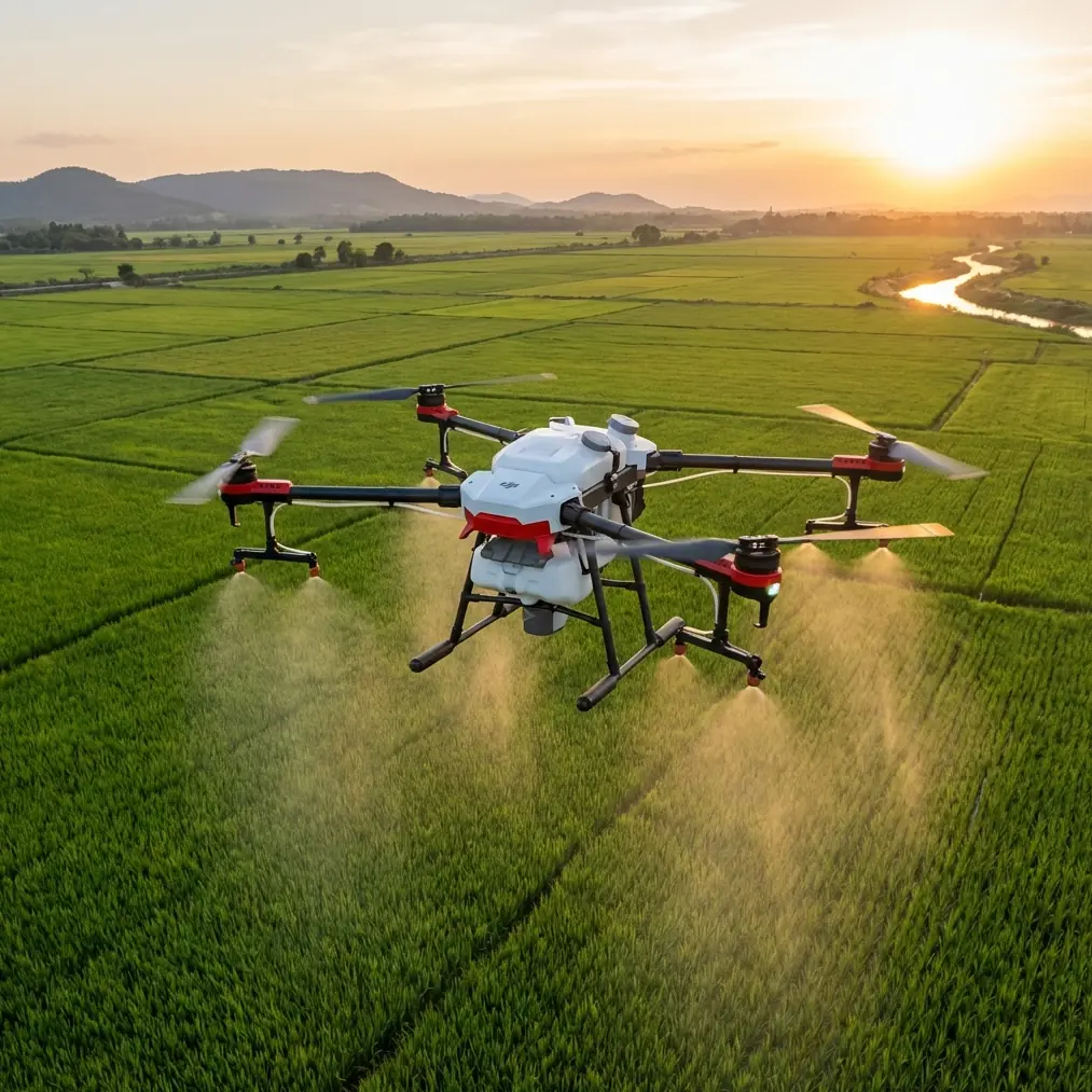
Flip’s obstacle avoidance is not a luxury in urban habitat edges
Urban wildlife does not live in clean open fields. It lives in all the inconvenient places.
Tree canopies overhang alleys. Utility lines cross feeding zones. Bridge columns create dead visual pockets. Construction fencing cuts through line of sight. This is exactly why obstacle avoidance on Flip deserves more attention in the wildlife context than it usually gets.
In recreational use, obstacle sensing is often treated as reassurance. In scouting, it is a practical enabler. It allows slower, more deliberate movement around vegetation and structures where animals are likely to shelter. That makes a difference when following a canal edge, tracing a shrub corridor between parking lots, or observing nest approach routes near building facades.
The goal is not to chase animals. The goal is to maintain a calm, observational flight posture in spaces where a less aware aircraft would force you to back off too early or fly too aggressively.
ActiveTrack and subject tracking can help, but only selectively. In urban settings, automatic tracking is most useful when the subject-background relationship is clean enough to avoid confusion. A bird crossing a uniform water surface may be a valid candidate. A squirrel moving through branching shadows is often not. Experienced pilots know when to use automation and when to revert to slow manual framing.
A third-party accessory can make Flip better for field interpretation
One upgrade that genuinely helps in urban wildlife scouting is a third-party tablet sun hood or monitor hood attached to your controller setup.
This is not glamorous gear, but it solves a real problem. City wildlife scouting often happens in bright, reflective conditions: rooftops, pavement, water, light concrete, and glass all fight your screen visibility. A sun hood improves your ability to evaluate subject position, branch clearance, and subtle movement on the live feed. That means fewer false sightings and fewer missed details.
I have seen pilots spend too much energy on post-processing profiles while ignoring the basic problem of not seeing the live image clearly enough in the first place. If your Flip setup includes D-Log recording for better tonal flexibility later, that is useful, but field interpretation starts with a visible monitor.
A compact hood, paired with a neck strap or stable controller mount, changes the experience more than many expect. It is a small accessory with operational impact.
Learning from survey accuracy: acceptable results can still hide problems
One of the most revealing details in the reference material is this: across 6 DLG map sheets, elevation error met the required standard, with mean errors ranging from 0.27 m to 0.36 m, yet the gross error rate was relatively high and in some cases reached 5%.
That is a powerful reminder for wildlife operators.
A mission can appear successful while still containing too many weak moments.
Applied to Flip scouting, your sortie should not be judged only by whether you “got some footage.” You should ask:
- Were the observation angles repeatable?
- Did the aircraft hold stable enough near habitat edges?
- Did tracking lose the subject during obstruction?
- Was there enough scene context to interpret the behavior?
- Were there too many unusable clips due to glare, branches, or sudden framing drift?
This is where QuickShots can be misunderstood. Automated cinematic moves look polished, but for wildlife analysis they are often secondary tools. A carefully chosen orbit or reveal can help contextualize habitat relationships, especially when documenting how green corridors connect to built structures. But the core scouting value usually comes from steady, repeatable, low-disturbance observation segments.
If too much of your footage is visually impressive but operationally weak, your own “gross error rate” is too high, even if a few clips look great.
Building a practical urban wildlife workflow with Flip
A strong Flip workflow for city wildlife scouting can look like this:
1. Predefine a repeatable route
Borrow the logic of the survey project’s structured flight planning. Split your area into two or more short sorties if needed, just as the reference mission used two flight batches. This keeps battery management cleaner and reduces rushed decisions.
2. Use stable relative altitude
The survey team used GPS navigation data to calculate relative flying height. For Flip, maintain a habitat-specific altitude rule. One height for canal edges. Another for roof nest surveys. Another for tree-line passes. Consistency beats improvisation.
3. Prioritize realistic image information
The source highlighted color uniformity and saturation as strengths even when sharpness was not exceptional. That is a useful reminder. Expose for truthful scene detail. If lighting is difficult, D-Log can preserve more flexibility for later review.
4. Use obstacle avoidance as a planning tool
Do not wait for it to save you from a mistake. Choose routes that let the sensing system support slow, confident movement near vegetation and structures.
5. Track sparingly
Subject tracking and ActiveTrack are excellent when the visual scene is clean. In clutter, use them as short-duration aids, not permanent crutches.
6. Add one meaningful accessory
A third-party sun hood, anti-glare screen solution, or compact landing pad for dusty embankments can improve field performance more than another editing preset ever will.
7. Review like a surveyor
Check not just whether animals appeared, but whether the footage is comparable over time. Reliability is the asset.
When Flip is the right choice for this job
Flip makes sense for urban wildlife scouting when the task demands mobility, speed of deployment, and low-friction repeat visits. If you are walking levees, crossing footbridges, working along drainage channels, or moving between urban parks and rooftop access points, a compact aircraft helps you scout more often and with less setup fatigue.
The drone becomes even more valuable when paired with a disciplined flight method inspired by survey thinking. That is the hidden thread connecting the reference material to real-world wildlife work. Precision is not just for map makers. It is what makes aerial observation trustworthy.
And that trust comes from details:
- two-sortie planning instead of one chaotic flight
- overlap logic instead of random pathing
- GPS-based consistency instead of eyeballed altitude
- repeated observation points instead of improvised hovering
- acceptance criteria that look beyond a few nice clips
If you want help tailoring a Flip setup for urban wildlife routes, controller visibility, and safer low-disturbance flight habits, you can message a field specialist here.
Flip is not defined by a feature checklist. In urban wildlife scouting, its value comes from how well it supports disciplined observation in complicated environments. The pilots who get the most from it are not the ones chasing dramatic footage. They are the ones building repeatable evidence from small, careful flights.
Ready for your own Flip? Contact our team for expert consultation.