Flip: How to Plan Forest Spraying Flights in Extreme
Flip: How to Plan Forest Spraying Flights in Extreme Temperatures
META: Learn how to use Flip effectively for forest spraying support in extreme temperatures, with practical guidance on flight altitude, obstacle awareness, battery strategy, and imaging setup.
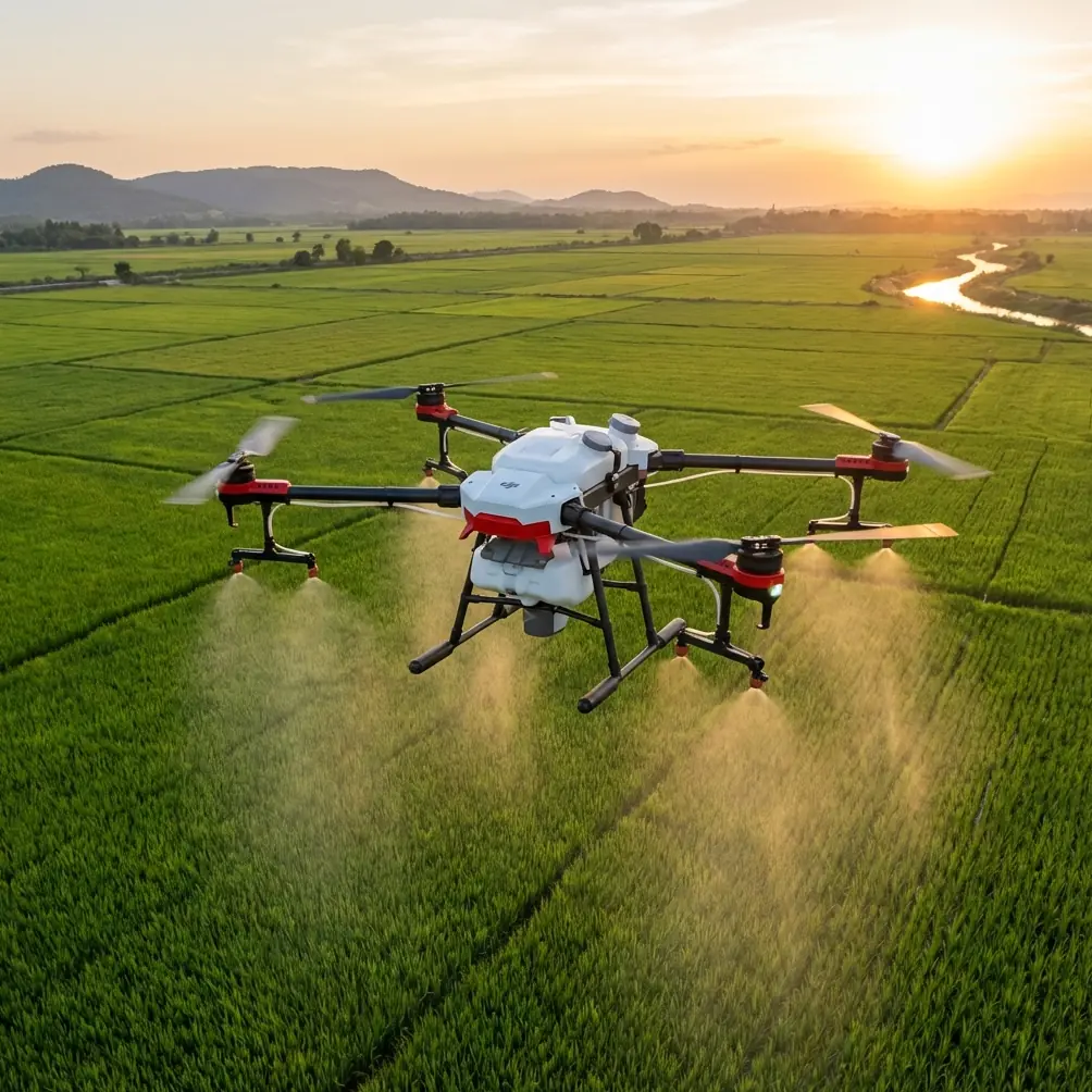
Forest work exposes every weak point in a drone operation. Heat punishes batteries, cold slows chemical behavior, dense canopies interfere with sightlines, and mountain winds can turn a tidy route into a recovery exercise. If you are using Flip around spraying operations in these conditions, the real question is not whether it can fly. The question is how to fly it so the footage, scouting data, and overwatch support remain useful when the environment starts stripping away your margin for error.
That distinction matters. Flip is not the aircraft applying product to timber blocks, but it can become a valuable layer in the spraying workflow when used for route preview, canopy inspection, edge mapping, spot documentation, and pilot awareness. In extreme temperatures, those support tasks become more critical because mistakes compound faster. A missed snag line, a hidden dead tree leaning into a corridor, or an unexpected thermal band along a ridge can disrupt the entire day.
As a photographer, I naturally look at aircraft through the lens first. With Flip, though, the camera is only half the story. Features such as obstacle avoidance, subject tracking, QuickShots, Hyperlapse, D-Log, and ActiveTrack are often discussed in creative circles, yet in forest spraying support they have operational value when handled with discipline. The challenge is knowing which features help, which ones distract, and what flight altitude gives you the cleanest working view without sacrificing safety.
Start with the mission, not the mode
Extreme temperature work punishes casual flying. Before launch, define what Flip is there to do. In a forest spraying scenario, that usually falls into one of four jobs:
- Pre-spray reconnaissance of terrain, tree line gaps, access roads, and hazard points
- Real-time visual support for the ground team near loading or staging areas
- Post-pass documentation of canopy coverage indicators, drift clues, and blocked access paths
- Environmental context capture for reporting, training, or client review
If you do not lock in one of those purposes, it becomes too easy to drift into cinematic flying habits. That is where useful battery time disappears.
QuickShots and Hyperlapse are good examples. They can create excellent overview sequences for training or site records, but they should not be the default in difficult temperature conditions. Every automated movement increases the need for predictable aircraft behavior and clean GPS performance. In a forest corridor with gusts and temperature-driven battery stress, the best flight is usually the simplest one.
The best altitude for this scenario
For forest spraying support, the most reliable working altitude with Flip is often 25 to 40 meters above the canopy edge or target observation zone, not high enough to lose detail and not so low that you compress your reaction time around trees.
That number is not random. Below roughly 25 meters in dense forest environments, your view starts collapsing into fragmented sightlines. Individual crowns block the field, terrain undulations become harder to read, and obstacle avoidance has less time to interpret branches, protruding trunks, and irregular openings. In extreme heat, where battery efficiency can drop during aggressive corrections, that is not where you want to live. In extreme cold, when power delivery can feel less eager, it is even less forgiving.
Above about 40 meters, the picture changes in a different way. You gain context, but you start sacrificing the exact details that matter to spray support: gap widths, branch intrusions into likely flight corridors, fresh windfall, vehicle bottlenecks, and the actual shape of canopy transitions. A high view can look tidy while hiding the practical hazards that will trouble a crew operating closer to the trees.
So the sweet spot is generally this:
- 25 to 30 meters when you are checking forest edges, loading clearings, and known obstacle zones
- 30 to 40 meters when you need broader terrain awareness, especially over broken ridgelines or mixed canopy height
If the stand is exceptionally uneven, measure from the tallest reliable obstacle in the area, not from the launch point. Too many pilots think in terms of takeoff altitude while the forest thinks in vertical layers.
Heat changes more than battery life
Extreme heat does not just shorten a session. It changes pilot decision-making because the aircraft can feel normal until it suddenly does not. Flip may still hold position well and produce crisp footage, but heat load tends to narrow your comfort window.
In hot forest operations, I would treat every battery as if it has less reserve than the display suggests. Keep climbs smooth, avoid repeated punch-outs above the canopy, and resist the urge to chase moving machinery with ActiveTrack unless you have a completely clear area. Subject tracking is attractive when vehicles or crews are moving between staging points, but automatic following near trees is only as good as the space around the subject. Dense branch structure and sharp sun angles can create ugly surprises.
This is also where D-Log earns its place. In harsh midday heat, contrast often becomes the enemy. Bright sky gaps over dark timber can obscure exactly the edge definition you need when reviewing footage for obstacles or drift clues. D-Log preserves more flexibility for pulling back highlights and opening shadow detail later. That is not just a color-grading nicety. It can mean the difference between seeing a branch intrusion clearly in review or missing it because the tonal range clipped too early.
If your purpose is operational documentation rather than social content, prioritize exposure discipline over visual punch. Keep the image neutral and readable. Pretty footage is optional. Usable footage is the standard.
Cold weather demands a slower start
Cold conditions create a different trap. Pilots often focus on whether the aircraft can lift off, but the better question is how the system behaves in the first few minutes. In forest spraying support, the launch phase is when you are usually closest to vehicles, people, equipment, and uneven terrain. That is the wrong time to discover sluggish power response.
Give Flip a gentler opening sequence. Let it hover briefly in a clear zone before moving toward the tree line. Check stability, watch for any odd drift or delayed braking feel, and avoid immediate long runs. This matters especially if your plan includes low edge work around staging areas or roads cut through timber.
Cold also affects the wider operation. Spray teams are often working within narrow weather windows, so there is pressure to move fast. That pressure can push the support drone into rushed launches and avoidable repositioning. Do the opposite. Front-load the thinking. A slower first minute usually saves more time than a rushed flight that has to be aborted and repeated.
Obstacle avoidance is a tool, not a permission slip
Obstacle avoidance is one of the most misunderstood features in tree-heavy work. It helps, but forests are full of thin branches, irregular shapes, partial occlusions, and contrast conditions that can confuse any sensing system. Add extreme temperatures and the cost of misreading the environment increases.
Use obstacle avoidance as a backstop, not as proof that a route is safe. The operational value is real in two specific moments:
- It can reduce risk during deliberate, moderate-speed inspection passes near canopy edges
- It can add a layer of protection when backing out of a confined view line after stopping to inspect a hazard
What it should not do is encourage fast threading through gaps. Forest geometry changes constantly. Broken limbs hang at odd angles. Small branch tips can be nearly invisible against bright background patches. The safest route is still the one with the largest clean margin.
When tracking helps and when it hurts
ActiveTrack and subject tracking sound useful for following a vehicle or crew through forest access roads, and sometimes they are. If your role is documenting movement into a treatment block or observing progress near a staging zone, tracking can reduce pilot workload and keep framing consistent.
But tracking becomes less reliable as the environment becomes more cluttered. In thick stands, the subject disappears behind cover, contrast changes sharply, and the aircraft may need to make decisions you would not make manually. In high heat, those sudden adjustments can consume battery faster than expected. In cold, the issue is less about battery drain and more about whether you want automation making tight path choices near timber.
My rule is simple: use tracking in open approach lanes, road corridors, or clearings. Drop back to manual control anywhere the forest starts deciding the route for you.
QuickShots and Hyperlapse still have a place
This may sound like I am arguing against Flip’s automated creative features. I am not. QuickShots and Hyperlapse can be genuinely useful around spraying programs when used at the right time.
QuickShots work well after the operational flight is done, especially in a safe open area where you want a fast visual record of terrain layout, treatment block access, or staging setup. Hyperlapse can help document moving weather, smoke, fog lift, or changing light over the site across a work window. That can be valuable in after-action reviews.
The key is sequencing. Do the operational job first. Creative automation comes later, when battery state, airspace, and site awareness are all in your favor.
Build a repeatable flight pattern
In extreme temperatures, consistency beats improvisation. A simple three-pass structure works well with Flip for forest spraying support:
- Pass one: broad perimeter look from around 35 to 40 meters for terrain, wind clues, and access status
- Pass two: edge inspection at around 25 to 30 meters for branch intrusion, snags, and canopy transitions
- Pass three: short targeted checks of staging areas, roads, or specific hazard points
This approach prevents a common mistake: spending too much battery wandering between macro and micro views without completing either. It also creates better records. When you review footage later, you know what each pass was trying to show.
If your team needs a clean communication channel during the day, set that up before launch. Even something as simple as a direct field contact like message the coordination lead here can reduce confusion when weather shifts quickly and the drone’s role needs to change from scouting to documentation.
Camera settings that favor decisions, not drama
For this use case, camera choices should support interpretation. That means:
- Prefer stable, readable movement over dramatic yaw or rapid reveal shots
- Use D-Log when contrast is severe and you may need review flexibility later
- Keep framing wide enough to preserve obstacle context around the target area
- Avoid flying so low that the image looks immersive but tells the team very little
This is where a photographer’s instinct can actually get in the way. Forests in extreme temperatures can look spectacular. Heat shimmer, cold haze, and side-lit canopy edges produce beautiful scenes. None of that matters if the operator reviewing the footage cannot tell whether a corridor is clean or whether a staging track is blocked by a leaning stem.
The real value of Flip in this environment
Flip becomes most useful in extreme-temperature forest spraying when it serves as a fast, precise observer. Not a substitute for the spray platform. Not a toy for collecting dramatic overheads. A disciplined eye in the sky.
Two details matter more than they are usually given credit for. First, obstacle avoidance has practical value for low-speed edge inspection, where a small safety buffer can prevent a needless incident near branches. Second, D-Log can preserve enough tonal information to make harsh, high-contrast forest footage operationally readable during later review. Neither feature is magic. Both become valuable when tied to a specific task.
If you remember one number, make it this: 25 to 40 meters is usually the most productive altitude band for this kind of work, with the lower end for detail and the upper end for context. Fly lower only when you have a clearly defined need and a clean margin. Fly higher only when the terrain demands a broader read.
Everything else follows from that mindset. Keep the mission narrow. Respect the temperature. Let automation help without taking over judgment. And when the forest starts taking away your options, climb back into a cleaner picture before it makes the decision for you.
Ready for your own Flip? Contact our team for expert consultation.