Flip in Coastal Vineyards: A Practical Tutorial for Safer
Flip in Coastal Vineyards: A Practical Tutorial for Safer, More Accurate Spray Planning
META: A hands-on Flip tutorial for coastal vineyard work, covering obstacle avoidance, ActiveTrack, QuickShots, Hyperlapse, D-Log, and antenna positioning for reliable range and better field results.
Coastal vineyards test both pilot judgment and aircraft setup. Wind comes off the water in uneven pulses. Rows can look clean from one angle and cluttered from another. Trellis wires, poles, tree lines, service roads, and rolling terrain all compete for your attention. If you are using Flip around that environment, the difference between a smooth mission and a frustrating one often comes down to preparation, camera workflow, and signal discipline rather than raw flying skill.
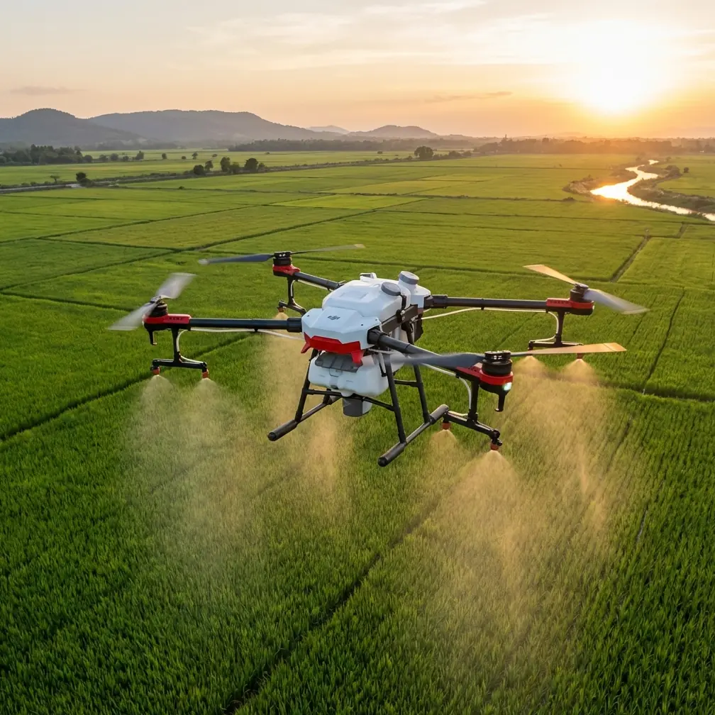
This tutorial is built around a very specific job: supporting vineyard spraying operations in coastal conditions with Flip. Not by turning the aircraft into a sprayer, but by using it as an aerial scouting and planning tool before crews enter the block. That distinction matters. A lightweight camera drone is most useful here when it helps you understand canopy variability, identify access issues, document wind patterns, and create repeatable visual records that improve timing and coverage decisions.
I’m approaching this from the perspective of Jessica Brown, a photographer who spends a lot of time thinking about light, movement, and what images reveal when you stop treating them as mere visuals. In vineyard operations, good imagery is operational data. Flip’s imaging features are not just creative extras. Used properly, they can help a grower or contractor decide where to start, where to slow down, and where conditions are not suitable for a spray pass.
Start with the vineyard, not the drone
Coastal vineyard work begins with terrain reading. Before powering on Flip, stand at the edge of the block and watch the site for a few minutes. Not a quick glance. Watch the movement of leaves across multiple rows. Notice whether the wind is crossing the vines, funneling through the headlands, or swirling near sheds and windbreaks. This is where many pilots get into trouble: they launch with a clean GPS lock but no real understanding of what the air is doing 30 or 40 feet above the canopy.
Flip’s obstacle avoidance becomes especially useful in this setting because vineyards rarely present a single obvious hazard. The risk is cumulative. One end of a row may have clear spacing, while the next section introduces poles, elevated irrigation lines, netting, or a tree branch extending just enough to matter. Obstacle avoidance helps reduce the chance of a small misjudgment becoming a damaged aircraft. Operationally, that means you can focus more attention on capturing useful scouting footage and less on constant micro-correction.
That said, obstacle avoidance is an aid, not permission to fly loosely. Thin wires, low-contrast structures, and side-angle approaches can still create problems. In coastal blocks where morning haze or late-day glare changes visual contrast, keep wider margins than you would inland on a calm, clear day.
Build a pre-spray visual baseline
For vineyard spraying support, the first objective is consistency. You want a baseline visual record of the block before any application begins. Flip gives you several ways to do that, but the most effective workflow is usually a combination of manual line flights, short automated capture sequences, and repeatable tracking shots.
A simple sequence works well:
- A high establishing pass over the full block.
- A medium-altitude run aligned with the rows.
- A lower oblique pass across areas with visible vigor variation.
- A short tracking sequence along the service road or perimeter.
- One time-based clip for wind and movement reference.
This is where QuickShots and Hyperlapse stop being “creative features” and start becoming practical tools. QuickShots can help you capture the same overview pattern at the start of each scouting session, which makes comparison easier over time. Hyperlapse is useful when you want to document changing cloud cover, fog burn-off, or wind behavior across a work window. In coastal agriculture, conditions often shift within an hour. A compressed visual record can reveal when a block moved from spray-suitable to marginal.
That operational significance is real. If you are advising a spray crew, the ability to show not only what the block looked like, but how it changed over time, can prevent wasted product, uneven coverage, and unnecessary reruns.
Use D-Log when the vineyard has contrast problems
Coastal vineyards often produce brutal contrast. Marine haze can flatten one section while reflective water light brightens another. White buildings, pale dust roads, and dark canopy gaps can sit in the same frame. If your goal is post-flight review rather than instant social-ready footage, D-Log deserves a place in your workflow.
D-Log preserves more flexibility for evaluating detail in highlights and shadows. In practice, that means you have a better chance of seeing canopy density changes, weak rows, runoff patterns near the edges, or damp areas hidden by contrasty midday light. For a photographer, that is obvious. For an operator supporting agricultural planning, it is even more useful. A flatter profile can make the difference between “this area looks fine” and “this section is clearly behaving differently from the rest of the block.”
I would not use D-Log for every single flight if the team needs immediate, no-edit footage on the spot. But for weekly block monitoring or pre-application documentation, it is one of the smarter choices you can make.
ActiveTrack and subject tracking: where they help, and where they don’t
The LSI terms matter here because they point to a common misunderstanding. Features like ActiveTrack and subject tracking are often treated as lifestyle tools, but in vineyard operations they can support observation if used carefully.
One example: tracking a utility vehicle moving along the headland before a spray cycle. This can help document road condition, turning radius constraints, puddling, dust, or access bottlenecks without requiring a second operator to manually frame every second. Another case is following a worker walking a perimeter to inspect drift-sensitive boundaries, especially in coastal areas where neighboring land uses may be close.
The benefit is not automation for its own sake. It is repeatability. ActiveTrack can reduce framing inconsistency and free the pilot to monitor aircraft position, wind drift, and obstacles more actively.
But there are limits. Vineyard rows create repetitive visual patterns. Shadows shift. Poles interrupt lines. Workers may disappear behind foliage or structures. Subject tracking can lose lock or make awkward path choices if the scene becomes cluttered. In dense agricultural spaces, I treat tracking as a supplement, not the backbone of the mission.
Antenna positioning advice for maximum range
Now to the piece that pilots ask about constantly, and rightly so: antenna positioning.
For maximum range and signal reliability with Flip, do not point the antenna tips directly at the aircraft. The strongest signal usually comes from the broadside of the antenna pattern, not the end. In plain terms, you want the flat faces or sides of the antenna orientation presented toward the drone, depending on the controller design, rather than aiming the tips like arrows.
In a coastal vineyard, this matters more than many people expect. Signal performance is rarely limited by distance alone. It is affected by terrain undulation, row orientation, vegetation mass, vehicles, nearby structures, and your own body position. Even a modest hill crest or a block of dense canopy can interrupt a clean link if your controller orientation is poor.
A few practical rules help:
- Keep the controller high and unobstructed, not tucked against your torso.
- Face the aircraft with your shoulders, not just your wrists.
- Reposition yourself at row ends or elevated access points to maintain cleaner line of sight.
- Avoid standing beside metal sheds, trucks, or heavy equipment when launching.
- If the aircraft is moving down a slope, adjust your stance before signal quality drops.
Operationally, proper antenna positioning gives you two things: steadier live view and more reliable command link. That translates into better framing, safer returns, and fewer interruptions when you are trying to capture comparable footage across multiple blocks. If you want a quick field checklist for controller setup, this direct WhatsApp line is useful: ask for the antenna positioning notes here.
Fly patterns that respect spray decision-making
If the mission is to support spraying in vineyards, the drone flight should answer practical questions. Can vehicles enter cleanly? Are there wet pockets near the lower rows? Is one section more exposed to wind than the rest? Are buffer edges clearly defined? Is the canopy uniform enough for a standard pass, or does one zone need separate treatment timing?
That means your routes should be designed around management decisions, not scenic coverage.
A useful pattern is the “three-height check”:
1. High overview
Fly high enough to understand block shape, neighboring land, and wind-facing edges. This is where QuickShots can help create a repeatable establishing perspective.
2. Mid-height diagnostic pass
Move parallel to the rows and look for vigor breaks, missing vines, shadowed pockets, and access constraints. This altitude often gives the best balance between context and detail.
3. Low oblique verification
Use this only where needed and only in safe, obstacle-aware segments. This is where Flip’s obstacle avoidance earns its keep, especially near poles, trellis elements, or boundary vegetation.
These three layers give managers a more complete decision picture than a single cinematic orbit ever will.
Make Hyperlapse work for operations
Hyperlapse is underused in agriculture because it is often dismissed as decorative. In coastal vineyard work, it can document one of the most operationally significant variables: time-dependent weather movement.
Set up a stable vantage point over or beside the block and record the changing scene over a defined interval. Look for:
- Marine haze lifting or thickening
- Shadow progression across rows
- Consistent canopy movement versus gusty bursts
- Vehicle traffic patterns near work entrances
- Moisture persistence in low-lying sections
A 20- to 30-minute visual compression can tell a spray coordinator more than a single still frame. It shows trend, not just condition. That distinction matters when deciding whether to proceed, delay, or split the work by block exposure.
Image discipline beats feature chasing
Flip includes attractive smart features, but vineyard support work rewards discipline more than novelty. Pick a repeatable capture method and stick with it. Use the same launch points when possible. Record at similar times of day if your goal is comparison. Keep your framing consistent enough that differences in footage reflect changes in the vineyard, not random pilot choices.
This is where the photographer mindset helps. Beautiful footage is not the mission. Readable footage is.
D-Log helps when contrast is ugly. ActiveTrack helps when a moving inspection subject needs to stay framed. QuickShots help when you want repeatable overview geometry. Hyperlapse helps when time is the hidden variable. Obstacle avoidance helps when the environment becomes visually busy and your attention is split. Each feature has value, but only when attached to a specific operational purpose.
A simple field workflow for coastal vineyard teams
If I were setting up a standard Flip routine for a vineyard before spraying, it would look like this:
- Arrive early enough to observe wind behavior on site.
- Choose a launch spot with strong line of sight and minimal metal interference.
- Set the controller and antennas for broadside signal orientation toward the aircraft.
- Capture one high overview of the entire block.
- Fly one or two mid-height passes aligned with row direction.
- Record targeted low obliques only where variability or access issues appear.
- Use D-Log for review footage when lighting is harsh or mixed.
- Run a short Hyperlapse if conditions appear changeable.
- Use ActiveTrack only in open, predictable segments where tracking genuinely saves workload.
- Review footage immediately for access, canopy variation, and wind-exposed edges before crews move.
That workflow is not flashy, but it is useful. And useful is what matters when the drone is supporting real field decisions.
Flip fits this role well when it is treated as an aerial observation platform rather than a toy or a substitute for agronomic judgment. In coastal vineyards, the aircraft’s real value lies in how clearly it helps you see the block, the wind, and the timing window before spraying begins. That is where safer operation, better documentation, and smarter field coordination come together.
Ready for your own Flip? Contact our team for expert consultation.