Flip for Construction Surveying in Complex Terrain
Flip for Construction Surveying in Complex Terrain: What Actually Matters in the Field
META: A practical expert guide to using Flip for surveying construction sites in complex terrain, with tips on obstacle avoidance, tracking, D-Log capture, Hyperlapse, QuickShots, and battery discipline.
Construction surveying gets messy the moment a site stops behaving like a flat diagram.
Steep cut slopes, stockpiles, temporary access roads, crane movement, half-built structures, reflective surfaces, dust, and changing light all interfere with clean aerial capture. On paper, the mission sounds simple: document progress, inspect terrain change, and create reliable visual records. On site, the challenge is holding consistency while the environment keeps changing.
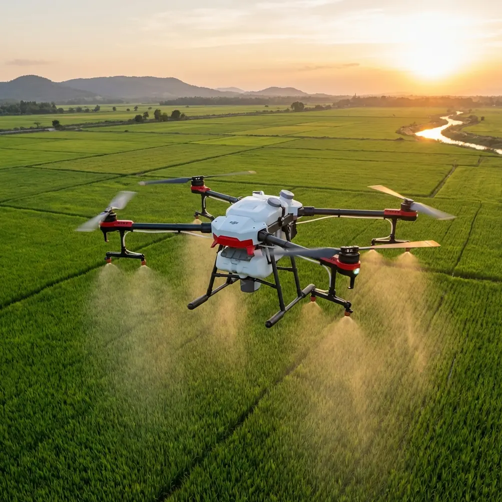
That is where a compact aircraft like Flip becomes useful, not because small drones magically solve hard survey conditions, but because the right flight behavior and camera workflow can reduce friction in places where larger, more cumbersome operations slow down. For site teams working in complex terrain, the value is less about spectacle and more about repeatability, obstacle handling, and getting usable imagery before wind, light, or battery constraints force you back to the ground.
This article looks at Flip through that lens: not as a toy for casual flying, but as a practical tool for construction-site documentation when access is awkward and terrain is uneven.
The real problem on complex construction sites
Surveying a site with elevation changes is rarely just a mapping exercise. The terrain itself creates line-of-sight interruptions. Excavation edges can hide movement below grade. Temporary steelwork and concrete walls change from week to week, so a flight route that was safe last Tuesday may be risky today.
A lot of drone workflows break down for three reasons.
First, pilots try to fly the same way they would over an open field. That tends to fail once the aircraft must move around partially built structures and irregular topography.
Second, they capture footage that looks good but does not help the project team. Dramatic movement is not the same as useful visual evidence.
Third, battery planning is treated as an afterthought. That mistake shows up late in the day, when you need one final pass over a drainage corridor or a retaining wall line and the remaining pack voltage says otherwise.
Flip fits this environment best when it is used deliberately. Features like obstacle avoidance, subject tracking, ActiveTrack, QuickShots, Hyperlapse, and D-Log are not there for novelty. They each solve a very specific field problem if you understand where they belong.
Why obstacle avoidance matters more on site than in open-air filming
Construction sites are full of temporary geometry. That is what makes obstacle avoidance operationally significant.
On a hillside development, for example, the drone may transition from open sky over a haul road into a tighter corridor near scaffolding, rebar staging, or the exposed face of an excavation. In those moments, obstacle awareness is not just a pilot comfort feature. It gives you margin when the site has changed since the previous flight.
That margin matters most during repeat documentation runs. Weekly progress capture often depends on flying the same lines from similar altitudes and camera angles. If the site team has added formwork, fencing, or machinery since the last mission, obstacle avoidance helps preserve the consistency of the route while reducing the chance of an abrupt manual correction that ruins the shot sequence.
There is also a less obvious benefit: it frees cognitive bandwidth. When the aircraft is helping manage proximity risk, the pilot can pay more attention to framing slope stability areas, drainage runs, spoil volumes, and access-road conditions. On active sites, that shift in attention often improves the quality of the final record more than people expect.
It does not remove the need for planning, of course. It simply makes planning more resilient against a worksite that never stays static.
ActiveTrack and subject tracking are not just for moving people
Some operators hear “subject tracking” and think of lifestyle filming. On construction sites, that misses the point.
Tracking functions, including ActiveTrack, can be useful when you need to follow a moving reference consistently across uneven ground. Think of a vehicle route along a temporary access road, a loader moving spoil from one elevation to another, or a supervisor walkthrough tracing the path of a future utility corridor. In difficult terrain, manual panning and repositioning often introduce jerky framing and inconsistent distance. Tracking can keep the moving subject centered while the pilot monitors the bigger site context.
The operational significance is simple: consistency creates better comparative records.
If you are documenting how traffic flows through a constrained work zone, or how material is moved around a steep section of the site, a tracking-based shot provides a more readable visual record than a one-off manual orbit. It lets project stakeholders see spacing, bottlenecks, and terrain interaction in a single continuous sequence.
That said, experienced pilots know when not to use it. Tracking around cranes, dense steel, or highly unpredictable vehicle paths can produce more complexity than value. Flip becomes strongest when tracking is used on controlled movements with clear separation and a defined objective.
QuickShots and Hyperlapse can serve documentation, not just presentation
QuickShots sound like a marketing feature until you use them intelligently on recurring site reports.
A consistent automated motion around a cut-and-fill zone, retaining structure, or building pad can produce a repeatable visual reference that management teams actually understand. Because the flight pattern is structured, you are less likely to introduce random angle changes from one reporting cycle to the next.
That repeatability matters when stakeholders are trying to compare progress across time rather than admire cinematic flying.
Hyperlapse has a similarly practical role. On larger construction projects, terrain and structure change can be difficult to communicate in still images alone. A Hyperlapse sequence captured from a repeatable vantage can show the pace of grading, staging reorganization, or vertical build-out in a compact form. For mixed teams of engineers, project managers, and clients, this often lands faster than handing over a folder full of isolated frames.
Neither mode replaces proper survey data collection. But for communication inside a project workflow, both can dramatically improve how site change is understood.
D-Log is where many teams either gain control or waste time
If your site surveys feed into progress reporting, stakeholder updates, or visual condition records, color flexibility matters. D-Log is significant because construction sites are visually harsh environments. Bright concrete, dark trench lines, reflective metal, dusty skies, and shaded cut faces all show up in the same frame.
A flatter capture profile preserves more room to balance those extremes later. That is useful when one side of the site sits in deep afternoon shade while another reflects direct sun. Standard color capture may clip highlights or crush shadow detail. D-Log gives your editor or documentation lead more latitude to recover visual information so details remain legible.
Operationally, this affects trust in the imagery.
If a slope face, drainage feature, or edge condition is hard to read because the footage was baked too aggressively in camera, the visual record becomes less useful. With D-Log, you have a better chance of keeping subtle detail in difficult lighting, especially during short weather windows when you cannot wait for perfect conditions.
The catch is discipline. If your team does not have a post-production workflow, D-Log can create unnecessary work. But if progress reporting is taken seriously, the extra grading step is often justified.
A field battery tip that saves more flights than any camera setting
Here is the battery management habit I recommend after enough long site days to learn it the annoying way: do not save your “one last pass” for the last battery.
Use your freshest battery on the most operationally critical route.
That route is usually not the glamorous one. It is the pass you must bring home clean no matter what happens later, such as a terrain overview, a retaining wall line, an excavation edge, or a utility corridor crossing rough ground.
On complex sites, the final battery tends to get spent in worse conditions than the first. Wind often picks up. Light gets harsher or flatter. The pilot gets tired. The site team asks for an extra angle. Then someone says, “Can we quickly check the far side?” That is how rushed endings happen.
My rule in the field is simple:
- Battery one handles the mandatory capture set.
- Battery two handles the comparison angles and medium-risk creative documentation.
- Battery three, if available, is for problem-solving, not promises.
Another practical trick: after every landing, write a quick note on what that pack just did. Not voltage data alone. The actual mission burden. “Steep climb over south cut,” “multiple hover holds,” “wind on ridge,” “long tracking pass.” Packs that have worked harder than average should not be casually assigned to the longest leg later in the session. On terrain-heavy jobs, that small bit of field discipline can prevent a mission from getting squeezed by unexpected return margins.
Battery planning is not glamorous, but it often decides whether your survey day feels controlled or improvised.
Building a smarter Flip workflow for difficult terrain
When surveying construction sites in complex topography, the best workflow is usually a layered one.
Start with a high-confidence overview route. Keep it simple and repeatable. This establishes your baseline visual record and gives context for every later detail shot.
Then move to terrain-specific sequences. This is where obstacle avoidance earns its place, especially near stepped elevations, temporary structures, or route constrictions.
Use ActiveTrack or subject tracking selectively for movement documentation, such as vehicle circulation or supervised walkthroughs that illustrate how the site is actually functioning on uneven ground.
Add one or two standardized QuickShots only if they help recurring comparison. If they do not improve decision-making, skip them.
Capture D-Log footage when the scene has difficult contrast or when the footage is likely to be reused in formal reporting.
And if progress communication is part of your deliverable, build a repeatable Hyperlapse from a known position. Over a few weeks, that single sequence can become one of the most persuasive visual assets in the whole project archive.
The point is not to use every feature because it exists. The point is to assign each feature a job.
What crews often get wrong about compact drones on job sites
The most common mistake is underestimating how capable a compact platform can be when the operator has a method.
Crews sometimes assume that a smaller aircraft is only suitable for casual site photos. In reality, a well-managed compact drone can be exactly the right tool when access is constrained, deployment time matters, and the objective is frequent, repeatable visual surveying rather than a one-off production day.
The second mistake is overcomplicating the mission. If the site team needs to understand grade change, access conditions, and structural progress, you do not need a hundred clips. You need a tight set of reliable passes flown consistently over time.
The third mistake is failing to connect flight features to site decisions. Obstacle avoidance is about safer repeat routes. ActiveTrack is about readable movement documentation. QuickShots can standardize recurring visual summaries. Hyperlapse can compress time-based change. D-Log helps preserve image detail under ugly site lighting.
Once you see Flip in operational terms, the platform becomes easier to evaluate.
Where Flip fits best for construction readers
Flip makes the most sense for teams that need agile aerial documentation in places where terrain and changing site geometry create friction. It is especially useful when the work requires frequent deployment, visual consistency, and enough onboard intelligence to reduce pilot workload near obstacles and shifting structures.
For construction surveying in complex terrain, that combination is often more valuable than raw size or spectacle.
If your workflow depends on clear weekly records, movement visibility, and adaptable imaging under less-than-perfect light, Flip has practical relevance. Not because it replaces formal survey instruments or every enterprise drone workflow, but because it can close the gap between “we should document this” and “we actually captured it properly.”
If you want to discuss a field setup for your site conditions, message the team here: https://wa.me/85255379740
A drone on a construction site is only as useful as the method behind it. With Flip, the wins come from discipline: smart route design, selective automation, controlled color capture, and battery decisions made before the day starts slipping away.
Ready for your own Flip? Contact our team for expert consultation.