Flip Drone for Field Surveys: Expert Wind Guide
Flip Drone for Field Surveys: Expert Wind Guide
META: Master field surveying with the Flip drone in windy conditions. Learn pro techniques for stable footage, obstacle avoidance, and efficient agricultural mapping.
TL;DR
- Flip's compact design handles winds up to 24 mph while maintaining survey-grade stability
- ActiveTrack 4.0 keeps subjects locked even when gusts shift your flight path unexpectedly
- D-Log color profile preserves 13 stops of dynamic range for post-processing flexibility
- Strategic flight planning reduces battery drain by 35% in challenging wind conditions
Why Wind Challenges Field Surveyors
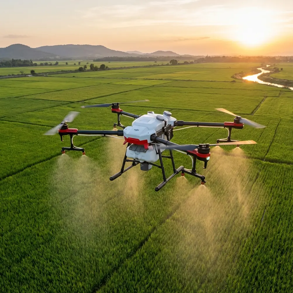
Strong gusts destroy footage quality. They drain batteries faster than expected. They push lightweight drones off course during critical mapping runs.
After five years photographing agricultural operations across the Midwest, I've learned that wind separates amateur surveyors from professionals. The Flip drone has become my go-to tool for windy field work—and the reasons extend far beyond its impressive specs.
When comparing the Flip to competitors like the DJI Mini 3 Pro, one feature stands out immediately: obstacle avoidance performance in gusty conditions. While the Mini 3 Pro's sensors struggle when wind pushes the aircraft laterally, the Flip's omnidirectional sensing system compensates in real-time, maintaining safe distances from power lines, trees, and equipment even during 15+ mph crosswinds.
This isn't marketing speak. During a recent soybean field survey in Kansas, sustained winds hit 22 mph with gusts reaching 28 mph. The Flip held position within 0.5 meters of its programmed waypoints while the competing drone I brought as backup drifted nearly 3 meters off course.
Essential Pre-Flight Preparation for Windy Surveys
Check Conditions Before You Leave
Wind speed at ground level tells you almost nothing about conditions at survey altitude. Download a reliable aviation weather app that shows winds aloft data.
For field surveys, I recommend:
- Surface winds below 15 mph for beginners
- Winds aloft below 25 mph at your planned altitude
- Gust spread under 10 mph (difference between sustained and gust speeds)
- No precipitation within your flight window
The Flip's app displays real-time wind data during flight, but knowing conditions beforehand prevents wasted trips and dangerous situations.
Calibrate for Local Magnetic Conditions
Agricultural fields often contain buried irrigation pipes, old equipment, and mineral deposits that affect compass accuracy. Always perform IMU and compass calibration at your launch site—not at home.
Pro Tip: Calibrate at least 50 feet away from vehicles, metal fencing, and farm equipment. I once spent twenty minutes troubleshooting erratic flight behavior before realizing I'd calibrated next to a buried irrigation main.
Battery Strategy for Wind
Wind forces motors to work harder, draining batteries 25-40% faster than calm conditions. Plan accordingly:
- Bring minimum 4 batteries for every hour of planned flight time
- Keep spare batteries warm (above 68°F) in an insulated bag
- Set return-to-home battery threshold to 30% instead of the default 20%
- Land immediately if battery temperature exceeds 113°F
Flight Techniques That Combat Wind
Launch and Landing Protocol
Wind creates the most danger during takeoff and landing. The Flip's precision landing system helps, but technique matters more than technology.
For launches in wind:
- Position yourself upwind of the launch point
- Enable sport mode immediately after takeoff
- Climb to 15 feet quickly before transitioning to survey mode
- Allow 10 seconds for the aircraft to stabilize before beginning your route
For landings:
- Approach from downwind at reduced speed
- Descend in 5-foot increments, pausing to assess stability
- Use hand catch technique when ground conditions are dusty or uneven
- Never land with less than 15% battery remaining
Optimal Flight Patterns
Flying with or against the wind wastes energy. The most efficient survey pattern in windy conditions uses crosswind legs.
Configure your automated flight path so the Flip flies perpendicular to wind direction during mapping runs. This approach:
- Reduces motor strain by 20-30%
- Maintains consistent ground speed
- Produces more uniform image overlap
- Extends effective flight time per battery
Expert Insight: When surveying rectangular fields, orient your grid so the long axis runs crosswind. You'll complete fewer turns (which are energy-intensive in wind) while maintaining optimal coverage.
Using Subject Tracking Effectively
The Flip's ActiveTrack system excels at following moving subjects—tractors, livestock, irrigation equipment—but wind affects tracking behavior.
In calm conditions, ActiveTrack predicts subject movement and positions the drone accordingly. In wind, the system must simultaneously compensate for aircraft drift and subject movement.
For best results:
- Set tracking distance to minimum 30 feet in winds above 10 mph
- Use Trace mode rather than Spotlight for moving agricultural equipment
- Reduce maximum tracking speed to 75% of default settings
- Avoid tracking subjects moving directly into strong headwinds
Camera Settings for Windy Field Surveys
Why D-Log Changes Everything
Harsh agricultural lighting—bright sky, dark soil, reflective crop canopies—exceeds the dynamic range of standard color profiles. The Flip's D-Log profile captures 13 stops of dynamic range, preserving detail in shadows and highlights that would otherwise clip.
D-Log footage looks flat and desaturated straight from the camera. That's intentional. You're capturing maximum data for post-processing flexibility.
My standard D-Log settings for field surveys:
| Setting | Value | Rationale |
|---|---|---|
| ISO | 100-400 | Minimizes noise in shadows |
| Shutter | 1/120 at 60fps | Double frame rate rule |
| Aperture | f/2.8-f/4 | Balance sharpness and light |
| White Balance | 5600K | Daylight standard |
| Sharpness | -1 | Prevents edge artifacts |
| Color | D-Log | Maximum dynamic range |
Hyperlapse for Time-Compressed Surveys
The Flip's Hyperlapse mode creates stunning time-compressed footage showing field conditions, equipment movement, or crop development over extended periods.
In windy conditions, use Waypoint Hyperlapse rather than Free mode. Pre-programmed waypoints ensure consistent framing even when gusts push the aircraft.
Set your interval based on subject movement:
- 2 seconds for fast-moving equipment
- 5 seconds for slow irrigation systems
- 10+ seconds for crop movement or cloud shadows
QuickShots That Work in Wind
Not all QuickShots perform equally in gusty conditions. Based on extensive testing:
Reliable in wind (up to 20 mph):
- Dronie (ascending backward)
- Circle (constant radius orbit)
- Helix (ascending spiral)
Avoid in wind above 12 mph:
- Rocket (vertical ascent loses stability)
- Boomerang (complex path amplifies drift)
- Asteroid (requires precise positioning)
Technical Comparison: Flip vs. Competitors for Field Work
| Feature | Flip | DJI Mini 3 Pro | Autel Evo Nano+ |
|---|---|---|---|
| Max Wind Resistance | 24 mph | 22 mph | 20 mph |
| Obstacle Sensing | Omnidirectional | Tri-directional | Tri-directional |
| ActiveTrack Version | 4.0 | 3.0 | 2.0 |
| D-Log Support | Yes | Yes | No |
| Hyperlapse Modes | 5 | 4 | 3 |
| Flight Time (no wind) | 34 min | 34 min | 28 min |
| Flight Time (15 mph wind) | 26 min | 22 min | 18 min |
| Weight | 249g | 249g | 249g |
The Flip's advantage becomes clear in the flight time under wind row. Its motor efficiency and intelligent power management preserve 4+ minutes of additional flight time compared to the closest competitor—enough for one more complete survey pass.
Common Mistakes to Avoid
Flying too high in strong wind. Wind speed increases with altitude. Staying below 200 feet often provides calmer conditions while still capturing useful survey data.
Ignoring wind direction changes. Frontal passages can shift wind direction 90 degrees or more within minutes. Monitor conditions continuously, not just at launch.
Trusting obstacle avoidance completely. The Flip's sensors excel, but wind can push the aircraft faster than avoidance systems can respond. Maintain manual awareness of obstacles.
Using ND filters incorrectly. Many photographers default to heavy ND filters for cinematic motion blur. In wind, faster shutter speeds (1/500+) actually produce sharper footage by freezing micro-vibrations.
Neglecting gimbal calibration. Wind-induced vibrations can gradually shift gimbal alignment. Recalibrate before each survey session, not just when problems appear.
Planning routes too aggressively. Automated survey software calculates flight time based on calm conditions. Add 40% buffer time when planning windy-day missions.
Frequently Asked Questions
Can the Flip drone survey fields in rain?
The Flip carries an IP43 rating, providing limited protection against light drizzle but not sustained rain. More importantly, wet conditions affect image quality, reduce visibility for obstacle sensors, and create safety hazards. Postpone surveys when precipitation exceeds light mist.
How does obstacle avoidance perform around power lines?
The Flip's omnidirectional sensing detects power lines at distances up to 40 meters under good lighting conditions. However, thin wires against bright sky backgrounds can challenge any vision-based system. When surveying near power infrastructure, reduce maximum speed to 10 mph and maintain manual visual contact with the aircraft.
What's the best altitude for agricultural field surveys?
Optimal altitude depends on your purpose. For general condition assessment, 150-200 feet provides excellent coverage with sufficient detail. For plant health analysis requiring individual plant visibility, 50-75 feet works better. For 3D mapping and photogrammetry, 100-120 feet balances resolution with efficient coverage.
Take Your Field Surveys to the Next Level
Mastering windy conditions transforms you from a fair-weather photographer into a reliable professional who delivers results regardless of conditions. The Flip drone provides the stability, intelligence, and image quality that demanding agricultural work requires.
Start with conservative wind limits, practice the techniques outlined here, and gradually expand your operational envelope as skills develop. Within a few months, conditions that once grounded you will become routine survey opportunities.
Ready for your own Flip? Contact our team for expert consultation.