Flip Guide: Surveying Mountain Forests Without Losing
Flip Guide: Surveying Mountain Forests Without Losing the Plot
META: A practical how-to for using Flip to survey forests in mountain terrain, with field-tested advice on obstacle avoidance, ActiveTrack, D-Log, Hyperlapse, QuickShots, and battery management.
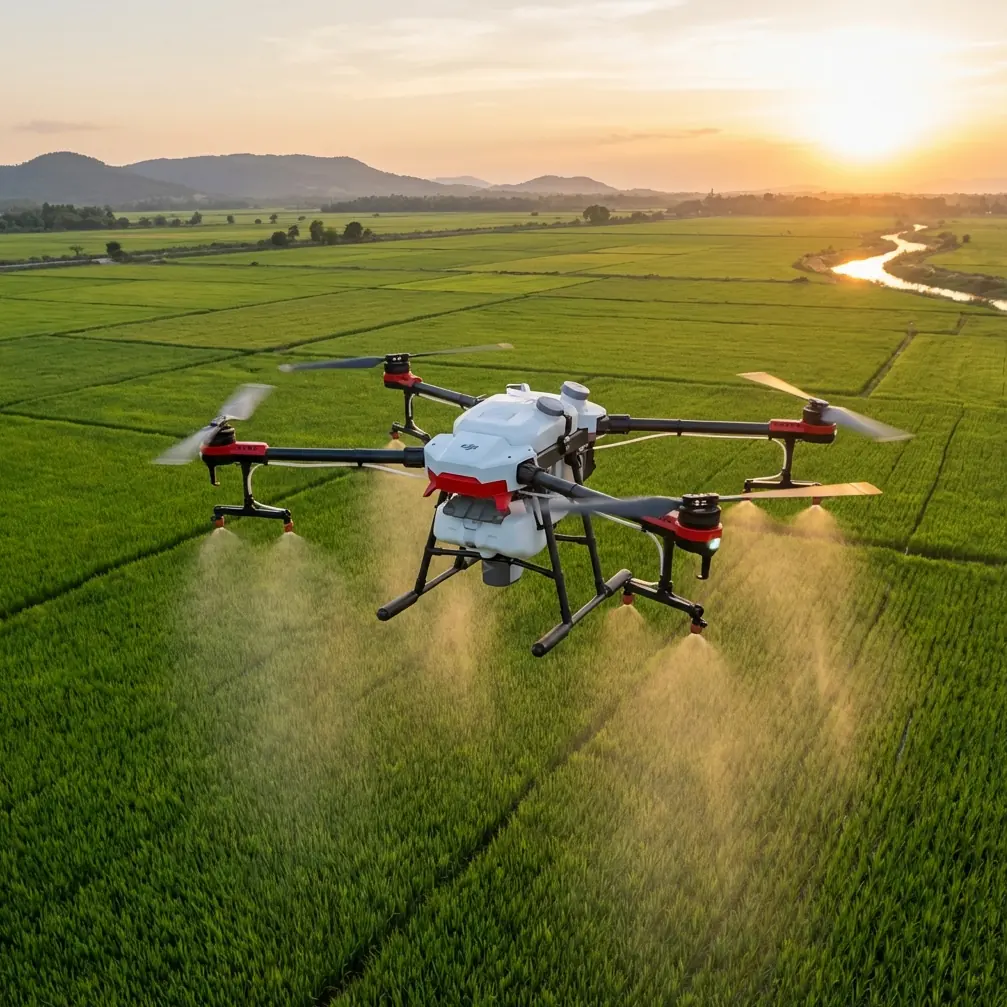
Mountain forest work exposes every weakness in a small drone workflow. Light shifts fast. Tree canopies break GPS confidence. Valleys distort your sense of distance. Cold air changes battery behavior. And if you are documenting terrain, tree health, access routes, or storm damage, you do not get much value from pretty footage alone. You need repeatable capture, safe routing, and files you can actually use later.
That is where a compact platform like Flip becomes interesting. Not because small drones magically simplify mountain operations. They do not. They force discipline. Every decision matters more: where you launch, how you pace battery use, whether you trust subject tracking in mixed canopy, and when obstacle avoidance is helping you versus when it is making route choices for you.
This guide is built for a specific job: surveying forests in mountain terrain with Flip. Not scenic flying for fun. Not broad consumer advice. The aim is to help you return with useful visual records and without burning time on preventable mistakes.
Start with the terrain, not the drone
The biggest planning error I see in wooded mountain flights is treating the forest as one environment. It is not. A ridgeline clearing, a steep conifer slope, a mixed hardwood draw, and a creek corridor all behave differently in the air.
Before powering up Flip, divide the site into three practical zones:
Launch and recovery zone
This should be open enough for clean ascent and descent, but also sheltered from gusts rolling over the ridge. In mountain forests, the “open” spot that looks ideal can actually be the windiest point on site.Transit zone
This is the stretch between launch and your observation area. It usually creates the most risk because pilots rush through it. Trees are taller than they appear from the ground, and slope angle compresses your visual depth judgment.Work zone
This is where you gather the imagery that matters: canopy condition, stand boundaries, trail erosion, drainage paths, burn scars, storm-fall patterns, or inaccessible cuts.
Flip’s compact size helps in tight access areas, but it does not remove the need for a clean mission structure. If anything, a smaller aircraft demands tighter discipline because it can disappear visually against dark timber much faster than larger platforms.
Use obstacle avoidance as a brake, not a crutch
Obstacle avoidance is one of the most useful tools in wooded environments, but mountain forests are full of edge cases. Thin branches, dead snags, irregular saplings, hanging vines, and slanted trunks can all create a messy sensor picture. In low-angle morning or evening light, contrast can get weird fast.
The practical takeaway is simple: use obstacle avoidance to reduce consequence, not to authorize a bad route.
For forest surveying, I prefer to establish routes that are safe even if the aircraft becomes conservative and slows unexpectedly. That matters because obstacle avoidance behavior can change your flight rhythm. If Flip brakes or arcs around a protruding branch, your framing shifts, your timing changes, and your battery plan starts drifting. Over a long slope inspection, those small deviations stack up.
A strong mountain-forest workflow looks like this:
- Ascend vertically into clean air first.
- Move laterally only after you have visual and sensor confidence.
- Keep passes parallel to terrain features rather than improvising between trees.
- Maintain buffer height above the highest local canopy whenever the survey objective allows it.
If your task requires lower-altitude work near trunks or within broken canopy edges, reduce ambition. Gather fewer, cleaner passes. Dense forests punish overconfidence.
ActiveTrack and subject tracking are useful, but define the subject carefully
Subject tracking in a mountain forest sounds great until the “subject” is poorly defined. A hiker on a trail beneath patchy canopy, a vehicle on a logging road, or a ridgeline line-of-sight walker may vanish and reappear repeatedly. That can lead to jerky reacquisition behavior or route changes you did not intend.
For surveying use, ActiveTrack is best when the tracked subject acts as a spatial reference, not the final deliverable. For example:
- Tracking a surveyor moving along a trail can help document trail condition and canopy density from a consistent relative angle.
- Tracking a utility access vehicle can create an efficient visual record of road washouts, drainage cuts, and overhanging hazards.
- Tracking a ranger or field crew crossing a burn perimeter can help show scale and terrain steepness.
The operational significance is this: subject tracking becomes a mapping aid when the subject is stable, visible, and moving on a predictable path. It becomes a liability when the subject passes beneath broken cover and the drone has to choose between staying locked on target and avoiding a cluttered airspace.
My rule is blunt. If the subject enters mixed canopy or terrain shadow where reacquisition could produce sudden lateral movement, I cancel tracking and fly manually. In mountain forests, manual control is often the more professional choice because it preserves consistency.
QuickShots are not just for showreels
QuickShots are often dismissed as lightweight consumer features, but that misses their value in field documentation. In forest surveying, a standardized automated move can act like a repeatable visual template. Used carefully, it helps you compare one location to another or revisit the same site over time.
A short reveal move from a known starting point can show:
- canopy density at the edge of a clearing,
- storm damage progression across a slope,
- road encroachment into forest margins,
- or the relation between a stream corridor and adjacent tree loss.
The trick is not to overuse cinematic motion. You are not trying to impress anyone with movement. You are trying to standardize perspective. That is what makes a short automated sequence operationally useful.
If I am documenting a forest edge on a mountain shoulder, I will often capture a controlled QuickShot sequence first, then follow with slower manual passes for detail. The automated clip gives me a clean establishing reference. The manual passes capture what the automation cannot interpret: dead tops, leaning stems, understory breaks, and surface runoff patterns.
Hyperlapse has a real use in terrain reading
Hyperlapse can be surprisingly effective when your goal is understanding changing weather, moving shadow lines, or cloud-driven visibility across a mountainous site. In forest work, those changes directly affect what you can see and how safely you can fly.
A short hyperlapse from a fixed position can help reveal:
- fog lifting from drainage channels,
- sun exposure shifting across a slope,
- ridge winds stirring upper canopy first,
- or working light windows opening and closing in narrow valleys.
That matters because mountain forest surveys are often constrained by visibility more than by flight time. A slope that is unreadable under flat cloud can become far more legible once side light hits crown texture and terrain breaks.
Hyperlapse is not your main survey asset. It is your context tool. Use it to understand the environment you are about to document in more detail.
Shoot in D-Log when the forest is fighting your exposure
Forests in mountain terrain produce ugly contrast. Bright sky holes through the canopy. Dark trunks under shade. Reflective rock faces. Water flashes in creek lines. If you expose for the ground, the sky can blow out. If you expose for the sky, the understory turns into mush.
That is why D-Log matters here. It gives you more room to preserve tonal detail across scenes that would otherwise clip or collapse. For practical survey work, that flexibility is not about making footage look dramatic later. It is about extracting useful information from uneven light.
When I know I will be dealing with alternating patches of shade and exposed slope, I would rather bring back flatter footage with more recoverable detail than heavily processed footage that looks finished but hides information. D-Log gives you that margin.
Operationally, this matters most when you need to inspect subtle differences in canopy health or terrain texture. If your final goal is analysis, not instant social-ready footage, flatter capture is often the smarter call.
The battery mistake mountain pilots keep repeating
Here is the field tip I wish more pilots learned early: in mountain forests, do not use battery percentage as your real return threshold. Use location and elevation.
This sounds obvious, but it changes how you fly. A battery reading can look comfortable while you are still downhill, downwind, or tucked behind terrain that will require extra power to climb out. In cold mountain air, that mistake shows up fast.
My working habit is to assign a “turn point” before takeoff. Not a battery percentage. A physical point in space. Once Flip reaches that point, the mission shifts from outbound to recovery, even if the battery still looks generous. The reason is simple: recovery in mountain forest terrain is rarely a mirror image of the outbound leg.
You may need extra climb power to clear rising canopy. Wind may intensify as you move back toward a saddle. Obstacle avoidance may slow the most direct line home. And if you launched from a small clearing, the final descent may take more time than expected because you need to set up precisely.
A second battery habit matters even more in cold conditions: let the pack settle before asking for hard acceleration. I have seen pilots launch into chilled mountain air and immediately punch forward across a valley. That is an easy way to feel battery performance sag before the mission has even stabilized.
My routine is conservative on purpose:
- power on and confirm battery state calmly,
- take a short hover to assess stability,
- make a gradual initial climb,
- and only then begin the working leg.
That first minute tells you a lot. If the aircraft feels sluggish, if wind aloft is stronger than expected, or if the battery is dropping faster than the plan supports, adjust early. The mountain does not care that your checklist looked fine beside the vehicle.
If you want to compare notes on field setup before a difficult forest job, you can always message me here.
A simple mountain forest capture workflow that actually holds up
For most forest survey tasks with Flip, I recommend a five-part capture sequence:
1. Establish the site
Take off from the clearest safe zone available. Capture a brief high overview to define terrain shape, canopy spread, and access lines.
2. Record one repeatable automated move
Use a QuickShot only if it creates a consistent reference angle you can reproduce later. Keep it short and purposeful.
3. Fly manual inspection passes
This is where the actual work happens. Fly slower than you think you need to. Mountain forests reward patience because detail emerges late.
4. Use ActiveTrack only in open, predictable movement corridors
Trails, roads, or ridge paths can work. Mixed canopy corridors usually do not. Disable tracking before it forces a bad choice.
5. Finish with a context clip or hyperlapse
If weather, mist, or shadow movement is shaping visibility, capture that context before landing or while staging the next flight.
This structure keeps the mission disciplined. You return with overview, repeatable perspective, detailed passes, and environmental context. That package is far more useful than a memory card full of disconnected clips.
What people miss about flying forests in the mountains
The challenge is not just collision risk. It is interpretive risk. Forests flatten on camera when the pilot flies too high, too fast, or with no framing logic. Then the footage looks clean but says very little.
Flip becomes genuinely useful in this environment when you fly with a question in mind. Are you checking for windthrow? Mapping drainage impact? Monitoring canopy stress? Inspecting trail corridors? Looking for encroachment? Each objective should change your altitude, speed, angle, and feature settings.
Obstacle avoidance helps you stay out of trouble, but route planning still determines whether the footage is readable. ActiveTrack can save effort, but only when the subject path is predictable. QuickShots can standardize visual records, not just make them look polished. Hyperlapse can reveal light and weather changes that affect safety and interpretation. D-Log can preserve detail in brutal contrast that standard capture may throw away.
That is the real value of Flip in mountain forest surveying. Not that it does everything automatically. It does not. Its value is that, in a small and practical package, it gives you enough control and enough assistance to build a serious field workflow if you treat the mission seriously.
And that is the right mindset for this kind of work. The mountain forest is not a backdrop. It is the operating environment. Respect that, manage your batteries by geography rather than optimism, and use the smart features selectively rather than reflexively. You will come back with better data, safer flights, and footage that actually answers the question you went up to ask.
Ready for your own Flip? Contact our team for expert consultation.