Flip for Coastal Venue Surveys: Flying Smarter Around
Flip for Coastal Venue Surveys: Flying Smarter Around Sensitive Sites and Unpredictable Shorelines
META: A field-tested look at using Flip for coastal venue surveys, with practical insight on obstacle avoidance, ActiveTrack, D-Log, and why new Senate attention on drone response changes planning near critical infrastructure.
Coastal venue surveys look simple until you’re on site.
From the ground, a waterfront hotel, wedding deck, marina event space, or cliffside resort can feel open and easy to document. Once you’re in the air, the real variables show up fast: gusts curling off the water, reflective surfaces that confuse exposure, narrow access corridors, protected habitat zones, utility assets in the background, and guests or staff moving unpredictably through the frame. Add growing scrutiny around drone activity near sensitive infrastructure, and the margin for sloppy flying gets very small.
That is exactly where Flip becomes interesting.
I’m approaching this as a photographer first, but also as someone who has seen how venue surveying has shifted from “get a few aerials” to a more disciplined documentation workflow. The mission is no longer just pretty footage. Coastal operators want location awareness, safer flight paths, repeatable visuals for planning teams, and footage that can hold up across marketing, maintenance review, and site logistics. A drone that helps the pilot make better decisions matters more than one that simply gets airborne.
Recent policy attention makes that even clearer. On April 30, 2026, DroneLife reported on a Senate bill introduced by Senator Tom Cotton of Arkansas targeting drone threats to critical infrastructure. The bill focuses on expanding counter-UAS authority for operators of critical infrastructure sites, and it specifically points to three operational pillars: authority, training, and funding. Those three words aren’t abstract. For anyone surveying venues in coastal areas, they signal a more serious operating environment around ports, energy facilities, transport nodes, and other adjacent assets that often sit closer to event spaces than clients realize.
That matters because many coastal venues are not isolated postcard locations. They are mixed-use environments. A luxury event lawn may sit within visual range of a ferry terminal. A beachfront property may back onto utility corridors. A marina venue may share airspace concerns with commercial operations nearby. If infrastructure operators receive broader authority and better training to respond to drone threats, civilian drone crews will need tighter planning, cleaner visual identification, and more disciplined flight behavior. Not because responsible venue survey work is the problem, but because the line between harmless and suspicious can look thin from a distance.
So the real question is not whether Flip can capture beautiful coastal footage. It’s whether it supports a more professional way of working in a setting where environmental complexity and regulatory attention are both rising.
For that job, its practical flight tools matter more than the spec-sheet gloss.
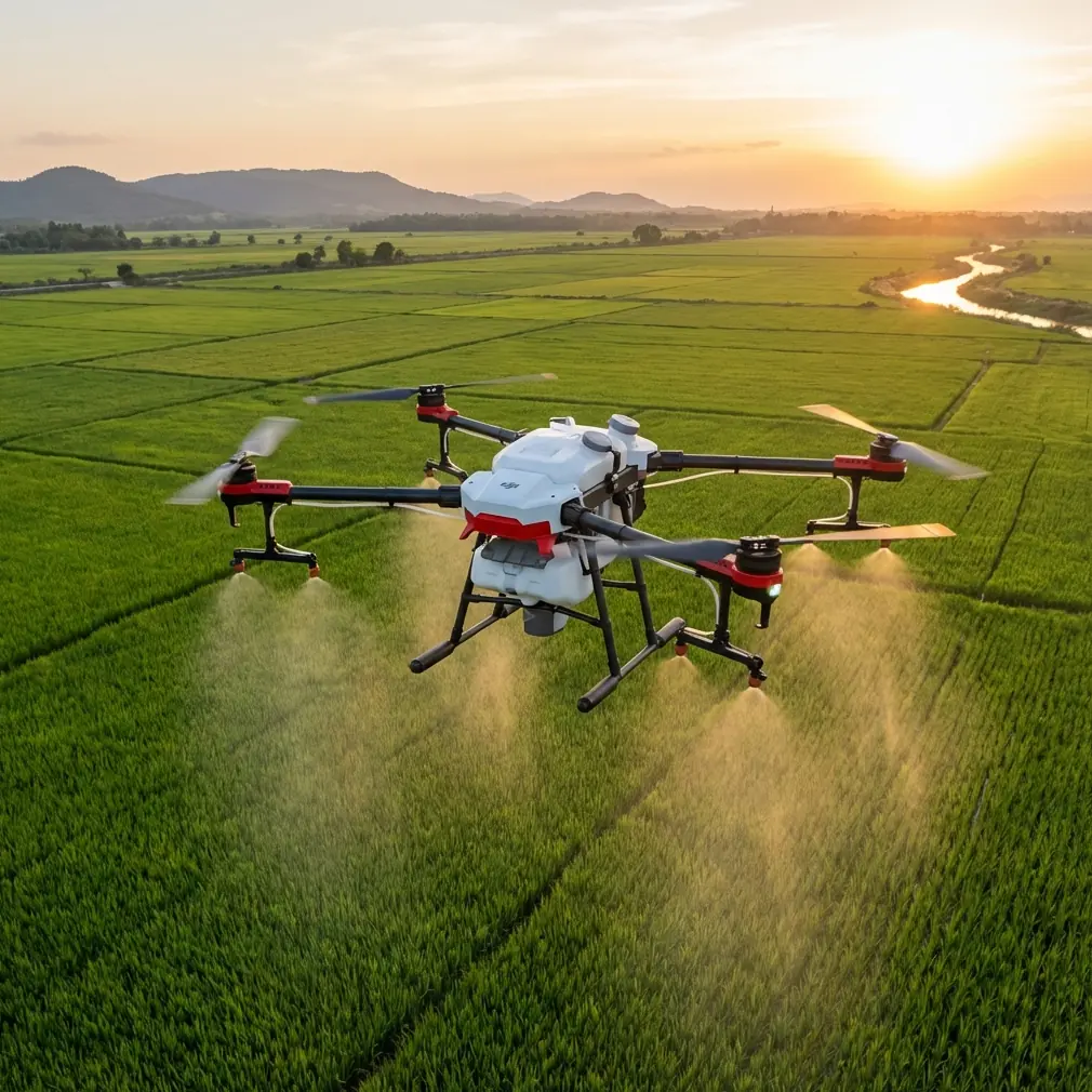
Obstacle avoidance is one of those features that gets oversimplified in marketing conversations. In coastal venue work, it is not just about avoiding a wall. It’s about reducing pilot overload when the environment is visually busy. Shoreline surveys often involve palms, flagpoles, pergolas, rigging lines, sailboat masts, lighting trusses, temporary event structures, and uneven terrain edges that are easy to misread while composing. If I’m working a venue recce at sunrise and trying to maintain a low lateral move past a reception terrace, I want the aircraft helping me hold a safe buffer from the decorative structures and vegetation that creep into the route.
I had one survey where that support stopped a bad decision before it became a real one. We were documenting a coastal event lawn beside a restored dune edge, with a boardwalk wrapping toward a private ceremony platform. The brief was simple: establish access, guest flow, and sightlines to the water. Mid-pass, a pair of egrets lifted from the reeds below the platform and crossed toward the shoreline. At almost the same moment, a gust pushed the drone slightly toward a weathered timber post near the boardwalk railing. That’s the kind of layered moment that exposes the gap between casual flying and field discipline. The sensors gave me enough warning to correct cleanly, hold distance from the structure, and let the birds clear the corridor without trying to force the shot. No drama, no rushed stick input, no compromised survey line. In venue work near wildlife and fragile coastal edges, that kind of assistance is not a luxury feature. It preserves both safety and usable footage.
Subject tracking also earns its keep when used properly. ActiveTrack, in particular, is useful for surveying how people actually move through a venue rather than how a site map claims they move. For planners, that distinction is huge. A coordinator walking the guest arrival path, a facilities lead moving from loading zone to service access, or a venue manager demonstrating the transition from ceremony lawn to dining area can reveal bottlenecks and blind spots that static overheads miss. If Flip can maintain reliable tracking while the pilot supervises spacing, altitude, and route context, the result is more than a cinematic clip. It becomes a planning asset.
That is where civilian drone work around sensitive areas needs maturity. New legislative attention on response authority at critical infrastructure sites means pilots should assume that visible professionalism counts. Smooth, predictable movement. Clear line choices. No drifting near restricted edges. No curiosity flights toward adjacent assets that have nothing to do with the job. A tracking mode like ActiveTrack is valuable not because it automates creativity, but because it can reduce erratic repositioning during a structured survey. Less wandering in the air often means fewer misunderstandings on the ground.
QuickShots and Hyperlapse can also serve a serious survey purpose if used with intention. People tend to file these under social content, but coastal venue assessments benefit from compressed visual storytelling. A Hyperlapse from service entrance to waterfront frontage can quickly show changing light exposure, foot-traffic patterns, and how spatial relationships shift across the property. A controlled QuickShot-style reveal can help stakeholders understand how hidden zones connect, especially at venues where the sea-facing side is impressive but the logistics side is tucked behind landscaping or elevation changes. The key is to treat these modes as communication tools, not gimmicks.
Image control matters too. Coastal scenes are unforgiving on the camera side. Bright sky, reflective water, white fabric structures, darker vegetation, and backlit decks all compete inside the same frame. Shooting in D-Log gives more room to recover highlights and preserve tonal detail when you’re building a venue record that may later be used across different departments. Marketing wants atmosphere. Operations wants clarity. Design teams want usable contrast in surfaces and access routes. If the footage breaks apart because the sky clipped or the promenade fell into muddy shadow, the survey loses value outside social media. D-Log helps bridge that gap by giving the editor a stronger starting point for balanced, consistent interpretation of the site.
There’s another reason this matters now. The Senate bill covered by DroneLife does not just mention authority; it also points to training and funding. That should get the attention of every civilian operator working around coastal commercial properties. Better-trained infrastructure teams will likely become better at spotting unusual flight behavior, documenting incidents, and questioning operators near their sites. Funding can mean more capability on their side. For venue survey crews, the practical response is simple: operate in a way that is easy to recognize as legitimate, limited, and site-specific.
That starts before takeoff. Confirm what sits beyond the venue boundary. Ports, substations, fuel facilities, bridges, and transportation assets are common in coastal corridors. Build flight paths that stay anchored to the assignment. Keep altitude and lateral distance conservative where adjacent assets enter the visual environment. Brief the client so they understand why some angles are off-limits or unnecessary. Good drone work is often defined by the footage you chose not to chase.
Flip fits this environment when it is used as a disciplined survey platform rather than a toy with a camera.
For a photographer, that changes the whole rhythm of the job. I’m not fighting the aircraft to get stable establishing shots over a windy shoreline. I’m using obstacle awareness to safely inspect transitions between landscaped guest areas and hard infrastructure like ramps, retaining walls, and service lanes. I’m using ActiveTrack to follow a venue representative through real circulation routes. I’m leaning on D-Log when contrast gets brutal near noon and I still need an accurate visual record. I’m using QuickShots and Hyperlapse selectively to help nontechnical stakeholders understand the property in a way stills often cannot.
And yes, the pretty shots still matter. Coastal venues live on atmosphere. They sell a sense of air, distance, horizon, and movement. But the best survey flights produce footage that does two jobs at once: it attracts attention and it answers questions. Can vendors access the lower terrace efficiently? Where do guests naturally pause? Which structures interrupt a direct sea view? How exposed is the ceremony deck to lateral wind? How close is the venue’s visual envelope to neighboring industrial or transport infrastructure? These are operational questions, and the drone is most valuable when it helps answer them without adding risk.
That last point is where the wider policy climate circles back into everyday fieldwork. When lawmakers start focusing on drone threats ahead of major events, as this bill does, it signals a broader shift in how airspace activity near sensitive locations will be perceived. Coastal venues often host exactly the kinds of gatherings that draw more scrutiny, more coordination, and less tolerance for ambiguity. A pilot using Flip for legitimate survey work needs to think like part of a professional site team, not an isolated content creator.
That means communication matters as much as flight technique. If a venue manager wants to talk through a survey plan near a shoreline property with neighboring infrastructure, I usually recommend sorting that conversation out before anyone powers up on site. If you need a quick way to coordinate a venue-specific drone brief, share the details here: message the survey desk on WhatsApp. A few minutes of alignment can prevent the kind of flight choices that create confusion later.
For coastal venue surveys, the strongest case for Flip is not that it makes aerial imaging easy. It’s that it can make careful aerial imaging practical.
That distinction is becoming more important. The shoreline is full of visual temptation and operational traps. Wildlife appears without warning. Wind shifts near structures. Sensitive facilities sit just outside the frame. Event teams need useful footage, not just dramatic footage. And now the external environment around drone operations is tightening, with legislation explicitly discussing expanded authority, training, and funding for infrastructure operators responding to drone activity.
Against that backdrop, the most capable drone is the one that helps a pilot stay precise.
Flip, used well, supports that precision. Obstacle avoidance reduces the odds of small mistakes becoming expensive ones. ActiveTrack turns moving walkthroughs into structured planning visuals. QuickShots and Hyperlapse, when used sparingly, help communicate site layout fast. D-Log preserves the flexibility needed to make coastal footage serve both aesthetic and operational goals. Put together, those tools make the aircraft genuinely useful for surveying venues where beauty and complexity share the same airspace.
Ready for your own Flip? Contact our team for expert consultation.