Flip in Windy Survey Conditions: What Actually Matters
Flip in Windy Survey Conditions: What Actually Matters for Mapping Accuracy
META: A technical review of Flip for surveying venues in windy conditions, grounded in UAV photogrammetry fundamentals like camera calibration, control-point accuracy, and flight stability.
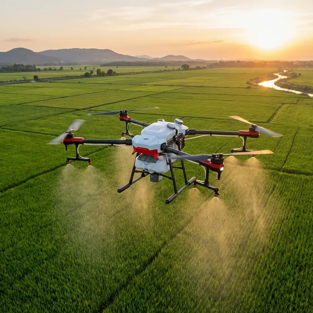
Wind exposes the difference between a drone that merely flies and one that can deliver survey-grade imagery with fewer retakes. That distinction becomes sharp when the job is a venue survey: open grounds, stadium-adjacent infrastructure, event layouts, access roads, parking areas, drainage edges, temporary installations. These sites often combine broad unobstructed sections with turbulent airflow around structures. For a platform like Flip, the real question is not whether it can get images. It is whether those images hold together once they enter a photogrammetry workflow.
That is where the underlying discipline of low-altitude UAV imaging becomes useful. A 2015 technical study on UAV image acquisition and processing highlighted a point that still gets overlooked today: before flight, the camera must be calibrated to account for residual aberrations and lens distortion, especially when using a non-metric camera. In that study, DLT, or direct linear transformation, was used to derive both interior and exterior orientation elements. This is not academic housekeeping. In windy survey work, the more the aircraft gets pushed, yaws, or makes small corrective motions, the more every weakness in lens modeling and image geometry shows up downstream as drift, mismatch, or noisy elevation.
That is the frame I would use to evaluate Flip for venue surveying in wind. Not as a lifestyle flying machine. As an imaging system that either preserves geometry under stress or forces you to spend extra hours compensating for instability in software.
Wind does not just affect flight. It affects reconstruction.
Most buyers think of wind as a control problem. Can the drone hold position? Can it return safely? Those are baseline concerns, but surveyors care about a second layer: what wind does to overlap consistency, camera angle repeatability, and tie-point reliability.
The reference study gives us a solid benchmark for why this matters. After aerial triangulation densification with control points, the researchers evaluated 20 ground control points and found that the results met both urban surveying norms and aerial photogrammetry standards. They also distributed 8 check points across the test area, and those results met the same standards. The imagery had a ground resolution of 15 cm. Planimetric error in x and y stayed within acceptable accuracy limits, while elevation error in z was slightly larger.
That last part is especially relevant for windy venues. Horizontal mapping usually survives moderate turbulence better than elevation modeling. Height is where weak geometry, inconsistent camera attitudes, and insufficiently controlled overlap often start to leak error. If Flip is being used on a venue where grading, drainage paths, temporary platform heights, or roof-edge relations matter, z performance deserves more scrutiny than the marketing sheet usually gets.
The camera pipeline matters as much as the airframe
The source paper listed actual calibration terms for the camera model, including a focal length of 21.13651 and distortion coefficients such as k1 = -1.80E-05, k2 = 3.75E-08, and k3 = 6.87E-12, along with principal point offsets x0 = 0.007697194 and y0 = -0.101756977. To a casual reader, these numbers look obscure. To anyone doing photogrammetry, they are the difference between believable geometry and a quietly warped dataset.
Why bring this up in a review of Flip? Because small drones aimed at broad audiences often rely on non-metric imaging hardware. That is not disqualifying. In fact, the paper explicitly noted the operational upside of non-metric cameras: shorter processing cycles and strong flexibility in complex terrain. That flexibility is exactly why compact UAVs remain attractive for venue work. You can move quickly, launch from constrained positions, and cover changing layouts without the logistical burden of larger systems.
But the tradeoff is that calibration discipline becomes non-negotiable. If Flip is your field tool in wind, the practical takeaway is simple: do not judge it only by image sharpness on a screen. Judge it by whether its imaging pipeline supports repeatable geometry after the aircraft has spent fifteen or twenty minutes fighting gusts around grandstands, lighting poles, or exhibition structures.
Why Flip can make sense for venue surveys
Flip’s appeal in this context is not one single feature. It is the mix.
Obstacle avoidance matters around venues because the job site is rarely a clean rectangle. Masts, banners, truss systems, canopies, trees, fencing, and rooftop edges can all complicate the mission. Strong avoidance does not improve photogrammetric accuracy on its own, but it lowers the operational friction of flying tighter envelopes safely. In windy conditions, that margin matters more. A pilot has less spare bandwidth when the aircraft is constantly making micro-corrections.
ActiveTrack and subject tracking are usually discussed for creative flight, but there is another angle here. In pre-survey reconnaissance, they help a pilot or site manager document moving setup elements, follow vehicle circulation patterns, or monitor temporary work zones before locking in the formal mapping plan. That is not the same as running a full autonomous survey grid, but it makes Flip more versatile at multi-phase venue jobs where planning and documentation happen back-to-back.
QuickShots and Hyperlapse are not core survey tools, yet they can support stakeholder communication after the technical capture. A project team often needs two outputs: measurable imagery for mapping and understandable visuals for non-technical decision-makers. If one drone can gather survey-supporting site context and also produce useful presentation material, that reduces field complexity. The key is to keep these modes in their lane. They are supplements, not substitutes, for disciplined survey capture.
D-Log also deserves a practical mention. For mapping itself, color profile is secondary to geometry. But on venue sites with mixed surfaces—painted pavement, turf, reflective roofing, temporary flooring, concrete, fabric structures—a flatter profile can preserve more tonal information for visual interpretation and reporting. It will not rescue bad overlap or poor calibration. It can, however, make downstream inspection and feature recognition easier when conditions are contrast-heavy.
Where Flip may outperform less thoughtful competitors
A lot of compact drones claim they can handle wind. The more useful comparison is this: which model remains operationally efficient when wind collides with a real venue environment?
Some competitors are stable enough in open air but become awkward near structures because they lack dependable obstacle sensing or struggle to maintain smooth pathing when gusts create lateral corrections. Others deliver nice-looking footage but are less convincing when the pilot tries to maintain survey discipline over repeated passes. Flip stands out if it can combine stable control, intelligent sensing, and a camera system that behaves predictably enough for structured image capture.
That combination matters more than raw headline specs. Surveyors do not get paid for owning features. They get paid for reducing uncertainty. If Flip lets you complete a venue survey with fewer interrupted runs, fewer missed edges, and fewer reconstruction issues caused by inconsistent image geometry, then it is doing the job better than a rival with more aggressive promotional language.
This is also why I would rate Flip above drones that lean too heavily on cinematic identity. In windy venue work, resilience is not just resistance to gusts. It is the ability to keep producing a coherent block of imagery suitable for processing. The paper’s results are a reminder: acceptable x and y error are achievable even with non-metric systems when control, calibration, and workflow are done properly. The z side is less forgiving. A drone that helps you maintain disciplined capture under real field conditions has an advantage that does not show up in casual reviews.
A realistic workflow for windy venue surveys with Flip
If I were deploying Flip on this kind of assignment, I would treat the mission in three layers.
First, reconnaissance. Use Flip’s obstacle awareness and tracking intelligence to understand the venue’s airflow trouble spots, vertical hazards, and temporary elements. This is where the platform’s general-flight intelligence can save time.
Second, structured image acquisition. This is where photogrammetry rules return to center stage. Maintain overlap discipline, avoid unnecessary speed, and pay special attention to consistency in turns and boundary lines where wind tends to introduce attitude changes. If the payload uses a non-metric camera architecture, preflight calibration assumptions and processing settings matter. The 2015 study’s emphasis on deriving distortion parameters before flight is still the right instinct.
Third, verification. Do not trust the visual neatness of the mission log. Validate with ground control and check points when the job demands true measurement confidence. The reference case used 20 ground control points and 8 check points, then confirmed compliance with accepted survey standards. That is not overkill for wind-sensitive work. It is what separates a nice orthomosaic from a defendable dataset.
If you are evaluating whether Flip suits your own venue workflow, it helps to compare expected site conditions against that three-part process. If you want a sounding board on setup choices, overlap strategy, or whether your site is a good fit for a compact survey platform, you can message a UAV specialist here.
The hidden issue: elevation confidence
The most honest reading of the source material is not “UAV surveying works.” We already know that. The more useful reading is that planimetric accuracy can be very strong, while elevation deserves extra care. In the study, the x and y mean errors stayed within the accepted accuracy range, but the z mean error came out somewhat larger.
That pattern mirrors what field teams see all the time. Wind can be survivable for horizontal alignment yet still degrade vertical consistency enough to matter for grading checks, drainage interpretation, or stage/platform height coordination. So if Flip is being used on windy sites, I would not ask only, “Can it map this venue?” I would ask, “Can it preserve enough vertical reliability for the specific decisions this survey supports?”
For broad site inventory, access planning, and top-down asset layout, the answer may well be yes. For work with tighter height tolerances, the capture design and control network become more important than the drone badge.
Final take
Flip makes the most sense for windy venue surveying when it is treated as a disciplined imaging platform rather than a casual flying camera. Its value comes from how its flight intelligence, obstacle avoidance, and flexible capture features support real field operations around complex sites. The source study on low-altitude UAV imaging reinforces the technical foundation behind that judgment: calibrate the camera, respect lens distortion, verify against control, and pay close attention to vertical error.
Two details from that study stand out operationally. One is the use of DLT calibration for a non-metric camera before flight, which matters because compact UAV imaging systems need accurate distortion modeling to hold geometry together under wind-induced motion. The other is the test structure of 20 ground control points and 8 check points, which matters because windy missions should be judged by verified output, not just stable-looking flight behavior. Add the reported 15 cm image resolution, and you have a realistic picture of what a well-run compact UAV survey can achieve.
That is the lens through which Flip should be judged. Not by hype. By whether it can produce trustworthy venue data when the air is moving and the site is messy.
Ready for your own Flip? Contact our team for expert consultation.